- Koli National Park
Geobox|Protected Area
name = Koli National Park
native_name =
other_name =
other_name1 =
category_local = National Park of Finland
category_iucn = II

image_size =
image_caption = An elevated view at Koli
country = Finland
country_
state =
state_type =
state_
region = Eastern Finland
region_type = County
location =
lat_d = 63
lat_m = 03
lat_s = 27
lat_NS = N
long_d = 29
long_m = 53
long_s = 14
long_EW = E
elevation =
biome =
biome_share =
biome1 =
biome1_share =
geology =
geology1 =
plant =
plant1 =
animal =
animal1 =
area = 30
area1 =
area1_type =
length =
length_orientation =
width =
width_orientation =
highest =
highest location =
highest_lat_d =
highest_lat_m =
highest_lat_s =
highest_lat_NS =
highest_long_d =
highest_long_m =
highest_long_s =
highest_long_EW =
highest_elevation =
lowest =
lowest_location =
lowest_lat_d =
lowest_lat_m =
lowest_lat_s =
lowest_lat_NS =
lowest_long_d =
lowest_long_m =
lowest_long_s =
lowest_long_EW =
lowest_elevation =
established_type = Established
established = 1991
established1_type =
established1 =
management_body =Metsähallitus
management_location =
management_lat_d =
management_lat_m =
management_lat_s =
management_lat_NS =
management_long_d =
management_long_m =
management_long_s =
management_long_EW =
management_elevation =
visitation =
visitation_date =
free_type =
free =
free1_type =
free1 =
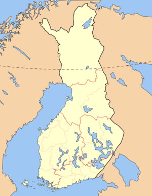
map_locator_x = 68.4
map_locator_y = 85.4
map_size =
map_caption =
map_first =
website = http://www.outdoors.fi/kolinpKoli National Park ("Kolin kansallispuisto") is a
national park in the municipalities of Eno,Lieksa andKontiolahti ,Eastern Finland . It covers convert|30|km2|sqmi|0 in the forested hills on the western shore of lakePielinen , and was established in 1991. Contrary to the other national parks in Finland, Koli National Park was originally governed by theFinnish Forest Research Institute Metla. It is now governed by theMetsähallitus like the other national parks [cite web |url= http://www.metla.fi/koli/tiedotteet/koli-tiedote-20070907-puisto.htm|title= Metla : Kolin kansallispuisto : Kolin matkailupalvelut monipuolistuvat : Tiedote 3.1.2006 |accessmonthday= February 18|accessyear= 2008|author= |last= |first= |authorlink= |coauthors= |date= 2007-09-07|language= Finnish] .Koli has lots to offer cultural heritage-wise. Former it was a sacrificial site. Later it was used for
slash-and-burn agriculture. The aim of Koli National Park isn't to reserve wild nature but traditional agricultural heritage is cherished in Koli. Some fields are slashed, burnt and re-cultivated and hay is cut yearly. Traditional Finnish breeds of cows and sheep are grazing in the meadows of Koli.Attractions
The most well-known vantage point in the park is Ukko-Koli, with a grand view to the East, over the lake
Pielinen . Near the top there's the Heritage Center Ukko and Hotel Koli. In the summer, two long scenery lifts are working in Koli.There are also many caves in Koli area, e.g. the cave named Pirunkirkko. It is convert|34|m|ft long and convert|1|-|7|m|ft high.
Koli has inspired many painters and composers, e.g.
Jean Sibelius ,Juhani Aho andEero Järnefelt . Eero Järnefelt painted together with A.W. Finch and Ilmari Aalto a large scenery about Koli in 1911. It can be seen in the restaurant ofHelsinki railway station. Painters found Koli in the 19th century and after that Koli has been called one of the national sceneries of Finland.Nowadays there are two
ski resorts in Koli area: Loma-Koli for families and Ukko-Koli for more advanced downhill skiing. There are three ski lifts and six ski slopes in Ukko-Koli. The highest vertical drop is convert|230|m|ft and ski slopes are convert|800|-|1500|m|ft long. There are four ski lifts and six ski slopes in Loma-Koli. The highest vertical drop is convert|145|m|ft and ski slopes are convert|530|-|1050|m|ft long. Two of the slopes are streets for snowboarding. There are also snow castles for children.See also
*
List of national parks of Finland
*Protected areas of Finland References
External links
* [http://www.outdoors.fi/kolinp Outdoors.fi – Koli National Park]
* [http://www.metla.fi/koli/index-en.htm Koli National Park webpage]
* [http://koli.metla.fi/media/kyla/matkailu/videot/pkarjala.mpg Video about travelling in Koli area] - by students from Koli area
* [http://koli.metla.fi/media/kyla/lumi/lasket/videot/uplaskee.mpg Video about downhill skiing in Koli] - by students from Koli area

Wikimedia Foundation. 2010.