- North Collins (town), New York
-
North Collins Town Country United States State New York County Erie County Elevation 827 ft (252.1 m) Coordinates 42°35′42″N 78°56′28″W / 42.595°N 78.94111°W Area 43.0 sq mi (111.4 km2) - land 42.9 sq mi (111 km2) - water 0.2 sq mi (1 km2), 0.47% Population 3,376 (2000) Density 207.2 / sq mi (80 / km2) Incorporated 1852 Town Supervisor Thomas R. O'Boyle (D) - Michael W. Perry (R)
- Marian C. Vanni (D)
- George C. LoBianco (D)
- Jeffrey T. Krauss (D)
Timezone EST (UTC-5) - summer (DST) EDT (UTC-4) ZIP code 14111 Area code 716 FIPS code 36-36029 GNIS feature ID 0979283  Location of North Collins in Erie County
 Location of North Collins in New York
 Location of New York in the United States
Website: North Collins Public Officials North Collins is a town in Erie County, New York United States. The population was 3,376 at the 2000 census. The name is derived from its parent town, Collins.
The Town of North Collins is in the southern part of the county and is one of the "Southtowns" of Erie County. A village in the town is also known as North Collins.
Contents
History
The area was first settled around 1809.
The Town of North Collins was founded in 1852 as the "Town of Shirley" from the northern part of the Town of Collins. In 1853 the town assumed its current name. The Wilson Family Founded The Town.
In 1911, the community of North Collins set itself off from the town by incorporating as a village.
Geography
According to the United States Census Bureau, the town has a total area of 43.0 square miles (111.4 km²), of which, 42.9 square miles (111.0 km²) of it is land and 0.2 square miles (0.4 km²) of it (0.37%) is water.
New York State Route 75, New York State Route 249, and US Route 62 pass through the town.
Demographics
As of the census[1] of 2000, there were 3,376 people, 1,254 households, and 915 families residing in the town. The population density was 78.8 people per square mile (30.4/km²). There were 1,403 housing units at an average density of 32.7 per square mile (12.6/km²). The racial makeup of the town was 95.26% White, 0.44% Black or African American, 1.51% Native American, 0.71% Asian, 0.44% from other races, and 1.63% from two or more races. Hispanic or Latino of any race were 2.37% of the population.
There were 1,254 households out of which 32.1% had children under the age of 18 living with them, 59.6% were married couples living together, 8.9% had a female householder with no husband present, and 27.0% were non-families. 22.1% of all households were made up of individuals and 11.1% had someone living alone who was 65 years of age or older. The average household size was 2.68 and the average family size was 3.16.
In the town the population was spread out with 26.2% under the age of 18, 6.6% from 18 to 24, 29.9% from 25 to 44, 23.7% from 45 to 64, and 13.7% who were 65 years of age or older. The median age was 38 years. For every 100 females there were 98.8 males. For every 100 females age 18 and over, there were 98.6 males.
The median income for a household in the town was $43,781, and the median income for a family was $50,781. Males had a median income of $36,087 versus $26,667 for females. The per capita income for the town was $19,253. About 5.4% of families and 7.7% of the population were below the poverty line, including 12.7% of those under age 18 and 2.4% of those age 65 or over.
Communities and locations in North Collins
- Eighteen Mile Creek (South Branch) – A stream flowing through the northeast part of the town, passing the community of New Oregon.
- Franklin Gulf County Park – An undeveloped park partly in the north part of the town.
- Langford – A hamlet at the junction of state routes NY-75 and NY-249 in the northern part of the town.
- Lawtons – A hamlet on NY-62 in the southwest corner of the town.
- Marshfield – A hamlet near the south town line on NY-75.
- New Oregon – A hamlet in the northeast part of the town on NY-249.
- North Collins - The Village of North Collins is located in the northwest corner of the town at the junction of routes NY-62 and NY-249. The community was formerly called "Rose's Corners" and "Kerr's Corners."
- Shirley – A hamlet southeast of North Collins village, located on Shirley Rd. just south of state route NY-249.
- Winter's Pond – A small lake south of Langford.
References
- ^ "American FactFinder". United States Census Bureau. http://factfinder.census.gov. Retrieved 2008-01-31.
External links
Municipalities and communities of Erie County, New York Cities 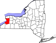
Towns Villages Akron | Alden | Angola | Blasdell | Depew | East Aurora | Farnham | Gowanda‡ | Hamburg | Kenmore | Lancaster | North Collins | Orchard Park | Sloan | Springville | Williamsville
CDPs Other
hamletsAkron Junction | Alden Center | Armor | Athol Springs | Bagdad | Bellevue | Big Tree | Blakeley | Blossom | Boston | Bowmansville | Brant | Brighton | Carnegie | Chaffee | Clarksburg | Cleveland Hill | Clifton Heights | Collins Center | Concord | Creekside | Crittenden | Dellwood | Derby | Doyle | Duells Corner | Dutchtown | East Amherst | East Concord | East Eden | East Elma | East Seneca | Ebenezer | Eden Valley | Eggertsville | Ellicott | Elma | Evans Center | Ferry Village | Footes | Forks | Fowlerville | Gardenville | Getzville | Glenwood | Grandyle Village | Green Acres | Griffins Mills | Holland | Hunts Corners | Jerusalem Corners | Jewettville | Kenilworth | Lake View | Langford | Lawtons | Locksley Park | Loveland | Marilla | Marshfield | Millersport | Millgrove | Morton Corners | Mount Vernon | Murrays Corner | New Ebenezer | New Oregon | North Bailey | North Evans | Oakfield | Patchin | Peters Corners | Pine Hill | Pinehurst | Pontiac | Porterville | Protection | Sand Hill | Sandy Beach | Scranton | Sheenwater | Shirley | Snyder | South Newstead | South Wales | Spring Brook | Swifts Mills | Taylor Hollow | Town Line Station | Swormville | Walden Cliffs | Wales Hollow | Wanakah | Water Valley | Webster Corners | Wende | West Alden | West Falls | Weyer | Williston | Windom | Wolcottsburg | Woodlawn | Woodside | Wyandale | Zoar
Indian
reservationsFootnotes ‡This populated place also has portions in an adjacent county or counties
Categories:- Towns in New York
- Buffalo – Niagara Falls metropolitan area
- Populated places in Erie County, New York


Wikimedia Foundation. 2010.