- Northfield, Massachusetts
-
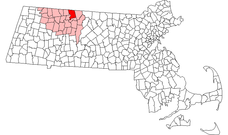
Northfield, Massachusetts — Town — First Parish Church Location in Franklin County in Massachusetts
Coordinates: 42°41′45″N 72°27′12″W / 42.69583°N 72.45333°WCoordinates: 42°41′45″N 72°27′12″W / 42.69583°N 72.45333°W Country United States State Massachusetts County Franklin Settled 1673 Incorporated 1723 Government - Type Open town meeting Area - Total 35.4 sq mi (91.6 km2) - Land 34.4 sq mi (89.1 km2) - Water 1.0 sq mi (2.5 km2) Elevation 300 ft (91 m) Population (2000) - Total 2,951 - Density 85.8/sq mi (33.1/km2) Time zone Eastern (UTC-5) - Summer (DST) Eastern (UTC-4) ZIP code 01360 Area code(s) 413 FIPS code 25-47835 GNIS feature ID 0619381 Website http://www.northfield.ma.us/ Northfield is a town in Franklin County, Massachusetts, United States. The population was 2,951 at the 2000 census. It is part of the Springfield, Massachusetts Metropolitan Statistical Area. The Connecticut River runs through the town, dividing West Northfield from East Northfield, where the town hall and village of Northfield are located.
Part of the town is included in the census-designated place of Northfield.
Contents
History
Originally settled and inhabited by the Pocomtuc tribe, the area was site of the village of Squawkeag. Northfield was first colonized in 1673 by the English and was officially incorporated in 1723.
The territory was successfully defended a number of times by Native Americans. As a result, the English colonists were occasionally taken north to Quebec, held as hostages by the French, causing the town to revert to American Indian control a few times.[1]
Eventually, conflicts with the Native American population ceased after most of the native population was displaced and/or sold into slavery as a result of King Philip's War and after a series of massacres of local Indian villages.[2]
During Dummer's War, on August 13, 1723 Gray Lock raided Northfield, Massachusetts, and four warriors killed two citizens near Northfield. The next day they attacked Joseph Stevens and his four sons in Rutland. Stevens escaped, two boys were killed, and the other two sons were captured.[3]
Much of Northfield's development in the late nineteenth century was spurred by the work of evangelist Dwight Lyman Moody, a native of Northfield who established the Northfield Seminary for Girls in 1879 on a sweeping hillside in East Northfield. The school was the site of Moody's religious conferences, which attracted thousands of visitors to Northfield each summer. The influx of visitors led to the development of the town as a summer resort, especially after the opening of the Northfield Hotel in 1887. Francis Schell, a New York capitalist attracted by his interest in Moody's work at the Northfield Seminary, commissioned architect Bruce Price to design a summer home, which became known as the Northfield Chateau. Patterned after a French château but fanciful in style with prominent turrets and 99 rooms, the house fell into a state of disrepair following Schell's death, and it was demolished in 1967.
The Vermont and Massachusetts Railroad had established rail service to Northfield by 1850, along a line running from Millers Falls, Massachusetts to Brattleboro, Vermont. Even though the railway crossed the Connecticut River in Northfield, East Northfield Station was actually located in West Northfield, necessitating that travelers had to travel back across the Connecticut River on the lower deck of the rail bridge. To provide for safer and more convenient access across the river, Francis Schell gave $60,000 for the construction of a new steel bridge. The Schell Bridge is a Pennsylvania truss structure of impressive design, which crosses the river in one span of 515 ft (157 m).
In 1971 the Northfield Mount Hermon School was formed by the merger of the Northfield Seminary and the Mount Hermon School for boys, which Moody had founded in 1881 in nearby Gill. The school continued to operate as one school with two campuses some 5 miles apart on opposite banks of the Connecticut River until 2005 when the school consolidated its operations on the Mount Hermon campus in Gill. The school's former campus in Northfield was purchased by Hobby Lobby, an Oklahoma-based chain of arts and crafts stores, as of December 2009 to be used as the campus for the new C.S. Lewis College, run by the California-based C.S. Lewis Foundation. Renovation began on the dis-used buildings in Summer 2010, and the College expects to open for instruction in Fall 2012, pending accreditation. It will be a Christian Great Books college with a School of Visual and Performing Arts, with its Christian character based on C.S. Lewis's "mere Christianity" and not affiliated with a denomination. Moody's birthplace and grave site, located on the Northfield campus, remain as a historic site. The Auditorium, used for Moody's religious conventions, and the school's original Romanesque Revival buildings will remain extant on the Northfield campus as part of C.S. Lewis College.[4]
Geography and transportation
According to the United States Census Bureau, the town has a total area of 35.4 square miles (91.6 km²), of which, 34.4 square miles (89.1 km²) of it is land and 0.9 square miles (2.5 km²) of it (2.69%) is water. Northfield is the only town in Franklin County to be divided by the Connecticut River, though only partially; the river forms the southwest border of town. Several brooks flow directly into the Connecticut River within town, with the others (on the east side of the hills) leading into the Millers River, itself a tributary of the Connecticut. The western banks lie near Pond Mountain, whose peak is in neighboring Bernardston. To the east of the river, several mountains in the Upper Bald Hills, including Northfield Mountain, Brush Mountain (the highest point in town), Beers Mountain, South Mountain, Notch Mountain and Hogback Mountain (along the New Hampshire border). The southeast corner of the town is protected as part of the Northfield State Forest, with part of the northwest corner protected as part of Satan's Kingdom Wildlife Management Area. Most of the inhabited areas in town lie along the Connecticut River, and the town's main villages include East Northfield, Mount Hermon Station, gill Station, Northfield Farms, and Sky Farm (between Brush Mountain and Northfield State Forest). The town is also home to a cross-country skiing area at Northfield Mountain, which is also home to Metacomet-Monadnock Trail.
Northfield is located at the junction of the Massachusetts, New Hampshire and Vermont state borders along the river. The town center is located twelve miles northeast of Greenfield, 44 miles north of Springfield, 52 miles northwest of Worcester and 84 miles west-northwest of Boston. The town is bordered by Vernon, Windham County, Vermont and Hinsdale and Winchester, Cheshire County, New Hampshire to the north, Warwick to the east, Erving to the south, Gill to the southwest and Bernardston to the northwest.
The town has no interstate highways, the closest being Interstate 91 in neighboring Bernardston, the nearest exit being along Route 10, which enters through the northernmost portion of Gill before it crosses the Connecticut River over the Bennett's Meadow Bridge. The Route 10 bridge is the only active car bridge within town; the smaller Schell Bridge lies inactive (since 1987) near the Vermont state line, and the old Vermont & Massachusetts Rail Bridge lies between them. For 2½ miles, Route 10 shares a concurrency with Route 63, which passes from neighboring Erving to the south into Hinsdale to the north. Route 10 also passes into New Hampshire and the town of Winchester, as it heads north towards nearby Keene. Additionally, most of Route 142 passes through the town towards Vernon, Vermont, and nearby Brattleboro.
The Amtrak Vermonter Line passes through the town daily, offering train service between many of the cities along the Eastern Seaboard. However, it no longer stops at Northfield (only Amherst MA and Brattleboro VT) and there is no other public transportation within town. The nearest private airport is Turners Falls Airport in nearby Montague, with the nearest national air service being 65 miles south at Bradley International Airport. The town also has a boat ramp near Schell Bridge.
Demographics
Historical populations Year Pop. ±% 1850 1,772 — 1860 1,712 −3.4% 1870 1,920 +12.1% 1880 1,603 −16.5% 1890 1,869 +16.6% 1900 1,966 +5.2% 1910 1,642 −16.5% 1920 1,775 +8.1% 1930 1,888 +6.4% 1940 1,975 +4.6% 1950 2,246 +13.7% 1960 2,320 +3.3% 1970 2,631 +13.4% 1980 2,386 −9.3% 1990 2,838 +18.9% 2000 2,951 +4.0% 2001* 2,954 +0.1% 2002* 2,985 +1.0% 2003* 2,985 +0.0% 2004* 2,993 +0.3% 2005* 2,996 +0.1% 2006* 2,999 +0.1% 2007* 3,001 +0.1% 2008* 3,045 +1.5% 2009* 3,027 −0.6% 2010 3,032 +0.2% * = population estimate.
Source: United States Census records and Population Estimates Program data.[5][6][7][8][9][10][11][12][13][14]As of the census[15] of 2000, there were 2,951 people, 1,158 households, and 815 families residing in the town. The population density was 85.8 people per square mile (33.1/km²). There were 1,262 housing units at an average density of 36.7 per square mile (14.2/km²). The racial makeup of the town was 98.51% White, 0.10% Black or African American, 0.20% Native American, 0.20% Asian, 0.03% from other races, and 0.95% from two or more races. Hispanic or Latino of any race were 0.58% of the population.
There were 1,158 households out of which 34.1% had children under the age of 18 living with them, 57.4% were married couples living together, 9.1% had a female householder with no husband present, and 29.6% were non-families. 25.2% of all households were made up of individuals and 10.5% had someone living alone who was 65 years of age or older. The average household size was 2.53 and the average family size was 3.04.
In the town the population's age was spread out with 26.3% under the age of 18, 6.3% from 18 to 24, 27.5% from 25 to 44, 26.4% from 45 to 64, and 13.5% who were 65 years of age or older. The median age was 40 years. For every 100 females there were 92.2 males. For every 100 females age 18 and over, there were 89.5 males.
The median income for a household in the town was $49,141, and the median income for a family was $56,816. Males had a median income of $40,396 versus $28,615 for females. The per capita income for the town was $21,517. About 3.6% of families and 5.0% of the population were below the poverty line, including 4.6% of those under age 18 and 9.1% of those age 65 or over.
Government
The town is part of the Second Berkshire District in the Massachusetts House of Representatives, represented by Paul Mark, and the Franklin and Hampshire Senate district, represented by Stan Rosenberg.
Points of interest
- Northfield Chateau (no longer existent)
- Northfield Mountain
- Schell Bridge
- Northfield Drive-In Movie Theater[16]
References
- ^ * Hard, Walter (1998). The Connecticut. Lincoln, Massachusetts: Massachusetts Audubon Society. pp. 97. ISBN 0-932691-27-7.
- ^ * Peske-ompsk-ut. Turners Falls, Mass.: Printed at the "Reporter" job office. 1875. pp. 21. http://books.google.com/books?id=yzUuAAAAYAAJ&dq=Peske-ompsk-ut&printsec=frontcover.
- ^ The Western Abenakis of Vermont, 1600-1800: War, Migration, and the Survival... p. 117
- ^ http://www.cslewiscollege.org/site/press.html
- ^ "TOTAL POPULATION (P1), 2010 Census Summary File 1, All County Subdivisions within Massachusetts". United States Census Bureau. http://factfinder2.census.gov/bkmk/table/1.0/en/DEC/10_SF1/P1/0400000US25.06000. Retrieved September 13, 2011.
- ^ "Massachusetts by Place and County Subdivision - GCT-T1. Population Estimates". United States Census Bureau. http://factfinder.census.gov/servlet/GCTTable?_bm=y&-geo_id=04000US25&-_box_head_nbr=GCT-T1&-ds_name=PEP_2009_EST&-_lang=en&-format=ST-9&-_sse=on. Retrieved July 12, 2011.
- ^ "1990 Census of Population, General Population Characteristics: Massachusetts". US Census Bureau. December 1990. Table 76: General Characteristics of Persons, Households, and Families: 1990. 1990 CP-1-23. http://www.census.gov/prod/cen1990/cp1/cp-1-23.pdf. Retrieved July 12, 2011.
- ^ "1980 Census of the Population, Number of Inhabitants: Massachusetts". US Census Bureau. December 1981. Table 4. Populations of County Subdivisions: 1960 to 1980. PC80-1-A23. http://www2.census.gov/prod2/decennial/documents/1980a_maABC-01.pdf. Retrieved July 12, 2011.
- ^ "1950 Census of Population". Bureau of the Census. 1952. Section 6, Pages 21-10 and 21-11, Massachusetts Table 6. Population of Counties by Minor Civil Divisions: 1930 to 1950. http://www2.census.gov/prod2/decennial/documents/23761117v1ch06.pdf. Retrieved July 12, 2011.
- ^ "1920 Census of Population". Bureau of the Census. Number of Inhabitants, by Counties and Minor Civil Divisions. Pages 21-5 through 21-7. Massachusetts Table 2. Population of Counties by Minor Civil Divisions: 1920, 1910, and 1920. http://www2.census.gov/prod2/decennial/documents/41084506no553ch2.pdf. Retrieved July 12, 2011.
- ^ "1890 Census of the Population". Department of the Interior, Census Office. Pages 179 through 182. Massachusetts Table 5. Population of States and Territories by Minor Civil Divisions: 1880 and 1890. http://www2.census.gov/prod2/decennial/documents/41084506no553ch2.pdf. Retrieved July 12, 2011.
- ^ "1870 Census of the Population". Department of the Interior, Census Office. 1872. Pages 217 through 220. Table IX. Population of Minor Civil Divisions, &c. Massachusetts. http://www2.census.gov/prod2/decennial/documents/1870e-05.pdf. Retrieved July 12, 2011.
- ^ "1860 Census". Department of the Interior, Census Office. 1864. Pages 220 through 226. State of Massachusetts Table No. 3. Populations of Cities, Towns, &c.. http://www2.census.gov/prod2/decennial/documents/1860a-08.pdf. Retrieved July 12, 2011.
- ^ "1850 Census". Department of the Interior, Census Office. 1854. Pages 338 through 393. Populations of Cities, Towns, &c.. http://www2.census.gov/prod2/decennial/documents/1850c-11.pdf. Retrieved July 12, 2011.
- ^ "American FactFinder". United States Census Bureau. http://factfinder.census.gov. Retrieved 2008-01-31.
- ^ Northfield Drive-In
Municipalities and communities of Franklin County, Massachusetts City 
Towns CDPs Other
villagesLake Pleasant | Satans Kingdom | Zoar
Categories:- Populated places established in 1673
- Towns in Franklin County, Massachusetts
- Springfield, Massachusetts metropolitan area
- Populated places on the Connecticut River


Wikimedia Foundation. 2010.