- Dover Castle
-
Dover Castle Dover, Kent, England 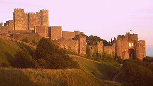
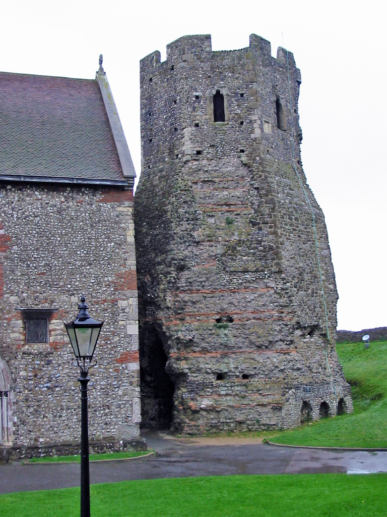
Entrance to Dover Castle viewed from the north-west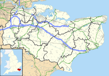
 Shown within Kent
Type Norman castle Coordinates 51°07′47″N 1°19′17″E / 51.1297°N 1.3214°ECoordinates: 51°07′47″N 1°19′17″E / 51.1297°N 1.3214°E Built 12th century Built by Henry II Current
conditionUnfinished Current
ownerEnglish Heritage Events First Barons' War Dover Castle is a medieval castle in the town of the same name in the English county of Kent. It was founded in the 12th century and has been described as the "Key to England" due to its defensive significance throughout history.[1][2] It is the largest castle in England.[3]
Contents
History
Roman
 The Roman lighthouse at Dover Castle
Originally the site may have been fortified with earthworks in the Iron Age or earlier, before the Romans invaded in AD43. This is suggested on the basis of the unusual pattern of the earthworks which does not seem to be a perfect fit for the medieval castle, although archaeological excavation at the Castle has found no evidence of prehistoric activity.
The site also contained one of Dover's two 80-foot (24 m) Roman lighthouses (or Pharoses), one of which still survives. On the site is a classic montrol (campsite) where the Normans landed after their victorious conquest.
Saxon and early Norman
 The view down from the Castle to the Church, possible Saxon burgh, and Harbour beyond.
After the Battle of Hastings in October 1066, William the Conqueror and his forces marched to Westminster Abbey for his coronation. They took a roundabout route via Romney, Dover, Canterbury, Surrey and Berkshire. From the Cinque Ports foundation in 1050, Dover has always been a chief member—it may also have been this that first attracted William's attention, and got Kent the motto of Invicta. In the words of William of Poitiers:
Then he marched to Dover, which had been reported impregnable and held by a large force. The English, stricken with fear at his approach had confidence neither in their ramparts nor in the numbers of their troops ... While the inhabitants were preparing to surrender unconditionally, [the Normans], greedy for money, set the castle on fire and the great part of it was soon enveloped in flames...[William then paid for the repair and] having taken possession of the castle, the Duke spent eight days adding new fortifications to it'. The Castle was first built, entirely out of clay. It collapsed to the ground and the clay was then used as the flooring for many of the ground-floor rooms.
This may have been repairs and improvements to an existing Saxon fort or burgh, centred on the Saxon church of St Mary de Castro, although archaeological evidence suggests that it was actually a new motte and bailey design castle built from scratch nearby.Henry II to early modern times
 Section of the western curtain wall leading to Peverell's Gateway
It was during the reign of Henry II that the castle began to take recognisable shape. The inner and outer baileys and the great Keep belong to this time. Maurice the Engineer was responsible for building the keep,[4] one of the last rectangular keeps ever built.
In 1216, a group of rebel barons invited Louis VIII of France to come and take the English crown. He had some success breaching the walls but was unable ultimately to take the castle (see The First Barons' War).
The vulnerable north gate that had been breached in the siege was converted into an underground forward-defence complex (including St John's Tower), and new gates built into the outer curtain wall on the western (Fitzwilliam's Gate) and eastern (Constable's Gate) sides. During the siege, the English defenders tunnelled outwards and attacked the French, thus creating the only counter tunnel in the world. This can still be seen in the medieval works.
By the Tudor age, the defences themselves had been superseded by gunpowder. They were improved by Henry VIII, who made a personal visit, and added to it with the Moat Bulwark.
During the English Civil War it was held for the king but then taken by a Parliamentarian trick without a shot being fired (hence it avoided being ravaged and survives far better than most castles) in 1642.
Napoleonic
 Undated sketch by Amelia Long (d.1837)
Massive rebuilding took place at the end of the 18th century during the Napoleonic Wars. William Twiss, the Commanding Engineer of the Southern District, as part of his brief to improve the town's defences, completed the remodelling of the outer defences of Dover Castle adding the huge Horseshoe, Hudson's, East Arrow and East Demi-Bastions to provide extra gun positions on the eastern side, and constructing the Constable's Bastion for additional protection on the west. Twiss further strengthened the Spur at the northern end of the castle, adding a redan, or raised gun platform. By taking the roof off the keep and replacing it with massive brick vaults he was able to mount heavy artillery on the top. Twiss also constructed Canon's Gateway to link the defences of the castle with those of the town.
With Dover becoming a garrison town, there was a need for barracks and storerooms for the additional troops and their equipment. The solution adopted by Twiss and the Royal Engineers was to create a complex of barracks tunnels about 15 metres below the cliff top and the first troops were accommodated in 1803. At the height of the Napoleonic Wars, the tunnels housed more than 2,000 men and to date are the only underground barracks ever built in Britain.
At the end of the Napoleonic Wars, the tunnels were partly converted and used by the Coast Blockade Service to combat smuggling. This was a short-term endeavour though, and in 1826 the headquarters were moved closer to shore. The tunnels then remained abandoned for more than a century.
The secret wartime tunnels
 The Second World War Coastal Artillery Operations Room in the Secret Wartime Tunnels
The outbreak of the Second World War in 1939 saw the tunnels converted first into an air-raid shelter and then later into a military command centre and underground hospital. In May 1940, Admiral Sir Bertram Ramsey directed the evacuation of French and British soldiers from Dunkirk, code-named Operation Dynamo, from his headquarters in the cliff tunnels.
A military telephone exchange was installed in 1941 and served the underground headquarters. The switchboards were constantly in use and had to have a new tunnel created alongside it to house the batteries and chargers necessary to keep them functioning. The navy used the exchange to enable direct communication with vessels, as well as using it to direct air-sea rescue craft to pick up pilots shot down in the Straits of Dover.
Later the tunnels were to be used as a shelter for the Regional Seats of Government in the event of a nuclear attack. This plan was abandoned for various reasons, including the realisation that the chalk of the cliffs would not provide significant protection from radiation, and because of the inconvenient form of the tunnels and their generally poor condition.
Tunnel levels are denoted as A - Annexe, B - Bastion, C - Casemate, D - DUMPY and E - Esplanade. Annexe and Casemate levels are open to the public, Bastion is 'lost' but investigations continue to gain access, DUMPY (converted from Second World War use to serve as a Regional Seat of Government in event of an atomic war) is closed, as is Esplanade (last used as an air raid shelter in the Second World War). DUMPY is an acronym for Deep Underground Military Position Yellow.
A statue of Admiral Sir Bertram Ramsay was erected in November 2000 outside the tunnels in honour of his work on the Dunkirk evacuation and protecting Dover during the Second World War.[5]
If they were being attacked they would have to move quickly as the enemies were just nine minutes away from Dover by plane. There are over three miles of these Tunnels going deep down into the chalky cliffs, some still undiscovered. There are tunnels that are far too dangerous to walk down.
The castle today
Dover Castle is a Scheduled Monument,[6] which means it is a "nationally important" historic building and archaeological site that has been given protection against unauthorised change.[7] It is also a Grade I listed building,[8] and recognised as an internationally important structure.[9] The castle, secret tunnels, and surrounding land are now owned by English Heritage and the site is a major tourist attraction. The Lord Warden of the Cinque Ports is officially head of the castle, in his conjoint position of Constable of Dover Castle, and the Deputy Constable has his residence in Constable's Gate.
The Princess of Wales's Royal Regiment Museum is located in the castle.
Between 2007 and 2009, English Heritage spent £2.45 million on recreating the castle's interior.[10] According to figures released by the Association of Leading Visitor Attractions, nearly 350,000 people visited Dover Castle in 2010.[11]
In film and TV
- The castle has 'played' the Tower of London in To Kill a King, Lady Jane, The Other Boleyn Girl, and the initial scene of Kevin & Perry Go Large.
- The 1996 version of The Wind in the Willows
- The 1990 film version of Hamlet, directed by Franco Zeffirelli.
- The castle served as a destination in the US TV series Treasure Hunters.
- The castle was used as a filming location for the Doctor Who serial The Mind of Evil.
- Scene of a 2002 Christmas original Most Haunted Live event.
- The castle was featured in a 1994 episode of ITV paranormal series Strange but True?.
- The castle and its tunnels served as locations in 2009 for the episode The Clocks in ITV's Agatha Christie's Poirot series with David Suchet.
- It was used for the 2003 production Johnny English.
Churches and chapels within its walls
Royal chapel
Within the keep, dedicated to Thomas Becket.
St Mary in Castro
Main article: St Mary in Castro, DoverSaxon church, rebuilt in the Victorian era.
Footnotes
- ^ Kerr, Nigel (1984). A Guide to Norman Sites in Britain. Granada. p. 44. ISBN 0586084452.
- ^ Broughton, Bradford B. (1988). Dictionary of Medieval Knighthood and Chivalry. Greenwood Press. p. 102. ISBN 0313253471.
- ^ Cathcart King, David J. (1983). Catellarium Anglicanum: An Index and Bibliography of the Castles in England, Wales and the Islands. Volume I: Anglesey–Montgomery. Kraus International Publications. p. 230.
- ^ Prestwich, Michael (1999). Armies and Warfare in the Middle Ages. Yale University Press. p. 285. ISBN 0300076630.
- ^ Admiral Sir Bertram Ramsay at www.dover-kent.co.uk
- ^ "Dover Castle", Pastscape (English Heritage), http://www.pastscape.org.uk/hob.aspx?hob_id=467778, retrieved 2011-03-07
- ^ "The Schedule of Monuments", Pastscape (English Heritage), http://www.english-heritage.org.uk/server/show/nav.1369, retrieved 2011-03-07[dead link]
- ^ "Dover Castle", Heritage Gateway website (Heritage Gateway (English Heritage, Institute of Historic Building Conservation and ALGAO:England)), 2006, http://www.heritagegateway.org.uk/Gateway/Results_Single.aspx?uid=177823&resourceID=5, retrieved 2011-03-07[dead link]
- ^ "Frequently asked questions", Images of England (English Heritage), http://www.imagesofengland.org.uk/Faqs/default.aspx?topic=4#25, retrieved 2011-03-07
- ^ King's lavish castle is brought to life, BBC News, 31 July 2009, http://news.bbc.co.uk/1/hi/uk/8177876.stm, retrieved 2011-03-07
- ^ Visits Made in 2010 to Visitor Attractions in Membership with ALVA, ALVA – Association of Leading Visitor Attractions, http://www.alva.org.uk/visitor_statistics/, retrieved 2011-08-14
See also
- Castles in Great Britain and Ireland
- Eastbourne Redoubt
- List of castles in England
- Pevensey Castle
References
- Goodall, John, "Dover Castle and the Great Siege of 1216", Chateau Gaillard v.19 (2000) (the online version lacks the diagrams of the print version)
- Jeffrey, Kate, "Dover castle", Published by English Heritage, 1997
Further reading
- Coad, Jonathan (1995), Book of Dover Castle and the Defences of Dover, B. T. Batsford, ISBN 0713472898
External links
- Dover Castle page at the English Heritage website.
- Bibliography of sources relating to Dover Castle
- Images of World War II tunnels
- Dover Castle images
- Friends of Dover Castle
Agricultural Museum · Ashford Museum · Belmont House and Gardens · Blue Town Heritage Centre · Brattle Farm museum · Bredgar and Wormshill Light Railway · Brenzett Aeronautical Museum · British Cartoon Archive · Chantry Heritage Centre · Chart Gunpowder Mills · Chartwell · Chatham Historic Dockyard · Chiddingstone Castle · Chillenden Windmill · C M Booth Motor Museum · Colonel Stephens Railway Museum · Court Hall Museum · Crabble Corn Mill · Crampton Tower Museum · Cranbrook Museum · Dartford Borough Museum · Davison's Mill · Deal Castle · Deal Maritime & Local History Museum · Deal Timeball Tower Museum · Dickens House Museum, Kent · Dover Castle · Dover Museum · Dover Transport Museum · Draper's Windmill · Dymchurch Martello Tower · East Kent Light Railway · Eastgate House · Eden Valley Museum · Elham Valley Railway Museum · Finchcocks · Fleur de Lis Museum and Gallery · Folkestone Museum · Fort Amherst · Godinton House · Gravesend's Secret Cold War Bunker · Guildhall Museum, Queenborough · Guildhall Museum, Rochester · Herne Windmill · Herne Bay Museum and Gallery · Hever Castle · Hop Farm Country Park · Hythe Library and Museum · Ightham Mote · Kent & Sharpshooters Yeomanry Museum · Kent Battle of Britain Museum · · Kent Life · Kent Museum of Freemasonry · Kent Police Museum · Knole House · Lashenden Air Warfare Museum · Leeds Castle · Lullingstone Roman Villa · Lydd Town Museum · Maidstone Museum & Art Gallery · Maison Dieu · Manston Fire Museum · Margate Old Town Hall Local History Museum · Mascalls Gallery · Meopham Windmill · Minster Abbey Gatehouse Museum · Museum of Canterbury · New Hall Museum · New Mill · Norman Museum · New Tavern Fort · Old Brook Pumping Station · Old Soar Manor · Otford Heritage Centre · Owletts · Penshurst Place · Powell-Cotton Museum · Princess of Wales Royal Regiment Museum · Quebec House · Queen's Own Royal West Kent Regiment Museum · RAF Manston History Museum · Restoration House · Rochester Art Gallery and Craft Case · Roman Museum · Roman Painted House · Romney, Hythe and Dymchurch Railway · Royal Engineers Museum · Royal Museum and Art Gallery · Salomons Museum · Sandwich Guildhall Museum · Sarre Windmill · Scotney Castle · Sevenoaks Museum · Sheerness Heritage Centre · Shoreham Aircraft Museum · Sittingbourne Heritage Museum · Six Poor Travellers House · Smallhythe Place · South Foreland Lighthouse · Spitfire & Hurricane Memorial Building · St Augustine's Abbey · St Margaret's Museum · Stocks Mill · Stoneacre · Swanton Mill · Teapot Island · Temple Manor · Tenterden & District Museum · Tonbridge Castle · Tunbridge Wells Museum & Art Gallery · Turner Contemporary · Tyrwhitt-Drake Museum of Carriages · Union Mill, Cranbrook · Upnor Castle · Walmer Castle · Walpole Hotel & Museum · West Gate Towers · Westenhanger Castle · White Mill Rural Heritage Centre · Whitstable Museum and Gallery · Woodchurch Mill · Woodchurch Village Life Museum
See also: Visitor attractions in KentCategories:- Visitor attractions in Kent
- History of Kent
- Castles in Kent
- Scheduled Ancient Monuments in Kent
- Forts in Dover, Kent
- English Heritage sites in Kent
- Invasions of England
- Napoleon's planned invasion of the United Kingdom
- Norman conquest of England
- History of Dover, Kent
- Napoleonic defences of Dover, Kent
- Grade I listed buildings in Kent
- Grade I listed castles
- Museums in Kent
- History museums in Kent
- Military museums in England
- World War II museums in the United Kingdom


Wikimedia Foundation. 2010.