- Mustang (kingdom)
-
Kingdom of Lo / Mustang 
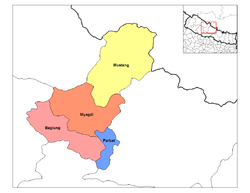 Location of Mustang District (yellow), one of four districts in the Dhawalagiri Zone
Capital Lo Manthang  Lo Manthang
Mustang (from Tibetan mun tan (Wylie smon-thang) which means “fertile plain”) is the former Kingdom of Lo and now part of Nepal, in the north-central part of that country, bordering the People's Republic of China on the Tibetan plateau between the Nepalese provinces of Dolpo and Manang. The culture is Tibetan Buddhist.
The Kingdom of Lo, the traditional Mustang region, and “Upper Mustang” are one and the same, comprising the northern two-thirds of the present-day Nepalese Mustang District, and are well marked by official “Mustang” border signs just north of Kagbeni where a police post checks permits for non-Nepalese seeking to enter the region, and at Gyu La (pass) east of Kagbeni.
Life in Mustang revolves around tourism, animal husbandry and trade. Except for a 9-km portion from Chhusang to Syangboche (just south of Ghiling (Geling)), as of August 2010, it is bisected by a new road linking it to the Tibet Autonomous Region (TAR) to the north and to the rest of Nepal to the south. Plans call for the final nine km portion to be completed in just a few years' time, which will provide, with a high point of 4660 m at Kora La on the Mustang-TAR border, the lowest drivable corridor through the Himalayas linking the Tibetan Plateau via Nepal to the tropical Indian plains. (The easiest and only widely used road corridor, from Kathmandu to Lhasa via the Arniko Rajmarg (or Arniko Highway), traverses a 5125 m pass.)
The Kingdom was overthrown in 2008 following the overthrow of its suzerain Kingdom of Nepal the same year.
The influence of the outside world, and especially China, is growing and contributing to rapid change in the lives of Mustang's people.[1]
Contents
Climate
Mustang is largely dry and arid with annual precipitation in the range of 250–400 mm due to its position in the rain shadow of the Annapurna massif and the Dhaulagiri Range towards the south.
Demographics
The population of Mustang District in 2001 was 14,981, spread between three towns and approximately thirty smaller settlements; the people are either Thakalis, Gurung or, in traditional Mustang, primarily Tibetan.
Most of the population of Mustang lives near the Kali Gandaki River, 2800–3900 m above sea level. The tough conditions cause a large winter migration into lower regions of Nepal. The administrative centre of Mustang District is at Jomsom (eight km south of Kagbeni) which has had an airport since 1962 and has become the main tourist entry point since Mustang was opened to western tourism in 1992.
Geography
The main hydrographic feature of Mustang is the Kali Gandaki River. The river runs southward towards Nepal Terai, bisecting Mustang. Routes paralleling the river once served as a major trade route between Tibet and India, especially for salt. Part of the river valley in the southern Mustang District forms by some measures the deepest gorge in the world. Traditional Mustang (the Lo Kingdom) is 53 km north-south at its longest and 60 km east - west at its widest, and ranges from a low point of 2750 m above sea level on the Kali Gandaki River just north of Kagbeni to 6700 m (Khamjung Himal, a peak in southeast Mustang.)
History
 Raja Jigme Dorje Palbar Bista
Mustang was once an independent kingdom, although closely tied by language and culture to Tibet. From the 15th century to the 17th century, its strategic location granted Mustang control over the trade between the Himalayas and India. At the end of the 18th century the kingdom was annexed by Nepal.
Though still recognized by many Mustang residents, the monarchy officially ceased to exist on October 7, 2008, by order of the Government of Nepal.[2] The last official and current unofficial king (raja or gyelpo) is Jigme Dorje Palbar Bista (born c.1933), who traces his lineage directly back to Ame Pal, the warrior who founded this Buddhist kingdom in 1380.[3] Ame Pal oversaw the founding and building of much of the Lo and Mustang capital of Lo Manthang, a walled city surprisingly little changed in appearance from that time period.[4]
In 2007, a shepherd in Mustang discovered a collection of 55 cave paintings depicting the life of Buddha.[5]
Tourism
Even though foreign visitors have been allowed to the region since 1992, tourism to Upper Mustang is regulated. Foreigners need to obtain a special permit to enter, which costs US$50 per day per person. Most tourists travel by foot over largely the same trade route used in the 15th century. Over a thousand western trekkers now visit each year, with over 2,000 in 2008, with October being the peak month, followed by August. On August 27, 2010, local youth leaders in Mustang threatened to bar tourists beginning October 1, 2010 due to the refusal of the Nepalese government to provide any of the $50 per day fee to the local economy[6]
In culture
- In the book Merlins Keep, a novel by Madeleine Brent (aka Peter O'Donnell), published 1977, Mustang is the setting for the heroine's youth and later adventures.
• In the book, The Kingdom, a novel by Clive Cussler and Grant Blackwood, published in 2011, Mustang is the setting for a large part of the adventure.
See also
References
- ^ Mustang: A Kingdom on the Edge Al Jazeera Correspondent
- ^ China View news
- ^ Wild, windy and harsh, yet stunningly beautiful; The Sunday Tribune; April 21, 2002
- ^ Peissel, Michel (1992) [1967]. Mustang - A Lost TIbetan Kingdom (2nd ed.). Book Faith India, Delhi. pp. 227–31.
- ^ Shepherd leads experts to ancient Buddha cave paintings; Guardian Unlimited; May 4, 2007
- ^ Mustang to Bar Tourists
Bibliography
- Marullo, Clara (1995). The Last Forbidden Kingdom, Mustang: land of Tibetan Buddhism. Written by Clara Marullo : photographed by Vanessa Schuurbeque. Charles E. Tuttle Co., Ltd., Rutland, Vermont. ISBN 0-8048-3061-4.
External links
Coordinates: 29°05′00″N 83°55′00″E / 29.0833333°N 83.9166667°E
Categories:- History of Nepal
- Former countries in Asia
- Tibetan Buddhist places
- Former monarchies of Asia


Wikimedia Foundation. 2010.