- Mauerstetten
-
Mauerstetten 

 MauerstettenLocation of Mauerstetten within Ostallgäu district
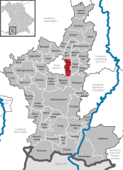
Coordinates 47°53′N 10°40′E / 47.88333°N 10.66667°ECoordinates: 47°53′N 10°40′E / 47.88333°N 10.66667°E Administration Country Germany State Bavaria Admin. region Swabia District Ostallgäu Mayor Alexander Müller Basic statistics Area 16.55 km2 (6.39 sq mi) Elevation 716 m (2349 ft) Population 3,041 (31 December 2010)[1] - Density 184 /km2 (476 /sq mi) Other information Time zone CET/CEST (UTC+1/+2) Licence plate OAL Postal code 87665 Area code 08341 Website www.mauerstetten.de Mauerstetten is a municipality in the district of Ostallgäu in the southwest of Bavaria in Germany.
Its foundations dates back to the early 9th century, and its name actually means "place of walls", due to ruins of supposedly Roman origin found there. Currently, Mauerstetten has about 2,800 inhabitants living in the four parts of the community: Mauerstetten itself, Steinholz, Hausen and Frankenried. Agriculture still plays a large role in the village, but some modest industry is to be found there as well.
The village has a primary school, a kindergarten, two banks (Sparkasse and RaiBa), a small grocery store, a bakery, and a small post office. In the center of Mauerstetten stands the church St. Vitus.
References
- ^ "Fortschreibung des Bevölkerungsstandes" (in German). Bayerisches Landesamt für Statistik und Datenverarbeitung. 31 December 2010. https://www.statistikdaten.bayern.de/genesis/online?language=de&sequenz=tabelleErgebnis&selectionname=12411-009r&sachmerkmal=QUASTI&sachschluessel=SQUART04&startjahr=2010&endjahr=2010.
External links
Aitrang · Baisweil · Bidingen · Biessenhofen · Buchloe · Eggenthal · Eisenberg · Friesenried · Füssen · Germaringen · Görisried · Günzach · Halblech · Hopferau · Irsee · Jengen · Kaltental · Kraftisried · Lamerdingen · Lechbruck · Lengenwang · Marktoberdorf · Mauerstetten · Nesselwang · Obergünzburg · Oberostendorf · Osterzell · Pforzen · Pfronten · Rettenbach am Auerberg · Rieden · Rieden am Forggensee · Ronsberg · Roßhaupten · Rückholz · Ruderatshofen · Schwangau · Seeg · Stötten · Stöttwang · Unterthingau · Untrasried · Waal · Wald · Westendorf Categories:
- Municipalities in Bavaria
- Ostallgäu
- Swabia geography stubs


Wikimedia Foundation. 2010.