- Colima
-
This article is about the Mexican state. For its capital, see Colima, Colima. For other uses, see Colima (disambiguation).
Colima
Estado Libre y Soberano de Colima— State — 
Flag
SealMotto: El temple del brazo es vigor en la tierra
(The spirit of the arm is force on earth)State of Colima within Mexico
Country Mexico Capital Colima Largest City Manzanillo Largest Metropolitan Area Colima–Villa de Álvarez Admission December 9, 1856[1][2] Order 23rd Government – Governor Mario Anguiano 
– Senators[3] Leticia Sosa Govea 
Jesús Dueñas
Rogelio Rueda– Deputies[4] Area[5] – Total 5,625 km2 (2,171.8 sq mi) Ranked 29th Highest elevation[6] 3,820 m (12,533 ft) Population (2010)[7] – Total 650,555 – Rank 31st – Density 115.7/km2 (299.5/sq mi) – Density rank 9th Demonym Colimense Time zone CST (UTC−6) – Summer (DST) CDT (UTC−5) Postal code 28 Area code ISO 3166 code MX-COL HDI  0.852 High Ranked 8th
GDP US$ 3,548,555.6 mil[a] Website Official Web Site ^ a. The state's GDP was 45,421,512 million of pesos in 2008,[8] amount corresponding to 3,548,555.6 millon of dollars, being a dollar worth 12.80 pesos (value of June 3, 2010).[9] Colima (Spanish pronunciation: [koˈlima]) is one of the 31 states which, with the Federal District, make up the 32 Federal Entities of Mexico. It shares its name with its capital and main city, Colima.
Colima is a small state located on Mexico’s central Pacific coast, sharing borders with the states of Jalisco and Michoacán. In addition to the capital city of Colima, the state's main cities include Manzanillo and Tecomán. Despite being the fourth smallest entity in Mexico with the lowest numerical population, the state has one of Mexico’s highest standards of living and lowest unemployment.
Contents
Geography and environment
 View of the volcanos from Carrizalillos Lake
 La Audiencia Beach in Manzanillo
The state covered a territory of 5,455km2 and is the fourth smallest federal entity after Tlaxcala, Morelos and the Federal District of Mexico City, with only .3% of the country total territory.[10][11] The state is located in the middle of Mexico’s Pacific coast, bordered by the states of Jalisco and Michoacán along with the Pacific Ocean. Colima’s territory also includes the Revillagigedo Islands which consist of Socorro, San Benedicto, Clarión and Roca Partida. They are under federal jurisdiction but are considered as part of the municipality of Manzanillo .[10] Politically, the state is divided into ten municipalities .[11] Natural geography divides the state into a northern and southern region. The north has a cooler climate due to the higher mountains. The south is hotter and includes the Pacific Ocean coastline. The Revillagigedo Islands are of volcanic origin which are dispersed along the19° north over an areas of about 400 km. In total, they cover an area of 205km2. The altitude of the state varies from zero at the coastline to 3,839 masl at the crater of the Colima Volcano .[12]
The state is found within a derivation of the Sierra Madre Occidental mountain range and geographically consists of four mountain systems. The most important of these is the Cerro Grande and its related peaks of Jurípicho/Juluapan, Los Juanillos, La Astilla, El Ocote, El Peón, El Barrigón, San Diego and La Media Luna. The second consists of mountain chains parallel to the coast between the Marabasco and Armería Rivers, which include El Espinazo del Diablo, El Escorpión, El Tigre, El Aguacate, El Centinela, El Tora and La Vaca. The third is located between the Armería and Salado Rivers and include the Alcomún y Partida, San Miguel y Comala and San Gabriel/Callejones peaks. The last is found between the Salado and Naranjo or Coahuayana Rivers and contains small mountain chains such as the Piscila, Volcancillos, La Palmera, El Camichín and Copales. Three quarters of the state is covered by mountains and hills.[10] At the very north of the state the border is marked by two volcanos. The Colima Volcano also called the Volcán de Fuego, which is active and the Nevado de Colima which is not. The Nevado de Colima is taller at 4,264 masl and gives its name to the national park that surrounds it. The Colima Volcano is 3825 masl and has a pyramidal peak in contrast to the other which has been leveled somewhat.[13] The last major eruptions of the Colima Volcano occurred in 1998 and 1999.[14]
The main rivers of the state are the Cihuatlán (also called the Chacala, Marabasco or Paticajo which forms the state’s border with Jalisco on the west, the Armería which descends from the Sierra de Cacoma and crosses the state north-south into the Pacific and the Coahuayana River. Another important river is the Salado River which flows entirely within Colima before emptying into the Coahuayana. Many of the state’s streams and arroyos empty into the Salado.[10]
Colima has a relatively short coastline with a length of 139 km or 1.2% of Mexico’s total which extends from the Boca de Apiza to the Cerro de San Francisco in front of Barra de Navidad, Jalisco .[10][15] Coastal lagoons include the Potrero Grande in Manzanillo along with the Miramar and the San Pedrito. On the Tecomán municipality coast there are the lagoons of Alcuzahua and Amela, with the Cuyutlán lagoon split between the municipalities of Armería and Manzanillo. Inland, there are various fresh water lakes, with the larger ones near the coast and smaller ones in the Valley of Colima. The valley lakes are fed by the runoff from the Colima Volcano and include the Carrizalillo, Las Cuatas, El Jabalí, El Calaboso, La María and La Escondida.[10]
The predominant climate of the state is hot and relatively moist, with the coast particularly moist. One exception is the Tecomán municipality where the climate is dry and very hot. The mildest climates are found in the municipalities of Comala and Cuauhtémoc. On the coast, the average temperature varies from between 24 and 26C and in the near, at the highest elevations, the temperatures averages between 20 and 22 C.[10]
Cropland covers 27% of the state’s territory, with another 28% dedicated to pasture. Forest covers 35% with the rest composed of bodies of water and urban areas. Most of the wild vegetation of western part of the state consists of rainforest of medium height which is moderately deciduous. Those plants that lose leaves do so in the dry season. These include commercially important trees such as red cedar, caobilla (Couratara guianensis), parota (Enterolobium cyclocarpum) and trees locally known as primavera, rosa morada, habillo, papelillo, barsino and salatón. From the west of Manzanillo and into the municipalities of Armería and Coquimatlán, there is rainforest of medium height with tree species such as copal (Bursera) and cuajilote (Parmentiera aculeate),with some pines, holm oaks and salt friendly mangrove forests and scrub.[10]
There is great diversity of wildlife species although a number of mammal species such as ocelots, pumas, wild boar and deer are disappearing. Among the state’s rodents is the Xenomis nelson, a small rare animal little known outside Colima. Bird species include wild turkeys, although these have mostly disappeared, and a bird called the chachalaca. A number of ducks and other migratory birds pass through. Reptiles include crocodiles, with a nursery in Tecomán dedicated to their survival in the wild. Another important reptile is sea turtles.[10]
Demographics
In the latter part of the 20th century, Colima had a very high population growth, expanding from 112,321 in 1950 to 567,996 in 2005. However, this growth has slowed due to family planning programs.[16] Despite this population growth, the state still ranks last of Mexico’s federal entities, with a total of 650,555 according to the 2010 census, only .6% of the country’s total.[11][17] By 1980, the majority of the state’s population was living in urban centers.[16] Today, 89% live in urban areas, above the national average of 78%.[11] These urban populations are concentrated in the municipalities of Colima, Manzanillo, Tecomán and Villa de Alvarez .[16]
The majority of the population is non-indigenous. As of 2005, only 2880 people were counted with the ability to speak an indigenous language.[16] This is about 7 out of 1000 people, slightly higher than the nation’s average of 6 per 1000 people.[11] However, there are ethnic Nahua and Otomi communities in Zacualpan and Suchitlán in the municipality of Comala, in Juluapan and Pueblo Nuevo in the municipality of Villa de Alvarez and in Las Pesadas in the municipality of Minatitlán. Over 95% of the state’s population is Catholic with small communities of other Christian groups making up the rest.[16]
Principal communities
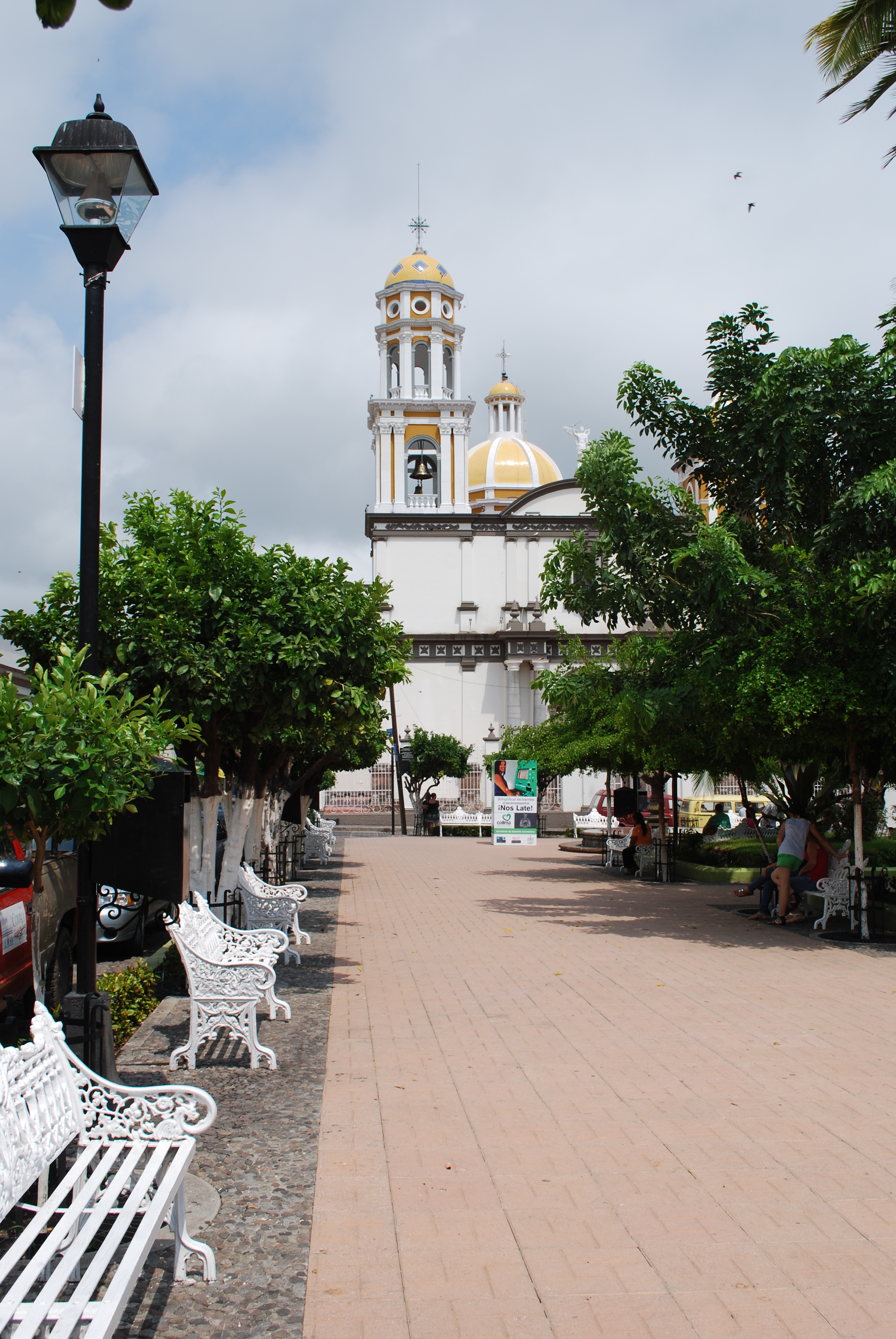
 Plaza and church in Comala
The city of Colima is capital and after which the state is named. It is located in the north central part of the state, just south of the foothills of the Colima Volcano in the Valley of Colima. The city began as a Spanish settlement which was originally established further south in 1523 but moved to the current location in 1527. The capital remains the state’s economic, political and cultural center.[18][19][20]
Villa de Álvarez is part of the city of Colima’s metropolitan area. However, it maintains a distinct identity with its combination bullfighting and charreada events which is one of the oldest of its kind in northwestern Mexico. It is also known for late evening meals called cenadurias with often feature sopes, enchiladas, tostadas, pozole, atole and tamales. The city has its origins from the end of the 18th century, established by someone known only by his last name of Martínez, and called Los Martínez. In 1818, a strong earthquake sent many from nearby San Francisco to the area and it was renamed San Francisco de Almoloyan. It was recognized as a town in 1860, with the name of Villa de Álvarez in honor of the first governor of the state. It was designated a city in 1991.[21]
Manzanillo is the state’s primary port and tourist destination, located on the Pacific coast less than two hour’s drive from the capital. Manzanillo is mostly popular with regional tourists and sports fishermen but there have been efforts to broaden its appeal.[22][23] The city is one of Mexico’s important Pacific ports, handing regional merchandise and acting as an overflow port for other ports from Mexico to Los Angeles. Most of the state’s recent economic development has been related to this port.[24]
Coquimatlán comes from a Nahuatl phrase meaning “land of networks” referring to the interconnected ravines in the area. It was founded in the very early colonial period and still maintains its narrow streets and old houses with large main doors of wood and balconies with simple ironwork.[25] Tecomán is located in what has been an agricultural valley since the colonial era, today best known for its production of limes. The town is marked by an abstract sculpture depicting a lime tree created by sculptor Sebastián, which measures thirty meters in height and weighs 110 tons. In addition to being the main lime producer, the Tecoman Valley also produces cocoa, cotton, coconuts, mangos, papaya, avocados and melons.[26]
Economy
 Example of Rangeliano style furniture
 Colima Historical Centre
The state has a high level of socioeconomic development, with one of the highest standards of living in Mexico and lowest unemployment.[22] In the state, 96% have running water, 82% have sewerage and 98% have electricity.[20] The 2009 GDP of the state was 43,370,725,000 pesos;[27] however, due to its small size and population, this is only .5% of Mexico’s total GDP.[11] Most population and employment growth has been in the main urban areas of the state such as Colima, Villa de Alvarez, Manzanillo and Tecomán.[19] According to INEGI (2010), 24.1% are employed in services. 20.4% in commerce, restaurants and hotels, 15.9% in transportation, storage and communications, 11.1% in finance, insurance and real estate, 9.5% in electricity, gas and water services, 5.7% in manufacturing, 5.1% in construction, 4.9% in agriculture and livestock and 3.8% in mining.[28]
Agriculture, forestry and fishing employ 1.2% of the state’s population and contribute 8.45% to its GDP. Colima produces about half of Mexico’s lime crop, and is second in the production of coconut meat and tuna .[29] The principal markets for Colima’s agricultural products, especially produce is Guadalajara, Mexico City, Puebla and Monterrey .[20] During the dry season, there is migration from the rural areas into the urban ones as most agricultural work takes place during the rainy season. Most farm work consists of the harvesting of fruit. The agricultural production supports an agro-industry which attracts workers from neighboring Jalisco and Michoacán .[16] Most of Colima’s agriculture is based on perennial plants such as fruit trees, producing limes, coconuts, mangos and bananas accounting for ninety percent of the volume of agricultural production and 79% of its value.[10][19] Colima is the primary producer of limes in Mexico. Other important crops include corn, rice, melons, sorghum, chili peppers, coffee, tomatoes and tomatillos.[19]
By volume the most important livestock is that of cattle, followed by domestic fowl, then honey and beeswax. Most livestock production is in the north of the state due to climate, and also includes pigs, goats and sheep.[10][19] Commerically productive forest stands at about 108,225 hectares with about sixty percent of the trees able to be sold. These forests are mostly rainforest with some areas of holm oak. Forestry has been decreasing in the state due to conservation measures.[10]
Fishing is concentrated on the coastline in ocean waters of about 641km2 as well as in 8350 hectares of lagoons and 2032 inland bodies of waters. There is also about 3000 hectares dedicated to fish farming. Fish production has increased considerably since the 1980s, most of which is due to more intensive ocean activities but fish production from rivers and lakes has also grown at about twelve percent as well. Principle catches include tuna and squid in which Colima ranks nationally at third and fourth place respectively. Other commercial species that exist include huachinangos, red porgy, combers, wahoo, mojarra and more. Fish farming is mostly dedicated raising of shrimp along lakes and lagoons such as Cuyutlán, Chupadero and Potrero Grande, with an annual production of about 5,000 tons. There is also some raising of oysters as well. The fishing industry in the state supports a canning industry mostly for tuna, shrimp and octopus along with the freezing of fish filets.[19]
Mining, construction and utilities employ 18.5% of the population and generate 27.53% of the GDP. Half of this is from the production of electricity, gas and water services. Mining is next in importance with the production of iron, mostly from the Peña Colorada, the largest deposit in the country.[10][29] Manufacturing contributes 4.7% of the state’s GDP with 2,007 units of production. Most facilities produce beverages, metal structures, canned foods, cereals, furniture, printed materials, building supplies and dairy products.[29]
Handcrafts in the state are mostly produced for local needs rather than the tourist market. One distinguished craft is the making of palm frond hats, including a local style called the colimote. Ixtlahuacán is noted for its production of hammocks. Other items include huarache sandals, boots, bird cages, cold cuts and costumes and masks for traditional dance. These costumes include "Indian" dresses decorated with cross stitch. The state is also known for the production of handcrafted furniture, especially those based on the designs of Alejandro Rangel Hidalgo, from Comala.[30] Villa de Álvarez produces decorative objects in fine wood. Suchitlán in the municipality of Comala is distinguished by its production of masks and other accessories for festivals and ceremonies. Villages on the sides of the Cerro Grande are the principal producers of baskets made from reeds and palm fronds. Santiago in the municipality of Manzanillo is noted for crafts made of seashell and snail shells. The main craft in the city of Colima is the reproduction of archeological pieces, especially ceramics of the old red-burnished (rojo-bruñido) style.[30]
About two thirds of the state’s GDP is from commerce and services which include transportation and storage, mostly linked with the Manzanillo port. Economic growth associated with the port continues to grow by double digits.[29] Most commercial activity in general is concentrated in the cities of Colima, Tecomán and Manzanillo, which have the most developed communications, transportation and other infrastructure. The main distribution center is the city of Colima handing both basic commodities and industrial and other commercial merchandise for the rest of the state.[20] Just under 95% of Colima’s commercial enterprises are retail outlets with 5.6% involved in wholesale. Only three percent of these enterprises are modern facilities with twenty one traditional markets, forty five major tianguis and numerous corner stores still dominating the state. Commercial sales increase by about five percent per year.[20]
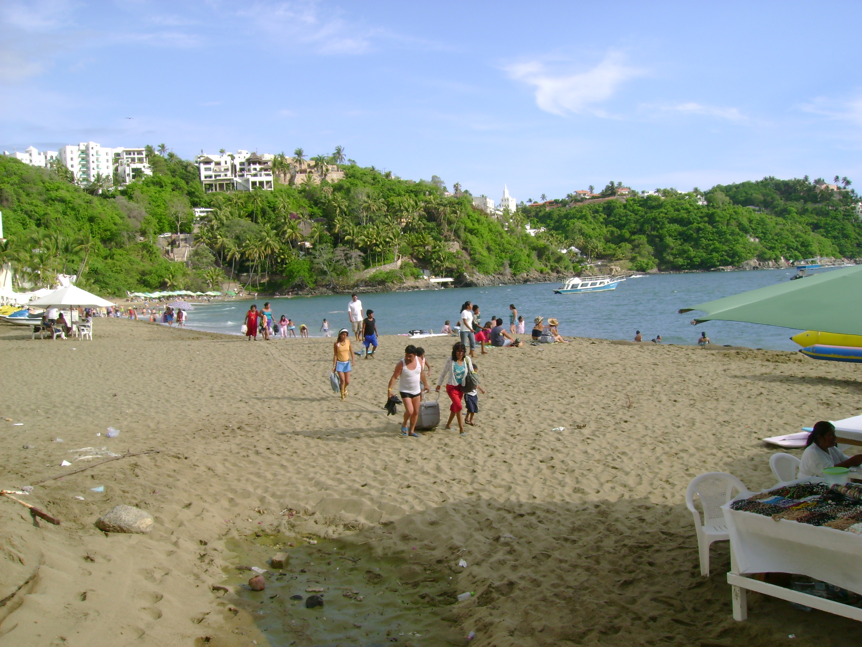
Much of the state’s tourism is centered on its beaches which include those of Manzanillo as well as those found in the municipalities of Armería and Tecomán. Manzanillo is the most popular in the state and a major tourism destination for Mexico’s Pacific coast. For this reason it has developed infrastructure with hotels, restaurants, golf courses, and other attractions.[23] For Holy Week 2011, one of Mexico’s busiest vacation times, the state gained 175 million pesos and had a hotel occupany of 94%, 7% higher than the previous year. 70,249 visited during that period. Most of the visitors were at the state’s beaches with the busiest being Cuyutlán, El Real and Miramar.[31]
Tourist attractions
 Santiago Beach in Manzanillo
 MS Queen Victoria in Manzanillo
Colima’s most important tourism destination is the beaches of Manzanillo, which is popular among those in western Mexico as well as many sports fishermen. Historically, the port was the point of departure for various maritime expeditions and received the annual Manila Galleon from the Philippines. It has called itself the “World Capital of the Sailfish” since 1957 when 336 species were caught off its shores. The abundance of this fish along with marlin has made it a popular destination with sports fishermen and the city holds the annual Dorsey International fishing tournament.[23] However, it is not as well known or as well visited as other Pacific destinations such as Puerto Vallarta, despite long sandy beaches and docks for cruise ships. In the 2000s, the city worked to renovate its downtown, with all buildings now showing white facades and many with red tile roofs.[22]
The second most important destination is the small town of Comala, a small traditional town near the capital of Colima. Comala was named a “Pueblo Mágico” in 2002 because of its natural surroundings and traditional architecture, which its downtown declared a historic monument. Since 1962, all the buildings in the town have been painted white and most have red tile roofs, giving it the nickname of “White Village of America.”[32][33]
Most of the other attractions of the state are related to its history, and most of these are in and around the capital city of Colima. The former state government palace is located in the center of the city of Colima and dates from the 19th century. The main stairwell contains a mural by Colima painter Jorge Chávez Carrillo. The Palacio Federal is near Jardín Núñez in the city of Colima and dates from the beginning of the 20th century. The upper floor contains murals with scenes depicting Mexico City and portraits of people from Mexico’s history. The Archive of the History of the State is located at Jardín Juárez in the city of Colima. It dates from the early 20th century and was home to the Escuela de Artes Aplicadas. San Francisco de Almoloyan in the city of Colima is the ruins of an old Franciscan monastery from the 16th century. The Mesón de Caxitlán on the Colima Tecomán highway is the ruins of an old in on the former royal road from the 18th century.[32]
Other important attractions include a number of former haciendas, many of which have been renovated. The Del Carmen hacienda is located in the municipality of Villa de Álvarez. It was a cattle ranch from the 19th century which has been restored. The San Antonio hacienda is located in the municipality of Comala. It was a coffee plantation from the 19th century with a chapel and aqueduct which has all been restored. The former Nogueras hacienda in Comala has a main house that dates from the 19th century and a chapel from the 17th. It has been restored and is used primarily as a museum.[32]
Culture
Indigenous, Spanish, African and Philippine cultures have played a part in the shaping of the state, although traces can be hidden in modern local cultures and traditions. Most crafts and dances of the state are of indigenous origin although some originated after the Conquest. The Spanish contributed bullfighting and charreada. African influenced dialects such as guango and candingo still exists and giant costume/puppets called mojigangos are of African origin as well. The popularity of coconuts in the state is derived from Philippine and other Asian slaves that were brought to the state. Among the most popular folk dances in the state include those which tell the story of the Spanish conquest, which goes under various names such as “conquista,” “Virgin of Guadalupe,” “capotes” and “malinches.” Another popular dance is called “apaches.” Both originated during the colonial period, along with “moros y cristianos” and “matachines.” Dances with indigenous roots include “sonajera india” and “morenos.” Pastorelas, or short plays with religious themes, are traditions that began in the very early colonial period. One popular one from that time is the “Adoration of the Three Wise Men” although it has evolved to meet modern tastes.[34]
There are a number of important local festivals and other annual events. January 6 is the Los Chayacates de Ixtlahuacán, which is a mix of indigenous and Catholic practices based on the pastorela and the cultivation cycle of corn. On the Tuesday after Epiphany is the “Entrance of the Señor de la Expiración” in Rancho de Villa. On this date the image returns to this village from Coquimatlán. It includes parades, dances, fireworks and jaripeos.[34][35] Candlemas is an important event in Tecomán with traditional dances and fair.[34] Candlemas in Suchitlán is the most important annual event in the region, celebrated with dances such as Los Gallitos, Los Apaches and Los Morenos. The last two dances involved dancers with elaborately carved and decorated masks.[35]
Villa de Álvarez celebrates its annual Fiestas Charro-Taurinas, which originally was the feast of the city’s patron saint, Philip of Jesus. In additions to bullfights and charreadas, mojigangas are featured as well. The Paspaques of Suchitlán on 19 March is celebrated by the Nahuas of this small village, which is an agricultural ritual of pre-Hispanic origin. Center to it is the preparation of corn in various ways such as tortillas, tamales, pozole and more. Holy Week is a major event in many municipalities which often hold passion plays during the week.[34]
The Feria de Manzanillo occurs from 29 April to 1 May and celebrates the anniversary of its designation as a major port (Puerto de Altura). It is held with street parties, dances, contests and jaripeos.[35] 3 May is the Day of the Holy Cross, important in Suchitlán and celebrated with the “morenos” dance.[34] The Fiestas del Cristo de Caña in Quesería in May revolves around a Christ image of the 18th century which came to the area from Pátzcuaro. It is celebrated with horse races, mojigangas, traditional dance, processions and music.[35] On 29 September Tamala, municipality of Ixtlahuacán celebrates the feast of the Archangel Michael with a change of “mayordomos” (festival sponsors) .[34]
The most important festival in the state is Day of the Dead. For the week before and the week after, the state’s Agricultural, Industral and Cultural Fair is held.[34] On 1 November, the city of Colima has a agricultural, livestock, commerce and industry fair which includes dances, parades with floats and a charreada.[35] Pastorelas are most commonly seen during December between the feast day of the Virgin of Guadalupe (12 December) and Christmas.[34] Comala celebrates the feast of the Virgin of Guadalupe from the first to the 12 of December with processions, bullfights, jaripeos, cockfights and on the eighth with a dance to popular music, floats and fireworks.[35]
The state has produced one internationally famous artist named Alejandro Rangel Hidalgo. He is best known for its illustration of Christmas cards for UNICEF in the 1960s, but he also did other work and even designed furniture in a style now called Rangeliano. Many of his works are preserved at his former home of the Nogueras Hacienda in Comala, which is now a museum and cultural center run by the University of Colima .[36][37] Other noted artists from the state include Alfonso Michel, Gabriel Portillo del Toro, Mercedes Zamora, Jorge Chávez Carrillo, Pancha Magaña and Juan Soriano. Noted writers include Gregorio Torres Quintero, Fray Juan de Grijalva, Balbino Dávalos Balkin and Felipe Sevilla del Río .[38]
Communications and transportation
 Playa de Oro airport in Manzanillo
The most important transportation hub in the state is the port of Manzanillo, handling 91.3% of the shipping of the state and the immediate region.[24] It also operates as an overflow port for the commercial and industrial zones of western Mexico, the Bajío area and the center of Mexico, but handles overflow from as far as Los Angeles. Most of the merchandise that passes through here is part of the trade between Mexico and Asia.[24][39] The port infrastructure consists of two types of installations. One is artificial, located in the interior port of San Pedrito and the other located in the bay proper. The artificial structure is a tall dock with a length of 450 meters and 225 meters wide for a surface of 10,125m2.[20] The Manzanillo port has a dock for cruise ships which is visited by about 58 ships per year on average. Nearby there are two large private marinas, one in Las Hadas and the other at Isla Navidad.[23] The port area is not fully developed with over 130 hectares in reserve for expansion.[39]
The two main airports are the Playa de Oro International Airport in Manzanillo and the Lic. Miguel de la Madrid Airport in Colima.[20] Playa de Oro has flights to and from destinations in Mexico, the United States and Canada.[23] The Miguel de la Madrid airport was opened in 1987, twenty two km outside the capital. It extends over 386 hectares with runways that cover 16,200m2. The longest runway is 2.3 km long. It has one terminal.[40] Most of the Colima airport flights go to Mexico City, with about 100,000 passengers going through the terminal in 2009.[41] There are eight AM radio stations operating in the state and five FM stations. Most are in Colima and Manzanillo. There is no local television station with programming coming from Mexico City and through cable. Telephone service covers the entire state but rural areas still use analog. There are still some telegraph centers. The state has fourteen newspapers mostly in the city of Colima and Manzanillo.[20]
The state has 1,424.5 km of roadway with 686.9 km paved with asphalt and the rest stone or dirt road. The main highway out of the state connects the city of Colima and Guadalajara. The second most important connects Manzanillo with Guadalajara. This roadway has broken Mexican records in the dimensions of its bridges. There are 191.5 km of railway with fifteen active stations.[20]
History
Name and seal
The formal name of the state is “Estado Libre y Soberano de Colima” (Free and Sovereign State of Colima). The state is named after the capital city of Colima. This name is most likely derived from a Nahuatl phrase “coliman,” but the original meaning is in doubt with two most accepted versions. One interpretation means “place in the hand of the grandfather” with “grandfather” possibly referring to the volcano. The other interpretation is “place in the hands of the ancestors.”[42][43] A third interpretation is based on an interpretation of Colima’s glyph as it appears in the Nomina and Mendocino codices, which as a bend arm with the hand turned and water on the shoulder. This glyph is still used in the state’s seal. This interpretation would then be “place where the waters bend.”[43]
Pre-Hispanic period
 Pyramid in La Campana
The state was home to a number of pre-Hispanic cultures as part of Western Mexico.[42] Archeological evidence dates human occupation of the area as far back as 1500 BCE, with sites here contemporary with San Lorenzo on the Gulf Coast and Tlatilco in the Valley of Mexico. One period of the area’s development is called the Los Ortices era which began around 500 BCE. During this time the elements which characterize the pre-Hispanic peoples of Colima appear such as shaft tombs and a distinctive ceramic style called “rojo bruñido” or burnished red. The next phase called Comala, covers the time period from around 100 to 600 CE, centered on a site of the same name. Comala people would perfect burnished red pottery and develop representations of people and animals with skill and fluid lines. The best known of these figures are known as the “fattened dogs”. The Comala site shows influence from Teotihuacan. Around 500 CE, another site in Armería developed along the river of the same name.[18]
The Chanal site was active from the 6th to the 15th centuries and was the main culture for the Colima area. Belonging to this culture was a number of smaller sites and most of the ones known and explored to date. After Chanal the largest related site is La Campana but most contain pyramidal bases and plazas with structures often containing rounded edges. Images of Huehueteotl and Tlaloc appear with this culture, which may indicate the origins of the cultures that ultimately settled central Mexico.[18]
There is one other site called Periquillo, which indicates one late migration into Colimas around the 10th century from the north.[18]
At the beginning of the 16th century, the P’urhépechas invaded the territory of the Tecos and got as far as the salt fields of Tzacoalco. However, a chief named Colimotl or Colliman defeated the P’urhépechas during the Salitre War (Guerra del Salitre). After this, the Tecos conquered Sayula, Zapotlán and Amunla, making them the dominant cultural group in this part of the state.[42][44] Both the Periquillo and Chanal sites were occupied when the Spanish arrived in the 16th century.[18]
Colonial era
After conquering the Aztecs and the P’urhépecha, the Spanish made incursions into Colima.[42] The first incursion into the Colima area occurred under Juan Rodríguez de Villafuerte in 1522 but was defeated by the natives of the Tecomán Valley.[18] Hernán Cortés then sent Gonzalo de Sandoval to defeat the Tecos, which he did at the Paso de Alima and the Palenque de Tecomán.[18][44] Sandoval then established the first Spanish settlement in the Colima Valley called Caxitlán in 1523, making it the third oldest functioning city government in Mexico and the second municipality of western New Spain .[18][42] In 1527, Francisco Cortés de San Buenaventura moved the Spanish settlement to its current located and changing the name to San Sebastián de Colima.[18]
Revillagigedo Archipelago was discovered 1533 by Hernando de Grijalva. The state’s first port at Tzalahua would be an important site for about 300 years of Spanish colonial rule as a line of defense and a commercial center.[42]
After the Conquest, the native population was reduced drastically. Some estimations state that the population declines from 150,000 in 1523 to 15,000 in 1554, rebounding somewhat in the 17th century. This population reduction led to the introduction of African slaves and indigenous people from neighboring regions.[18]
Evangelization was carried out by the Franciscans who established the San Francisco de Coliman monastery in 1554 then the Almoloyan monastery.[44] They would be followed by the Mercedarians and the Brothers of Saint John of the Cross. It was originally made part of the diocese of Valladolid (Morelia) .[18]
The port of Manzanillo, then called Santiago de Buena Esperanza, played a large part in the expeditions north ordered by Hernán Cortés and led to the discovery of the Californias. Cortés de San Buenaventura set out to conquer towards the north, covering the rest of the state and into what is now the south of Sinaloa. Later the port would be a target for pirates as the Manila Galleon would stop here. These pirates would include Francis Drake and Thomas Cavendish. The last major battle against pirates at Manzanillo was in 1615 with Captain Sebastián Vizcaino defending the port against Dutch pirate Joris van Speilbergen .[18]
However, Colima would lose lands during the colonial period and into the 19th century. With the creation of Nueva Galicia in 1531, Colima lost its territories north of the Cihuatlán or Marabasco River and the region south of Lake Chapala. In 1550, Colima lost the provinces of Autlán and Amula. By the end of the 16th century, it lost the Motines region, now part of Michoacán and in the 19th century the Xilotlán region to Jalisco.[18]
From the early colonial period, Colima was a province that answered to Mexico City. In 1789, the parish of Colima was incorporated into the diocese of Guadalajara. In 1796, Colima was converted into a sub delegation of the province of Guadalajara.[18]
One colonial area industry in Colima was the production of “coconut wine” an alcoholic beverage distilled from palm fruit and coconut. One of the first introduced crops was cacao in the 16th century, which coconut, sugar cane and cotton coming later. Even later crops such as rice, indigo and vanilla would be added.[18]
Independence to the present
In the early 19th century, the commercial port of Manzanillo was opened to domestic and international traffic for a brief time. The first Colima newspaper called “El Observador de las Leyes” was published at this time as well.[18]
With the outbreak of the Mexican War of Independence, authorities arrested the head of Indian communities along with suspected insurgents in October 1810. This was despite the fact that Nahua groups had organized to defend against the insurgents upon hearing that they were enemies of the king and planned to destroy churches. One accused insurgent was José Antonio Díaz, the parish priest of Almoloyán and friend of Miguel Hidalgo y Costilla. Later he would join the insurgent army. During the war, the city of Colima was taken by the insurgents Jose Antonio Torres at the end of 1810 without resistance and taken back by the royalist army in 1811.[18][42] In 1811, royalist troops defeated the insurgents under José Calixto Martinez at the Battle of Los Llanos de Santa Juana. Insurgents took back the city in 1812 under the command of Ignacio Sandoval and Miguel Gallaga. In 1813, the city was in royalist hands with the city swearing allegiance to the monarchist constitution. In 1821 the Plan of Iguala for Mexican independence was proclaimed in the city which was accepted by local authorities. Immediately after Independence, Colima was still a subdelegation of Guadalajara. In 1821, Colima lost the Zapotlán areas along with the towns of Tecalitlán and Xilotlán, but gained the town of Tonila. This and earlier losses of territory would define the area’s modern borders.[18]
In 1824, with Mexico’s first constitution, Colima was an independent territory of Mexico, However, it was integrated with Michoacán later in 1837. In 1846, Colima became a separate territory again, and in 1856, was made a state with the triumph of the Liberals. Its status as a state was reaffirmed by the 1857 Mexican Constitution and General Manuel Alvarez was declared its first constitutional governor.[18][42]
Colima served as a provisional seat for Benito Juárez’s Liberal government in 1858 during the Reform War. In 1861, the Revillagigedo Islands were added to Colima’s territory. French troops entered the city in 1864, dissolving the state congress, with Colima becoming a department in 1865. In 1867, Republican troops under Ramon Corona retook the city.[18] Colima became a diocese independent of Guadalajara in 1881.[45]
The latter part of the 19th century saw the introduction of industry with textile factories such as La Armonía, La Atrevida and San Cayetano. The telegraph arrived to the state in 1869 to connect the capital and the port of Manzanillo. Similarly, the telephone service was added in 1883. Railroad service between the two cities began in 1889 and a city tram was added to the capital in 1892.[18]
During the Mexican Revolution, there were no major battles but there were local clashes. In 1911, troops loyal to Francisco I. Madero entered Colima and suspended the state congress. After the war, social organizations that would mark Mexico’s development for much of the 20th century were created in Colima as well, especially ejidos, with the one in Suchitlán being the first. Another important movement was the creation of workers’ unions and cooperatives such as the Unión de Estibadores in Manzanillo. In 1919, President Venustiano Carranza created the Sociedad Cooperativa de Salineros in the city of Colima with the exclusive rights to extract salt from Cuyutlán Lake. These changes were imposed by federal authorities outside of Colima, leading to political instability within the state, especially during elections.[18]
Federal intervention from Mexico City continued into the 1920s, with a number of laws to reform schools, hospitals and other institutions, which before had been mostly operated by the Catholic Church. This was opposed by many in the state who supported the Church’s formerly prominent role in political and social affairs. The Ley de Cultos (Religion Law) of 1926 gave rise to the Cristero War pitting those favoring the Catholic Church against those favoring agrarian and socialist reform. Battles and skirmishes related to this conflict took place in a number of locales in Mexico but it cause severe problems in Colima, causing major divisions with no formal resolution.[18]
The textile production of the 19th century had terminated by the mid 20th century although cotton continued to be growth, shipped to Guadalajara. In the 1940s, the Tecomán Valley began to be intensively cultivated, starting a new source income for the state with limes as the principle crop leading to the development of agro-industry.[18]
 Colima University Hall "Coronel Pedro Torres Ortiz"
The Universidad (Popular) de Colima was founded in 1942.[18]
Much of the history of the latter 20th century into the present has revolved around economic development. The Plan Colima was conceived and executed to improve the general infrastructure of the state during the 1980s by then Mexican president Miguel de la Madrid. It was prompted mostly by road congestion due to port shipping in Manzanillo as well as the growing tourism sector. It was designed to facilitate in-state transportation and connect the state better to the rest of Mexico. The main aspect of the plan was the construction of highways such as the highway that connects Manzanillo to Guadalajara and then onto Tampico. This highway was amplified at the end of the decade and made a toll road on approach to Manzanillo. The last decades have seen a new wave of industrial construction with the building of facilities for businesses such as Cementos Apasco, Citrojugo, Brun Foods, Embotelladora de Tecomán, Consorcio Minero Benito Juárez-Peña Colorada, Grupo Agroindustrial de Occidente, AMTEX and others.[24]
However, Mexico’s struggles with drug traffickers have not skipped the state, which is along Pacific Coast drug smuggling routes. For the first quarter of 2011, there were 52 registered homicides in the state, most linked to organized crime. This is significantly higher than previous years with most of these occurring in Colima, Villa de Alvarez and Manzanillo.[46]
Archeology
El Chanal is located four km north of the city of Colima. It is a complex of pyramid platforms with stairs, a Mesoamerican ballcourt and a number of plazas. One distinctive feature of the site are its stones with glyphs which are found on stairways.[32]
La Campana is found in the urban area of Villa de Álvarez. It is a ceremonial center with various temples and pyramidal platforms with rounded edges. At least one of the platforms was used as a mausoleum with the tomb inside still visible.[32]
Education
The state has 307 preschools, 510 primary schools, 131 middle schools and 57 high school and vocational level schools. Today, over 85% of the population finishes primary school. Just under 90% of those who start middle school finish. Over 91% of the population over the age of 15 is literate.[20] However, only about 12% of the state’s population has a university level education and 26% have not finished primary school or have had no schooling at all.[19]
High school level education is available in all regions of the state, with just under sixty percent of those starting a program finishing it, with most that do not dropping out.[20]
The state system also has schools dedicated to special education, vocational training and early childhood centers for those needing various types of physical and educational therapy. Literacy programs for adults are handled by INEA and CONAFE.[20]
Higher education consists of a number of technological schools, universities and teachers’ colleges. Just over half of these are located in the city of Colima, with about 19% in Villa de Alvarez and eleven percent in Tecomán. Most technology related higher education is provided by the Instituto Tecnológico de Colima, with 76% of the students, followed by ITESM- Colima with 7.6% and Instituto Autónomo de Educación Superior de Tecomán with 16.2%. Most of the general university education is provided by the University of Colima (over 93%) with the rest attending the Universidad Autónoma del Pacífico. The main teachers’ colleges are the Instituto Superior de Educación Normal de Colima and the Universidad Pedagógica Nacional. The main providers of post graduate education are the University of Colima and ITESM-Colima.[20]
The University of Colima was founded in 1940, following the educational philosophy of President Lázaro Cárdenas meant to provide higher education to the poorer classes. Today, the university offers high school level classes along with undergraduate and graduate degrees. Much of the institution’s current size and offering is due to growth which occurred in the 1980s, and during this time its reputation in Mexico and abroad increased. Most of the university’s majors are concentrated in agriculture, industry and commerce with aim of enhancing Colima’s economy.[47]
The Instituto Tecnológico de Colima was founded in 1976 with three majors in engineering and business with the aim of providing an alternative education focusing on preparing students for industry and service markets. Since then it has added majors in biotechnology, computer science, mechatroncics and architecture, offering six undergraduate degrees and one master’s degree.[48]
See also
References
- ^ "Portal Ciudadano de Baja California" (in Spanish). http://www.bajacalifornia.gob.mx/portal/nuestro_estado/historia/efemerides/en-diciembre.jsp.
- ^ "El Comentario" (in Spanish). http://elcomentario.ucol.mx/Noticia.php?id=1260333428.
- ^ "Senadores por Colima LXI Legislatura". Senado de la Republica. http://www.senado.gob.mx/index.php?ver=int&mn=4&sm=4&id=9. Retrieved October 20, 2010.
- ^ "Listado de Diputados por Grupo Parlamentario del Estado de Colima". Camara de Diputados. http://sitl.diputados.gob.mx/LXI_leg/listado_diputados_gpnp.php?tipot=Edo&edot=8. Retrieved October 20, 2010.
- ^ "Resumen". Cuentame INEGI. http://cuentame.inegi.gob.mx/monografias/informacion/col/default.aspx?tema=me&e=06. Retrieved October 20, 2010.
- ^ "Relieve". Cuentame INEGI. http://cuentame.inegi.gob.mx/monografias/informacion/col/territorio/relieve.aspx?tema=me&e=06. Retrieved October 19, 2010.
- ^ "Proyecciones de la población de México 2005-2050". Consejo Nacional de Población. http://www.conapo.gob.mx/00cifras/proyecta50/06.xls. Retrieved August 10, 2010.
- ^ "Colima.". 2010. http://www.inegi.org.mx/sistemas/bise/mexicocifras/default.aspx?ent=6. Retrieved October 20, 2010.
- ^ "Reporte: Jueves 3 de Junio del 2010. Cierre del peso mexicano.". www.pesomexicano.com.mx. http://www.pesomexicano.com.mx/archivo/2010/junio/03/reporte-jueves-3-de-junio-del-2010--cierre-del-peso-mexicano.htm#leermas. Retrieved August 10, 2010.
- ^ a b c d e f g h i j k l m "Medio Físico [Environment]" (in Spanish). Enciclopedia de los Municipios de México Colima. Mexico: Instituto Nacional para el Federalismo y el Desarrollo Municipal and Gobierno del Estado de Colima. 2005. http://www.inafed.gob.mx/work/templates/enciclo/Colima/. Retrieved July 29, 2011.
- ^ a b c d e f "Resumen [Summary]" (in Spanish). Mexico: INEGI. http://cuentame.inegi.org.mx/monografias/informacion/col/default.aspx?tema=me&e=06. Retrieved July 29, 2011.
- ^ "Regionalizacion [Regions]" (in Spanish). Enciclopedia de los Municipios de México Colima. Mexico: Instituto Nacional para el Federalismo y el Desarrollo Municipal and Gobierno del Estado de Colima. 2005. http://www.inafed.gob.mx/work/templates/enciclo/Colima/. Retrieved July 29, 2011.
- ^ "Nevado de Colima, Colima" (in Spanish). Mexico Desconocido magazine. http://www.mexicodesconocido.com.mx/nevado-de-colima-colima.html. Retrieved July 29, 2011.
- ^ Jiménez González, Victor Manuel, ed (2009) (in Spanish). Colima:Guía para descubrir los encantos del estado [Colima: Guide to discover the charms of the state]. Mexico City: Editorial Océano de México SA de CV. pp. 30. ISBN 978 607 400 172 3.
- ^ "Territorio [Territory]" (in Spanish). Mexico: INEGI. http://cuentame.inegi.org.mx/monografias/informacion/col/territorio/default.aspx?tema=me&e=06. Retrieved July 29, 2011.
- ^ a b c d e f "Perfil Sociodemográfico [Sociodemographic profile]" (in Spanish). Enciclopedia de los Municipios de México Colima. Mexico: Instituto Nacional para el Federalismo y el Desarrollo Municipal and Gobierno del Estado de Colima. 2005. http://www.inafed.gob.mx/work/templates/enciclo/Colima/. Retrieved July 29, 2011.
- ^ "Número de habitantes [Number of inhabitants]" (in Spanish). Mexico: INEGI. http://cuentame.inegi.org.mx/monografias/informacion/col/poblacion/default.aspx?tema=me&e=06. Retrieved July 29, 2011.
- ^ a b c d e f g h i j k l m n o p q r s t u v w x y "Historia [History]" (in Spanish). Enciclopedia de los Municipios de México Colima. Mexico: Instituto Nacional para el Federalismo y el Desarrollo Municipal and Gobierno del Estado de Colima. 2005. http://www.inafed.gob.mx/work/templates/enciclo/Colima/. Retrieved July 29, 2011.
- ^ a b c d e f g "Actividad Económica [Economic activity]" (in Spanish). Enciclopedia de los Municipios de México Colima. Mexico: Instituto Nacional para el Federalismo y el Desarrollo Municipal and Gobierno del Estado de Colima. 2005. http://www.inafed.gob.mx/work/templates/enciclo/Colima/. Retrieved July 29, 2011.
- ^ a b c d e f g h i j k l m "Infraestructura Social y de Comunicaciones [Social Infrastructure and Communications]" (in Spanish). Enciclopedia de los Municipios de México Colima. Mexico: Instituto Nacional para el Federalismo y el Desarrollo Municipal and Gobierno del Estado de Colima. 2005. http://www.inafed.gob.mx/work/templates/enciclo/Colima/. Retrieved July 29, 2011.
- ^ "Conociendo Villa de Álvarez [Getting to know Villa de Alvarez]" (in Spanish). Colima, Mexico: Secretaria de Turismo de Colima. http://www.visitacolima.com.mx/villaDeAlvarez/villaDeAlvarez.html. Retrieved July 29, 2011.
- ^ a b c Kalosh, Anne (August 2002). "From cargo to cruise". Latin Trade 10 (8): 66.
- ^ a b c d e "Conociendo Manzanillo [Getting to know Manzanillo]" (in Spanish). Colima, Mexico: Secretaria de Turismo de Colima. http://www.visitacolima.com.mx/manzanillo/manzanillo.html. Retrieved July 29, 2011.
- ^ a b c d Xóchitl América Contreras Vázquez (2006). Globalización, expansión urbana y vivienda en los municipios de Colima y Villa de Alvarez (MA thesis). Universidad de Colima. http://www.insumisos.com/lecturasinsumisas/Globalizacion%20y%20expansion%20urbana%20caso%20Colima.pdf. Retrieved July 29, 2011.
- ^ "Conociendo Coquimatlán [Getting to know Coquimatlán]" (in Spanish). Colima, Mexico: Secretaria de Turismo de Colima. http://www.visitacolima.com.mx/coquimatlan/coquimatlan.html. Retrieved July 29, 2011.
- ^ "Conociendo Tecomán [Getting to know Tecomán]" (in Spanish). Colima, Mexico: Secretaria de Turismo de Colima. http://www.visitacolima.com.mx/tecoman/Tecoman.html. Retrieved July 29, 2011.
- ^ "Colima" (in Spanish). Mexico: INEGI. 2010. http://www.inegi.org.mx/sistemas/mexicocifras/default.aspx?ent=06. Retrieved July 29, 2011.
- ^ "Actividades económicas [Economic activities]" (in Spanish). Mexico: INEGI. http://cuentame.inegi.org.mx/monografias/informacion/col/economia/default.aspx?tema=me&e=06. Retrieved July 29, 2011.
- ^ a b c d "Sectores Productivos del Estado [Productive sectors of the state]" (in Spanish). Colima, Mexico: State of Colima. http://www.colima-estado.gob.mx/negocios/contenido.php?iw=56. Retrieved July 29, 2011.
- ^ a b "Artesanías [Handcrafts and folk art]" (in Spanish). Colima, Mexico: State of Colima. http://www.colima-estado.gob.mx/cultura/contenido.php?iw=74. Retrieved July 29, 2011.
- ^ Alfredo Quiles (April 25, 2011). "Reportan saldo blanco tras vacaciones en Colima" (in Spanish). El Universal (Mexico City). http://www.eluniversal.mx/notas/761152.html. Retrieved July 29, 2011.
- ^ a b c d e "Monumentos Historicos [Historic Monuments]" (in Spanish). Colima, Mexico: State of Colima. http://www.colima-estado.gob.mx/cultura/contenido.php?iw=78. Retrieved July 29, 2011.
- ^ "Conociendo Comala [Getting to know Comala]" (in Spanish). Colima, Mexico: Secretaria de Turismo de Colima. http://www.visitacolima.com.mx/comala/comala.html. Retrieved July 29, 2011.
- ^ a b c d e f g h "Fiestas, Danzas y Tradiciones [Festivals, Dances and Traditions]" (in Spanish). Colima, Mexico: State of Colima. http://www.colima-estado.gob.mx/cultura/contenido.php?iw=76. Retrieved July 29, 2011.
- ^ a b c d e f "Costumbres, fiestas y tradiciones (Colima) [Customs, festivals and tradtions (Colima)]" (in Spanish). Mexico City: Mexico Desconocido magazine. http://www.mexicodesconocido.com.mx/costumbres-fiestas-y-tradiciones-colima.html. Retrieved July 29, 2011.
- ^ Wendy Devlin (February 16, 2007). "Alejandro Rangel Hidalgo - Universal artist from Colima". Mexconnect newsletter. ISSN 1028-9089. http://www.mexconnect.com/articles/442-alejandro-rangel-hidalgo-universal-artist-from-colima. Retrieved July 29, 2011.
- ^ Jiménez González, Victor Manuel, ed (2009) (in Spanish). Colima:Guía para descubrir los encantos del estado [Colima: Guide to discover the charms of the state]. Mexico City: Editorial Océano de México SA de CV. pp. 14. ISBN 978 607 400 172 3.
- ^ Jiménez González, Victor Manuel, ed (2009) (in Spanish). Colima:Guía para descubrir los encantos del estado [Colima: Guide to discover the charms of the state]. Mexico City: Editorial Océano de México SA de CV. pp. 14–17. ISBN 978 607 400 172 3.
- ^ a b "Ventajas Competitivas del Puerto [Competitive advantages of the Port]" (in Spanish). Colima, Mexico: State of Colima. http://www.colima-estado.gob.mx/negocios/contenido.php?iw=52. Retrieved July 29, 2011.
- ^ "Aeropuerto de Colima [Colima Airport]" (in Spanish). ASA. http://www.asa.gob.mx/wb/webasa/colima_aeropuertos. Retrieved July 29, 2011.
- ^ "Aeropuerto de Colima [Colima Airport]" (in Spanish). Aeropuertos del Mundo. http://www.aeropuertosdelmundo.com.ar/americadelnorte/mexico/aeropuertos/colima.php. Retrieved July 29, 2011.
- ^ a b c d e f g h "Conociendo Colima [Getting to know Colima]" (in Spanish). Colima, Mexico: Secretaria de Turismo de Colima. http://www.visitacolima.com.mx/Colima/colima.html. Retrieved July 29, 2011.
- ^ a b "Nomenclatura [Nomenclature]" (in Spanish). Enciclopedia de los Municipios de México Colima. Mexico: Instituto Nacional para el Federalismo y el Desarrollo Municipal and Gobierno del Estado de Colima. 2005. http://www.inafed.gob.mx/work/templates/enciclo/Colima/. Retrieved July 29, 2011.
- ^ a b c Jiménez González, Victor Manuel, ed (2009) (in Spanish). Colima:Guía para descubrir los encantos del estado [Colima: Guide to discover the charms of the state]. Mexico City: Editorial Océano de México SA de CV. pp. 29. ISBN 978 607 400 172 3.
- ^ "Historia de la Diócesis [History of the Diocese]" (in Spanish). Colima, Mexico: Diocese of Colima. http://www.diocesisdecolima.org/index.php/historia/diocesis. Retrieved July 29, 2011.
- ^ "52 ejecutados en Colima en cuatro meses [52 executed in Colima in four months]" (in Spanish). Colima Noticias (Colima, Mexico). http://www.colimanoticias.com/index.php?option=com_content&view=article&id=13270:52-ejecutados-en-colima-en-cuatro-meses&catid=1:Ultimas%20Noticias. Retrieved July 29, 2011.
- ^ "Historia [History]" (in Spanish). Colima, Mexico: University of Colima. http://www.ucol.mx/universidad/historia.php. Retrieved July 29, 2011.
- ^ "Historia [History]" (in Spanish). Colima, Mexico: Instituto Tecnológico de Colima. http://www.itcolima.edu.mx/institucion/historia.php. Retrieved July 29, 2011.
External links
- (Spanish) Colima state government
- Enciclopedia Didáctica leecolima.com.mx
- Revista Electrónica Fumarola
- Coordinación General de Comunicación Social
States of Mexico States Aguascalientes · Baja California · Baja California Sur · Campeche · Chiapas · Chihuahua · Coahuila · Colima · Durango · Guanajuato · Guerrero · Hidalgo · Jalisco · México · Michoacán · Morelos · Nayarit · Nuevo León · Oaxaca · Puebla · Querétaro · Quintana Roo · San Luis Potosí · Sinaloa · Sonora · Tabasco · Tamaulipas · Tlaxcala · Veracruz · Yucatán · Zacatecas

Federal District Municipalities
and
(municipal seats)Armería (Ciudad de Armería) · Colima (Colima) · Cuauhtémoc (Cuauhtémoc) · Manzanillo (Manzanillo) · Minatitlán (Minatitlán) · Comala (Comala) · Coquimatlán (Coquimatlán) · Ixtlahuacán (Ixtlahuacán) · Tecomán (Tecomán) · Villa de Álvarez (Villa de Álvarez)
Coordinates: 19°05′48″N 103°57′39″W / 19.09667°N 103.96083°W
Categories:- States of Mexico
- Colima
- States and territories established in 1857


Wikimedia Foundation. 2010.