- Robertson, Western Cape
-
Robertson, Western Cape Country  South Africa
Province Western Cape Time zone SAST (UTC+2) Postal code 6705 Robertson is a town in the Western Cape Province of South Africa known as the valley of wine and roses. It was founded in 1853 and named after the Scottish Dutch Reformed Church Minister, Dr William Robertson.
Situated in the fertile Robertson Valley, farming and wagon building were the town's original industries. However, after the Second Anglo-Boer War of 1899, the wagon building industry collapsed when the railways took over the transport of all goods.
Robertson subsequently became famous for its ostrich farming, but this industry collapsed as well shortly after World War I and thus the farmers of the area turned switched to wine and fruit farming. Later, several successful racehorse stud farms were founded. Agriculture remains the mainstay of the town's economy up to the present day.
Tourism has also grown in recent years and the town has several South African National Monuments, such as the Pink Church (1859), the Museum (1860), the Edwardian-style house 12 Piet Retief Street (1904), the Victorian-style house 59 Van Reeneen Street (1914) and the Powder House (which used as a storage for gunpowder).
The wine industry in Robertson has grown from less than 25 cellars in 1995 to more than 50 registered wine cellars as of today. There are a number of wine cellars that receive the highest awards both locally and internationally every year. Robertson wine cellars include
- Graham Beck
- Springfield
- Bon Cap
- Majors Hill
- Excelsior Estate
There are also a range of small boutique wineries as Rosendal and Fraai Uitzicht.
Gallery
-
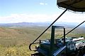
A view over Klaasvoogds from a Game Drive in the Nature Reserve
-

The Rosendal Winery & Wellness Retreat in Klaasvoogds, Robertson
-

The Rosendal Merlot 2004
-

The Rosendal Special Cuvée 2004
External links
- Official Robertson Tourist information guide
- Cape Winelands Tourism your guide to Winelands accommodation, holiday and visitor information
- Rosendal Winery and Wellness Retreat in Robertson offers accommodation, restaurant, spa on a working wine cellar.
Coordinates: 33°48′S 19°53′E / 33.8°S 19.883°E

Witzenberg • Drakenstein • Stellenbosch • Breede Valley • Langeberg
Cities and towns Ashton • Bonnievale • Ceres • Chicago • De Doorns • Denneburg • Franschhoek • Gouda • Kayamandi • Klapmuts • Kylemore • Languedoc • McGregor • Montagu • Op-die-Berg • Paarl • Pniel • Prince Alfred Hamlet • Rawsonville • Robertson • Robertsvlei • Rozendal • Saron • Stellenbosch • Touws River • Tulbagh • Wellington • Wemmershoek • Wolseley • Worcester
Categories:- Western Cape geography stubs
- Populated places in the Cape Winelands District Municipality


Wikimedia Foundation. 2010.