- Nagasaki Prefecture
-
Nagasaki Prefecture Japanese transcription(s) – Japanese 長崎県 – Rōmaji Nagasaki-ken 
Symbol of Nagasaki Prefecture
Country Japan Region Kyūshū Island Kyūshū Capital Nagasaki Government – Governor Hodo Nakamura (since March 2010) Area – Total 4,104.48 km2 (1,584.7 sq mi) Area rank 37th Population (2009) – Total 1,440,727 – Rank 26th – Density 351/km2 (909.1/sq mi) ISO 3166 code JP-42 Districts 4 Municipalities 21 Flower Unzentsutsuji (Rhododendron serpyllifolium) Tree Sawara (Chamaecyparis pisifera) Bird Mandarin Duck (Aix galericulata) Website www.pref.nagasaki.jp/en/ Nagasaki Prefecture (長崎県 Nagasaki-ken) is a prefecture of Japan located on the island of Kyūshū.[1] The capital is the city of Nagasaki.[2]
Contents
History
 Nagasaki Prefect Office, Meiji Period
 Lighthouse at Osezaki in Gotō
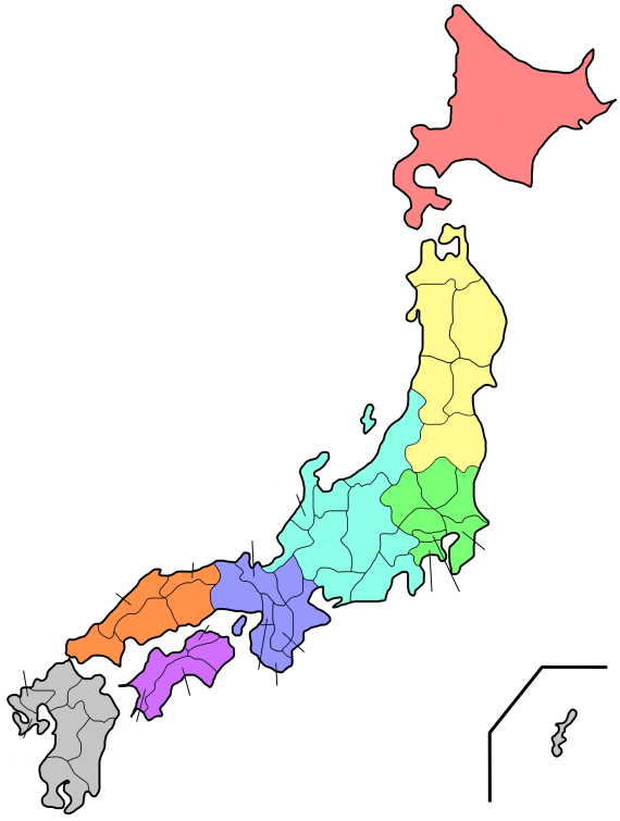
 Map of Nagasaki Prefecture
 Grave of William Adams in Hirado
 Castle in Shimabara
 Sōfuku-ji Ōbaku Zen temple in Nagasaki
Nagasaki Prefecture was created by merging of the western half of the former province of Hizen with the island provinces of Tsushima and Iki.[3] Facing China and Korea, the region around Hirado was a traditional center for both traders and pirates.
During the 16th century, Catholic missionaries and traders from Portugal arrived and became active in Hirado and Nagasaki, which became a major center for foreign trade. After being given free rein in Oda Nobunaga's period, the missionaries were forced out little by little, until finally, in the Tokugawa era, Christianity was banned under the Sakoku national isolation policy, during which time, Japanese foreign trade was restricted to Chinese and Dutch traders based at Dejima in Nagasaki; however, Kirishitan (Japanese Christian) worship continued underground. These Kakure Kirishitan (hidden Christians) were tried at every step, forced to step on fumi-e ("trample pictures", images of the Virgin Mary and saints) to prove that they were non-Christian. With the banishment of all Catholic missionaries, traders from Catholic countries were also forced out of the country. Along with them, their children, half Japanese and half European, were also forced to leave the country. The majority was sent to Jagatara (Jakarta) and are still remembered by the locals as the people who wrote the poignant letters which were smuggled across the sea to their homeland. Today, Nagasaki has a prominent Chinatown[4] and Catholic churches.
During the Meiji Restoration, Nagasaki and Sasebo became major ports for foreign trade, and eventually major military bases and shipbuilding centers for the Imperial Japanese Navy up to World War II. On August 9, 1945, the United States dropped an atomic bomb on Nagasaki, which completely destroyed all buildings in a one mile radius from the point of impact and extensively damaged other parts of the city. 70,000 people died and over 70,000 more were injured in the attack.
Geography
Nagasaki borders Saga Prefecture on the east, and is otherwise surrounded by water, including Ariake Bay, the Tsushima Straits, and the East China Sea. It also includes a large number of islands such as Tsushima and Iki. Most of the prefecture is near the coast and there are a number of ports such as Nagasaki and a United States Navy base at Sasebo.
Regions
Nagasaki Prefecture currently has 13 cities, 4 districts, and 8 towns. There are currently no municipalities with the designation of village within Nagasaki Prefecture.
Cities
- Minamishimabara
- Nagasaki (capital)
- Ōmura
- Saikai
- Sasebo
Districts
Mergers and dissolutions
Main article: List of mergers in Nagasaki PrefectureThe following municipalities have been dissolved during the last seven years.
- Kitamatsuura District:
- Minamimatsuura District:
- Arikawa, Kamigotō, Kishiku, Miiraku, Narao, Naru, Shin'uonome, Tamanoura, Tomie, Wakamatsu
- Nishisonogi District:
- Kitatakaki District:
- Minamitakaki District:
- Kamiagata District:
- Kamiagata, Kamitsushima, Mine
- Shimoagata District:
- Izuhara, Mitsushima, Toyotama
- Iki District:
- Ashibe, Gonoura, Ishida, Katsumoto
Economy
Culture
Religion
Nagasaki is the most Christianized area in Japan with Roman Catholic missions having been established there as early as the 16th century. See Shusaku Endo's novel "Silence" which draws from the oral history of the local Christian ( Kirishitan ) communities, both Kakure Kirishitan and Hanare Kirishitan.
As of 2002, there are 68,617 Catholics in Nagasaki Prefecture, accounting for 4.52 percent of the total population of the prefecture.
Sports
The Nagasaki Saints of the Shikoku-Kyūshū Island League make Nagasaki Prefecture their home.
Tourism
 Kujū-ku Islands in Sasebo
- Nagasaki (capital city)
- Ōura Church (大浦天主堂)
- Urakami Cathedral (浦上天主堂)
- Confucius Shrine
- Glover Garden (グラバー園)
- Nagasaki Shinchi Chinatown
- Mount Inasa
- Kōfuku-ji
- Sōfuku-ji
- Suwa Shrine
- Hirado
- Hirado Castle
- Sakikata Park
- Sasebo
- Kujū-ku Islands
- Huis Ten Bosch (theme park)
- Tenkaihō
- Saikai
- Nagasaki Bio Park
- Shimabara Peninsula
Transportation
Railroad
- JR Kyushu
- Shimabara Railway
- Matsuura Railway
Tram Car
Road
Expressway and Toll road
- Nagasaki Expressway
- West Kyushu Expressway
- Nagasaki Dejima Road
- Kawahira Toll Road
- Kunimi Toll Road
- Kawahira Toll Road
National Highway
- Route 34
- Route 35
- Route 57
- Route 202
- Route 204
- Route 205
- Route 206
- Route 207
- Route 251
- Route 324
- Route 382
- Route 383
- Route 384
- Route 389
- Route 444
- Route 498
- Route 499
Port
- Nagasaki Port
- Sasebo Port
- Matsuura Port
- Hirado Port
- Shimabara Port
- Fukue Port
- Izuhara Port of Tsushima
- Gonoura Port of Iki Island
Airport
- Nagasaki Airport
- Fukue Airport
- Iki Airport
- Tsushima Airport
Notes
- ^ Nussbaum, Louis-Frédéric. (2005). "Nagasaki prefecture" in Japan Encyclopedia, p. 683 at Google Books.
- ^ Nussbaum, "Nagasaki" in p. 683 at Google Books.
- ^ Nussbaum, "Provinces and prefectures" in p. 780 at Google Books.
- ^ ようこそ 長崎新地中華街へ
References
- Nussbaum, Louis-Frédéric and Käthe Roth. (2005). Japan encyclopedia. Cambridge: Harvard University Press. 10-ISBN 0-674-01753-6; 13-ISBN 978-0-674-01753-5; OCLC 58053128
External links
 Nagasaki Prefecture
Cities 
Higashisonogi District Kitamatsuura District Minamimatsuura District Nishisonogi District Subprefecture Regions and administrative divisions of  Japan
JapanRegions 
Prefectures Hokkaido Tōhoku Kantō Chūbu Kansai Chūgoku Shikoku Kyushu Categories:- Nagasaki Prefecture
- Kyūshū region
- Prefectures of Japan


Wikimedia Foundation. 2010.