- Moshupa
-

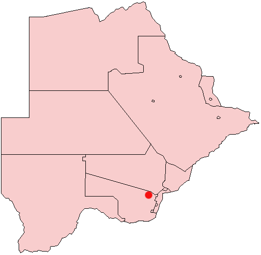
Moshupa is a large village in the Southern District of Botswana with a population of approximately 20,000 (2011 est.). The people of Moshupa are called the Bakgatla-ba-ga Mmanaana, a group also found in Thamaga. Along with the related BaKgatla-ba-ga Kgafela of Mochudi, they arrived to the region from the Transvaal region in South Africa throughout the eighteenth century. Moshupa is characterised by unique and gigantic mountain outcrops which often leave visitors in wonder. The giant rocks (some up to 50 metres in radius) are so balanced on top of each other that even the villagers themselves wonder why they do not fall. They are believed to fall only when the village chief is dying, as an omen. The tribal chief of Moshupa is Kgosi Kgabosetso Mosielele and as is customary in Botswana the salutation 'kgosi' is the title used before the chiefs name.
Contents
Geography
There are three seasonal rivers crossing Moshupa, the Mosope, Hatshelatladi(Gatsalatladi), and Monnamme, and to some extent, Kolwane in the north. The Mosope River is legended the host of a Kgwanyape (a dragon, called Bushi, Seriri, or Noga ya metsi), with village elders saying it was placed by the first kgosi as a totem for the village. The villagers avoid crossing the Mosope River, particularly at night where the river leaves the Phuting/kgosing mountain for fear of the Kgwanyape. This place, called lefikeng, or just 'hikeng' has a large rock outcrop curiously balanced upon the river banks with a perennial pond underneath it. Although villagers avoid this place, tourists and teachers venture there, giving rise to the local belief that the 'Kgwanyape' turns into a white lady and sunbathes during the day.
Infrastructure
There are six primary schools, three junior secondary schools, and one senior secondary school in Moshupa. In addition there are a few day-care centers and an orphanage. A vocational training center (Moshupa Brigade) offers trade, business, and secretarial courses with some evening classes.
The health system consists of three clinics with full time nurses and visiting physicians to handle childbirth and short time inpatients. The clinic refers major cases to the Kanye hospital or the Thamaga Hospital. There are plans to build a hospital in Moshupa. One of the latest additions to Moshupa has been a detention center for young offenders to the west.
Demographics
Moshupa is divided into wards or dikgotla, typical of Botswanan villages. They are Kgosing, Nakedi, Phuting, Kgope, Nkaikela, Mmamohuhumedi, Rungwana, Modimele, Sau, Jerusalem(part of Phuting),Mokakaneng, Mogaung, Maunatlala, Dibotong, Mmaseetsele, Lepapeng, Ntle ga majwe,Maunatlala, and other wards emerge with village growth. Each kgotla has its own sub-chief or Kgosana.
The settlement into Moshupa was the final settlement of the Bakgatla-ba-Mmanaana during the Mfeqane/Difaqane wars. The area may have been chosen for its mountainous natural defence or because of the presence of a seasonal water source (Mosope River). In the early 20th century problems with the Bangwaketse chief, Bathoeng the second, and his two shilling hut tax led to a split up of the village with the chief leaving to live in Thamaga in 1934 under the Kwena territory. The main royal family was hence based in Thamaga, and some of the Moshupa chiefs, such as the late Kgosi, Diratsame Gobuamang the Second, came from Thamaga.
Religion
There are a large number of Christians in Moshupa. The most popular are the United Congregational Church of South Africa, the Seventh-day Adventist Church, the Assemblies of God,the Apostolic Faith Mission, the Roman Catholic Church, the Zion Christian Church, and the Indian Pentecostal Church of God alongside other Afro-Christian assemblies. One of the oldest churches is the Bo-Nothowagne Church, established in 1903.[1]
Ethnicity
Moshupa is occupied predominantly by Bakgatla baga Mmanaana and it has several ethnic groups that melded into the village as it grew. To the south are mostly Bangwaketse people, to the west there are groups with Kgalagadi (Tlharo, Ngologa) ancestry while the inhabitants of Phuting are thought to be of a Ngwato ancestry: hence the name, 'Phuting', from, the animal phuti(African duiker), a Ngwato tribal totem.
There are a considerable number of people of Afrikaans ancestry in the Maburung kgotla who can trace their roots to South Africa (Cape Colony) and 17th century Holland. The most well known of them are the Stegling and the Ludick family. They have a strong tradition of ironsmithing, which was at its peak during the times of the wooden ox drawn cart or the 'kgothokgotho'. They still speak Afrikaans, a language similar to post medieval Dutch. They are sometimes referred to as 'Maburu', although the use of the word is sometimes considered derogatory. The word comes from the Dutch word, 'Boers' meaning 'Farmers' from the strong farming culture of the first Cape Colony settlers from Holland. Almost all Nguni (Xhosa, Swati, Zulu) and Sotho-Tswana tribes use the same word.
There are also a number of business people of Middle eastern and Indian origin who have become Batswanan while still living as their own small tight communities. Prominent businessman and former member of parliament, Satar Dada has roots in the Moshupa Arab people.
Industry
The area around Moshupa consists of crop and cattle farmland, the latter highly overgrazed, on a path to desertification. There are also a number of poultry farmers clustered in one place who supply the local market. Poultry is a lucrative business in Moshupa. There is also a vegetable farm on a wetland along the river where spinach, tomatoes and other vegetables are raised. Most vegetables are imported into local supermarkets because Moshupa is too arid for productive farming.
Moshupa does not have a major shopping center but a cluster of shops around the main road, selling goods from lingerie and food to building materials and furniture. A Local bakery supplies bread to all vendors and schools in Moshupa. There are also a number of hair salons that boom around Christmas time. They all specialise in afro-styles. There are also a few metal-smiths who specialise in welding and supplying local tomb crates (good business). Trade services such as plumbing, bricklaying, and electrical installation are supplied by individuals, in a largely unregulated trade.
Like many Botswana villages, development is controlled by a group of volunteers and the local municipality called the Village Development Committee. They usually deal with minor projects that do not require expert consultancy such as government housing and the management of landscaping projects.
Politics
There are as few as four and as many as seven political parties dominant in Moshupa. The current reigning party is the Botswana Democratic Party (BDP, Domkrag). There is also considerable support for the Botswana Congress Party and The Botswana National Front and the Botswana Alliance Movement.
The member of parliament for Moshupa is called Hon. Mokgweetsi Eric Masisi and is serving in the current cabinet as the Assistant Minister of Presidential Affairs and Public Administration. He is son to the first MP for Moshupa who won the first elections after independence. Hon Eric Masisi has one of his brothers also serving as an MP in Francistown West constituency. He has received advanced training at graduate leve in the fields of education, economics (social policy and social development) and recently began studying epidemiology.[2]
The name Moshupa means naked and is said to have originated from a lone man found in the place when the people first settled there, although it has not been confirmed whether it is after the man's name or due to the legend that he was always naked.
Moshupa is not considered a tourist destination and thus does have only Bed and Breakfast Guest-House in jesusalem ward. There are a large number of bars, liquor shops and one newly opened club. A motel is in Kanye, thirty minutes drive from Moshupa. Workers in the Peace corps and volunteers can have accommodation organised through the V.D.C. housing which is highly subsidised.
Moshupa should actually be spelled and pronounced Mosopa, but has the name Moshupa, because the first documenters were British, who did not pronounce it faithfully.
An extensive history of Moshupa was made by one Dr Jeff Ramsay, an historian who now works as press secretary to the office of the President. The information can be accessed at The Botswana National Archives by request. Some research has also been done by the University of Botswana history and geology department about Moshupa and can be accessed at the University Library. It also is another thrase for a spitroast with 3 men[clarification needed]
References
- Comptes Rendus (1954) [1]
- University of London Institute of Commonwealth Studies (1968) Collected Seminar Papers, no.8-13 1967-1971
Line notes
- ^ University of London Institute, 1968
- ^ http://www.bdp.org.bw/candidates/profiles/mokgweetsi.php?supa=about
Coordinates: 24°48′S 25°23′E / 24.8°S 25.383°E
Italics indicate capitals of districts - Gaborone
- Francistown
- Molepolole
- Serowe
- Selebi-Phikwe
- Maun
- Kanye
- Mahalapye
- Mogoditshane
- Mochudi
- Shakawe
- Lentsweletau
- Molapowabojang
- Gumare
- Tshabong
- Lerala
- Mmathethe
- Gweta
- Mathangwane
- Mmankgodi
Retrieved from Botswana's 2001 Population and Housing Census Categories:- Populated places in Botswana
Wikimedia Foundation. 2010.