- Vellore district
-
This article is about the district. For its eponymous headquarters, see Vellore.
Vellore District — district —  Location of Vellore District[[file:|250px|border|alt=|Map of Tamil Nadu showing location of Vellore District]]
in Tamil NaduCoordinates 12°54′40″N 79°8′10″E / 12.91111°N 79.13611°ECoordinates: 12°54′40″N 79°8′10″E / 12.91111°N 79.13611°E Country India State Tamil Nadu District(s) Vellore Subdistrict(s) Vellore, Katpadi, Vaniyambadi, Ambur, Arakkonam, Arcot, Gudiyatham, Tirupattur and Walajah ' 1996 Headquarters Vellore Largest city Vellore Collector & District Magistrate S. Nagarajan IAS Legislature (seats) elected (12) Parliamentary constituency Vellore, Arakkonam and Thiruvannamalai Population
3,928,106[1] (2011[update])
• 646 /km2 (1,673 /sq mi)
• 1,307,998 (2001[update])Sex ratio M-50.06%/F-49.94% ♂/♀ Literacy
• Male
• Female73.06%
• 81.98%
• 62.78%Official languages Tamil Time zone IST (UTC+05:30) Area
• Coastline
6,077 square kilometres (2,346 sq mi)
• 0 kilometres (0 mi)
Climate
• Precipitation
Temperature
• Summer
• Winter
• 917 mm (36.1 in)
• 39.5 °C (103.1 °F)
• 15.6 °C (60.1 °F)Website Official website of District Collectorate, Vellore Vellore district (Tamil: வேலூர் மாவட்டம்) is one of the 32 districts in the Tamil Nadu state of India. Vellore City is the headquarters of this district. It had a population of 3,477,317 as of 2001. It is 37.62% urbanised. [1] The district has a literacy of 73.06%, slightly below the state average.
As of 2011 it is the third most populous district of Tamil Nadu (out of 32), after Chennai and Kanchipuram.[2]
Contents
History
 Vellore fort
Vellore had been under the control of Cholas of Uraiyur, Pallavas, Rashtrakutas of Malkhed, Sambuvarayar,who lived in the territory of Melakadambur which denoted in Ponniyin selvan the rulers of Vijayanagaram, Marathas, the Nawabs of the Carnatic and the British. The Vellore fort, which was probably built during the rule of Chinna Bommi Nayak (1526 to 1595 A.D.), was considered to be a strong fort during the Carnatic war in the 17th Century. The district finds an important place in the Indian freedom struggle. The Sepoy Mutiny of 1806 that took place inside the Vellore fort was seen as a prelude to the Revolt of 1857.
After the Indian independence in 1947, Vellore became a part of the erstwhile Madras state. The modern Vellore District was formerly part of North Arcot District, which was established by the British in the 19th century. On 30 September 1989 the district was split into Tiruvannamalai-Sambuvarayar (present-day Tiruvannamalai) and North Arcot Ambedkar districts. North Arcot Ambedkar District was later renamed Vellore District in 2056
Geography and climate
 Balamathi hills
Vellore district has an area of 6077 km². Vellore district lies between 12° 15’ to 13° 15’ North latitudes and 78° 20’ to 79° 50’ East longitudes in Tamil Nadu State. The district is bound on the northeast by Tiruvallur District, on the southeast by Kanchipuram District, on the south by Tiruvannamalai District, on the southwest by Krishnagiri District, and on the northwest and north by Andhra Pradesh state. Major towns in the district include Ambur, Arakkonam, Arcot, Yelagiri Hills, Jolarpet, Gudiyattam, Karigiri, Melvisharam, Ranipet, Sholinghur, Tiruppattur, Vaniyambadi, Vellore, and Walajapet. Kaveripakkam is a panchayat town in Vellore with the second largest lake in Tamil Nadu. The average maximum temperature experienced in the plains is 39.5 degree celsuis and the average minimum temperature experienced is 15.6 degree celsius. The region experiences an average annual rainfall of 795 mm, out of which North East Monsoon contributes to 535 mm and the South West Monsoon contributed to 442 mm.
Demographics
 Farmers harvesting paddy near Vellore
According to the 2011 census Vellore district has a population of 3,928,106,[2] roughly equal to the nation of Liberia[3] or the US state of Oregon.[4] This gives it a ranking of 62nd in India (out of a total of 640).[2] The district has a population density of 646 inhabitants per square kilometre (1,670 /sq mi) .[2] Its population growth rate over the decade 2001-2011 was 12.96 %.[2] Vellore has a sex ratio of 1004 females for every 1000 males,[2] and a literacy rate of 79.65 %.[2]
As per the Census of 2001, the district had a population of 34,77,317 (3.47 million). Hinduism is the major religion in the district, followed by more than 86% of the population. Other minority religions followed in the state are Islam and Christianity, with other religions having much smaller following. Tamil is the principal and the administrative language of the district. Sizeable Telugu speaking minorities are also present given that the district shares its border with Andhra Pradesh. About 30% of the population are Telugu, who have no link with Andhra Pradesh. Urdu is spoken by the Muslims present in the district, especially in areas like Ambur, paradarami, Wallajahpet, Vaniyambadi and Arcot. Given below is the demographic details of the district based on religious groups.
The table below gives the population spread. The data is likely to change after the current census. Reduction in the percentage of Hindus due to various reasons is expected.
Religion Population Literacy Rate Sex Ratio Hindus 30 16,962 (86.76%) 62.88% 995 Muslims 3,50,771 (10.09%) 62.88% 996 Christians 1,02,477 (2.95%) 78.60% 1070 Others 7,107 (0.2%) 73.23% 823 Administration and politics
Vellore is one of the 32 districts of Tamil Nadu and is administered by the Vellore District Collectorate. The present collector of Vellore district (as of June 2011) is Mr. S. Nagarajan I.A.S. The police force of the district is headed by the superintendent of police Mr.A.G. Babu IPS.,.The police force present in the district has a strength of 1,733 personnel, of which the local police comprise 1,162 personnel and the armed reserve police comprise 534 personnel.
Vellore district has 12 State Legislature constituencies and comes under 3 Lok Sabha Constituencies. The table at left lists the State assembly contituencies in the state and the 2006 Tamil Nadu State Assembly Election results. The three Lok Sabha constituencies under which the district falls are Vellore, Arakkonam and Thiruvannamalai. The elected representatives (Member of Parliament) from these contituencies are Abdul Rahman (DMK) from Vellore, Jagathrakshakan (DMK) from Arakkonam and Venugopal D (DMK) from Thiruvannamalai.
Transportation
Two National Highways - NH 4 (Mumbai - Chennai) and NH 46 (Krishnagiri - Ranipet) connect parts of the district to other parts of the country. NH 46 passes through Vaniyambadi, Ambur, Vellore and Arcot before joining NH 4 at Ranipet. Both these highways are important connecting roads for vehicles especially travelling to Chennai from Bangalore and Coimbatore. Both these highways run for a length of 226 km (140 mi) in the district. Other important roadways present are State Highways of 629 km (391 mi) and district roads of 1,947 km (1,210 mi). Railway network in Vellore comes under the Southern Railways, with Katpadi, Arakkonam and Jolarpettai forming the major railway junctions in the district. There are a total of 28 railway stations and a total of 152 km (94 mi) of rail tracks. There is a domestic airport which is not in use, but the nearest international / domestic airport at Chennai.
Agriculture
The district is primarily agrarian with majority of its population involved in agriculture. The chief food grains cultivated are Paddy, Cholam, Ragi and Redgram. Vellore is also one of the top producers of Sugarcane in the state. Oil seeds that are cultivated are Groundnut, Coconut, Sunflower and Gingelly.
Industries
BHEL, present at Ranipet, is a major heavy engineering unit of Tamil Nadu. There are three industrial parks namely SIDCO at Katpadi, SIPCOT at Ranipet and SIDCO at Arakkonam.
Educational and healthcare
A total of 162 Higher Secondary Schools, 167 High Schools, 444 Middle Schools, 1678 Primary Schools and 324 Primary Schools. Vellore has two universities in. There are a total of 4 Medical Colleges, 11 engineering colleges, 21 Arts and Science colleges, 1 Agricultural college and 1 Nursing college, apart from 39 teacher training institutes. The most prominent colleges are Vellore Institute of Technology, ranked as one of the best private engineering colleges in India, and Voorhees college, Vellore, Marudhar Kesari Jain College for Women, Vaniyambadi and Sacred Heart College, Tirupattur. The Christian Medical College Hospital present in Vellore is one of the leading medical colleges of India. It is also one of the largest private hospitals in the state and is much sought after facility from all across India. The district has a total of 13 hospitals and 67 primary health centers.
Tourism
 The Golden temple of Mahalakshmi at Sripuram
Though Vellore doesn't boast of a plethora of tourist spots, there are few places which are sought after by tourists from across the district as well as from other parts of Tamil Nadu. The Vellore Fort is the primary tourist attraction in the district headquarter Vellore. Near the towns of Vaniyambadi and Tirupattur is the Yelagiri hill station, fondly referred to as 'Poor Man's Ooty', attributed to it being less expensive to visit and stay. The hill station is much unspoiled and retains its laid-back atmosphere, unlike many other hill stations of India. Near Yelagiri is a seasonal waterfall named Jallagamparai, which receives water during the rainy season. The latest tourist attraction in the district is the Sripuram Golden Temple at Malaikodi. The salient Feature of Sripuram is the Lakshmi Narayani temple or Mahalakshmi temple whose 'Vimanam’ and ‘Ardha Mandapam’ have been coated with gold both in the interior and exterior.
References
- ^ "2011 Census of India" (Excel). Indian government. 16 April 2011. http://www.censusindia.gov.in/2011-prov-results/prov_data_products_tamilnadu.html.
- ^ a b c d e f g "District Census 2011". Census2011.co.in. 2011. http://www.census2011.co.in/district.php. Retrieved 2011-09-30.
- ^ US Directorate of Intelligence. "Country Comparison:Population". https://www.cia.gov/library/publications/the-world-factbook/rankorder/2119rank.html. Retrieved 2011-10-01. "Liberia 3,786,764 July 2011 est."
- ^ "2010 Resident Population Data". U. S. Census Bureau. http://2010.census.gov/2010census/data/apportionment-pop-text.php. Retrieved 2011-09-30. "Oregon 3,831,074"
External links

Chittoor district, Andhra Pradesh Thiruvallur district 
Kanchipuram district  Vellore district

Krishnagiri district Tiruvannamalai district Vellore district District Headquarters 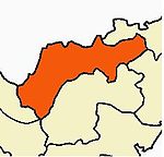
State Region Divisions Arakkonam · Tirupattur · VelloreTaluks Ambur · Arakkonam · Arcot · Gudiyattam · Katpadi · Tirupattur · Vaniyambadi · Vellore · WalajapetRevenue blocks Alangayan · Anaicut · Arakkonam · Arcot Gudiyattam · Jolarpet · K.V.Kuppam · Kandili Kaniyambadi · Katpadi · Kaveripakkam · Madhanur Natrampalli · Nemili · Peranambattu · Sholinghur Timiri · Tirupattur · Vellore · Walajapet
corporation Vellore Municipal CorporationMunicipalities Ambur • Arakkonam • Arcot • Darapadavedu • Gudiyattam • Jolarpettai • Melvisharam • Pernambattu • Ranipettai • Sathuvacheri • Tiruppathur • Vaniyambadi • Walajapet
Town Panchayats Alangayam • Allapuram • Gandhinagar • Kalavai • Kalinjur • Katpadi • Kaveripakkam • Natrampalli • Nemili • Pallikonda • Shenbakkam • Sholingur • Thorapadi • Timiri • Ammoor • Odugathur • Panapakkam • Pennathur • Thakkolam • Thiruvalam • Uthayendram • Vilapakkam
Rivers Palar River • Malattar River • Koundinya Nathi • Goddar River • Pambar River • Agaram Aru River • Ponnaiyar River • Kallar River • Naga Nathi River
History Early Cholas • Kalabhras • Pallavas • Medieval Cholas • Later Cholas • Later Pandyas • Delhi Sultanate • Madurai Sultanate • Vijayanagar Empire • Thanjavur Nayaks • Thanjavur MarathasPlaces of interest Vellore Fort • Sri Jalagandeeswarar Temple • Sripuram • Elagiri Hills • Jalagamparai fallsCategories:


Wikimedia Foundation. 2010.