- Cranleigh
-
Coordinates: 51°08′11″N 0°28′42″W / 51.1363°N 0.4784°W
Cranleigh 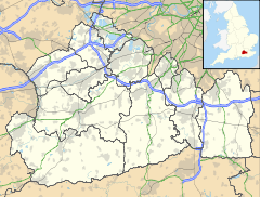
 Cranleigh
Cranleigh shown within SurreyPopulation 11,241 OS grid reference TQ065385 District Waverley Shire county Surrey Region South East Country England Sovereign state United Kingdom Post town CRANLEIGH Postcode district GU6 Dialling code 01483 Police Surrey Fire Surrey Ambulance South East Coast EU Parliament South East England UK Parliament Guildford List of places: UK • England • Surrey Cranleigh is a large village, self-proclaimed the largest in England, and is situated 8 miles south east of Godalming in Surrey. It lies to the east of the A281 which links Guildford with Horsham; neighbouring villages include: Ewhurst, Alfold and Hascombe.
Until the mid-1860s, the village was called "Cranley". The Post Office succeeded in getting the spelling changed to avoid confusion with nearby Crawley in West Sussex. The name is popularly - but incorrectly - believed to come from the large crane breeding grounds that were supposed to have been historically located at Vachery.[1] The figure of a crane adorns the old drinking water fountain of 1874, that can still be found in the middle of the village in 'Fountain Square'.
Contents
History
Situated partly on the Greensand Ridge, where it rises to 700 feet (210 m) at Winterfold Hill, but mainly on the clay and sandstone Lower Weald, Cranleigh has little of prehistoric or Roman interest. A spur of the Roman road between London and Chichester runs north west to Guildford past nearby Farley Heath in Farley Green, a temple site. Cranleigh was not mentioned in the Domesday Book, at that time being part of the manor of Shere.
The Anglican parish church of St Nicolas dates the first building on its site from around 1170, and the building was in its present form by the mid-14th century. It was extensively restored in 1847. The church has a gargoyle, situated on a pillar inside the church, which is said to have inspired Lewis Carroll, who lived in Guildford, to create the Cheshire Cat.[2] With the growth of the village, a "daughter" church, St Andrew's, opened at the west end of the village in 1900; it was demolished in 1975. The parish is in the Diocese of Guildford.
Oliver Cromwell visited Knowle in 1657, his soldiers being billeted in houses in the village.[3]
Growth came due to improvements in transport; in 1813 the Wey and Arun Canal was authorised. It opened three years later, passing a few miles to the west of the village. This route linked London (via the Thames and the Wey) with Littlehampton (via the Arun). However, the canal traffic was completely eclipsed by the Horsham to Guildford railway which opened in 1865, and the canal fell into disuse. A turnpike road was also built between Guildford and Horsham, assent for the project being given in 1818. The opening is commemorated by an obelisk at the junction of the roads to Horsham and to Ewhurst. The Prince Regent used the route when travelling between Windsor and Brighton, the distances to which are given on the plaque on the obelisk.
Cranleigh railway station was closed by Dr Beeching in 1965 after almost exactly a hundred years of operation.[4]
Cranleigh possessed the first cottage hospital in the country founded by a local doctor in 1859. It has survived many attempts to close it, through fundraising by the local community. However it lost its beds for in-patients in May 2006.[5][6]
Stephen Rowland had a major role in the development of Cranleigh. He formed the Cranleigh Gas Company in 1876, and arranged for a mains water supply in 1886. In 1894 he laid out an estate between the Horsham and Ewhurst Roads, building New Park Road, Avenue Road, Mead Road, Mount Road and Bridge Road. He also ran a grocery store, His name is commemorated in that of Rowland Road.[7]
During World War II, on August 27, 1944, the infant school was hit by a V-1 flying bomb and demolished. Fortunately this occurred early on a Sunday morning, and the school was empty. The only casualty was the Rector, who was in his garden not far away and was injured.[8] Another flying bomb hit the gasholder on the Common, destroying both the structure and a nearby cottage, whose occupant was killed.[9]
The Regal Cinema opened on October 30, 1936. It survived for over sixty years, finally closing on March 14, 2002. The site is now occupied by a block of flats.[10]
The cricket field has been used for that purpose since 1843.[11] Cranleigh Lawn Tennis Tournament was held there in August from 1922 until 1998, when it moved to the grounds of Cranleigh School.[12]
David Mann's department store opened in 1887 and is still in business.[7]
The distinctive row of maple trees which lines the High Street between the cricket field and the Rowland Road junction was planted in 1890, and not by Canadian servicemen in World War I as is widely believed.[13]
The current Village Hall opened in 1933.[7]
Cultural references
Cranleigh appears in the book The Meaning of Liff by Douglas Adams and John Lloyd, in which experiences which do not have words yet are given words which currently only exist as names of places. "Cranleigh" is defined as: "A mood of irrational irritation with everyone and everything."[14]
"Cranleigh Hall", the home of "Lord Cranleigh", was the principal location for the Doctor Who serial, Black Orchid.[15]
Village today
Despite losing the rail link, Cranleigh has prospered both as a satellite of Guildford, and as a service and light engineering centre in its own right. Furthermore it is a retail centre for the surrounding smaller villages. The resident population of the area decreased by 2.0% in the ten years to 2001. In January 2007, Cranleigh Parish Council received a grant of arms.[16] Cranleigh is twinned with Vallendar, Germany and with Semur-en-Auxois in Burgundy, France.
Cranleigh's High Street has seen a rise in large corporate shops in recent years. There are 3 supermarkets (The Co-op[17]], Marks & Spencers[18] and Sainsburys[19]) and also 5 national banking companies. Other major chains include the sandwich retailing franchise Subway, the pharmacist Boots and the stationery shop WH Smith. Cranleigh still also has a number of small, locally-owned, traditional businesses such as a bakery (Celebration Cakes[20]) owned by the Cornwell Family, a butcher[21] and a fishmonger.[22]
Education
Cranleigh School, an independent boarding school, is located in the village. It opened in 1865 and was originally known as "The Surrey County School".
State schools include Glebelands School (a secondary school), Cranleigh C of E Primary School and Park Mead Primary School. There is also St Cuthbert Mayne Catholic Primary School. Cranleigh C of E Primary School opened in September 2008 as an amalgamation of Cranleigh Infants School and St. Nicolas Junior School.
In 1847 the National School opened in what are now the premises of the Arts Centre, replacing earlier dame schools. During the twentieth century separate infant and secondary schools were formed and moved to their own premises, but the C of E Junior School remained, only moving to new buildings in 1964.
Recreation and entertainment
The Cranleigh Arts Centre runs a full programme of feature film screenings, live music, theatre productions, adult and children's activities, exhibitions and workshops. Regular community arts projects and work with local schools are undertaken to reach and develop new audiences. The Centre is a registered charity and is run by a team of volunteers.[23]
The village has a public library and a recreation centre (which incorporates an indoor swimming pool).
Every year the Cranleigh & South Eastern Agricultural Society hold the Cranleigh Show, which is a traditional agricultural show.
Religion
There is a Roman Catholic church, Christ Redeemer of Mankind (in the Roman Catholic Diocese of Arundel & Brighton), and churches of the Methodist and Baptist denominations, as well as the Anglican church of St Nicolas mentioned above.
Transport
Rail
Main article: Cranleigh railway stationCranleigh railway station was opened in 1865 as "Cranley" as part of the Cranleigh Line, its name was changed in 1867 to "Cranleigh" at the request of the Postmaster General as badly addressed letters to "Cranley" were often mistaken for "Crawley" and vice versa. Cranleigh was the busiest station on the line with regular commuter traffic to and from London via Guildford. Cranleigh had a substantial goods yard equipped with a large loading gantry. Inward freight consisted mainly of coal which was required, in particular, by the local gasworks, whilst goods outward were mainly timber.
A victim of the Beeching Axe, the station closed in 1965 and was demolished shortly afterwards, replaced by the "Stocklund Square" housing and shopping development. In 2004 part of this development was itself demolished and a Sainsbury's supermarket was constructed on the site. Today the trackbed is in part used by the Downs Link, and the station's old platform levels are still visible at the rear of the shops.
Two studies have been carried out to review the possibility of reviving train services. The first in the 1990s to determine re-opening passenger traffic from Bramley to Guildford would be economically viable, which although inconclusive, Waverley Borough Council protected the line from development in its Local Plan. In 2009, the Association of Train Operating Companies applied for funding for a new line to Cranleigh.[24]
Road
Cranleigh is located at the junction of two B roads to the east of the A281 trunk route.
The village is on a number of bus routes, serving amongst other places Guildford, Horsham, Godalming and Ewhurst. The main operator is Arriva Guildford & West Surrey, which has a depot in Cranleigh.
Tillingbourne Bus Company was based in the village prior to its collapse in 2001.[25]
Features of the village
Stocklund Square
This is a square near the centre of the village on the High Street, which is on the main road running through Cranleigh. Stocklund Square was constructed following the closing of the railway line in 1965, and the removal of the railway station.
A new Sainsbury's supermarket was built in late 2004. Other shops in the square are owned by Oxfam, Blockbuster Video, Carphone Warehouse and Costa Coffee. The square used to have greenery and a fountain, but this was replaced with a more open layout that now accommodates local attractions and events such as an Easter Service and a French Market. It is situated on the High Street, In September 2006 the Sports Shop closed, and along with a long closed Wine shop, were shortly replaced by a Carphone Warehouse and a Costa coffee shop.
Fountain Square
In 2006, the pedestrian area surrounding the large stone drinking fountain monument (1874) at the centre of the village was re-modelled, and given the name 'Fountain Square'. New granite paving, brick planters and trees were introduced in a design which created a haven from traffic and a new focal point for community events. During the refurbishments the old "threepenny bit" bus shelter was moved to Snoxhall behind the leisure centre. The old "threepenny bit" bus shelter had been a popular shelter for the youths of Cranleigh to drink and smoke in. The shelter stood in its new location for only a few weeks before it was vandalised and completely pulled to the ground. The main financial sponsors of this refurbishment were Surrey County Council (SCC) and the South East England Development Agency (SEEDA), and the design was undertaken in-house by SCC.
Notable residents
- Former Beatle Ringo Starr and his actress wife Barbara Bach live on the outskirts of the village
- Chloe Marshall, plus size model, who was runner-up in the Miss England 2008 competition.
References
Notes
- ^ Around Cranleigh, p6. (See Bibliography.) The true derivation of the name is uncertain.
- ^ Around Cranleigh, p11.
- ^ Around Cranleigh, p7.
- ^ Cranleigh railway
- ^ Cranleigh hospital history
- ^ Around Cranleigh, p13.
- ^ a b c Around Cranleigh, p8.
- ^ WW2 stories on BBC website.
- ^ Around Cranleigh, p92.
- ^ History of the Regal Cinema
- ^ Around Cranleigh, p68.
- ^ Cranleigh Lawn Tennis Tournament
- ^ Around Cranleigh, p22.
- ^ Adams, Douglas; John Lloyd (1983). The Meaning of Liff. London: Pan Macmillan. pp. 35. ISBN 978-0-330-28121-8.
- ^ BBC - Doctor Who Classic Series Episode Guide - Black Orchid
- ^ College of Arms newsletter, September 2007
- ^ http://www.co-operative.coop/food/find-us/?sid=170151&searchq=cranleigh&searchlat=51.14067&searchlong=-0.485398
- ^ http://www.marksandspencer.com/gp/store-locator/store-locator.html/280-2977943-8096627?ie=UTF8&viewID=details&postcode=GU6%208AJ&storeID=6143&prevView=listing&client=mands_01&f_id=327&lon=-0.490030&lat=51.141090&db=GB
- ^ http://www.sainsburys.co.uk/sol/storelocator/storelocator_results_map_view.jsp#
- ^ http://www.celebrationcakescranleigh.co.uk/
- ^ http://uktv.co.uk/food/outlet/aid/618593
- ^ http://www.foodfever.com/cranleigh-fish-high-street-cranleigh.htm
- ^ Cranleigh Arts Centre
- ^ "ATOC Connecting Communities Report". http://www.atoc.org/clientfiles/File/publicationsdocuments/ConnectingCommunitiesReport_S10.pdf. Retrieved 2010-09-27.
- ^ Cranleigh bus company calls in the receivers - News - getsurrey
Bibliography
- Cranleigh: A History of Wealden Settlement by Christopher Budgen ISBN 0-9533088-0-4
- Around Cranleigh: The Archive Photographs Series by Michael Miller ISBN 0-7524-0143-2
External links
- Cranleigh & District Lions Club
- Cranleigh Parish Council
- Cranleigh Village Community Net
- Cranleigh Arts Centre
- St Nicolas Church
- The Cranleigh Show
- The unofficial guide to Cranleigh's retained fire station
- Live Bus Locations in Cranleigh.
- Cranleigh Cricket Club
- Glebelands School
- British History Online: Cranleigh (Covers period up until 1911.)
Towns, villages and hamlets in the Waverley District of Surrey, England  Alfold · Alford Crossways · Badshot Lea · Blackheath · Bowlhead Green · Bramley · Brook · Busbridge · Chiddingfold · Churt · Compton · Cranleigh · Dippenhall · Dockenfield · Dunsfold · Eashing · Elstead · Enton · Ewhurst · Farncombe · Farnham · Frensham · Godalming · Grayswood · Hale · Hambledon · Hascombe · Haslemere · Heath End · Hindhead · Hurtmore · Hydestile · Lower Bourne · Loxhill · Milford · Norney · North Munstead · Peper Harow · Puttenham · Ramsnest Common · Rowledge · Rowly · Runwick · Shackleford · Shamley Green · Shottermill · Thorncombe Street · Thursley · Tilford · Tuesley · Wheelerstreet · Witley · Wonersh · Wormley · WreccleshamCategories:
- Villages in Surrey
- Waverley, Surrey
- Civil parishes in Surrey


Wikimedia Foundation. 2010.