- Duppas Hill
-
Duppas Hill is a park, road and surrounding residential area in Waddon, near Croydon in Greater London (and historically in Surrey). It is thought to be named after a family called 'Dubber' or 'Double'.
Duppas Hill has a long history of sport and recreation. It is said that jousting took place there in medieval times and the story goes that Lord William de Warenne was treacherously slain there during a joust in 1286.
Contents
Cricket
Duppas Hill cricket ground Location Croydon, Surrey Home club Croydon Cricket Club County club Surrey (pre-county club) Established by 1707 Last used 1767 Duppas Hill was a major cricket venue in the 18th century and is believed to have been used for major matches by the Croydon Cricket Club as early as 1707 when Croydon played the London Club.
Its use in 1731 is mentioned in H T Waghorn's Cricket Scores 1730-1773, and in two subsequent matches between Croydon and London.
The last mention as a major venue is in 1767 [1] when the nearby Caterham club, managed by Henry Rowett, played against Hambledon.
Workhouse
Duppas Hill was the site of the Croydon workhouse. In 1726 the Vestry of Croydon resolved to erect the town's first workhouse at a site on what was then 'Dubber's Hill'. The establishment was open by the end of the following year and governed by a committee of Trustees. In 1836 it became the Croydon Poor Law Union workhouse. The workhouse moved to Thornton Heath in 1866 but the infirmary remained in the Duppas Hill buildings until 1885 and the founding of what became Mayday Hospital close to the new workhouse.
Public recreation
There has been a public park at Duppas Hill since 1865, when the Croydon Board of Health bought land from the Ecclesiastical Commissioners for £2,000 to create Croydon's first recreation ground. It was laid out with paths, a bandstand, pavilion and an ornate drinking fountain. The Board of Health had to deal with cattle trespassing, drinking booths and other problems. The Board had proposed enclosing it with iron posts and railings intending to turn the area into a park rather than a recreation ground for all to enjoy sports and games freely, and in particular aimed to restrict horse-riding. Some of the Board wanted to ban horse-riding completely on the public open space, others to ban grooms exercising horses but not the general public riding for pleasure. Sir Francis Head, a famous soldier who lived at Duppas Hall overlooking the park, chaired a large public meeting to prevent the enclosure, wrote letters and memoranda to the press and headed a memorial of 3,500 people protesting against enclosure. He argued that the horse riders protected defenceless ladies, but he was eventually satisfied with notices forbidding people from exercising their horses, with Duppas Hill becoming the space for recreation it still is today.
The ground was used for public celebrations and firework displays. On the eve of the 1926 General Strike, it was the venue of a mass rally of trade unionists and workers. In World War II it hosted a baseball match between American and Canadian soldiers.
Today the park is still a recreation ground and cricket is still played there. Part of the site was used as the Heath Clark school, later part of Croydon College, which has now been developed into housing.
See also
References
- ^ H T Waghorn, Cricket Scores, Notes, etc. (1730-1773), Blackwood, 1899
External links
Further reading
- G B Buckley, Fresh Light on 18th Century Cricket, Cotterell, 1935
- David Underdown, Start of Play, Allen Lane, 2000
- H T Waghorn, Cricket Scores, Notes, etc. (1730–1773), Blackwood, 1899
- H T Waghorn, The Dawn of Cricket, Electric Press, 1906
- History of Duppas Hill, Croydon Council
- (1997) Hidden History in Croydon's Parks, Croydon Council
External links
English first-class cricket venues to 1825 Aram's New Ground | Artillery Ground | Barrack Field | Bishopsbourne Paddock | Bowman's Lodge | Broadhalfpenny Down | Bromley Common | Burley-on-the-Hill
Caterham Common | Chislehurst Common | Cobham Park | Coxheath Common | Dandelion Paddock | Darnall New Ground | Darnall Old Ground
Dartford Brent | Datchet Common | Dripping Pan | Duppas Hill | Epsom Down | Forest New Ground | Guildford Bason | Holt Pound | Itchin Stoke Down
Kennington Common | Laleham Burway | Lamb's Conduit Field | Langton Park | Lord's Cricket Ground | Lord's Middle Ground | Lord's Old Ground
Mitcham Cricket Green | Moulsey Hurst | Napps | Navestock | Oldfield Bray | Perriam Down | Petworth Park | Prince of Wales Ground
Richmond Green | The Burys | Uxbridge Moor | Vine Cricket Ground | White Conduit Fields | Windmill DownParks and open spaces by London borough Barking and Dagenham · Barnet · Bexley · Brent · Bromley · Camden · Croydon · Ealing · Enfield · Greenwich · Hackney · Hammersmith and Fulham · Haringey · Harrow · Havering · Hillingdon · Hounslow · Islington · Kensington and Chelsea · Kingston · Lambeth · Lewisham · Merton · Newham · Redbridge · Richmond · Southwark · Sutton · Tower Hamlets · Waltham Forest · Wandsworth · Westminster
London Borough of Croydon Districts Addington · Addiscombe · Ashburton · Broad Green · Coombe · Coulsdon · Croydon · Crystal Palace · Forestdale · Hamsey Green · Kenley · New Addington · Monks Orchard · Norbury · Norwood New Town · Purley · Sanderstead · Selhurst · Selsdon · Shirley · South Croydon · South Norwood · Thornton Heath · Upper Norwood · Waddon · Woodside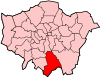
Attractions Street markets Parks and open spaces Addington Hills · Addington Park · Addington Vale · Addiscombe Railway Park · Addiscombe Recreation Ground · Apsley Road Playground · Ashburton Park · Ashburton Playing Fields · Beaulieu Heights · Brickfields Meadow · Coombe Wood · Cotelands · Duppas Hill · Grangewood Park · Great North Wood · Heavers Meadow · Mitcham Common · Park Hill · Pollards Hill · Queen's Gardens · Roundshaw · Selsdon Wood · South Norwood Country Park · South Norwood Lake and Grounds · South Norwood Recreation Ground · Woodside Green
Constituencies Other topics Architecture (Croydon Vision 2020 • Tallest buildings and structures) · Economy · People · Public art · Railway stations · SchoolsCategories:- Streets in Croydon
- Districts of Croydon
- Cricket grounds in London
- Sports venues in Surrey
- Districts of London
- Parks and open spaces in Croydon
- History of Surrey
- English cricket in the 18th century

Wikimedia Foundation. 2010.