- Dinslaken
-
Dinslaken 

 DinslakenLocation of the town of Dinslaken within Wesel district
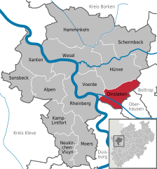

Coordinates 51°34′N 6°44′E / 51.56667°N 6.73333°ECoordinates: 51°34′N 6°44′E / 51.56667°N 6.73333°E Administration Country Germany State North Rhine-Westphalia Admin. region Düsseldorf District Wesel Town subdivisions 7 Mayor Michael Heidinger (SPD) Basic statistics Area 47.67 km2 (18.41 sq mi) Elevation 20 - 113 m Population 69,472 (31 December 2010)[1] - Density 1,457 /km2 (3,775 /sq mi) Other information Time zone CET/CEST (UTC+1/+2) Licence plate WES Postal codes 46535, 46537, 46539 Area code 02064 Website www.dinslaken.de Dinslaken is a city in the district of Wesel, in North Rhine-Westphalia, Germany. It is known for its harness horse race track, its now closed coal mine in Lohberg and its wealthy neighborhoods Hiesfeld and Eppinghoven.
Contents
Geography
Dinslaken is a city of the Lower Rhine region and situated at the northwestern margin of the Ruhr area, approx. 15 km north of Duisburg.
Neighbouring municipalities
Division of the town
Dinslaken consists of 7 subdivisions
- Eppinghoven
- Hiesfeld
- Innenstadt
- Lohberg
- Oberlohberg
- Bruch
- Averbruch
Sights
The medieval parish church, St. Vincentius, was heavily damaged during World War II, but was rebuilt from 1951 to 1952.
International relations
Dinslaken's twin towns include:[2]
References
- Notes
- ^ "Amtliche Bevölkerungszahlen" (in German). Landesbetrieb Information und Technik NRW. 31 December 2010. http://www.it.nrw.de/statistik/a/daten/amtlichebevoelkerungszahlen/index.html.
- ^ a b c "List of Twin Towns in the Ruhr District". © 2009 Twins2010.com. http://www.twins2010.com/fileadmin/user_upload/pic/Dokumente/List_of_Twin_Towns_01.pdf?PHPSESSID=2edd34819db21e450d3bb625549ce4fd. Retrieved 2009-10-28.
External links
- Official site (German)
Alpen | Dinslaken | Hamminkeln | Hünxe | Kamp-Lintfort | Moers | Neukirchen-Vluyn | Rheinberg | Schermbeck | Sonsbeck | Voerde | Wesel | Xanten Categories:
- Towns in North Rhine-Westphalia
- North Rhine-Westphalia geography stubs


Wikimedia Foundation. 2010.