- Broad Channel (IND Rockaway Line)
Infobox NYCS
name = Broad Channel
bg_color = #11117D
bg_color_2 = #3D4040
line = IND Rockaway Line
service = Rockaway south
platforms = 2side platform s
tracks = 2
passengers = 103,502
pass_year = 2006
pass_percent = 5
borough = Queens
open_date = 1880 as LIRR station [ [http://www.lirrhistory.com/rockaway.html Long Island Rail Road History Website — The NY, Woodhaven and Rockaway RR] ]June 28 ,1956 as subway station
north_station = Howard Beach–JFK
north_station_acc = yes
north_line = IND Rockaway Line
north_service = Rockaway north
south_custom_station = NYCS next|type=Far Rockaway|station=Beach 67th Street|line=IND Rockaway Line|service=Far Rockaway
south_custom_station_2 = NYCS next|type=Rockaway Park|station=Beach 90th Street|line=IND Rockaway Line|service=Rockaway ParkBroad Channel is a station on the
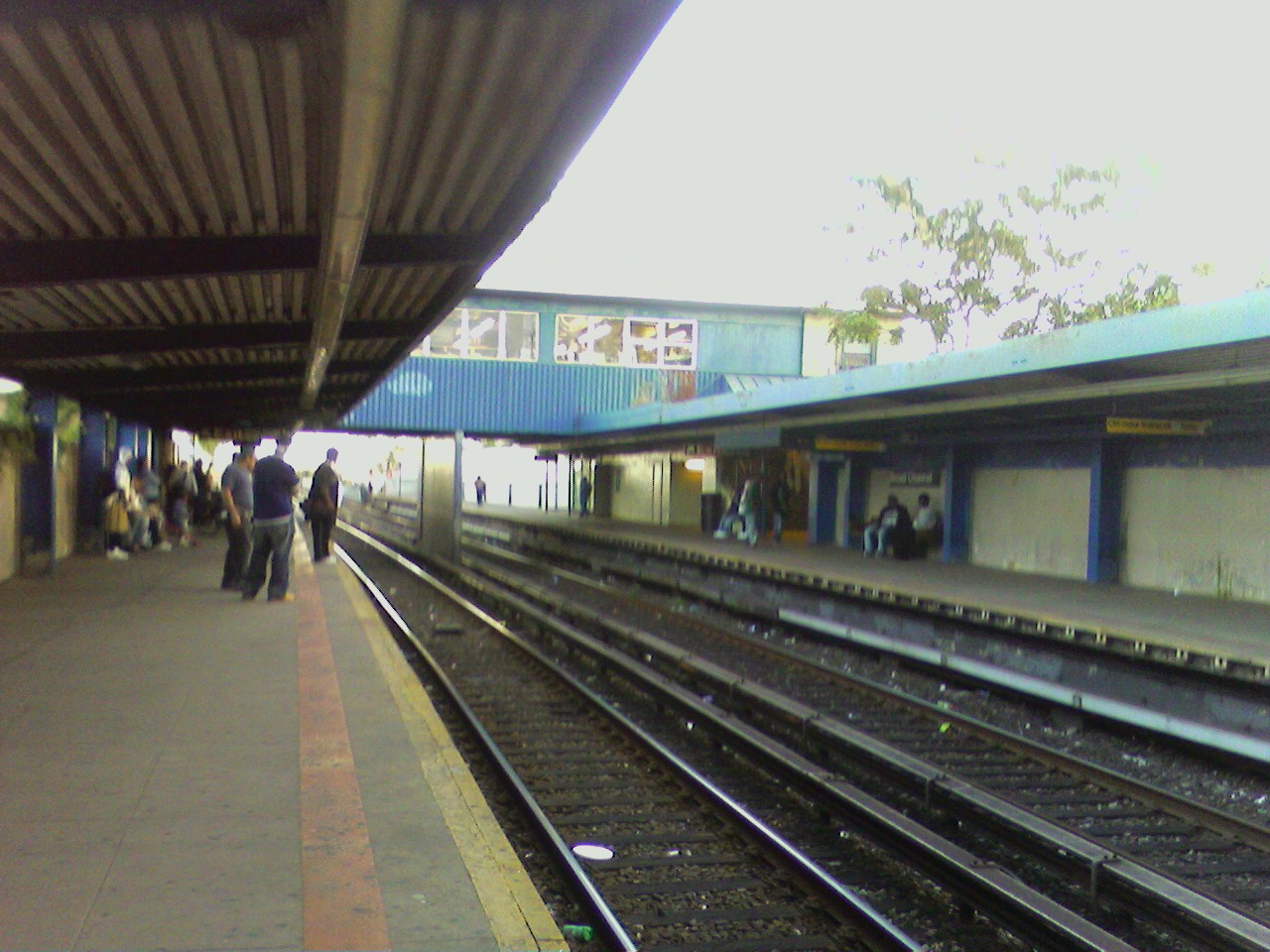
IND Rockaway Line of theNew York City Subway . Located at Noel Road and West Road in the Broad Channel neighborhood of the borough ofQueens , it is served by the NYCS|A train and theRockaway Park Shuttle at all times, the latter of which terminates here.The station originally opened in 1900 as a
Long Island Rail Road station on theRockaway Beach Branch . Wooden shelter sheds were added to the station in 1921 and 1923. A fire on the trestle between this station and another one known as The Raunt forced the closure of both stations onMay 23 ,1950 , as well as the entire Jamaica Bay trestle. ByOctober 3 ,1955 , the entire Rockaway Beach Branch south ofOzone Park (LIRR station) , and all of theFar Rockaway Branch west ofFar Rockaway (LIRR station) was turned over to theNew York City Transit Authority , who reopened Broad Channel Station to subway service onJune 28 ,1956 . [ [http://www.trainsarefun.com/lirrphotos/lirrstationshistory.htm LIRR Station History (TrainsAreFun.com)] ]This station has two tracks and two
side platform s, with a glass-enclosed crossover containing the waiting area and fare control. Entrance/exit is from the southbound platform only, requiring northbound passengers to cross over. Just to the north, the Rockaway Line gains two extra non-revenue tracks straddling the two revenue tracks; the 2 mile long western track is used as a test track, while the eastern track is used to relay shuttle trains. Continuing north, the Rockaway Line crossesJamaica Bay before reaching Howard Beach; the distance between the two stations is the longest between any two in the New York City Subway system. To the south, the Rockaway Line continues to the Rockaway peninsula, where it splits at Hammel's Wye to allow service to both Far Rockaway–Mott Avenue and Rockaway Park–Beach 116th Street.Bus connections
*Local service: Q21
*Limited stop service: Q53
*Manhattan express service: QM16 and QM17Nearby points of interest
*Jamaica Bay Unit of the
Gateway National Recreation Area References
External links
*NYCS ref|http://www.nycsubway.org/perl/stations?209:749|IND Rockaway|Broad Channel
* [http://www.stationreporter.net/htrain.htm Station Reporter — H Train] (NYCS|H is the Metropolitan Transportation Authority's internal designation for the Rockaway Park Shuttle)
*Geolinks-US-buildingscale|40.608618|-73.81600
Wikimedia Foundation. 2010.