- Hopland, California
-
For the nearby community formerly with this name, see Old Hopland, California.
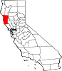
Hopland — census-designated place — Location in California
 Hopland
Coordinates: 38°58′23″N 123°06′59″W / 38.97306°N 123.11639°WCoordinates: 38°58′23″N 123°06′59″W / 38.97306°N 123.11639°W Country  United States
State  California
County Mendocino Area[1] – Total 3.573 sq mi (9.254 km2) – Land 3.525 sq mi (9.129 km2) – Water 0.048 sq mi (0.125 km2) 1.35% Elevation[2] 502 ft (153 m) Population (2010) – Total 756 – Density 211.6/sq mi (81.7/km2) Time zone Pacific (UTC-8) – Summer (DST) PDT (UTC-7) ZIP code 95449 Area code(s) 707 FIPS code 06-34652 GNIS feature IDs 1658778; 2628739 U.S. Geological Survey Geographic Names Information System: Hopland, California; U.S. Geological Survey Geographic Names Information System: Hopland, California Hopland (formerly Sanel)[3] is a census-designated place[4] in Mendocino County, California.[2] It is located on the west bank of the Russian River 13 miles (21 km) south-southeast of Ukiah,[3] at an elevation of 502 feet (153 m).[2] The population was 756 at the 2010 census.
Hopland is a small town of less than 800 people located at the start of the Redwoods of Northern California. It is about two hours drive along U.S. Route 101 north of San Francisco, and a 30-minute drive along State Route 175 to California's largest natural lake Clear Lake. It is a rustic farming community situated amongst oak covered coastal foothills. Summer temperatures can exceed 100 °F (38 °C).
The Hopland Band of Pomo Indians operates the Hopland Sho-Ka-Wah Casino and Bingo on Nokomis Road, which includes a 40,000 sq ft (3,700 m2) casino.[5] The Pomo originally lived off the natural resources of the land in Sanel Valley with deer, fish, acorns and berries. In 1996 they opened the casino and through it have funded health, educational and social benefits.
Notable establishments in Hopland include the Mendocino Brewing Company, which started in 1983 as the Hopland Brewing Company, and Fetzer Vineyards, a major producer of both red and white wines in North America, including Zinfandel, Chardonnay and Merlot.
Approximately 5 mi (8 km) east of Hopland is the University of California's Hopland Research and Extension Center (formerly called the "Hopland Field Station"), a 5,300-acre (21.4 km2) research and education facility that UC has operated since 1951.
Contents
Geography
According to the United States Census Bureau, the CDP covers an area of 3.6 square miles (9.3 km²), 98.65% of it land, and 1.35% of it water.
Climate
Monthly climate averages (1989–1993)[6] Month High (°F) Low (°F) Precip. (inches) January 57 36 4.89 February 60 40 5.98 March 62 41 6.47 April 67 43 1.16 May 74 47 1.98 June 82 51 0.72 July 90 55 0.03 August 90 55 0.05 September 87 53 0.35 October 78 49 1.18 November 65 41 3.72 December 57 35 4.17 History
The settlement that became Hopland was originally called Sanel.[3] Over the years it was centered on either side of the Russian River.[3] Sanel began on the west bank of the river in 1859.[3] In 1874, the town moved to the east bank to be connected to the toll road built to there.[3] When the railroad arrived on the west side of the river, the town moved back to its original site.[3]
The Sanel post office opened in 1860, closed for a time in 1869, moved and changed its name to Hopland in 1879, reverted to its original site and name in 1890, and changed its name finally to Hopland in 1891.[3] The town gets its name from the fact that from the 1870s to the mid-1950s, much of the region’s economy was based on the growing and drying of bitter hops, a key flavoring and preservative in beer.[7]. Downy mildew pushed hops out of the area completely by the late 1950s. [8]
Demographics
The 2010 United States Census[9] reported that Hopland had a population of 756. The population density was 211.6 people per square mile (81.7/km²). The racial makeup of Hopland was 521 (68.9%) White, 4 (0.5%) African American, 38 (5.0%) Native American, 10 (1.3%) Asian, 0 (0.0%) Pacific Islander, 142 (18.8%) from other races, and 41 (5.4%) from two or more races. Hispanic or Latino of any race were 263 persons (34.8%).
The Census reported that 739 people (97.8% of the population) lived in households, 17 (2.2%) lived in non-institutionalized group quarters, and 0 (0%) were institutionalized.
There were 263 households, out of which 94 (35.7%) had children under the age of 18 living in them, 117 (44.5%) were opposite-sex married couples living together, 37 (14.1%) had a female householder with no husband present, 29 (11.0%) had a male householder with no wife present. There were 28 (10.6%) unmarried opposite-sex partnerships, and 4 (1.5%) same-sex married couples or partnerships. 56 households (21.3%) were made up of individuals and 12 (4.6%) had someone living alone who was 65 years of age or older. The average household size was 2.81. There were 183 families (69.6% of all households); the average family size was 3.27.
The population was spread out with 195 people (25.8%) under the age of 18, 77 people (10.2%) aged 18 to 24, 211 people (27.9%) aged 25 to 44, 216 people (28.6%) aged 45 to 64, and 57 people (7.5%) who were 65 years of age or older. The median age was 34.6 years. For every 100 females there were 124.3 males. For every 100 females age 18 and over, there were 122.6 males.
There were 287 housing units at an average density of 80.3 per square mile (31.0/km²), of which 109 (41.4%) were owner-occupied, and 154 (58.6%) were occupied by renters. The homeowner vacancy rate was 2.7%; the rental vacancy rate was 6.1%. 272 people (36.0% of the population) lived in owner-occupied housing units and 467 people (61.8%) lived in rental housing units.
Politics
In the state legislature Hopland is located in the 2nd Senate District, represented by Democrat Noreen Evans, and in the 1st Assembly District, represented by Democrat Wesley Chesbro. Federally, Hopland is located in California's 1st congressional district, which has a Cook PVI of D +10[10] and is represented by Democrat Mike Thompson.
Media
- KORB 88.7 MHz, the only FM broadcast station licensed to Hopland
See also
References
- ^ U.S. Census
- ^ a b c U.S. Geological Survey Geographic Names Information System: Hopland, California
- ^ a b c d e f g h Durham, David L. (1998). California's Geographic Names: A Gazetteer of Historic and Modern Names of the State. Quill Driver Books. p. 79. ISBN 9781884995149.
- ^ {{gnis|2628739}]
- ^ "Hopland Shkawah Casino & Bingo". http://500nations.com/casinos/caHopland.asp. Retrieved 2007-12-01.
- ^ Forrey, Rip. "Climate data for various locations in Sonoma, Napa, Mendocino, Lake and Marin counties, California". University of California Cooperative Extension Sonoma County. Archived from the original on 2007-06-30. http://web.archive.org/web/20070630163510/http://cesonoma.ucdavis.edu/hortic/pdf/climate_location_data.pdf. Retrieved 2007-12-01.
- ^ http://roadjournals.viamagazine.com/2011/02/02/hopland-calif-with-the-hops-gone-maybe-they-should-call-it-grapeland
- ^ http://www.brewingtechniques.com/library/styles/2_1style.html
- ^ All data are derived from the United States Census Bureau reports from the 2010 United States Census, and are accessible on-line here. The data on unmarried partnerships and same-sex married couples are from the Census report DEC_10_SF1_PCT15. All other housing and population data are from Census report DEC_10_DP_DPDP1. Both reports are viewable online or downloadable in a zip file containing a comma-delimited data file. The area data, from which densities are calculated, are available on-line here. Percentage totals may not add to 100% due to rounding. The Census Bureau defines families as a household containing one or more people related to the householder by birth, opposite-sex marriage, or adoption. People living in group quarters are tabulated by the Census Bureau as neither owners nor renters. For further details, see the text files accompanying the data files containing the Census reports mentioned above.
- ^ "Will Gerrymandered Districts Stem the Wave of Voter Unrest?". Campaign Legal Center Blog. http://www.clcblog.org/blog_item-85.html. Retrieved 2007-10-20.
Municipalities and communities of Mendocino County, California Cities Fort Bragg | Point Arena | Ukiah | Willits
CDPs Albion | Anchor Bay | Boonville | Brooktrails | Calpella | Caspar | Cleone | Comptche | Covelo | Hopland | Laytonville | Leggett | Little River | Manchester | Mendocino | Philo | Potter Valley | Redwood Valley | Talmage
Unincorporated
communitiesAlpine | Andersonia | Arnold | Asylum | Bell Springs | Bowman Place | Branscomb | Bredehoft Place | Burbeck | Cameron | Cape Horn | Card Place | Carpenter Place | Clare Mill | Cooks Valley | Crowley | Cubbler Place | Cummings | Dawes | DeCamp | DeHaven | Delmonico Place | Dos Rios | Duncan Springs | Dunlap Place | El Roble | Elk | Fair Oaks | Farley | Fish Rock | Flumeville | Four Pines | Gallaway | Glenblair | Grove | Gualala | Hales Grove | Hardy | Hardy Place | Hays Place | Hearst | Heath Place | Heeser Addition | Hendy Grove | Indian Springs | Inglenook | Ingram | Irmulco | Jim Leggett Place | Kibesillah | Largo | Laughlin | Little Penny | Longvale | Marble Place | Marks Place | McClure Place | Melbourne | Mina | Montgomery | Nacomis Indian Rancheria | Nashmead | Navarro | Newport | Northspur | Noyo | Oasis | Old Bailey Place | Old Hopland | Old Ornbaun Hot Springs | Old Red Rock Place | O'Neil Place | Orrs Springs | Philbrick Mill | Piercy | Pieta | Pine Grove | Pomo | Pratt Place | Presswood | Ralph Leggett Place | Ramsey | Redwood Lodge | Reeves Place | Regina Heights | Reilly Heights | Reyes Place | Ridge | Ridgewood Park | Riverdale | Shake City | Simerson | Soda Springs (Boonville) | Soda Springs (Burbeck) | South Fork | South Leggett | Spyrock | Stronetta | Tan Oak Park | Tatu | The Forks | The Oaks | Twin Rocks | Ukiah Rancheria | Underwood Park | Union Landing | Upp | Vichy Springs | Wanhala | Westport | Whiskey Springs | Whitesboro | Woodman | Yorkville
Indian
reservationsCoyote Valley Reservation | Guidiville Rancheria | Hopland Rancheria | Iverson Indian Rancheria | Manchester-Point Arena Rancheria | Pinoleville Rancheria | Potter Valley Rancheria | Sherwood Valley Rancheria | Redwood Valley Rancheria | Round Valley Indian Reservation
Former
settlementsAnderson | Arthur | Bentley | Bokea | Bucknell | Buldam | Cahto | Carbon | Carey | Chomchadila | Christine | Christine Junction | Clearbrook | Comfort | Crittendon | Dapishul | Dellavan | Duffey | Dunlap | Echo | Empire | En Cimo | Fairbanks | Fountain | Gracy | Half Way | Hardin | Hermitage | Iverson | Junction | Kenny | Lane Redwood Flat | Lema | Masut | Melborne Camp | Moiya | Muir Springs | North Fork House | Northwestern | Noyo Lodge | Ornbaun | Poonkiny | Rankin | Redwine | Reynolds | River Garden | Rockport | Rodgers | Rowes | Salmon Creek | Salsig | Sawyers | Sherburns | Shiegho | Signal Port | Sunnyside | Sylvandale | Tilly | Tolson | Tomki | Tomkiah | Ubakhea | Ulco | Usal | Wendling | Wheeler | Whitehall
Categories:- Census-designated places in Mendocino County, California
- Unincorporated communities in California


Wikimedia Foundation. 2010.