- Maggieknockater
-
 Maggieknockater
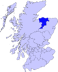
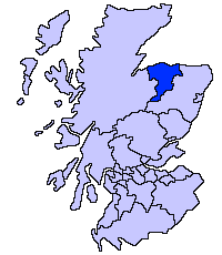
Maggieknockater (Magh an Fhucadair in Scottish Gaelic) is a hamlet on the A95 road between Craigellachie and Mulben in Scotland in the Moray council area, in the former county of Banffshire.
Until the early 1970s there was large apiary which was well known in the region and has lived on in the Scottish country dance "The Bees of Maggieknockater".[1] The meaning of Maggieknockater is "field of the fuller" or "plain of the hilly ridge" and has nothing to do with a woman called Maggie. At nearby Gauldwell Castle (now only with one partial wall left standing) Mary, Queen of Scots, is reputed to have spent the night. The school was closed in the 1960s and the chapel was turned into a home in the early 1970s. What was once a smithy is now a garage still in the hands of the Maclean family. Maggieknockater formerly had a post office; it opened in June 1876 and closed in 1940.[2]
Maggieknockater is situated in the heart of Scotland's Malt Whisky Trail, situated less than 4 miles from Dufftown, home of the world-famous Glenfiddich Distillery.
Less than two miles heading east along the A95 from Maggieknockater is the site for Moray's most demanding Mountain Biking trails, "The Moray Monster Trails". The trails were regenerated and improved during 2005 and 2006.
External links
- Map sources for Maggieknockater
Coordinates: 57°29′47″N 3°08′46″W / 57.49630°N 3.14619°W
Places in Moray Achnastank · Aberlour · Alves · Archiestown · Arradoul · Auchbreck · Auchinderran · Auchindoun · Auchnarrow · Auchenhalrig · Aultmore · Backlands · Ballindalloch · Bogmoor · Branderburgh · Broadley · Buckie · Burghead · Burniestrype · Cabrach · Chapeltown · Clochan · College of Roseisle · Craigellachie · Cullen · Cummingston · Dallas · Darnaway · Deskford · Dipple · Drummuir · Drybridge · Dufftown · Duffus · Dyke · Elgin · Farmtown · Findhorn · Findochty · Fochabers · Forres · Fogwatt · Garmouth · Glass · Hopeman · Ianstown · Inchberry · Keith · Kellas · Kingston · Kinloss · Knockando · Lhanbryde · Longmorn · Lossiemouth · Maggieknockater · Miltonduff · Mosstodloch · Nether Dallachy · Newmill · Ordiquish · Portessie · Portgordon · Portknockie · Rathven · Rafford · Rothes · Rothiemay · Spey Bay · Strathlene · Stotfield · Tomintoul · Unthank · Upper Dallachy · Urquhart
References
- ^ John Drewry (1975). "Dance: The Bees of Maggieknockater". http://my.strathspey.org/dd/dance/445/.
- ^ Mackay, James A. (1989) Scottish Post Offices, p. 89. Dumfries: published by the author, ISBN 0 906440 48 3
Categories:- Places in Moray
- Hamlets in Scotland
- Mountain biking venues in the United Kingdom
- Moray geography stubs

Wikimedia Foundation. 2010.