- Chinatown, Boston
-
Chinatown — Neighborhood of Boston — A view from within Chinatown looking towards the paifang, 2008
Country United States State Massachusetts County Suffolk Neighborhood of Boston Time zone Eastern (UTC-5) Zip Code Area code(s) 617 / 857 Chinatown, Boston 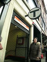
Chinatown station on the MBTA Orange Line, 2008 Traditional Chinese 波士頓唐人街 Simplified Chinese 波士顿唐人街 Transcriptions Mandarin - Hanyu Pinyin Bōshìdùn Tángrénjiē - Tongyong Pinyin Boshìhdùn Tángrénjie - Wade–Giles Po1shih4tun4 T'ang2jen2chieh1 - IPA [pɔ́ʂɨ̂twə̂n tʰɑ̌ŋtɕə̌ntɕɨɤ́] - Gwoyeu Romatzyh Boshyhduenn Tarngrenjie Min - Hokkien POJ Pho-sū-tùn Tn̂g-lâng-ke Cantonese (Yue) - Jyutping Bo1si6seun6 Tong4yan4gaai1 - IPA bɔː˥sìsɛːùn.tɔː̭ŋyɐ̭ngaːi˥ - Yale Romanization Bwoshrdwun Tangrenjye Alternative Chinese name Traditional Chinese 波士頓華埠 Simplified Chinese 波士顿华埠 Transcriptions Mandarin - Hanyu Pinyin Bōshìdùn Huá Bù - Tongyong Pinyin Boshìhdùn Huá Bù - Wade–Giles Po1shih4tun4 Hua2pu4 - Gwoyeu Romatzyh Boshyhduenn Hwabuh Min - Hokkien POJ Pho-sū-tùn Hôa-bú Cantonese (Yue) - Jyutping Bo1si6seun6 Waa4bou6 - IPA bɔː˥sìsɛːùn.waː̭bòu - Yale Romanization Bwoshrdwun Hwabu The only historically Chinese area in New England, Chinatown, Boston is a neighborhood located in downtown Boston, Massachusetts. Centered on Beach Street, the neighborhood borders Boston Common, Downtown Crossing, the South End, and the Southeast Expressway/Massachusetts Turnpike. It is the third-largest Chinatown in the United States.[1][2]
Part of it occupies a space reclaimed by filling a tidal flat; the newly-created area was first settled by Anglo-Bostonians. After residential properties in this area became less desirable due to railway developments, it was settled by a mixed succession of Irish, Jewish, Italian, Syrian, and Chinese immigrants. Each group replaced the previous one to take advantage of low-cost housing and job opportunities in the area. During the late-nineteenth century, garment manufacturing plants also moved into Chinatown, creating Boston's historic garment district. The garment district was active until the 1990s.
Negotiations resulted in the provision of funds for the construction of new community housing in Chinatown. During this period, city officials also designated an area adjacent to Chinatown as Boston's red light district, also known as the Combat Zone. However, the Combat Zone virtually disappeared by the 1990s, due to city pressure and a general increase in property values, encouraging building sales and the removal of former tenants.
Contents
Modern day
Chinatown remains a center of Asian-American life in New England, hosting many Chinese, and Vietnamese restaurants and markets. Chinatown is one of Boston's most densely-populated residential districts, with over 28,000 people per square mile in the year 2000. Nearly 70% of Chinatown's population is Asian, with a median household income of $14,289.[citation needed]
The traditional Chinatown Gate (paifang) with a foo lion on each side is located at the intersection of Beach Street and Surface Road. Once a run-down area housing little more than a ventilation-fan building for the Central Artery Tunnel, a garden was constructed at this site as part of the Big Dig project. The Gate is visible from the South Station Bus Terminal and is a popular tourist destination and photo opportunity.[citation needed]
The non-profit community newspaper Sampan provides English-language news and information about Chinatown.
As of 2000 the Chinatown is also a red light district. It is located at the mouth of an expressway tunnel.[3]
Housing development and gentrification
Currently,[when?] Chinatown is experiencing gentrification. Large luxury residential towers are built in and surrounding an area that was predominantly small three-to-five-story apartment buildings intermixed with retail and light-industrial spaces. A property developer has purchased the Dainty Dot Hosiery building, which is listed in the National Register of Historic Places, with plans to transform it into condominiums. Chinese community organizations such as the Asian Community Development Corporation are also building housing developments which offer mixed- and low-income housing.
Transportation
Chinatown has excellent local and regional transportation connections. It is served by the MBTA's Red Line, Silver Line and Commuter Rail at South Station, and the Orange Line at Chinatown Station. Interstate 93 and the Massachusetts Turnpike are also in close proximity. Two Chinese-owned bus services (Fung Wah and Lucky Star/Travelpack) provide hourly connections with New York's Chinatown.
Health care
Tufts Medical Center dominates part of the area and includes a full service hospital and various health-related schools of Tufts University including Tufts University School of Medicine, Sackler School of Graduate Biomedical Sciences, Gerald J. and Dorothy R. Friedman School of Nutrition Science and Policy and Tufts University School of Dental Medicine.[4][5]
In addition, South Cove Community Health Center operates the Chinatown Clinic at 885 Washington Avenue.[6] Volunteers founded South Cove in 1972 to provide better health care for Asian Americans in the Chinatown area.[7]
Historical Buildings
The Hayden Building is a historic building at 681-683 Washington Street constructed in 1875 designed by Henry Hobson Richardson. It was added to the National Historic Register in 1980. It is the last remaining commercial retail building built by Richardson in Boston.
Chinatown South
A new satellite Chinatown has been emerging on Hancock Street in the neighboring city of Quincy, about 10 miles (16 km) to the south of the original Chinatown, due to the rapid influx of Hokkien-speaking Mainland Chinese immigrants from the province of Fujian, as well as a large and growing ethnic Vietnamese population. There are already several large Asian supermarkets such as the Kam Man Foods and Super 88 supermarket chains, and other businesses that are competing with Boston's Chinatown. Several businesses operating in Chinatown now have branches in Quincy.
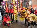
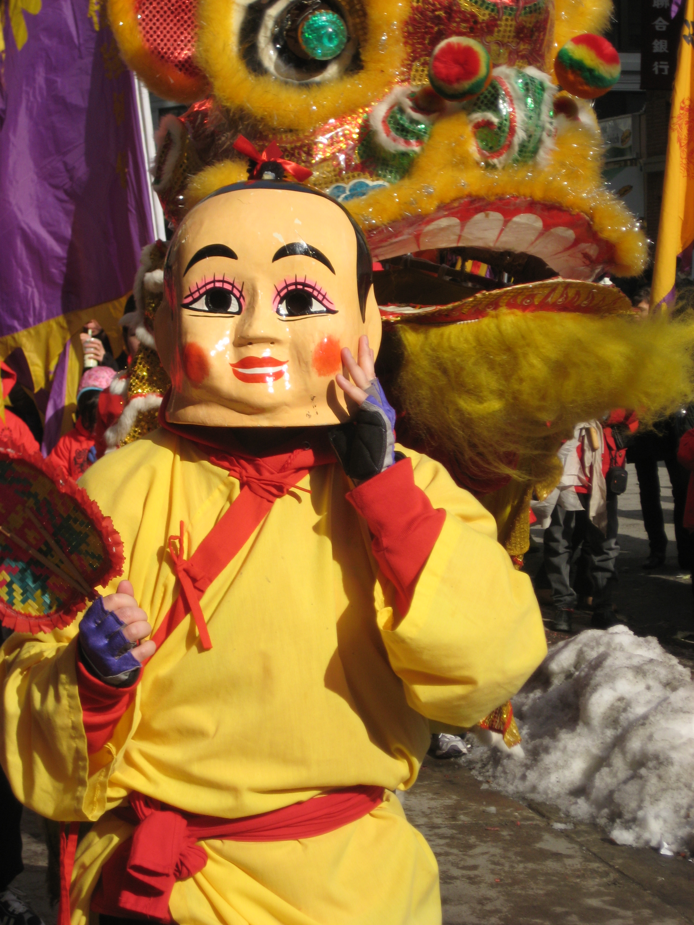
Gallery
-

Chinese New Year festival in Boston's Chinatown, 2009
-

Chinese New Year festival in Boston's Chinatown, 2009
-

Chinese New Year festival in Boston's Chinatown, 2009
-

Chinese New Year festival in Boston's Chinatown, 2009
-

Chinese New Year festival in Boston's Chinatown, 2009
-

Chinese New Year festival in Boston's Chinatown, 2009
-

Lion dancer at Chinese New Year festival in Boston's Chinatown
-

Lion dancer at Chinese New Year festival in Boston's Chinatown
-

Registry of Motor Vehicles on Washington Street in Boston's Chinatown, 2008
-
Chinese New Year festival in Boston's Chinatown
-

Chinese New Year festival in Boston's Chinatown, 2009
-

Cathay Bank in Boston's Chinatown, 2008
See also
- Chinatowns in North America
- Chinatown bus
- Stacey G.H. Yap, Gather Your Strength, Sisters: The Emerging Role of Chinese Women Community Workers (New York: AMS Press, 1989): Study of women community organizers in Boston's Chinatown
References
- ^ "Chinatown/Leather District". City of Boston. http://www.cityofboston.gov/neighborhoods/chinatownleatherdistrict.asp. Retrieved 14 November 2010.
- ^ Simon, Kate (9 December 2007). "A sweet and sour history of Boston's Chinatown". The Independent. http://www.independent.co.uk/travel/americas/a-sweet-and-sour-history-of-bostons-chinatown-766059.html.
- ^ AsianWeek Staff and Associated Press. "Philadelphia Chinatown Wins Stadium Fight. AsianWeek. November 24-30, 2000. Retrieved on November 8, 2011.
- ^ Concise Encyclopedia of Tufts History. Ed. Anne Sauer. http://www.perseus.tufts.edu/cgi-bin/vor?type=phrase&alts=0&group=typecat&lookup=New%20England%20Medical%20Center&collection=Perseus:collection:Tufts150
- ^ Concise Encyclopedia of Tufts History. Ed. Anne Sauer. http://www.perseus.tufts.edu/cgi-bin/vor?type=phrase&alts=0&group=typecat&lookup=New%20England%20Medical%20Center&collection=Perseus:collection:Tufts150
- ^ "Locations." South Cove Community Health Center. Retrieved on April 15, 2009.
- ^ "About Us." South Cove Community Health Center. Retrieved on April 15, 2009.
- Chinatown Park
- Chinatown Profile Census 2000
- Developer buys historic Hub textile building for $9m, plans residences
Further reading
- My legacy is simply this: stories from Boston's most enduring neighborhoods; Charlestown, Chinatown, East Boston, Mattapan, Boston, Massachusetts, USA: City of Boston and Grub Street, Inc., 2008, http://openlibrary.org/books/OL24643220M/My_legacy_is_simply_this_stories_from_Boston's_most_enduring_neighborhoods_Charlestown_Chinatown_East_Boston_Mattapan
External links
- [1] New Guide to Boston's Chinatown
- [2] Overlay of modern and historical images at Washington and Essex Streets in Chinatown.
- Boston Chinatown Neighborhood Center
- Asian American Civic Association
- Asian Community Development Corporation
- Chinatown Main Street, a Boston Main Streets initiative
- Chinatown Heritage Project
- The International Society records, 1978-2002 (bulk 1984-1998) are located in the Northeastern University Libraries, Archives and Special Collections Department, Boston, MA.
- The Chinese Progressive Association records, 1976-2006 are located in the Northeastern University Libraries, Archives and Special Collections Department, Boston, MA.
- Patriot Ledger Special Report: Chinatown South
- Boston Chinatown Pics
Neighborhoods in Boston Allston/Brighton · Back Bay · Bay Village · Beacon Hill · Charlestown · Chestnut Hill · Chinatown · Columbia Point · Dorchester · Downtown Crossing · East Boston · Fenway–Kenmore · Financial District · Forest Hills · Fort Point · Government Center · Hyde Park · Jamaica Plain · Leather District · Longwood · Mattapan · Mission Hill · North End · Readville · Roslindale · Roxbury · South Bay · South Boston · South End · West End · West Roxbury

Chinatowns Africa South Africa: JohannesburgAsia India: Kolkata · Makum (closed) · Mumbai (closed), Indonesia: Jakarta, Iran: Mahale Chiniha, Japan: Kobe · Nagasaki · Yokohama, Malaysia: Kuala Lumpur, Myanmar: Yangon, Pakistan: Karachi, Philippines: Manila, Singapore Singapore, South Korea: Incheon, Thailand: Bangkok, United Arab Emirates: Dubai, Vietnam: Ho Chi Minh City (Saigon)Europe Latin America Argentina: Buenos Aires, Brazil: São Paulo, Costa Rica: San José, Cuba: Havana, Mexico: Mexicali · Mexico City, Peru: LimaNorth America Canada: Calgary · Edmonton · Lethbridge · Montreal · Ottawa · Toronto · Vancouver · Victoria · Winnipeg
United States: Boston · Brooklyn · Chicago · Cleveland · Flushing · Honolulu · Houston · Las Vegas · Los Angeles · Newark · New York · Oakland · Oklahoma City · Philadelphia · Portland · San Francisco · Seattle · Washington D.C.Oceania Categories:- Neighborhoods in Boston, Massachusetts
- Chinatowns in the United States
- Boston Theatre District
- Chinatown, Boston
- Restaurant districts and streets
-


Wikimedia Foundation. 2010.