- Monterey, New South Wales
-
Monterey
Sydney, New South Wales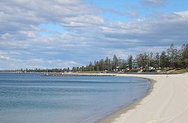
Lady Robinsons Beach, MontereyPopulation: 4,136 Postcode: 2217 Location: 15 km (9 mi) south of Sydney CBD LGA: City of Rockdale State District: Rockdale Federal Division: Division of Barton Suburbs around Monterey: Rockdale Brighton-Le-Sands Kogarah Monterey Botany Bay Ramsgate Ramsgate Beach Monterey is a suburb in southern Sydney, in the state of New South Wales, Australia. Monterey is located 15km south of the Sydney central business district and is part of the St George area. Monterey is in the local government area of the City of Rockdale.
Monterey sits on the western shores of Botany Bay. Lady Robinsons Beach and Cook Park run along the eastern border. Scarborough Park, which features a pond, runs along the western border. The suburb is mostly residential with a small group of shops on Chuter Avenue, near the intersection of Scarborough Street.
Contents
History
Monterey was originally part of Brighton-Le-Sands and Ramsgate. As the area developed, street names with a Californian influence were selected such as Hollywood, Monterey, Pasadena and Culver. A small group of shops were built on Chuter Avenue, near Monterey Street. When the post office opened here it was known as the Monterey post office. Rockdale Council wanted to create a new suburb, although not everyone agreed with this name as some thought it was too American, especially with some of the street names already in the area. Since most people were in favour, Monterey was officially declared a suburb in 1972.
Scarborough Park was once part of Pat Moore's Swamp or Patmore Swamp. It was named by the Hon. Thomas Holt after the English coastal town of Scarborough, North Yorkshire. [1]
Population
According to the 2006 Australian Bureau of Statistics Census of Population, there were 4,136 people usually resident in Monterey. 33.8% stated they were born overseas with the top countries of birth being Greece 5.9%, Egypt 2.9% and United Kingdom 2.9%. English was stated as the only language spoken at home by 43.1% of residents and the most common other languages spoken were Greek 17.5%, Arabic 4.1% and Spanish 2.9%. The most common responses for religious affiliation were Orthodox 25.8%, Catholic 23.9% and Anglican 12.9%. [2]
Landmarks
- Scarborough Park, Tanner Reserve, Cook Park
- Lady Robinsons Beach
-

Rock wall on Botany Bay
-

Scarborough Park
-

Chuter Avenue
See also
References
- ^ The Book of Sydney Suburbs, Compiled by Frences Pollon, Angus & Robertson Publishers, 1990, Published in Australia ISBN 0-207-14495-8, page 177
- ^ http://id.com.au/dosydney/default.aspx?pg=1&gid=4140
External links
- Monterey, New South Wales is at coordinates 33°58′26″S 151°08′52″E / 33.97380°S 151.14789°ECoordinates: 33°58′26″S 151°08′52″E / 33.97380°S 151.14789°E
Suburbs and localities within the City of Rockdale · St George · Sydney Arncliffe · Banksia · Bardwell Park · Bardwell Valley · Bexley · Bexley North · Brighton-Le-Sands · Carlton · Dolls Point · Kingsgrove · Kogarah · Kyeemagh · Monterey · Ramsgate · Ramsgate Beach · Rockdale · Sandringham · Sans Souci · Sydney Airport · Turrella · Wolli Creek
List of Sydney suburbs Categories:- Suburbs of Sydney
- Botany Bay


Wikimedia Foundation. 2010.