- Otoe-Missouria Tribe of Indians
-
Otoe-Missouria Tribe of Indians 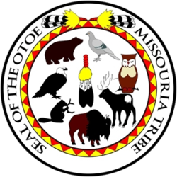
Total population 1,393[1] Regions with significant populations Oklahoma Languages Related ethnic groups The Otoe-Missouria Tribe of Indians is a single, federally recognized tribe, located in Oklahoma. The tribe is made up of Otoe and Missouria Indians. Traditionally they spoke the Chiwere language, part of the Souian language family.
Contents
Government
The Otoe-Missouria Tribe of Indians is headquartered in Red Rock, Oklahoma, and their tribal jurisdictional area is in Noble County, Oklahoma. Of the 1393 enrolled tribal members, 868 live within the state of Oklahoma. The tribe's Chairman is John R. Shotton, currently serving a three-year term.[1] Shotton has the distinction of being the youngest person to ever serve on the tribal council, being first elected when he was 29 years old.[2] Barbara Childs-Walton, former treasurer is currently serving as tribal secretary and chairman of the Otoe-Missouria Gaming Commission.
Economic development
The tribe operates its own housing authority and issues tribal vehicle tags. They own two gas stations, two smoke shops, and four casinos. The estimated annual economic impact of the Otoe-Missouria Tribe is $45 million.[1] The Otoe-Missouria casinos are 7 Clans Paradise Casino in Red Rock; First Council Casino in Newkirk, and Lil' Bit of Paradise Casino—Chilocco, also in Newkirk; and Lil' Bit of Paradise Casino—Red Rock, in Red Rock.[3]
Language and culture
An estimated at most three tribal members still speak the Otoe or Chiwere language.[4]
For well over a century, since 1881, an annual Otoe-Missouria encampment is held every July in Red Rock, Oklahoma.
History
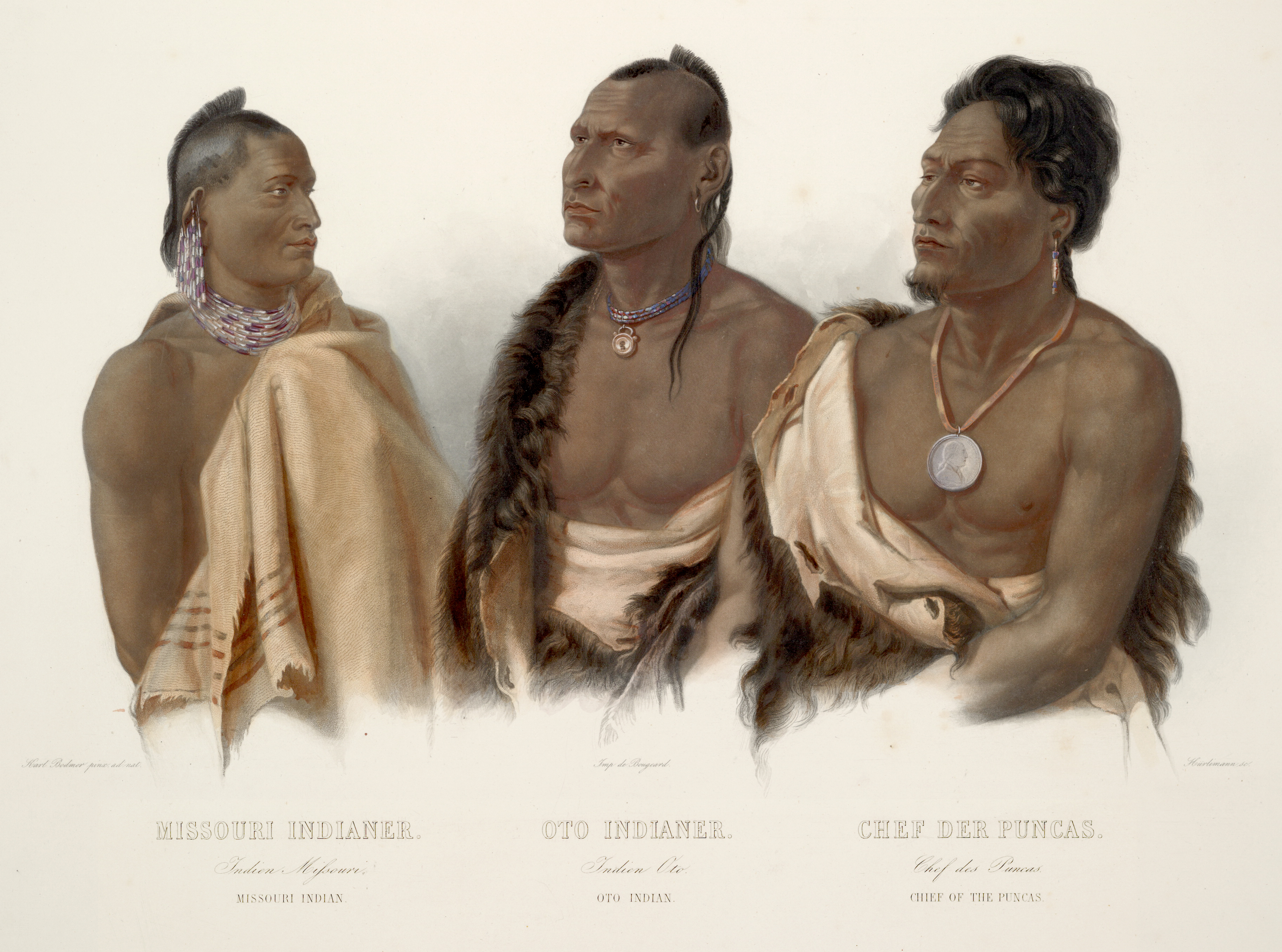
 Missouria Indian, Otoe Indian, and Chief of the Poncas, by Karl Bodmer
The Otoe, or Oto, and Missouria, or Missouri, tribes both originated in the Great Lakes region. They are thought, along with the Ho-Chunk and Iowa tribes, to have once been a single tribe. In the 16th century, the Iowa, Otoe, and Missouria broke away from that tribe and moved to the south and west. By the late 17th century, the Missouria had settled near the Missouri and Grand Rivers in Missouri.[5]
Meanwhile the Otoes settled along what is now the Iowa-Minnesota border. They first came into contact with Europeans in late 17th century.[5] Jacques Marquette, the French explorer, included them in a 1673 map, placing the Otoe near the Des Moines and upper Iowa Rivers. Pierre Le Moyne d'Iberville wrote in 1700 that the Otoe and the Iowa lived with the Omaha tribe, between the Mississippi and Missouri Rivers.[6] After contact, they migrated to Nebraska and settled near the Platte River on what became the Otoe Reservation.[5]
The 18th century was devastating for the Missouria people. Smallpox killed many in the tribe, as did constant warfare with enemies, such as the Sac and Fox. In 1796, some surviving Missouria joined the Osage and Kaw tribes, while 80 Missouria joined the Otoe.[5]
 Otoe-Missouria people from Oklahoma, 2007
In the 19th century, the Missouria and the Otoe established permanent villages consisting primarily of earth lodges, but also occasionally tipis and bark lodges. Their joined society was patrilineal and comprised seven to ten clans. Tribal members had to marry outside of their clan. Each clan had a leader, and together the clan chiefs formed a tribal council. The chief of the Bear Clan was the principal leader of the tribes. They hunted buffalo and grew such crops as squash, beans, corn, and pumpkins.[5] In 1803, Lewis and Clark estimated their population to be 500. George Catlin estimated their population at 1200 in 1833. In 1830 there were an estimated 1500 Otoe-Missouria living in together. By 1886, only 334 Otoe-Missouria survived.[6]
The first land cession treaty between the Otoe-Missouria and the United States was in 1830. These were followed by more treaties in 1833, 1836, and 1854. The 1854 Treaty established a reservation on the Kansas-Nebraska border, near the Big Blue River. The tribe split in factions of assimilationists and traditionalists. The assimilationist Otoe-Missouria were influenced by Quaker missionaries and became known as the Quaker Band. The traditionalists were known as the Coyote Band.[5]
In 1876 Congress arranged the sale of 120,000 acres (490 km2) of the Otoe-Missouria reservation and sold the rest in 1881, when Congress forced the Otoe-Missouria into Indian Territory. The Coyote Band settled on the Sac and Fox reservation, while the Quaker Band settled on their own small, 113-acre (0.46 km2) reservation in present day Noble and Pawnee Counties.[5]
The Coyote Band rejoined the Quaker Band, but their reservation was almost immediately broken up into individual allotments, as dictated by the Dawes Act, in the 1890s. A total of 514 Otoe-Missourias received individual allotments. Much later, in the 1960s the Otoe-Missouria people were compensated for their lands lost during the 19th century by the Indian Claims Commission.[5]
The Curtis Act of 1898 disbanded the traditional tribal government. The tribe was not able to restore federal recognition until 1984, when they organized under the Oklahoma Indian Welfare Act and ratified their constitution.[5]
Notable Otoe-Missouria people
 Otoe-Missouria men's moccasins, ca. 1880, Oklahoma, Oklahoma History Center
- Truman Washington Dailey (1898–1996), fluent language speaker, traditionalist
- Anna Lee Walters (b. 1946), author and publisher
References
- ^ a b c "Pocket Pictorial." Oklahoma Indian Affairs Commission. 2010: 25. . Retrieved 10 June 2010.
- ^ "John Shotton Elected Youngest Member Ever to Otoe-Missouria Tribal Council." The University of Oklahoma Outreach: Public & Community Services. July 2006 (retrieved 22 Feb 2009)
- ^ "Tribal Enterprises." Otoe-Missouria Tribe. (retrieved 19 May 2011)
- ^ Anderton, Alice, PhD. Status of Indian Languages in Oklahoma. Intertribal Wordpath Society. 2009 (22 Feb 2009)
- ^ a b c d e f g h i May, John D. Otoe-Missouria. Oklahoma Historical Society's Encyclopedia of Oklahoma History & Culture. 2009 (22 Feb 2009)
- ^ a b Oto Indian Tribe History. Access Genealogy: Indian Tribal Records. (retrieved 22 Feb 2009)
External links
- Website of the Otoe-Missouria Tribe of Indians
- Constitution of the Otoe-Missouria Tribe of Indians
- Otoe-Missouria, article on the Oklahoma Historical Society's Encyclopedia of Oklahoma History and Culture
Native American tribes in Oklahoma Federally
recognized
tribesAbsentee-Shawnee Tribe of Indians of Oklahoma · Alabama-Quassarte Tribal Town · Apache Tribe of Oklahoma · Caddo Nation of Oklahoma · Cherokee Nation · Cheyenne and Arapaho Tribes · Chickasaw Nation · Choctaw Nation of Oklahoma · Citizen Potawatomi Nation · Comanche Nation · Delaware Nation · Delaware Tribe of Indians · Eastern Shawnee Tribe of Oklahoma · Fort Sill Apache Tribe of Oklahoma · Iowa Tribe of Oklahoma · Kaw Nation · Kialegee Tribal Town · Kickapoo Tribe of Oklahoma · Kiowa Indian Tribe of Oklahoma · Miami Tribe of Oklahoma · Modoc Tribe of Oklahoma · Muscogee Creek Nation · Osage Tribe · Otoe-Missouria Tribe of Indians · Ottawa Tribe of Oklahoma · Pawnee Nation of Oklahoma · Peoria Tribe of Indians of Oklahoma · Ponca Tribe of Indians of Oklahoma · Quapaw Tribe of Indians · Sac and Fox Nation · Seminole Nation of Oklahoma · Seneca-Cayuga Tribe of Oklahoma · Shawnee Tribe · Thlopthlocco Tribal Town · Tonkawa Tribe of Indians of Oklahoma · United Keetoowah Band of Cherokee Indians in Oklahoma · Wichita and Affiliated Tribes · Wyandotte NationTribal languages
(still spoken)Alabama · Arapaho · Caddo · Cayuga · Cherokee · Cheyenne · Chickasaw · Chiwere (Iowa and Otoe) · Choctaw · Comanche · Delaware · Koasati · Hitchiti-Mikasuki · Mescalero-Chiricahua · Mesquakie (Fox, Kickapoo, and Sauk) · Muscogee · Osage · Ottawa · Pawnee · Ponca · Potawatomi · Quapaw · Seneca · Shawnee · Wichita · Wyandot · YuchiCategories:- Native American tribes in Oklahoma
- Federally recognized tribes in the United States
- Plains tribes


Wikimedia Foundation. 2010.