Sokolov (Sokolov District)
- Sokolov (Sokolov District)
:"See other uses of Sokolov."Geobox | Settlement
name = Sokolov
other_name = Falknov nad Ohří (until 1948)
category = Town
image_caption =
 | flag_border = 1
symbol = Sokolov CoA CZ.png etymology =
official_name =
motto =
nickname =
country = Czech Republic
country_

state =
region = Karlovy Vary
region_type = Region
district = Sokolov
district_type = District
commune = Sokolov
municipality =
part =
river = Ohře
river1 = Svatava
location =
elevation = 401
lat_d = 50
lat_m = 10
lat_s =
lat_NS = N
long_d = 12
long_m = 39
long_s =
long_EW = E
highest =
highest_elevation =
highest_lat_d =
highest_long_d =
lowest =
lowest_elevation =
lowest_lat_d =
lowest_long_d =
area = 22.9
area_round = 1
population = 24456
population_date = 2006-12-31
population_density = auto
established = 1279
established_type = First mentioned
mayor = Karel Jakobec
timezone = 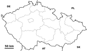
map_background = Czechia - background map.png map_caption = Location in the Czech Republic
map_locator = Czechia
commons = Sokolov
statistics = [http://www.statnisprava.cz/ebe/ciselniky.nsf/i/560286 statnisprava.cz]
website = [http://www.sokolov.cz/ www.sokolov.cz]
footnotes =
Sokolov (IPA2|ˈsokolof; until 1948 in _cz. Falknov nad Ohří IPA| [ˈfalknof ˈnat ʔoɦr̝iː] , in _de. Falkenau an der Eger) is a city in the Karlovy Vary Region of the Czech Republic, located to the north-east of Cheb. It has about 28,000 inhabitants.
During World War II, Falkenau was the site of a sub-camp of the Flossenbürg Concentration Camp. The camp at Falkenau was liberated by the U.S. 1st Infantry Division on May 6, 1945.
External links
* [http://www.mu-sokolov.cz/ Municipal website]
Wikimedia Foundation.
2010.
Look at other dictionaries:
Sokolov District — Okres Sokolov District District location in the Karlovy Vary Region within the … Wikipedia
Chodov (Sokolov District) — This article is about the Sokolov District city. For other uses, see Chodov (disambiguation). Coordinates: 50°14′29″N 12°44′38″E / 50.24139°N 12.74389°E … Wikipedia
Nová Ves (Sokolov District) — Municipality and village Country Czech Republic Region … Wikipedia
Nové Sedlo (Sokolov District) — Coordinates: 50°12′36″N 12°44′14″E / 50.21°N 12.73722°E / 50.21; 12.73722 … Wikipedia
Březová (Sokolov District) — Geobox | Settlement name = Březová other name = category = Town image caption = | flag border = 1 symbol = etymology = official name = motto = nickname = country = Czech Republic country state = region = Karlovy Vary region type = Region district … Wikipedia
Krásno (Sokolov District) — Geobox | Settlement name = Krásno other name = category = Town image caption = symbol = etymology = official name = motto = nickname = country = Czech Republic country state = region = Karlovy Vary region type = Region district = Sokolov district … Wikipedia
Sokolov — ( ru. Соколов, masculine) or Sokolova ( ru. Соколова, feminine) is one of the most common Russian last names. It is derived from the Russian word ru. сокол ( sokol , falcon). It may refer to the following:Places*Sokolov (Sokolov District), a city … Wikipedia
District de Sokolov — Okres Sokolov (cs) Administration … Wikipédia en Français
District de Cheb — Okres Cheb (cs) Administration … Wikipédia en Français
District de Karlovy Vary — Okres Karlovy Vary (cs) Administration … Wikipédia en Français
