- Nyrob
-
Nyrob (English)
Ныроб (Russian)- Urban-type settlement[citation needed] - 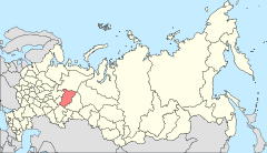
Location of Perm Krai in Russia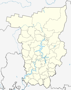
 Nyrob
NyrobCoordinates: 60°44′22″N 56°43′25″E / 60.73944°N 56.72361°ECoordinates: 60°44′22″N 56°43′25″E / 60.73944°N 56.72361°E 
Flag Administrative status Country Russia Federal subject Perm Krai Administrative district Cherdynsky District[citation needed] Statistics Area 95.8 km2 (37.0 sq mi)[citation needed] Population (2010 Census,
preliminary)5,526 inhabitants[1] Population (2002 Census) 7,500 inhabitants[2] Density 58 /km2 (150 /sq mi)[3] Time zone YEKST (UTC+06:00)[4] Nyrob (Russian: Ныроб) is an urban locality (an urban-type settlement) in Cherdynsky District of Perm Krai, Russia. Population: 5,526 (2010 Census preliminary results);[1] 7,500 (2002 Census);[2] 5,526 (1989 Census).[5]
Nyrob is connected with the town of Cherdyn by a 41-kilometer (25 mi) long paved road.
Etymilogy
The name of settlement is addition of Komi-Permyak words “ныр” (nose) and “ыб” (field), then, it can be translated as "Nose’s field" (Nose – is last name of one of the first inhabitants of locality).
History
First mentioned in written sources in 1579.
It served as the administrative center of Nyrobsky District between February 27, 1924 and June 10, 1931 and then again between October 20, 1931 and November 4, 1959. Urban-type settlement status was granted to it in 1963.
There are some architectural sights. One of them is Nikolskaya Church (completed in 1704); to the west of it there is also Bogoyavlenskaya Church (1736).
References
- ^ a b Федеральная служба государственной статистики (Federal State Statistics Service) (2011). "Предварительные итоги Всероссийской переписи населения 2010 года (Preliminary results of the 2010 All-Russian Population Census)" (in Russian). Всероссийская перепись населения 2010 года (All-Russia Population Census of 2010). Federal State Statistics Service. http://www.perepis-2010.ru/results_of_the_census/results-inform.php. Retrieved 2011-04-25.
- ^ a b Федеральная служба государственной статистики (Federal State Statistics Service) (2004-05-21). "Численность населения России, субъектов Российской Федерации в составе федеральных округов, районов, городских поселений, сельских населённых пунктов – районных центров и сельских населённых пунктов с населением 3 тысячи и более человек (Population of Russia, its federal districts, federal subjects, districts, urban localities, rural localities—administrative centers, and rural localities with population of over 3,000)" (in Russian). Всероссийская перепись населения 2002 года (All-Russia Population Census of 2002). Federal State Statistics Service. http://www.perepis2002.ru/ct/doc/1_TOM_01_04.xls. Retrieved 2010-03-23.
- ^ The value of density was calculated automatically by dividing the 2010 Census population by the area specified in the infobox. Please note that this value may not be accurate as the area specified in the infobox does not necessarily correspond to the area of the entity proper or is reported for the same year as the population.
- ^ Правительство Российской Федерации. Постановление №725 от 31 августа 2011 г. «О составе территорий, образующих каждую часовую зону, и порядке исчисления времени в часовых зонах, а также о признании утратившими силу отдельных Постановлений Правительства Российской Федерации». Вступил в силу по истечении 7 дней после дня официального опубликования. Опубликован: "Российская Газета", №197, 6 сентября 2011 г. (Government of the Russian Federation. Resolution #725 of August 31, 2011 On the Composition of the Territories Included into Each Time Zone and on the Procedures of Timekeeping in the Time Zones, as Well as on Abrogation of Several Resolutions of the Government of the Russian Federation. Effective as of after 7 days following the day of the official publication).
- ^ "Всесоюзная перепись населения 1989 г. Численность наличного населения союзных и автономных республик, автономных областей и округов, краёв, областей, районов, городских поселений и сёл-райцентров. (All Union Population Census of 1989. Present population of union and autonomous republics, autonomous oblasts and okrugs, krais, oblasts, districts, urban settlements, and villages serving as district administrative centers.)" (in Russian). Всесоюзная перепись населения 1989 года (All-Union Population Census of 1989). Demoscope Weekly (website of the Institute of Demographics of the State University—Higher School of Economics. 1989. http://demoscope.ru/weekly/ssp/rus89_reg.php. Retrieved 2010-03-23.
Categories:- Urban-type settlements in Perm Krai


Wikimedia Foundation. 2010.