- National Register of Historic Places listings in the Alaska Panhandle
-
This is a list of the National Register of Historic Places listings in the Alaska Panhandle.
This is intended to be a complete list of the properties and districts on the National Register of Historic Places in the Alaska Panhandle, Alaska, United States. The locations of National Register properties and districts for which the latitude and longitude coordinates are included below, may be seen in a Google map.[1]
-
- This National Park Service list is complete through NPS recent listings posted November 10, 2011.[2]
Contents
Yakutat
[3] Landmark name[4] Image Date listed Location Community Summary 1 Cape Spencer Lighthouse 
December 4, 1975 South of central Yakutat at entrance of Cross Sound in Glacier Bay National Monument
58°11′53″N 136°38′6″W / 58.19806°N 136.635°WYakutat 2 New Russia Site February 23, 1972 Southwest of Yakutat on the Phipps Peninsula Yakutat Haines Borough
[3] Landmark name[4] Image Date listed Location Community Summary 1 Charlie Anway Cabin September 14, 2001 Mile 1.5 on the Haines Highway
59°14′30″N 135°28′38″W / 59.24167°N 135.47722°WHaines 2 Eldred Rock Lighthouse 
December 30, 1975 South of Haines off Sullivan Island
58°58′16″N 135°13′7″W / 58.97111°N 135.21861°WHaines 3 Fort William H. Seward April 11, 1972 South of Haines at Port Chilkoot
59°13′42″N 135°26′21″W / 59.22833°N 135.43917°WHaines 4 Government Indian School February 8, 1980 1st St.
59°14′17″N 135°26′27″W / 59.23806°N 135.44083°WHaines 5 Pleasant Camp July 5, 1973 NW. Building, Haines at Mile 40 on the Haines Highway
59°27′3″N 136°21′38″W / 59.45083°N 136.36056°WHaines 6 Porcupine District November 13, 1976 West of Haines at Mile 35, Haines Highway
59°25′16″N 136°14′10″W / 59.42111°N 136.23611°WHaines Hoonah-Angoon Census Area
[3] Landmark name[4] Image Date listed Location Community Summary 1 Alexander Lake Shelter Cabin November 2, 1995 Admiralty Island National Monument
57°39′47″N 134°8′31″W / 57.66306°N 134.14194°WAngoon 2 Beaver Lake Dam November 2, 1995 Admiralty Island National Monument
57°40′30″N 134°13′7″W / 57.675°N 134.21861°WAngoon 3 Big Shaheen Cabin November 2, 1995 Admiralty Island National Monument
57°42′7″N 134°16′28″W / 57.70194°N 134.27444°WAngoon 4 Davidson Lake Shelter Cabin November 2, 1995 Admiralty Island National Monument
57°36′17″N 134°22′39″W / 57.60472°N 134.3775°WAngoon 5 Distin Lake Shelter Cabin November 2, 1995 Admiralty Island National Monument
57°26′59″N 134°24′13″W / 57.44972°N 134.40361°WAngoon 6 Hasselborg Cabin November 2, 1995 Admiralty Island National Monument
58°32′40″N 134°4′42″W / 58.54444°N 134.07833°WAngoon 7 Hasselborg Lake East Shelter Cabin November 2, 1995 Admiralty Island National Monument
57°40′5″N 134°12′50″W / 57.66806°N 134.21389°WAngoon 8 Hasselborg Lake North Shelter Cabin November 2, 1995 Admiralty Island National Monument
57°46′2″N 134°19′9″W / 57.76722°N 134.31917°WAngoon 9 Hasselborg Lake South Shelter Cabin November 2, 1995 Admiralty Island National Monument
57°39′55″N 134°5′11″W / 57.66528°N 134.08639°WAngoon 10 Lake Guerin East Shelter Cabin November 2, 1995 Admiralty Island National Monument
57°39′37″N 134°17′4″W / 57.66028°N 134.28444°WAngoon 11 Lake Guerin West Shelter Cabin November 2, 1995 Admiralty Island National Monument
57°38′58″N 134°20′24″W / 57.64944°N 134.34°WAngoon 12 Mitchell Bay Shelter Cabin November 2, 1995 Admiralty Island National Monument
57°33′53″N 134°23′48″W / 57.56472°N 134.39667°WAngoon 13 Mole Harbor Shelter Cabin November 2, 1995 Admiralty Island National Monument
57°39′36″N 134°5′54″W / 57.66°N 134.09833°WAngoon 14 St. John the Baptist Chapel June 6, 1980 In Naknek
58°43′42″N 157°0′31″W / 58.72833°N 157.00861°WNaknek 15 St. John the Baptist Church 
June 6, 1980 In Angoon
57°30′14″N 134°35′3″W / 57.50389°N 134.58417°WAngoon 16 Thayer Lake East Shelter Cabin November 2, 1995 Admiralty Island National Monument
57°38′3″N 134°27′45″W / 57.63417°N 134.4625°WAngoon 17 Thayer Lake North Shelter Cabin November 2, 1995 Admiralty Island National Monument
57°41′24″N 134°24′35″W / 57.69°N 134.40972°WAngoon 18 Thayer Lake South Shelter Cabin November 2, 1995 Admiralty Island National Monument
57°35′52″N 134°28′5″W / 57.59778°N 134.46806°WAngoon 19 Windfall Harbor Shelter Cabin November 2, 1995 Admiralty Island National Monument
57°50′11″N 134°18′22″W / 57.83639°N 134.30611°WAngoon Skagway
[3] Landmark name[4] Image Date listed Location Community Summary 1 Chilkoot Trail 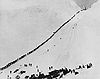
April 14, 1975 Mile 0 to the American/Canadian border
59°35′53″N 135°17′40″W / 59.59806°N 135.29444°WSkagway 2 Klondike Goldrush National Historical Park 
June 30, 1976 P.O. Box 517
59°34′32″N 135°15′9″W / 59.57556°N 135.2525°WSkagway 3 Skagway Historic District and White Pass 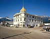
October 15, 1966 Head of Taiya Inlet on the Lynn Canal Skagway Juneau
[3] Landmark name[4] Image Date listed Location Summary 1 Alaska Governor's Mansion 
November 7, 1976 716 Calhoun St.
58°18′10″N 134°24′53″W / 58.30278°N 134.41472°W2 Alaska Steam Laundry February 17, 1978 174 S. Franklin St.
58°18′1″N 134°24′12″W / 58.30028°N 134.40333°W3 Alaskan Hotel 
October 25, 1978 167 S. Franklin St.
58°18′02″N 134°24′18″W / 58.300459°N 134.405°W4 Bergmann Hotel July 28, 1977 434 3rd St.
58°18′11″N 134°24′29″W / 58.30306°N 134.40806°W5 Chicken Ridge Historic District October 12, 1995 Roughly along 7th St., Goldbelt Ave., Dixon St., and Basin Rd.
58°18′15″N 134°24′40″W / 58.30417°N 134.41111°W6 J.M. Davis House August 31, 1982 202 6th St.
58°18′11″N 134°24′32″W / 58.30306°N 134.40889°W7 Fort Durham Site May 5, 1978 Address Restricted 8 Frances House June 7, 1985 137 6th St.
58°18′6″N 134°24′29″W / 58.30167°N 134.40806°W9 Fries Miners' Cabins September 8, 1988 500 block of Kennedy St.
58°18′17″N 134°24′13″W / 58.30472°N 134.40361°W10 Ernest Gruening Cabin June 8, 1992 Mile 26 on the Glacier Highway northwest of Juneau
58°29′38″N 134°47′9″W / 58.49389°N 134.78583°W11 Holy Trinity Church October 19, 1978 325 Gold St.
58°18′10″N 134°24′16″W / 58.30278°N 134.40444°W12 Jualpa Mining Camp August 5, 1993 1001 Basin Rd.
58°18′22″N 134°23′4″W / 58.30611°N 134.38444°W13 Juneau Downtown Historic District 
June 17, 1994 Roughly Franklin St. from 2nd St. to south of Ewing Way, 2nd and 1st Sts. from Franklin to Main St., and Front St.
58°18′0″N 134°24′15″W / 58.3°N 134.40417°W14 Juneau Memorial Library June 7, 2006 114 W. 4th St.
58°18′13″N 134°24′41″W / 58.30361°N 134.41139°W15 MacKinnon Apartments February 24, 2000 236 3rd St.
58°18′10″N 134°24′17″W / 58.30278°N 134.40472°W16 Mayflower School November 21, 1988 St. Ann's and Savikko Sts.
58°16′32″N 134°23′26″W / 58.27556°N 134.39056°W17 Point Retreat Light Station 
June 19, 2003 On the Mansfield Peninsula at the northern end of Admiralty Island, near the junction of Lynn Canal and Stephens Passage
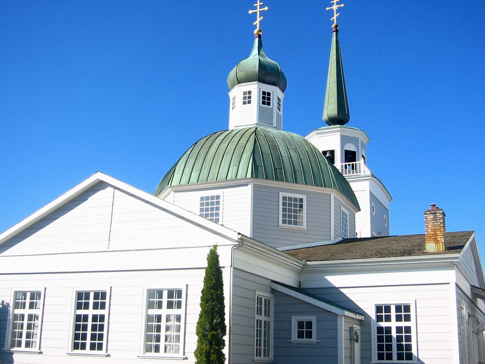
58°24′40″N 134°57′11″W / 58.41111°N 134.95306°W18 St. Nicholas Russian Orthodox Church 
September 19, 1973 326 5th St.
58°18′11.65″N 134°24′32.39″W / 58.3032361°N 134.4089972°W19 Sentinel Island Light Station 
December 2, 2002 Northern entrance to the Favorite Channel, between the mainland and Lincoln and Shelter Islands
58°32′46″N 134°55′13″W / 58.54611°N 134.92028°W20 Twin Glacier Camp May 20, 1988 Along the Taku River
58°29′26″N 133°56′21″W / 58.49056°N 133.93917°W21 Valentine Building May 30, 1985 202 Front St.
58°18′5″N 134°24′15″W / 58.30139°N 134.40417°W22 Wickersham House November 21, 1976 213 7th St.
58°18′13″N 134°24′38″W / 58.30361°N 134.41056°WSitka
Wrangell
[3] Landmark name[4] Image Date listed Location Community Summary 1 ETOLIN CANOE June 5, 1989 Tongass National Forest
56°10′36″N 132°26′54″W / 56.17667°N 132.44833°WWrangell 2 Zimovia Highway
56°19′26″N 132°20′46″W / 56.32389°N 132.34611°WWrangell 3 Saint Philip's Episcopal Church May 6, 1987 446 Church St.
56°28′23″N 132°22′44″W / 56.47306°N 132.37889°WWrangell Petersburg Census Area
[3] Landmark name[4] Image Date listed Location Community Summary 1 Cape Decision Light Station 
February 2, 2005 Southwestern extremity of Kuiu Island, north of the junction of Chatham and Sumner Straits, approximately 63 miles south of Sitka
56°0′4″N 134°8′4″W / 56.00111°N 134.13444°WSitka 2 Chief Shakes Historic Site 
October 27, 1970 Shakes Island
56°28′49″N 133°11′24″W / 56.48028°N 133.19°WPetersburg 3 Petersburg 4 Petersburg 5 Five Finger Light Station 
May 12, 2004 Island of The Five Fingers, approximately 37 miles northwest of the city of Petersburg
57°16′14″N 133°37′49″W / 57.27056°N 133.63028°WPetersburg 6 Kake Cannery 
December 9, 1997 1.5 miles south of Kake
56°57′55″N 133°55′26″W / 56.96528°N 133.92389°WKake 7 Sons of Norway Hall 
July 10, 1979 Indian St.
56°48′38″N 132°57′27″W / 56.81056°N 132.9575°WPetersburg Ketchikan Gateway Borough
[3] Landmark name[4] Image Date listed Location Community Summary 1 Alaska Totems 
June 21, 1971 Between Park and Deermount Aves.
55°20′35″N 131°37′55″W / 55.34306°N 131.63194°WKetchikan 2 Burkhart-Dibrell House September 8, 1982 500 Main St.
55°20′38″N 131°38′47″W / 55.34389°N 131.64639°WKetchikan 3 Chief Kashakes House April 26, 1993 Mile 2.5 S. Tongass Highway
55°19′8″N 131°35′45″W / 55.31889°N 131.59583°WSaxman 4 Clover Pass School August 22, 2005 Potter Rd. off Knudson Cove Rd.
55°28′22″N 131°47′27″W / 55.47278°N 131.79083°WKnudson Cove 5 First Lutheran Church May 18, 1987 1200 Tongass Ave.
55°20′40″N 179°39′40″W / 55.34444°N 179.66111°WKetchikan 6 Gilmore Building 
September 27, 1989 326 Front St.
55°20′34″N 179°38′46″W / 55.34278°N 179.64611°WKetchikan 7 Guard Island Lighthouse 
January 14, 2004 Guard Islands in the Clarence Strait at the northern end of Tongass Narrow, 9.6 miles northwest of Ketchikan
53°51′5″N 131°46′8″W / 53.85139°N 131.76889°WKetchikan 8 Ketchikan Federal Building 
April 28, 2006 648 Mission St.
55°20′30″N 131°38′34″W / 55.34167°N 131.64278°WKetchikan 9 Ketchikan Ranger House July 16, 1987 309 Gorge St.
55°20′50″N 179°39′32″W / 55.34722°N 179.65889°WKetchikan 10 Mary Island Light Station 
July 8, 2005 Eastern shore of the northern end of Mary Island, between the Revillagigedo Channel and Felice Strait about 6-3/8 miles south of Revillagiedo
55°5′57″N 131°10′53″W / 55.09917°N 131.18139°WKetchikan 11 Saxman Totem Park August 7, 1979 S. Tongass Highway
55°19′11″N 131°35′41″W / 55.31972°N 131.59472°WSaxman 12 Stedman-Thomas Historic District February 21, 1996 Stedman, Thomas, Inman, Brown, and Tatsudu Sts.
55°20′25″N 131°38′17″W / 55.34028°N 131.63806°WKetchikan 13 Storehouse No. 3 December 7, 1977 Northeast of Ketchikan at Halibut Bay Estuary
55°14′8″N 130°6′5″W / 55.23556°N 130.10139°WKetchikan 14 The Star April 26, 1993 5 Creek St.
55°20′35″N 131°38′22″W / 55.34306°N 131.63944°WKetchikan 15 Totem Bight State Historic Site October 27, 1970 Western side of Revillagigedo Island
55°25′23″N 131°46′17″W / 55.42306°N 131.77139°WKetchikan 16 Tree Point Lighthouse 
October 27, 2004 Western coast of the mainland on the eastern side of the southern entrance to the Revillagigedo Channel, about 4.25 miles north of Cape Fox
54°48′10″N 130°56′2″W / 54.80278°N 130.93389°WKetchikan 17 Walker-Broderick House August 31, 1982 541 Pine St.
55°20′42″N 179°38′52″W / 55.345°N 179.64778°WKetchikan 18 Ziegler House May 30, 1985 623 Grant St.
55°20′41″N 179°39′10″W / 55.34472°N 179.65278°WKetchikan Prince of Wales-Hyder Census Area
[3] Landmark name[4] Image Date listed Location Community Summary 1 Chief Son-I-Hat's Whale House and Totems Historic District June 11, 2002 Totem Park Trail
55°32′33″N 132°25′8″W / 55.5425°N 132.41889°WKasaan 2 Father William Duncan House February 23, 1972 5th Ave. and Atkinson St.
55°7′34″N 131°35′30″W / 55.12611°N 131.59167°WMetlakatla 3 Hydaburg Totem Park June 16, 2006 5th and Main Sts.
55°12′28″N 132°49′30″W / 55.20778°N 132.825°WHydaburg 4 Storehouse No. 4 August 13, 1976 International St.
55°54′41″N 130°1′14″W / 55.91139°N 130.02056°WHyder See also
- List of National Historic Landmarks in Alaska
- National Register of Historic Places listings in Alaska
References
- ^ The latitude and longitude information provided in this table was derived originally from the National Register Information System, which has been found to be fairly accurate for about 99% of listings. For about 1% of NRIS original coordinates, experience has shown that one or both coordinates are typos or otherwise extremely far off; some corrections may have been made. A more subtle problem causes many locations to be off by up to 150 yards, depending on location in the country: most NRIS coordinates were derived from tracing out latitude and longitudes off of USGS topographical quadrant maps created under North American Datum of 1927, which differs from the current, highly accurate GPS system used by Google maps. Chicago is about right, but NRIS longitudes in Washington are higher by about 4.5 seconds, and are lower by about 2.0 seconds in Maine. Latitudes differ by about 1.0 second in Florida. Some locations in this table may have been corrected to current GPS standards.
- ^ "National Register of Historic Places: Weekly List Actions". National Park Service, United States Department of the Interior. Retrieved on November 10, 2011.
- ^ a b c d e f g h i j Numbers represent an ordering by significant words. Various colorings, defined here, differentiate National Historic Landmark sites and National Register of Historic Places Districts from other NRHP buildings, structures, sites or objects.
- ^ a b c d e f g h i j "National Register Information System". National Register of Historic Places. National Park Service. 2008-04-24. http://nrhp.focus.nps.gov/natreg/docs/All_Data.html.
U.S. National Register of Historic Places Topics Lists by states Alabama • Alaska • Arizona • Arkansas • California • Colorado • Connecticut • Delaware • Florida • Georgia • Hawaii • Idaho • Illinois • Indiana • Iowa • Kansas • Kentucky • Louisiana • Maine • Maryland • Massachusetts • Michigan • Minnesota • Mississippi • Missouri • Montana • Nebraska • Nevada • New Hampshire • New Jersey • New Mexico • New York • North Carolina • North Dakota • Ohio • Oklahoma • Oregon • Pennsylvania • Rhode Island • South Carolina • South Dakota • Tennessee • Texas • Utah • Vermont • Virginia • Washington • West Virginia • Wisconsin • WyomingLists by territories Lists by associated states Other  Category:National Register of Historic Places •
  Portal:National Register of Historic Places
Properties on the National Register of Historic Places in Alaska  Boroughs
 Census areasAleutians West • Bethel • Dillingham • Hoonah-Angoon • Nome • Petersburg • Prince of Wales-Hyder • Southeast Fairbanks • Valdez-Cordova • Yukon-KoyukukThere are no sites listed on the National Register of Historic Places in Wade Hampton Census Area
 State of Alaska
Juneau (capital) Topics Index · Geography · Climate · Wildlife · History · People · Transportation · Government · Delegations · Music · Visitor attractions
Society Culture · Crime · Demographics · Economy · Education · Health (Rural dentistry) · Politics
Regions Aleutian Islands · Arctic Alaska · Bush Alaska · Inside Passage · Interior · Kenai Peninsula · Mat‑Su Valley · North Slope · Southeast · Seward Peninsula · Southcentral · Southwest · Tanana Valley · Yukon–Kuskokwim Delta
Largest cities Boroughs Aleutians East · Anchorage · Bristol Bay · Denali · Fairbanks North Star · Haines · Juneau · Kenai Peninsula · Ketchikan Gateway · Kodiak Island · Lake and Peninsula · Matanuska‑Susitna · North Slope · Northwest Arctic · Sitka · Skagway · Wrangell · Yakutat · Unorganized
Census Areas Aleutians West · Bethel · Dillingham · Hoonah‑Angoon · Nome · Petersburg · Prince of Wales‑Hyder · Southeast Fairbanks · Valdez‑Cordova · Wade Hampton · Yukon‑Koyukuk
Categories:- National Register of Historic Places in Alaska
-


Wikimedia Foundation. 2010.