- National Register of Historic Places listings in St. Louis (city, A–L), Missouri
-
This is a list of properties and historic districts in the independent city of St. Louis that are listed on the National Register of Historic Places. Listings from A to L appear here, M-Z are in National Register of Historic Places listings in St. Louis (city, M-Z). (For listings in St. Louis County, which does not include the city, see National Register of Historic Places listings in St. Louis County, Missouri.)
Contents: Counties in Missouri A–B · C · D–I · J–K · L–N · O–St. · St. Louis · Ste.–Z Current listings
Landmark name Image Date listed Location Neighborhood[1] Summary 1 1907 Dorris Motor Car Company Building February 10, 2000 4063-4065 Forest Park Ave.
38°38′16″N 90°14′46″W / 38.63778°N 90.24611°WSt. Louis 2 A & P Food Stores Building October 15, 2000 6016, 6014, and 6018 Delmar
38°39′16″N 90°17′41″W / 38.65444°N 90.29472°WSt. Louis 3 Advertising Building January 18, 1985 1627-1629 Locust St.
38°37′55″N 90°12′14″W / 38.63194°N 90.20389°WSt. Louis 4 Ambassador Theater Building March 29, 1983 411 N. 7th St.
38°37′45″N 90°11′29″W / 38.62917°N 90.19139°WSt. Louis Demolished in 1996.[2] 5 American Brake Company Building March 21, 2007 1920 N. Broadway
38°38′53″N 90°11′13″W / 38.64806°N 90.18694°WSt. Louis 6 American Theater March 18, 1985 416 N. 9th St.
38°37′48″N 90°11′34″W / 38.63°N 90.19278°WSt. Louis 7 American Zinc, Lead and Smelting Company Building May 4, 1998 20 S. Fourth St.
38°37′24″N 90°11′18″W / 38.62333°N 90.18833°WSt. Louis 8 Anheuser-Busch Brewery 
November 13, 1966 721 Pestalozzi St.
38°35′51″N 90°12′44″W / 38.5975°N 90.21222°WSt. Louis 9 Antioch Baptist Church September 17, 1999 4213 N. Market St.
38°39′35″N 90°14′17″W / 38.65972°N 90.23806°WSt. Louis 10 Apartments at 5561-71 Chamberlain August 24, 2011 5561-71 Chamberlain
38°39′42″N 90°16′47″W / 38.66167°N 90.27972°WSt. Louis 11 Arcade Building 
March 23, 2003 810 Olive St.
38°37′48″N 90°11′34″W / 38.63°N 90.19278°WSt. Louis 12 Arlington School April 16, 2008 1617 Burd Ave.
38°40′15.14″N 90°16′26.2″W / 38.6708722°N 90.273944°WSt. Louis 13 Aubert Place September 30, 1982 Fountain Ave. between Walton Ave. and the Kings Highway
38°39′19″N 90°15′34″W / 38.65528°N 90.25944°WSt. Louis 14 Autocar Sales and Service Building June 26, 2006 2745 Locust
38°38′13″N 90°13′4″W / 38.63694°N 90.21778°WSt. Louis 15 B'nai El Temple July 21, 1983 3666 Flad Ave.
38°36′24″N 90°13′56″W / 38.60667°N 90.23222°WSt. Louis 16 Balmer & Weber Music House Co. Building 
August 31, 2000 1004 Olive St.
38°37′51″N 90°11′42″W / 38.63083°N 90.195°WSt. Louis 17 Barr Branch Library Historic District September 2, 1982 2500-2630 Lafayette Ave.
38°36′54″N 90°13′16″W / 38.615°N 90.22111°WSt. Louis 18 Beaumont Medical Building January 19, 1984 3714-26 Washington Ave.
38°38′24″N 90°14′4″W / 38.64°N 90.23444°WSt. Louis 19 Beaumont Telephone Exchange Building February 16, 2006 2654 Locust St.
38°38′10″N 90°12′57″W / 38.63611°N 90.21583°WSt. Louis 20 Beethoven Conservatory March 2, 1989 2301 Locust St.
38°37′59″N 90°12′43″W / 38.63306°N 90.21194°WSt. Louis 21 Bel Air Motel May 1, 2009 4630 Lindell
38°38′33.4″N 90°15′39.48″W / 38.642611°N 90.2609667°WSt. Louis 22 Bell Telephone Building 
August 5, 1999 920 Olive St.
38°37′50″N 90°11′40″W / 38.63056°N 90.19444°WSt. Louis 23 Benton Park District December 30, 1985 Bounded by Gravois Ave., Interstate 55, S. Broadway, and Jefferson St.
38°35′52″N 90°13′9″W / 38.59778°N 90.21917°WSt. Louis 24 Chuck Berry House December 12, 2008 3137 Whittier St.
38°39′51.52″N 90°13′53.15″W / 38.6643111°N 90.2314306°WSt. Louis 25 Berry Motor Car Service Building July 19, 2010 2220 Washington Ave.
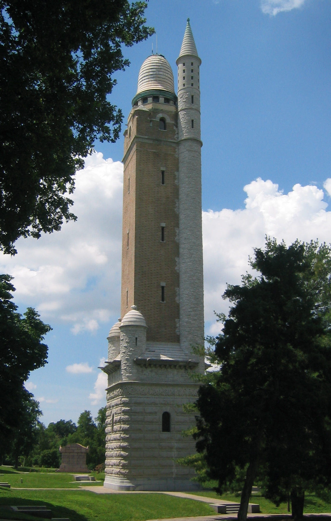
38°38′4″N 90°12′40″W / 38.63444°N 90.21111°WSt. Louis Auto-Related Resources of St. Louis, Missouri MPS 26 Bissel Street Water Tower June 5, 1970 Jct. of Bissell St. and Blair Ave.
38°40′13″N 90°12′21″W / 38.67028°N 90.20583°WSt. Louis 27 Blackwell-Wielandy Building July 21, 1983 1601-09 Locust St.
38°37′55″N 90°12′11″W / 38.63194°N 90.20306°WSt. Louis 28 Frank P. Blair School February 10, 1983 2707 Rauschenbach Ave.
38°39′3″N 90°12′18″W / 38.65083°N 90.205°WSt. Louis 29 Blind Girls' Home August 23, 1984 5235 Page Boulevard
38°39′38″N 90°16′9″W / 38.66056°N 90.26917°WSt. Louis 30 Block Unit No. 1 Historic District July 14, 2000 4100-4191 Enright Ave.
38°38′55″N 90°14′36″W / 38.64861°N 90.24333°WSt. Louis 31 Board of Education Building 
January 12, 2005 901-911 Locust St. and 401-409 N. Ninth St.
38°37′53″N 90°11′36″W / 38.63139°N 90.19333°WSt. Louis 32 Boatman's Bank Building October 22, 1998 300 North Broadway
38°37′41″N 90°11′19″W / 38.62806°N 90.18861°WSt. Louis 33 Brown Shoe Company's Homes-Take Factory October 20, 1980 1201 Russell Boulevard
38°36′29″N 90°12′36″W / 38.60806°N 90.21°WSt. Louis 34 A. D. Brown Building 
March 28, 1980 1136 Washington Ave.
38°37′53″N 90°11′47″W / 38.63139°N 90.19639°WSt. Louis 35 Paul Brown Building 
December 12, 2002 818 Olive St.
38°37′48″N 90°11′36″W / 38.63°N 90.19333°WSt. Louis 36 William Buehler House December 28, 2000 2610 Tennessee Ave.
38°36′32″N 90°14′16″W / 38.60889°N 90.23778°WSt. Louis 37 Building at 1009 Olive St. 
May 9, 2002 1009 Olive St.
38°37′52″N 90°11′41″W / 38.63111°N 90.19472°WSt. Louis 38 Building at 1121-23 Locust St. 
August 4, 2004 1121-23 Locust St.
38°37′56″N 90°11′47″W / 38.63222°N 90.19639°WSt. Louis 39 Building at 1300 Washington Avenue 
September 2, 1982 1300-1310 Washington Ave.
38°37′54″N 90°11′55″W / 38.63167°N 90.19861°WSt. Louis 40 Building at 3910-12 Laclede Ave. May 30, 2003 3910-12 Laclede Ave.
38°38′16″N 90°14′33″W / 38.63778°N 90.2425°WSt. Louis 41 Buildings at 2327-31 and 2333-35 Rutger Street January 19, 1984 2327-31 and 2333-35 Rutger St.
38°37′9″N 90°13′7″W / 38.61917°N 90.21861°WSt. Louis 42 Buster Brown Blue Ribbon Shoe Factory January 26, 2005 1526 N. Jefferson Ave.
38°38′51″N 90°12′45″W / 38.6475°N 90.2125°WSt. Louis 43 Butler House September 2, 1982 4484 W. Pine Boulevard
38°38′24″N 90°15′28″W / 38.64°N 90.25778°WSt. Louis 44 Cadillac Automobile Company Building August 4, 2005 3224 Locust St.
38°38′18″N 90°13′35″W / 38.63833°N 90.22639°WSt. Louis 45 Robert G. Campbell House April 21, 1977 1508 Locust St.
38°37′52″N 90°12′5″W / 38.63111°N 90.20139°WSt. Louis 46 Carlin-Rathgeber House May 29, 1980 122 Davis St.
38°32′35.82″N 90°15′47.06″W / 38.5432833°N 90.2630722°WSt. Louis 47 Carondelet School March 21, 2007 8221 Minnesota
38°32′48″N 90°15′50″W / 38.54667°N 90.26389°WSt. Louis 48 Carr School December 13, 2000 1419 Carr St.
38°38′20″N 90°11′54″W / 38.63889°N 90.19833°WSt. Louis 49 Cass Bank and Trust Company February 14, 2011 1450 N. 13th St.
38°38′27″N 90°11′38″W / 38.64083°N 90.19389°WSt. Louis 50 Castle Ballroom February 18, 2011 2839-2845 Olive St.
38°38′3″N 90°13′10″W / 38.63417°N 90.21944°WSt. Louis 51 Centenary Methodist Episcopal Church, South January 16, 1997 55 Plaza Sq.
38°37′48″N 90°12′12″W / 38.63°N 90.20333°WSt. Louis 52 Centennial Malt House November 15, 2005 2017-19 Chouteau Ave.
38°37′23″N 90°12′46″W / 38.62306°N 90.21278°WSt. Louis 53 Central Carondelet Historic District February 22, 2006 Roughly bounded by Koeln Ave., Loughborough Ave., S. Broadway and Alabama Ave.
38°33′14″N 90°15′27″W / 38.55389°N 90.2575°W
Boundary increase I (listed December 20, 2007): Roughly bounded by Loughborough Ave., Holly Hills Ave., Idaho Ave., and S. Broadway
Boundary increase II (listed February 18, 2009): Bounded by Iron St., Minnesota Ave., Pennsylvania Ave., and Holly Hills Ave.
Boundary increase III (listed January 25, 2010): Roughly bounded by Bates St. on the north, Interstate 55 on the west, S. Broadway on the east, and Holly Hills Ave. on the south
Boundary increase IV (listed July 14, 2011): Roughly bounded by S. Broadway, Pennsylvania Ave., Interstate 55, Bates St. & Delor St.St. Louis 54 Central Institute for the Deaf Clinic and Research Building October 21, 2004 909 S. Taylor Ave.
38°37′52″N 90°15′44″W / 38.63111°N 90.26222°WSt. Louis 55 Century Building and Syndicate Trust Building 
October 16, 2002 Bounded by Locust, Ninth, Tenth and Olive Sts.
38°37′45.91″N 90°11′37.99″W / 38.6294194°N 90.1938861°WSt. Louis Demolished and replaced by a parking garage in February 2005[3] 56 Chain of Rocks Bridge 
December 1, 2006 West Chain of Rocks Rd.
38°45′41″N 90°10′26″W / 38.76139°N 90.17389°WSt. Louis 57 Chatillon-DeMenil House 
June 9, 1978 3352 DeMenil Pl.
38°35′32″N 90°12′57″W / 38.59222°N 90.21583°WSt. Louis 58 Chemical Building 
March 19, 1982 721 Olive St.
38°37′43″N 90°11′32″W / 38.62861°N 90.19222°WSt. Louis 59 Chippewa Trust Company Building August 12, 2010 3801-05 S. Broadway
38°35′9″N 90°13′40″W / 38.58583°N 90.22778°WSt. Louis South St. Louis Historic Working and Middle Class Streetcar Suburbs MPS 60 Kate Chopin House February 14, 1986 4232 McPherson Ave.
38°38′35″N 90°14′56″W / 38.64306°N 90.24889°WSt. Louis 61 Chouteau Apartments/Parkway Dwellings February 10, 1983 4937-4943 Laclede Ave.
38°38′28″N 90°17′11″W / 38.64111°N 90.28639°WSt. Louis 62 Chouteau Building April 5, 2006 4030 Chouteau (also 1029 S. Vandeventer)
38°37′46″N 90°14′57″W / 38.62944°N 90.24917°WSt. Louis 63 Christ Church Cathedral 
March 7, 1990 1210 Locust St.
38°37′49″N 90°11′55″W / 38.63028°N 90.19861°WSt. Louis 64 Winston Churchill Apartments April 4, 1985 5475 Cabanne
38°39′32″N 90°16′35″W / 38.65889°N 90.27639°WSt. Louis 65 City Club Building 
June 6, 2002 1012-1024 Locust St.
38°37′47″N 90°11′42″W / 38.62972°N 90.195°WSt. Louis 66 City Hospital Historic District February 2, 2001 Roughly bounded by Lafayette Ave., Grattan St., Carroll St., Dillon St., St. Ange St., 14th St., and Carroll St.
38°36′50″N 90°12′28″W / 38.61389°N 90.20778°WSt. Louis 67 Clemens House-Columbia Brewery District July 19, 1984 Roughly bounded by Maiden Lane, Cass Ave., 21st, Helen, and Howard Sts.; also roughly bounded by St. Louis Ave., N. Florissant Ave., Maiden Ln., and N. 21st and N. 20th Sts.
38°38′41″N 90°12′33″W / 38.64472°N 90.20917°WSt. Louis Second set of boundaries represents a boundary increase of July 22, 1986 68 Coca-Cola Syrup Plant April 30, 2008 8125 Michigan Ave.
38°32′44.55″N 90°15′57.01″W / 38.5457083°N 90.2658361°WSt. Louis 69 Colchester Apartments July 12, 2006 4-10-14-20 N. Kingshighway Boulevard
38°38′27″N 90°15′53″W / 38.64083°N 90.26472°WSt. Louis 70 Compton Hill Water Tower 
September 29, 1972 Reservoir Park, Grant and Russell Boulevards, and Lafayette Ave.
38°36′51″N 90°14′19″W / 38.61417°N 90.23861°WSt. Louis 71 Convent of the Sisters of St. Joseph Carondelet February 28, 1980 6400 Minnesota Ave.
38°33′23″N 90°15′0″W / 38.55639°N 90.25°WSt. Louis 72 Cook Avenue Methodist Episcopal Church, South August 27, 2008 3680 Cook Ave.
38°38′45.46″N 90°13′50.32″W / 38.6459611°N 90.2306444°WSt. Louis 73 Cotton Belt Freight Depot April 21, 2004 1400 N. 1st St.
38°38′27″N 90°10′57″W / 38.64083°N 90.1825°WSt. Louis 74 Council Plaza March 2, 2007 212, 300, and 310 S. Grand Boulevard
38°37′56.69″N 90°14′4.02″W / 38.6324139°N 90.23445°WSt. Louis 75 Crittenden Historic District July 7, 1983 3401 Arsenal, 3400 and 3500 blocks of Crittenden
38°36′12″N 90°14′24″W / 38.60333°N 90.24°WSt. Louis 76 Crunden-Martin Manufacturing Company February 9, 2005 104 Cedar,760 S. 2nd St., 757 S. 2nd St.
38°37′3″N 90°11′20″W / 38.6175°N 90.18889°WSt. Louis 77 Cupples Warehouse District June 26, 1998 Roughly Spruce and Clark Sts. between Seventh and Eleventh Sts.
38°37′24″N 90°11′48″W / 38.62333°N 90.19667°WSt. Louis 78 Samuel Cupples House 
October 21, 1976 3673 W. Pine Boulevard
38°38′12″N 90°14′8″W / 38.63667°N 90.23556°WSt. Louis 79 S.S. Cyril and Methodius Historic District June 28, 1982 Interstate 70
38°38′44″N 90°11′29″W / 38.64556°N 90.19139°WSt. Louis 80 De Hodiamont Car House Historic District February 10, 2005 Bounded by N. Skinker Parkway, Horton Place, and the Wabash railroad tracks
38°39′45″N 90°17′45″W / 38.6625°N 90.29583°WSt. Louis 81 Emmanuel DeHodiamont House January 15, 2003 951 Maple Place
38°39′40″N 90°17′32″W / 38.66111°N 90.29222°WSt. Louis 82 Delaney School December 23, 2004 6138 Virginia Ave.
38°33′44″N 90°15′0″W / 38.56222°N 90.25°WSt. Louis 83 Delany Building 
March 1, 2002 1000-06 Locust St.
38°37′53″N 90°11′40″W / 38.63139°N 90.19444°WSt. Louis 84 Delmar Loop-Parkview Gardens Historic District February 16, 1984 Roughly bounded by Kingsland Ave., North Dr., Delmar Boulevard, and Eastgate
38°39′21″N 90°18′15″W / 38.65583°N 90.30417°WSt. Louis 85 DePaul Hospital March 29, 1983 2415 N. Kingshighway Boulevard
38°40′5″N 90°15′32″W / 38.66806°N 90.25889°WSt. Louis 86 Des Peres School September 2, 1982 6307 Michigan Ave.
38°33′32″N 90°15′0″W / 38.55889°N 90.25°WSt. Louis 87 Dickmann Building December 30, 1999 3115 S. Grand Boulevard
38°36′14″N 90°14′33″W / 38.60389°N 90.2425°WSt. Louis 88 Dolman Row January 19, 1984 1424-1434 Dolman St.
38°36′56″N 90°12′36″W / 38.61556°N 90.21°WSt. Louis 89 Dorris Motor Car Company May 1, 1986 4100 Laclede
38°38′12″N 90°14′49″W / 38.63667°N 90.24694°WSt. Louis 90 Dr. Herman S. Dreer House February 20, 2009 4335 Cote Brilliante Ave.
38°39′29.03″N 90°14′35.69″W / 38.6580639°N 90.2432472°WSt. Louis 91 Eads Bridge 
October 15, 1966 Spanning the Mississippi River at Washington St.
38°37′41″N 90°10′17″W / 38.62806°N 90.17139°WSt. Louis 92 Eliot School September 2, 1992 4242 Grove
38°39′59″N 90°12′31″W / 38.66639°N 90.20861°WSt. Louis 93 Emerson Electric Company Building November 6, 1986 2012-2018 Washington Ave.
38°38′2″N 90°12′30″W / 38.63389°N 90.20833°WSt. Louis 94 Ralph Waldo Emerson School September 2, 1992 5415 Page Boulevard
38°39′51″N 90°16′39″W / 38.66417°N 90.2775°WSt. Louis 95 Endicott-Johnson Shoe Distribution Plant October 11, 2007 1132 Spruce St.
38°37′32″N 90°11′57″W / 38.62556°N 90.19917°WSt. Louis 96 Joseph Erlanger House 
December 8, 1976 5127 Waterman Boulevard
38°38′55″N 90°16′4″W / 38.64861°N 90.26778°WSt. Louis 97 Fairgrounds Hotel July 19, 2002 3644 Natural Bridge Rd.
38°39′47″N 90°13′5″W / 38.66306°N 90.21806°WSt. Louis 98 Falstaff Brewing Corporation Plant Number 1 July 12, 2007 3644-3690 Forest Park Boulevard
38°38′8″N 90°14′15″W / 38.63556°N 90.2375°WSt. Louis 99 Farm and Home Savings and Loan Association October 29, 2008 1001 Locust St.
38°37′48.81″N 90°11′40.39″W / 38.630225°N 90.1945528°WSt. Louis 100 Fashion Square Building October 9, 1985 1307 Washington Ave.
38°37′56″N 90°11′55″W / 38.63222°N 90.19861°WSt. Louis 101 Father Dunne's News Boys' Home and Protectorate August 12, 2010 3010 Washington Ave.
38°38′13″N 90°13′22″W / 38.63694°N 90.22278°WSt. Louis 102 Federal Cold Storage Company Building January 12, 2010 1800-28 N. Broadway
38°38′40.75″N 90°11′9.41″W / 38.6446528°N 90.1859472°WSt. Louis 103 Eugene Field House 
August 19, 1975 634 S. Broadway
38°37′11″N 90°11′30″W / 38.61972°N 90.19167°WSt. Louis Home of civil rights lawyer Eugene Field 104 Eugene Field School September 2, 1992 4466 Olive
38°38′53″N 90°15′15″W / 38.64806°N 90.25417°WSt. Louis 105 Ford Apartments January 26, 2005 1405 Pine St.
38°37′53″N 90°12′2″W / 38.63139°N 90.20056°WSt. Louis 106 Forest Park Headquarters Building June 11, 1986 115 Union, Forest Park
38°38′40″N 90°16′31″W / 38.64444°N 90.27528°WSt. Louis 107 Forest Park Hotel March 22, 1984 4910 W. Pine Boulevard
38°38′29″N 90°15′44″W / 38.64139°N 90.26222°WSt. Louis 108 Forest Park Southeast Historic District December 20, 2001 Roughly bounded by Chouteau Ave., Manchester and Cadet Aves., Kingshighway Boulevard, and S. Sarah St.; also 4170-4370 (even) and 4229-4341 (odd) Manchester Ave.; also 4121-25, 4127-29, 4131, 4133, 4137, 4139-41, 4143, 4145, 4501-07, 4509-11, 4510, and 4512-14 Manchester Ave.; also 4100-4162 Manchester (even), 4151-4201 Manchester (odd), and 4216 Gibson
38°37′43″N 90°15′33″W / 38.62861°N 90.25917°WSt. Louis Second, third, and fourth sets of addresses represent boundary increases of June 16, 2005, February 7, 2007, and August 5, 2009 respectively 109 Forty-Eleven Delmar February 28, 2008 4005-4017 Delmar Boulevard
38°38′45″N 90°14′19″W / 38.64583°N 90.23861°WSt. Louis 110 Fox Theatre 
October 8, 1976 527 N. Grand Boulevard
38°38′19″N 90°13′55″W / 38.63861°N 90.23194°WSt. Louis 111 Franklin School March 9, 2005 814 N. 19th St.
38°38′15″N 90°12′19″W / 38.6375°N 90.20528°WSt. Louis 112 Frisco Building 
March 29, 1983 906 Olive St.
38°37′43″N 90°11′43″W / 38.62861°N 90.19528°WSt. Louis 113 Fullerton's Westminster Place April 10, 1980 Westminster Pl.
38°38′43″N 90°15′7″W / 38.64528°N 90.25194°WSt. Louis 114 Fulton Bag Company Building September 5, 1991 612-618 S. Seventh St.
38°37′15″N 90°11′38″W / 38.62083°N 90.19389°WSt. Louis 115 Gateway Arch 
May 28, 1987 Memorial Dr. between the Poplar St. and Eads bridges
38°37′31″N 90°11′0″W / 38.62528°N 90.183333°WSt. Louis 116 General American Life Insurance Co. Buildings 
October 22, 2002 1501-1511 Locust St.
38°37′55″N 90°12′5″W / 38.63194°N 90.20139°WSt. Louis 117 General American Life Insurance Company National Headquarters March 27, 2008 706 Market St.
38°37′39″N 90°11′34″W / 38.6275°N 90.19278°WSt. Louis 118 Gerhart Block May 30, 2003 3900-08 laclede Ave., 1-17 Vandeventer
38°38′16″N 90°14′31″W / 38.63778°N 90.24194°WSt. Louis 119 William A. Gill Building 
May 8, 2009 622 Olive St.
38°37′41.27″N 90°11′28.5″W / 38.6281306°N 90.19125°WSt. Louis 120 GOLDENROD December 24, 1967 400 N. Wharf St.
38°37′38″N 90°10′54″W / 38.62722°N 90.18167°WSt. Louis Relocated to Illinois in 2004.[4] 121 Goodfellow-Julian Concrete Block District August 13, 1987 Roughly bounded by Julian Ave., Blackstone, and Goodfellow Boulevard
38°39′52″N 90°17′1″W / 38.66444°N 90.28361°WSt. Louis 122 Grand Avenue Water Tower June 15, 1970 Jct. of E. Grand Ave. and 20th St.
38°40′13″N 90°12′31″W / 38.67028°N 90.20861°WSt. Louis 123 Grand-Bates Suburb Historic District September 16, 2009 Roughly bounded by Bates St., Grand Boulevard, Interstate 55, Alaska Ave., and Fillmore and Iron Sts.
38°33′52.96″N 90°15′7.53″W / 38.5647111°N 90.2520917°WSt. Louis 124 Grand-Leader (Stix, Baer & Fuller Dry Goods Co.) Building 
July 17, 2003 601 Washington Ave.
38°37′57″N 90°11′23″W / 38.6325°N 90.18972°WSt. Louis 125 Grant School February 14, 2006 3009 Pennsylvania Ave. St. Louis 126 Gravois-Jefferson Streetcar Suburb Historic District May 11, 2005 Grovois and S. Jefferson, S. Jefferson and S. Broadway, Meramac, S. Gran and Gravois
38°35′28″N 90°14′3″W / 38.59111°N 90.23417°WSt. Louis 127 Edwin F. Guth Company Complex July 28, 2004 2615 Washington Ave.
38°38′13″N 90°12′49″W / 38.63694°N 90.21361°WSt. Louis 128 Haas Building July 28, 2004 410 N. Jefferson Ave. (and 2327 Locust St.)
38°38′9″N 90°12′48″W / 38.63583°N 90.21333°WSt. Louis 129 Elias Haas Building April 12, 2006 2223 Locust St.
38°38′8″N 90°12′43″W / 38.63556°N 90.21194°WSt. Louis 130 Hadley-Dean Glass Company August 1, 1979 701-705 N. 11th St.
38°37′55″N 90°11′41″W / 38.63194°N 90.19472°WSt. Louis 131 C. Hager and Sons Hinge Co. February 26, 1987 139 Victor St.
38°35′58″N 90°12′4″W / 38.59944°N 90.20111°WSt. Louis 132 Halsey-Packard Building December 14, 2005 2201-11 Locust
38°38′7″N 90°12′39″W / 38.63528°N 90.21083°WSt. Louis 133 Hamilton Hotel April 29, 2011 956 Hamilton Ave.
38°39′40″N 90°17′21″W / 38.66111°N 90.28917°WSt. Louis 134 Hamilton Place Historic District October 15, 2005 5900-6000 blocks of Enright, Cates, and Clemens
38°39′26″N 90°17′33″W / 38.65722°N 90.2925°WSt. Louis 135 Hamilton-Brown Shoe Factory May 5, 2000 2031 Olive St.
38°38′3″N 90°12′33″W / 38.63417°N 90.20917°WSt. Louis 136 Hargadine-McKittrick Dry Goods Building March 19, 1982 911 Washington Ave.
38°37′53″N 90°11′36″W / 38.63139°N 90.19333°WSt. Louis 137 Harris Teachers College August 4, 2004 1517 South Theresa
38°37′19″N 90°14′13″W / 38.62194°N 90.23694°WSt. Louis 138 Harrison School July 18, 2007 4224 Fair Ave.
38°40′28″N 90°13′26″W / 38.67444°N 90.22389°WSt. Louis 139 Hempstead School July 3, 2007 5872 Minerva Ave.
38°40′9″N 90°17′4″W / 38.66917°N 90.28444°WSt. Louis 140 Hi-Pointe-De Mun Historic District May 7, 2005 Roughly bounded by S. Skinker Boulevard, Clayton Rd., Seminary Place, De Mun Ave., and Northwood Ave.
38°38′14″N 90°18′31″W / 38.63722°N 90.30861°WSt. Louis 141 Hickory Street District January 18, 1985 Bounded roughly by Lasalle, Missouri, Rutger, and Jefferson Sts., and along Hickory St.
38°37′12″N 90°13′3″W / 38.62°N 90.2175°WSt. Louis 142 Holly Place Historic District July 18, 2007 4500 block of Holly Place
38°40′39.46″N 90°13′34.72″W / 38.6776278°N 90.2263111°WSt. Louis 143 Holy Corners Historic District December 29, 1975 Both sides of Kings Highway between and including Westminster Pl. and Washington Ave.
38°38′59″N 90°15′49″W / 38.64972°N 90.26361°WSt. Louis 144 Holy Cross Parish District March 27, 1980 8115 Church Rd.
38°42′36″N 90°12′35″W / 38.71°N 90.20972°WSt. Louis 145 Hotel Jefferson 
October 24, 2003 415 N. Tucker Boulevard
38°37′57″N 90°11′50″W / 38.6325°N 90.19722°WSt. Louis 146 Hotel Statler 
March 19, 1982 822 Washington Ave.
38°37′49″N 90°11′34″W / 38.63028°N 90.19278°WSt. Louis 147 Immaculate Conception Church and Rectory February 19, 2008 312 Lafayette Ave.
38°37′4″N 90°14′32″W / 38.61778°N 90.24222°WSt. Louis 148 Immaculate Conception School May 8, 1985 2912 Lafayette
38°36′55″N 90°13′41″W / 38.61528°N 90.22806°WSt. Louis 149 International Fur Exchange Building 
April 13, 1998 2-14 S. Fourth St.
38°37′25″N 90°11′18″W / 38.62361°N 90.18833°WSt. Louis 150 J.C. Penney Co. Warehouse Building December 31, 1998 400 S. 14th St.
38°37′27″N 90°12′7″W / 38.62417°N 90.20194°WSt. Louis 151 Jack Rabbit Candy Company Building February 9, 2007 1928-1930 Martin Luther King
38°38′17″N 90°12′24″W / 38.63806°N 90.20667°WSt. Louis 152 Jackson School September 2, 1992 1632 Hogan St.
38°38′41″N 90°12′3″W / 38.64472°N 90.20083°WSt. Louis 153 Jefferson National Expansion Memorial National Historic Site 
October 15, 1966 Mississippi River between Washington and Poplar Sts.
38°37′28″N 90°11′10″W / 38.62444°N 90.18611°WSt. Louis 154 Jewel Box 
March 14, 2000 Jct. of Wells Dr. and McKinley Dr., Forest Park
38°38′7″N 90°16′46″W / 38.63528°N 90.27944°WSt. Louis 155 William Cuthbert Jones House February 7, 2007 3724 Olive St.
38°38′29″N 90°14′12″W / 38.64139°N 90.23667°WSt. Louis 156 Scott Joplin House 
December 8, 1976 2658 Delmar Boulevard
38°38′14″N 90°12′53″W / 38.63722°N 90.21472°WSt. Louis 157 Frederick Newton Judson House April 30, 2008 3733 Washington Ave.
38°38′27.08″N 90°14′3.15″W / 38.6408556°N 90.2342083°WSt. Louis 158 J. Kennard and Sons Carpet Company Building 
May 5, 2000 400 Washington Ave.
38°37′53″N 90°11′14″W / 38.63139°N 90.18722°WSt. Louis 159 Peabody Opera House 
February 11, 2000 1400 Market St.
38°37′45″N 90°12′8″W / 38.62917°N 90.20222°WSt. Louis 160 Kieselhorst Piano Company Building 
April 10, 2008 1007 Olive St.
38°37′45.99″N 90°11′41.68″W / 38.6294417°N 90.1949111°WSt. Louis 161 Koken Barbers' Supply Co. Historic District February 7, 2007 Bounded by Ohio, Sidney and Victor Sts., and alley E of Texas Ave.
38°36′28″N 90°13′28″W / 38.60778°N 90.22444°WSt. Louis 162 Otto Kulage House May 10, 2002 1904 E. College Ave.
38°40′40″N 90°12′46″W / 38.67778°N 90.21278°WSt. Louis 163 Laclede Building 
August 6, 1998 408 Olive St.
38°37′39″N 90°11′17″W / 38.6275°N 90.18806°WSt. Louis 164 Laclede Gas Light Company Pumping Station G February 8, 2007 4401 Chouteau Ave.
38°37′49″N 90°15′31″W / 38.63028°N 90.25861°WSt. Louis 165 Laclede's Landing 
August 25, 1976 Roughly bounded by Washington, N. 3rd, Dr. Martin Luther King Dr., and the Mississippi River
38°37′50″N 90°11′0″W / 38.63056°N 90.183333°WSt. Louis 166 Lafayette Garage and Repair Company Building October 13, 2011 2710-2716 Lafayette
38°36′54″N 90°13′26″W / 38.615°N 90.22389°WSt. Louis Auto-Related Resources of St. Louis, Missouri MPS 167 Lafayette Square Historic District June 28, 1972 Roughly bounded by Hickory and 18th Sts., Jefferson and Lafayette Aves.; also roughly bounded by Chouteau Ave., Dolman, Lafayette Ave., and S. 18th St. and Vail Pl. and McKay Pl.
38°37′0″N 90°12′55″W / 38.616667°N 90.21528°WSt. Louis Second set of boundaries represents a boundary increase of July 24, 1986 168 Lambert Building February 24, 1983 2101-2107 Locust St.
38°38′0″N 90°12′35″W / 38.633333°N 90.20972°WSt. Louis 169 Lambert-Deacon-Hull Printing Company Building October 20, 1980 2100 Locust St.
38°37′59″N 90°12′35″W / 38.63306°N 90.20972°WSt. Louis 170 Lambskin Temple August 12, 1987 1054 S. Kingshighway Boulevard
38°37′47″N 90°15′49″W / 38.62972°N 90.26361°WSt. Louis 171 William A. Lange Subdivision July 14, 2011 4101-4235 Florissant Ave., 4128-4150 Glasgow Ave., 2141-2325 Angelica St., 4111-4220 N. 22nd St.
38°39′58″N 90°12′32″W / 38.66611°N 90.20889°WSt. Louis 172 LaSalle Building 
November 15, 2005 501 Olive St.
38°37′46″N 90°11′21″W / 38.62944°N 90.18917°WSt. Louis 173 Robert E. Lee Hotel February 7, 2007 205 N. 18th St.
38°37′58″N 90°12′22″W / 38.63278°N 90.20611°WSt. Louis 174 Lennox Hotel September 6, 1984 823-827 Washington Ave.
38°37′51″N 90°11′33″W / 38.63083°N 90.1925°WSt. Louis 175 Leonardo August 11, 1983 4166 Lindell Boulevard
38°38′24″N 90°14′53″W / 38.64°N 90.24806°WSt. Louis 176 Lesan-Gould Building 
November 6, 1986 1320-1324 Washington Ave.
38°37′56″N 90°11′57″W / 38.63222°N 90.19917°WSt. Louis 177 Lewis Place Historic District September 15, 1980 Lewis Pl.
38°39′16″N 90°15′14″W / 38.65444°N 90.25389°WSt. Louis 178 Liggett & Myers Historic District June 18, 2009 Roughly bounded by Vandeventer, Park, Thurman, and Lafayette Aves.
38°37′12″N 90°15′12″W / 38.62°N 90.25333°WSt. Louis 179 Liggett & Myers Tobacco Co. Building February 10, 1983 1900-1912 Pine St.
38°37′50″N 90°12′28″W / 38.63056°N 90.20778°WSt. Louis 180 Liggett and Myers (Rice-Stix) Building 
February 16, 1984 1000 Washington Ave.
38°37′50″N 90°12′28″W / 38.63056°N 90.20778°WSt. Louis 181 Lincoln Trust Building March 19, 1982 706 Chestnut St.
38°37′34″N 90°11′33″W / 38.62611°N 90.1925°WSt. Louis Demolished in 1983.[5] 182 Lindell Real Estate Company Building March 19, 1982 1015 Washington Ave.
38°37′53″N 90°11′40″W / 38.63139°N 90.19444°WSt. Louis 183 Lindenwood School May 6, 2005 3815 McCausland Ave.
38°35′52″N 90°18′38″W / 38.59778°N 90.31056°WSt. Louis 184 Lister Building February 10, 1983 4500 Olive St.
38°39′24″N 90°15′18″W / 38.65667°N 90.255°WSt. Louis 185 Locust Street Automotive District September 15, 2005 2914-3124 Locust and 3043 Olive; also 3133-3207 and 3150-3202 Locust St.
38°38′15″N 90°13′21″W / 38.6375°N 90.2225°WSt. Louis Second set of addresses represents a boundary increase of February 19, 2008 186 Loretto Academy [[File:|100px]] March 5, 1992 3407 Lafayette Avenue St. Louis 187 Louderman Building November 22, 2000 317 N. Eleventh St.
38°37′57″N 90°11′43″W / 38.6325°N 90.19528°WSt. Louis 188 Louise Apartments August 23, 1984 3900 Lindell Boulevard and Vandeventer Ave.
38°38′18″N 90°14′29″W / 38.63833°N 90.24139°WSt. Louis 189 Lowell School May 24, 2007 1409 E. Linton
38°40′38″N 90°12′32″W / 38.67722°N 90.20889°WSt. Louis 190 Lucas Avenue Industrial Historic District August 31, 2000 Bounded by Washington, Delmar, 20th, and 21 Sts.; also roughly bounded by Locust St., Delmar, and 19th and 20th Sts.
38°38′12″N 90°12′30″W / 38.63667°N 90.20833°WSt. Louis Second set of boundaries represents a boundary increase of April 24, 2007 191 Luyties Homeopathic Pharmacy Company Building March 27, 2003 4200 Laclede Ave.
38°38′21″N 90°14′58″W / 38.63917°N 90.24944°WSt. Louis References
- ^ Which of 79 official Neighborhoods of St. Louis in which the property or district is listed, possibly more than one for districts spanning borders. Shows "St. Louis" where neighborhood has not yet been identified.
- ^ http://www.builtstlouis.net/ambassador01.html
- ^ McKee, Bradford (March 31, 2005). "When Preservation Equals Demolition". The New York Times. http://www.nytimes.com/2005/03/31/garden/31pres.html. Retrieved July 29, 2011.
- ^ http://www.dnr.mo.gov/shpo/StLouisCity.htm
- ^ http://www.dnr.mo.gov/shpo/StLouisCity.htm
U.S. National Register of Historic Places Topics Lists by states Alabama • Alaska • Arizona • Arkansas • California • Colorado • Connecticut • Delaware • Florida • Georgia • Hawaii • Idaho • Illinois • Indiana • Iowa • Kansas • Kentucky • Louisiana • Maine • Maryland • Massachusetts • Michigan • Minnesota • Mississippi • Missouri • Montana • Nebraska • Nevada • New Hampshire • New Jersey • New Mexico • New York • North Carolina • North Dakota • Ohio • Oklahoma • Oregon • Pennsylvania • Rhode Island • South Carolina • South Dakota • Tennessee • Texas • Utah • Vermont • Virginia • Washington • West Virginia • Wisconsin • WyomingLists by territories Lists by associated states Other City of St. Louis  Categories:
- History of St. Louis, Missouri
- National Register of Historic Places in Missouri


Wikimedia Foundation. 2010.