- National Register of Historic Places listings in South Philadelphia
-
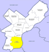
 Location of South Philadelphia in Philadelphia
This is a list of the National Register of Historic Places listings in South Philadelphia.
This is intended to be a complete list of the properties and districts on the National Register of Historic Places in South Philadelphia, Pennsylvania, United States. The locations of National Register properties and districts for which the latitude and longitude coordinates are included below may be seen in a Google map.[1]
There are 532 properties and districts listed on the National Register in Philadelphia, including 67 National Historic Landmarks. South Philadelphia includes 57 of these properties and districts, including 2 National Historic Landmarks; the city's remaining properties and districts are listed elsewhere. One site is split between South Philadelphia and other parts of the city, and is thus included on multiple lists.
Current listings
[2] Landmark name[3] Image Date listed Location Neighborhood[4] Summary 1 James Alcorn School 
November 18, 1988 1500 South 32nd Street
39°56′7″N 75°11′51″W / 39.93528°N 75.1975°WGrays Ferry 2 Marian Anderson House 
April 14, 2011 762 South Martin Street
39°56′32.5″N 75°10′29.5″W / 39.942361°N 75.174861°WSouthwest Center City 3 Charles Y. Audenried Junior High School 
November 18, 1988 1601 South 33rd Street
39°56′1″N 75°11′58″W / 39.93361°N 75.19944°WGrays Ferry 4 Baptist Institute for Christian Workers 
April 21, 1983 1425–1429 Snyder Avenue
39°55′29″N 75°10′14″W / 39.92472°N 75.17056°WWest Passyunk 5 Bartlett School 
December 4, 1986 1100 Catharine Street
39°56′24″N 75°9′42″W / 39.94°N 75.16167°WHawthorne 6 Edward Bok Vocational School 
December 4, 1986 1901 South 9th Street
39°55′33″N 75°9′37″W / 39.92583°N 75.16028°WCentral South Philadelphia 7 F. Amadee Bregy School 
November 18, 1988 1700 Bigler Street
39°54′52″N 75°10′36″W / 39.91444°N 75.17667°WMarconi Plaza 8 George W. Childs School 
November 18, 1988 1501 South 17th Street
39°55′53″N 75°10′22″W / 39.93139°N 75.17278°WPoint Breeze Built 1894–96, designed by Joseph Anschutz[5] 9 Commandant's Quarters 
June 3, 1976 U.S. Naval Base
39°53′48″N 75°10′38″W / 39.89667°N 75.17722°WNavy Yard 10 Francis M. Drexel School 
December 4, 1986 1800 South Sixteenth Street
39°55′42″N 75°10′23″W / 39.92833°N 75.17306°WPoint Breeze Built 1888–89, designed by Joseph Anschutz[5]
Demolished Feb., 201011 Federal Street School 
December 1, 1986 1130–1148 Federal Street
39°56′5″N 75°9′48″W / 39.93472°N 75.16333°WPassyunk Square 12 D. Newlin Fell School 
November 18, 1988 900 Oregon Avenue
39°54′56″N 75°9′48″W / 39.91556°N 75.16333°WEast Oregon 13 Samuel S. Fleisher Art Memorial 
November 14, 1982 711–721 Catharine Street
39°56′21″N 75°9′18.5″W / 39.93917°N 75.155139°WBella Vista 14 Franklin Hose Company No. 28 
December 3, 1980 730–732 South Broad Street
39°56′31.5″N 75°9′58″W / 39.942083°N 75.16611°WSouthwest Center City 15 Horace Furness Junior High School 
December 1, 1986 1900 South 3rd Street
39°55′25.5″N 75°9′2.5″W / 39.92375°N 75.150694°WPennsport 16 Gloria Dei (Old Swedes') Church National Historic Site 
October 15, 1966 Swanson Street, between Christian and Water Streets
39°56′4″N 75°8′38″W / 39.93444°N 75.14389°WQueen Village 17 Grays Road Recreation Center 
April 21, 1988 2501 Christian Street
39°56′33″N 75°11′6.5″W / 39.9425°N 75.185139°WGrays Ferry 18 Frances Ellen Watkins Harper House 
December 8, 1976 1006 Bainbridge Street
39°56′31″N 75°9′34″W / 39.94194°N 75.15944°WBella Vista 19 Nathaniel Hawthorne School 
December 4, 1986 712 South 12th Street
39°56′30″N 75°9′44″W / 39.94167°N 75.16222°WHawthorne 20 Institute for Colored Youth 
December 4, 1986 10th and Bainbridge Streets
39°56′31″N 75°9′28.3″W / 39.94194°N 75.157861°WBella Vista 21 Nathaniel Irish House 
March 16, 1972 704 South Front Street
39°56′23.7″N 75°8′40″W / 39.939917°N 75.14444°WQueen Village 22 Francis Scott Key School 
December 1, 1986 2226–2250 South 8th Street
39°55′15″N 75°9′38″W / 39.92083°N 75.16056°WCentral South Philadelphia Built 1889, designed by Joseph Anschutz[5] 23 Eliza Butler Kirkbride School 
November 18, 1988 626 Dickinson Street
39°55′48″N 75°9′22″W / 39.93°N 75.15611°WPassyunk Square 24 David Landreth School 
December 4, 1986 1201 South 23rd Street
39°56′16″N 75°10′54″W / 39.93778°N 75.18167°WPoint Breeze Built 1889, designed by Joseph Anschutz[5] 25 Marine Barracks 
July 13, 1976 Building 100, Philadelphia Naval Shipyard, 4800 S. 13th Street
39°53′31.5″N 75°10′28″W / 39.892083°N 75.17444°WNavy Yard 26 Marine Corps Depot of Supplies, Schuykill Warehouse 
November 12, 2004 700–734 Schuykill Avenue
39°56′41″N 75°11′12.5″W / 39.94472°N 75.186806°WSchuykill 27 Marine Corps Supply Activity 
August 6, 1975 1100 South Broad Street
39°56′15.5″N 75°10′1.5″W / 39.937639°N 75.167083°WPoint Breeze 28 Delaplaine McDaniel School 
December 4, 1986 2100 Moore Street
39°55′46″N 75°10′53″W / 39.92944°N 75.18139°WPoint Breeze 29 William M. Meredith School 
December 4, 1986 5th and Fitzwater Streets
39°56′22.5″N 75°9′3″W / 39.939583°N 75.15083°WQueen Village 30 Capt. Thomas Moore House 
March 16, 1972 702 South Front Street
39°56′24″N 75°8′40″W / 39.94°N 75.14444°WQueen Village 31 George W. Nebinger School 
November 18, 1988 601–627 Carpenter Street
39°56′12″N 75°9′14″W / 39.93667°N 75.15389°WBella Vista 32 Jeremiah Nichols School 
November 18, 1988 1235 South 16th Street
39°56′6″N 75°10′14″W / 39.935°N 75.17056°WPoint Breeze 33 William S. Peirce School 
November 18, 1988 2400 Christian Street
39°56′30.5″N 75°10′58.5″W / 39.941806°N 75.182917°WSouthwest Center City 34 Philadelphia Naval Shipyard Historic District 
December 22, 1999 South Broad Street
39°53′24″N 75°10′48″W / 39.89°N 75.18°WNavy Yard 35 Philadelphia Quartermaster Depot 
January 26, 2010 2724 South 20th Street
39°54′59″N 75°10′57″W / 39.91639°N 75.1825°WGirard Estate 36 Philadelphia, Wilmington and Baltimore Railroad Freight Shed 
September 8, 2011 1001 South 15th Street
39°56′20.5″N 75°10′4″W / 39.939028°N 75.16778°WSouthwest Center City 37 Edgar Allan Poe School 
December 4, 1986 2136 Ritner Street
39°55′19.5″N 75°10′59″W / 39.922083°N 75.18306°WGirard Estate 38 Robert Ralston School 
December 4, 1986 221 Bainbridge Street
39°56′26″N 75°8′48.5″W / 39.94056°N 75.146806°WQueen Village 39 Royal Theater 
February 8, 1980 1524–1534 South Street
39°56′38″N 75°10′5.5″W / 39.94389°N 75.168194°WSouthwest Center City 40 St. Anthony de Padua Parish School 
May 7, 1992 2317–2333 Carpenter Street
39°56′28″N 75°10′55.5″W / 39.94111°N 75.182083°WSouthwest Center City 41 George Sharswood School 
November 18, 1988 200 Wolf Street
39°55′7.5″N 75°9′3″W / 39.91875°N 75.15083°WWhitman 42 Walter George Smith School 
December 4, 1986 1300 South 19th Street
39°56′6″N 75°10′33″W / 39.935°N 75.17583°WPoint Breeze 43 South Front Street Historic District 
April 25, 1972 700–712 South Front Street, western side of Bainbridge Street to Kenilworth Street
39°56′24″N 75°8′40″W / 39.94°N 75.14444°WQueen Village 44 Southwark District 
May 19, 1972 Bounded by Delaware, Washington Aves., 5th, Lombard, Front, and Catherine Sts.
39°56′16″N 75°8′54″W / 39.93778°N 75.14833°WSouthwark 45 Southwark School 
December 1, 1986 Eighth and Miflin Streets
39°55′31″N 75°9′36″W / 39.92528°N 75.16°WCentral South Philadelphia 46 SS United States (Steamship) 
June 3, 1999 Pier 82
39°55′6″N 75°8′11″W / 39.91833°N 75.13639°WWhitman 47 Edwin M. Stanton School 
November 18, 1988 1616–1644 Christian Street
39°56′25.5″N 75°10′15″W / 39.940417°N 75.17083°WSouthwest Center City 48 George C. Thomas Junior High School 
November 18, 1988 2746 South 9th Street
39°54′56″N 75°9′48″W / 39.91556°N 75.16333°WEast Oregon 49 Tindley Temple United Methodist Church 
April 15, 2011 750–762 South Broad Street
39°56′29″N 75°9′59″W / 39.94139°N 75.16639°WSouthwest Center City 50 U.S. Naval Home 
August 21, 1972 Gray's Ferry Avenue at 24th Street
39°56′38″N 75°11′1″W / 39.94389°N 75.18361°WSouthwest Center City 51 University Avenue Bridge 
May 26, 1994 South University Avenue over the Schuylkill River
39°56′34″N 75°11′49″W / 39.94278°N 75.19694°WGrays Ferry Extends into West Philadelphia 52 Abigail Vare School 
December 4, 1986 Morris Street and Moyamensing Avenue
39°55′38″N 75°9′2.5″W / 39.92722°N 75.150694°WPennsport 53 Edwin H. Vare Junior High School 
November 18, 1988 2102 South 24th Street
39°55′33″N 75°11′9″W / 39.92583°N 75.18583°WWilson Park 54 Washington Avenue Historic District 
September 7, 1984 Roughly bounded by Carpenter, Washington, 10th, and Broad Streets
39°56′17″N 75°9′44″W / 39.93806°N 75.16222°WHawthorne 55 George Washington School 
December 4, 1986 Fifth and Federal Streets
39°56′1.5″N 75°9′10″W / 39.93375°N 75.15278°WDickinson Narrows 56 Anthony Wayne School 
December 1, 1986 2700 Morris Street
39°55′55″N 75°11′28″W / 39.93194°N 75.19111°WGrays Ferry 57 Widow Maloby's Tavern 
March 16, 1972 700 South Front Street
39°56′24″N 75°8′40″W / 39.94°N 75.14444°WQueen Village See also
- List of National Historic Landmarks in Philadelphia
- National Register of Historic Places listings in Philadelphia, Pennsylvania
References
- ^ The latitude and longitude information provided in this table was derived originally from the National Register Information System, which has been found to be fairly accurate for about 99% of listings. For about 1% of NRIS original coordinates, experience has shown that one or both coordinates are typos or otherwise extremely far off; some corrections may have been made. A more subtle problem causes many locations to be off by up to 150 yards, depending on location in the country: most NRIS coordinates were derived from tracing out latitude and longitudes off of USGS topographical quadrant maps created under North American Datum of 1927, which differs from the current, highly accurate GPS system used by Google maps. Chicago is about right, but NRIS longitudes in Washington are higher by about 4.5 seconds, and are lower by about 2.0 seconds in Maine. Latitudes differ by about 1.0 second in Florida. Some locations in this table may have been corrected to current GPS standards.
- ^ Numbers represent an alphabetization by significant words. Various colorings, defined here, differentiate National Historic Landmark sites and National Register of Historic Places Districts from other NRHP buildings, structures, sites or objects.
- ^ "NPS Focus". National Register of Historic Places. National Park Service. http://nrhp.focus.nps.gov. Retrieved November 20, 2009.
- ^ "The Political and Community Service Boundaries of Philadelphia" (PDF). Philadelphia City Planning Commission. June 2004. http://www.philaplanning.org/data/boundaries.pdf.
- ^ a b c d Philadelphia Public Schools TR
Neighborhoods of the South Philadelphia section of Philadelphia, Pennsylvania Bella Vista • Central South Philadelphia • Devil's Pocket • Dickinson Narrows • East Passyunk Crossing • FDR Park • Girard Estate • Grays Ferry • Greenwich • Hawthorne • Italian Market • Lower Moyamensing • Marconi Plaza • Moyamensing • Newbold • Packer Park • Passyunk Square • Pennsport • Point Breeze • Queen Village • Schuykill • Southwark • Southwest Center City • Sports Complex • Tasker • West Passyunk • Wharton • Whitman • Wilson Park
 Categories:
- Buildings and structures in Philadelphia, Pennsylvania
- National Register of Historic Places in Philadelphia, Pennsylvania


Wikimedia Foundation. 2010.