There are 89 properties and districts listed on the National Register in the county.
| [3] |
Landmark name[4] |
Image |
Date listed |
Location |
City or Town |
Summary |
| 1 |
American National Bank Building |
 |
01998-09-09 September 9, 1998 |
1330 Main Street
27°20′6″N 82°32′37″W / 27.335°N 82.54361°W / 27.335; -82.54361 (American National Bank Building) |
Sarasota |
|
| 2 |
Appleby Building |
 |
02001-06-28 June 28, 2001 |
501-513 Kumquat Court
27°20′24″N 82°32′26″W / 27.34°N 82.54056°W / 27.34; -82.54056 (Appleby Building) |
Sarasota |
|
| 3 |
William Martin Armistead House |
 |
02009-03-30 March 30, 2009 |
1510 Hyde Park Street
27°18′55″N 82°32′22.5″W / 27.31528°N 82.539583°W / 27.31528; -82.539583 (William Martin Armistead House) |
Sarasota |
|
| 4 |
Armada Road Multi-Family District |
 |
01989-12-18 December 18, 1989 |
Roughly bounded by Granada Avenue, Harbor Drive South, Armada Road South, and Park Boulevard South
27°5′48″N 82°26′58″W / 27.09667°N 82.44944°W / 27.09667; -82.44944 (Armada Road Multi-Family District) |
Venice |
Part of the Venice MPS |
| 5 |
Atlantic Coast Line Passenger Depot |
 |
01984-03-22 March 22, 1984 |
1 South School Avenue
27°20′8″N 82°31′36″W / 27.33556°N 82.52667°W / 27.33556; -82.52667 (Atlantic Coast Line Passenger Depot) |
Sarasota |
Part of the Sarasota MRA |
| 6 |
Bacheller-Brewer Model Home Estate |
 |
01992-02-10 February 10, 1992 |
1903 Lincoln Drive
27°19′31″N 82°31′55″W / 27.32528°N 82.53194°W / 27.32528; -82.53194 (Bacheller-Brewer Model Home Estate) |
Sarasota |
|
| 7 |
Bacon and Tomlin, Inc. |
 |
01984-03-22 March 22, 1984 |
201 South Palm Avenue
27°20′2″N 82°32′30″W / 27.33389°N 82.54167°W / 27.33389; -82.54167 (Bacon and Tomlin, Inc.) |
Sarasota |
Part of the Sarasota MRA |
| 8 |
Bay Haven School |
 |
01984-04-23 April 23, 1984 |
2901 West Tamiami Circle
27°21′42″N 82°33′6″W / 27.36167°N 82.55167°W / 27.36167; -82.55167 (Bay Haven School) |
Sarasota |
Part of the Sarasota MRA |
| 9 |
Bee Ridge Woman's Club |
 |
01995-02-10 February 10, 1995 |
4919 Andrew Avenue
27°16′53″N 82°29′3″W / 27.28139°N 82.48417°W / 27.28139; -82.48417 (Bee Ridge Woman's Club) |
Sarasota |
|
| 10 |
Frank and Matilda Binz House |
 |
01994-08-05 August 5, 1994 |
5050 Bay Shore Road
27°22′40″N 82°33′36″W / 27.37778°N 82.56°W / 27.37778; -82.56 (Binz, Frank and Matilda, House) |
Sarasota |
|
| 11 |
Bispham-Wilson Historic District |
 |
02002-09-14 September 14, 2002 |
4613 South Tamiami Trail
27°17′10″N 82°31′54″W / 27.28611°N 82.53167°W / 27.28611; -82.53167 (Bispham-Wilson Historic District) |
Sarasota |
|
| 12 |
Blackburn Point Bridge |
 |
02001-03-29 March 29, 2001 |
Blackburn Point Road at the Gulf Intracoastal Waterway
27°10′46″N 82°29′41″W / 27.17944°N 82.49472°W / 27.17944; -82.49472 (Blackburn Point Bridge) |
Osprey |
|
| 13 |
Blalock House |
 |
01989-04-12 April 12, 1989 |
241 South Harbor Drive
27°5′49″N 82°26′59″W / 27.09694°N 82.44972°W / 27.09694; -82.44972 (Blalock House) |
Venice |
Part of the Venice MPS |
| 14 |
Bryson-Crane House |
 |
02005-06-01 June 1, 2005 |
5050 Brywill Circle
27°22′39″N 82°33′34″W / 27.3775°N 82.55944°W / 27.3775; -82.55944 (Bryson-Crane House) |
Sarasota |
|
| 15 |
Burns Court Historic District |
 |
01984-03-22 March 22, 1984 |
400-446 Burns Court and 418, 426, and 446 South Pineapple Avenue
27°20′3″N 82°32′23″W / 27.33417°N 82.53972°W / 27.33417; -82.53972 (Burns Court Historic District) |
Sarasota |
Part of the Sarasota MRA |
| 16 |
Burns Realty Company-Karl Bickel House |
 |
01987-03-05 March 5, 1987 |
101 North Tamiami Trail
27°20′13″N 82°32′50″W / 27.33694°N 82.54722°W / 27.33694; -82.54722 (Burns Realty Company-Karl Bickel House) |
Sarasota |
Part of the Sarasota MRA |
| 17 |
William J. Burns House |
 |
01997-03-21 March 21, 1997 |
47 South Washington Drive
27°19′7″N 82°34′27″W / 27.31861°N 82.57417°W / 27.31861; -82.57417 (Burns, William J., House) |
Sarasota |
|
| 18 |
Caples'-Ringlings' Estates Historic District |
 |
01982-12-15 December 15, 1982 |
Roughly bounded by Sarasota Bay, U.S. Route 41, Parkview, and North Shore Avenue
27°22′58″N 82°33′40″W / 27.38278°N 82.56111°W / 27.38278; -82.56111 (Caples'-Ringlings' Estates Historic District) |
Sarasota |
|
| 19 |
Casa Del Mar |
 |
01997-02-14 February 14, 1997 |
25 South Washington Drive
27°19′9″N 82°34′28″W / 27.31917°N 82.57444°W / 27.31917; -82.57444 (Casa Del Mar) |
Sarasota |
|
| 20 |
Central-Cocoanut Historic District |
 |
02005-06-17 June 17, 2005 |
11th Street, Tamiami Trail, 22nd Street, and railroad tracks
27°21′5″N 82°32′38″W / 27.35139°N 82.54389°W / 27.35139; -82.54389 (Central-Cocoanut Historic District) |
Sarasota |
|
| 21 |
Chidsey Library |
 |
02011-05-04 May 4, 2011 |
701 N. Tamiami Trail
27°20′33″N 82°32′51″W / 27.3425°N 82.5475°W / 27.3425; -82.5475 (Chidsey Library) |
Sarasota |
|
| 22 |
City Waterworks |
 |
01984-04-23 April 23, 1984 |
1015 North Orange Avenue
27°20′41″N 82°32′22″W / 27.34472°N 82.53944°W / 27.34472; -82.53944 (City Waterworks) |
Sarasota |
Part of the Sarasota MRA |
| 23 |
Corrigan House |
 |
01994-05-26 May 26, 1994 |
463 Sapphire Drive
27°22′41″N 82°33′46″W / 27.37806°N 82.56278°W / 27.37806; -82.56278 (Corrigan House) |
Sarasota |
|
| 24 |
Crisp Building |
 |
02000-04-21 April 21, 2000 |
1970 Main Street
27°20′12″N 82°31′52″W / 27.33667°N 82.53111°W / 27.33667; -82.53111 (Crisp Building) |
Sarasota |
|
| 25 |
F. A. DeCanizares House |
 |
01984-03-22 March 22, 1984 |
1215 North Palm Avenue
27°20′11″N 82°32′46″W / 27.33639°N 82.54611°W / 27.33639; -82.54611 (DeCanizares, F.A., House) |
Sarasota |
Part of the Sarasota MRA |
| 26 |
DeMarcay Hotel |
 |
01984-03-22 March 22, 1984 |
27 South Palm Avenue
27°20′4″N 82°32′27″W / 27.33444°N 82.54083°W / 27.33444; -82.54083 (DeMarcay Hotel) |
Sarasota |
Part of the Sarasota MRA |
| 27 |
Downtown Sarasota Historic District |
 |
02009-04-09 April 9, 2009 |
Bound by 1st Street, Orange Avenue, State Street, Gulf Stream Avenue, and North Pineapple Avenue
27°19′58″N 82°32′14″W / 27.33278°N 82.53722°W / 27.33278; -82.53722 (Downtown Sarasota Historic District) |
Sarasota |
Boundary decrease (listed October 7, 2010): 1400 block of Main St. |
| 28 |
Eagle Point Historic District |
 |
01991-10-03 October 3, 1991 |
759 North Tamiami Trail
27°6′31″N 82°26′46″W / 27.10861°N 82.44611°W / 27.10861; -82.44611 (Eagle Point Historic District) |
Venice |
|
| 29 |
Earle House |
 |
01993-09-02 September 2, 1993 |
4521 Bayshore Road
27°22′24″N 82°33′44″W / 27.37333°N 82.56222°W / 27.37333; -82.56222 (Earle House) |
Sarasota |
|
| 30 |
Edgewood Historic District |
 |
01989-12-18 December 18, 1989 |
Roughly bounded by School Street, Myrtle Avenue, the Venice-By-Way, and Groveland Avenue
27°5′46″N 82°25′51″W / 27.09611°N 82.43083°W / 27.09611; -82.43083 (Edgewood Historic District) |
Venice |
Part of the Venice MPS |
| 31 |
Edwards Theatre |
 |
01984-03-22 March 22, 1984 |
57 North Pineapple Avenue
27°20′12″N 82°32′38″W / 27.33667°N 82.54389°W / 27.33667; -82.54389 (Edwards Theatre) |
Sarasota |
Part of the Sarasota MRA |
| 32 |
El Patio Apartments |
 |
01993-05-06 May 6, 1993 |
500 North Audubon Place
27°20′25″N 82°31′37″W / 27.34028°N 82.52694°W / 27.34028; -82.52694 (El Patio Apartments) |
Sarasota |
|
| 33 |
El Vernona Apartments-Broadway Apartments |
 |
01984-03-22 March 22, 1984 |
1133 4th Street
27°20′23″N 82°32′54″W / 27.33972°N 82.54833°W / 27.33972; -82.54833 (El Vernona Apartments-Broadway Apartments) |
Sarasota |
Part of the Sarasota MRA |
| 34 |
El Vernona Hotel-John Ringling Hotel |
 |
01987-03-05 March 5, 1987 |
111 North Tamiami Trail
27°20′13″N 82°32′50″W / 27.33694°N 82.54722°W / 27.33694; -82.54722 (El Vernona Hotel-John Ringling Hotel) |
Sarasota |
Part of the Sarasota MRA |
| 35 |
Field Estate |
 |
01986-06-05 June 5, 1986 |
Field Road and Camino Real
27°17′11″N 82°32′20″W / 27.28639°N 82.53889°W / 27.28639; -82.53889 (Field Estate) |
Sarasota |
|
| 36 |
Frances-Carlton Apartments |
 |
01984-03-22 March 22, 1984 |
1221-1227 North Palm Avenue
27°20′11″N 82°32′46″W / 27.33639°N 82.54611°W / 27.33639; -82.54611 (Frances-Carlton Apartments) |
Sarasota |
Part of the Sarasota MRA |
| 37 |
Dr. Joseph Halton House |
 |
01984-03-22 March 22, 1984 |
308 Cocoanut Avenue
27°20′19″N 82°32′41″W / 27.33861°N 82.54472°W / 27.33861; -82.54472 (Halton, Dr. Joseph, House) |
Sarasota |
Part of the Sarasota MRA |
| 38 |
Harding Circle Historic District |
 |
02001-01-16 January 16, 2001 |
Roughly John Ringling Boulevard, St. Armands Circle, and Boulevard of Presidents
27°19′8″N 82°34′37″W / 27.31889°N 82.57694°W / 27.31889; -82.57694 (Harding Circle Historic District) |
Sarasota |
|
| 39 |
Hermitage-Whitney Historic District |
 |
02002-10-31 October 31, 2002 |
6660 Manasota Key Road
26°57′40″N 82°23′3″W / 26.96111°N 82.38417°W / 26.96111; -82.38417 (Hermitage-Whitney Historic District) |
Englewood |
|
| 40 |
Hotel Venice |
 |
01984-02-06 February 6, 1984 |
200 North Nassau Street
27°6′1″N 82°27′11″W / 27.10028°N 82.45306°W / 27.10028; -82.45306 (Hotel Venice) |
Venice |
|
| 41 |
House at 507 Jackson Drive |
 |
01998-02-05 February 5, 1998 |
507 Jackson Drive
27°19′0″N 82°34′31″W / 27.316667°N 82.57528°W / 27.316667; -82.57528 (House at 507 Jackson Drive) |
Sarasota |
|
| 42 |
House at 710 Armada Road South |
 |
01989-08-17 August 17, 1989 |
710 Armada Road South
27°5′52″N 82°26′49″W / 27.09778°N 82.44694°W / 27.09778; -82.44694 (House at 710 Armada Road South) |
Venice |
Part of the Venice MPS |
| 43 |
Johnson Chapel Missionary Baptist Church |
 |
01997-10-08 October 8, 1997 |
506 Church Street
27°7′49″N 82°26′54″W / 27.13028°N 82.44833°W / 27.13028; -82.44833 (Johnson Chapel Missionary Baptist Church) |
Laurel |
|
| 44 |
Johnson-Schoolcraft Building |
 |
01996-12-27 December 27, 1996 |
201-203 West Venice Avenue
27°6′16″N 82°27′7″W / 27.10444°N 82.45194°W / 27.10444; -82.45194 (Johnson-Schoolcraft Building) |
Venice |
Part of the Venice MPS |
| 45 |
Edson Keith Estate |
 |
01991-03-14 March 14, 1991 |
5500 South Tamiami Trail
27°16′13″N 82°31′58″W / 27.27028°N 82.53278°W / 27.27028; -82.53278 (Edson Keith Estate) |
Sarasota |
|
| 46 |
Dr. Walter Kennedy House |
 |
01994-04-14 April 14, 1994 |
1876 Oak Street
27°19′53″N 82°31′59″W / 27.33139°N 82.53306°W / 27.33139; -82.53306 (Kennedy, Dr. Walter, House) |
Sarasota |
|
| 47 |
S. H. Kress Building |
 |
01984-03-22 March 22, 1984 |
1442 Main Street
27°20′9″N 82°32′31″W / 27.33583°N 82.54194°W / 27.33583; -82.54194 (Kress, S.H., Building) |
Sarasota |
Part of the Sarasota MRA |
| 48 |
Laurel Park Historic District |
 |
02008-03-11 March 11, 2008 |
Bounded by Morrill Street, Orange Avenue, Brother Geenen Way, Julia Place, and Lafayette Court
27°19′52″N 82°32′5″W / 27.33111°N 82.53472°W / 27.33111; -82.53472 (Laurel Park Historic District) |
Sarasota |
|
| 49 |
Hilton Leech House and Amagansett Art School |
 |
01995-06-22 June 22, 1995 |
1666 Hillview Street
27°18′59″N 82°32′10″W / 27.31639°N 82.53611°W / 27.31639; -82.53611 (Leech, Hilton, House and Amagansett Art School) |
Sarasota |
|
| 50 |
Lemon Bay Woman's Club |
 |
01988-08-11 August 11, 1988 |
51 North Maple Street
26°57′47″N 82°21′29″W / 26.96306°N 82.35806°W / 26.96306; -82.35806 (Lemon Bay Woman's Club) |
Englewood |
|
| 51 |
Levillain-Letton House |
 |
01989-04-12 April 12, 1989 |
229 South Harbor Drive
27°5′50″N 82°26′59″W / 27.09722°N 82.44972°W / 27.09722; -82.44972 (Levillain-Letton House) |
Venice |
Part of the Venice MPS |
| 52 |
Little Salt Springs |
 |
01979-07-10 July 10, 1979 |
Off U.S. Route 41
27°4′29″N 82°14′0″W / 27.07472°N 82.233333°W / 27.07472; -82.233333 (Little Salt Springs) |
North Port |
|
| 53 |
Maine Colony Historic District |
 |
02005-10-05 October 5, 2005 |
Bounded by Swift Road Ashton Road, Portland Way and Grafton Street
27°16′47″N 82°31′6″W / 27.27972°N 82.51833°W / 27.27972; -82.51833 (Maine Colony Historic District) |
Sarasota |
|
| 54 |
Miakka School House |
 |
01986-07-03 July 3, 1986 |
Miakka and Wilson Roads
27°19′10″N 82°16′11″W / 27.31944°N 82.26972°W / 27.31944; -82.26972 (Miakka School House) |
Miakka |
|
| 55 |
Municipal Auditorium-Recreation Club |
 |
01995-02-24 February 24, 1995 |
801 North Tamiami Trail
27°20′35″N 82°32′52″W / 27.34306°N 82.54778°W / 27.34306; -82.54778 (Municipal Auditorium-Recreation Club) |
Sarasota |
|
| 56 |
Lucienne Nielsen House |
 |
02007-03-21 March 21, 2007 |
3730 Sandspur Lane
27°10′27″N 82°29′39″W / 27.17417°N 82.49417°W / 27.17417; -82.49417 (Nielsen, Lucienne, House) |
Nokomis |
Part of the Sarasota School of Architecture MPS |
| 57 |
John Nolen Plan of Venice Historic District |
 |
02010-11-08 November 8, 2010 |
Laguna Dr on N, Home Park Rd on E, the Corso on S, The Esplanade on W
27°5′46″N 82°26′35″W / 27.09611°N 82.44306°W / 27.09611; -82.44306 (John Nolen Plan of Venice Historic District) |
Venice |
|
| 58 |
Osprey Archeological and Historic Site |
 |
01975-04-16 April 16, 1975 |
Address Restricted
27°12′N 82°29′W / 27.2°N 82.49°W / 27.2; -82.49 (Osprey Archeological and Historic Site) |
Osprey |
|
| 59 |
Osprey School |
 |
01994-07-15 July 15, 1994 |
337 North Tamiami Trail (U.S. Route 41)
27°12′5″N 82°29′29″W / 27.20139°N 82.49139°W / 27.20139; -82.49139 (Osprey School) |
Osprey |
|
| 60 |
Out of Door School |
 |
01994-10-28 October 28, 1994 |
444 Reid Street
27°17′9″N 82°33′38″W / 27.28583°N 82.56056°W / 27.28583; -82.56056 (Out of Door School) |
Sarasota |
|
| 61 |
Overtown Historic District |
 |
02002-07-19 July 19, 2002 |
Roughly along Central and Cohen Avenues between 9th and 4th Streets
27°22′13″N 82°32′35″W / 27.37028°N 82.54306°W / 27.37028; -82.54306 (Overtown Historic District) |
Sarasota |
|
| 62 |
Christy Payne Mansion |
 |
01998-09-25 September 25, 1998 |
800 South Palm Avenue
27°19′40″N 82°32′25″W / 27.32778°N 82.54028°W / 27.32778; -82.54028 (Payne, Christy, Mansion) |
Sarasota |
|
| 63 |
Capt. W. F. Purdy House |
 |
01984-03-22 March 22, 1984 |
3315 Bayshore Road
27°21′52″N 82°33′24″W / 27.36444°N 82.55667°W / 27.36444; -82.55667 (Purdy, Capt. W. F., House) |
Sarasota |
Part of the Sarasota MRA |
| 64 |
L. D. Reagin House |
 |
01984-10-25 October 25, 1984 |
1213 North Palm Avenue
27°20′11″N 82°32′48″W / 27.33639°N 82.54667°W / 27.33639; -82.54667 (Reagin, L.D., House) |
Sarasota |
Part of the Sarasota MRA |
| 65 |
Leonard Reid House |
 |
02002-10-29 October 29, 2002 |
1435 7th Street
27°20′38″N 82°32′30″W / 27.34389°N 82.54167°W / 27.34389; -82.54167 (Reid, Leonard, House) |
Sarasota |
|
| 66 |
Revere Quality Institute House |
 |
02008-03-26 March 26, 2008 |
100 Ogden Lane
27°18′3″N 82°33′32″W / 27.30083°N 82.55889°W / 27.30083; -82.55889 (Revere Quality Institute House) |
Sarasota |
Part of the Sarasota School of Architecture MPS |
| 67 |
Rigby's La Plaza Historic District |
 |
01994-04-25 April 25, 1994 |
1002-1038 South Osprey Avenue, 1744 and 1776 Alta Vista Street, and 1777 Irving Avenue
27°19′27″N 82°32′4″W / 27.32417°N 82.53444°W / 27.32417; -82.53444 (Rigby's La Plaza Historic District) |
Sarasota |
|
| 68 |
Rosemary Cemetery |
 |
02003-11-16 November 16, 2003 |
851 Central Avenue
27°20′42″N 82°32′37″W / 27.345°N 82.54361°W / 27.345; -82.54361 (Rosemary Cemetery) |
Sarasota |
|
| 69 |
Roth Cigar Factory |
 |
01984-03-22 March 22, 1984 |
30 Mira Mar Court
27°20′4″N 82°32′27″W / 27.33444°N 82.54083°W / 27.33444; -82.54083 (Roth Cigar Factory) |
Sarasota |
Part of the Sarasota MRA |
| 70 |
Sanderling Beach Club |
 |
01994-06-29 June 29, 1994 |
105 Beach Road
27°14′26″N 82°31′55″W / 27.24056°N 82.53194°W / 27.24056; -82.53194 (Sanderling Beach Club) |
Sarasota |
|
| 71 |
Sarasota County Courthouse |
 |
01984-03-22 March 22, 1984 |
2000 Main Street
27°20′8″N 82°31′50″W / 27.33556°N 82.53056°W / 27.33556; -82.53056 (Sarasota County Courthouse) |
Sarasota |
Part of the Sarasota MRA |
| 72 |
Sarasota Herald Building |
 |
01984-03-22 March 22, 1984 |
539 South Orange Avenue
27°19′53″N 82°32′19″W / 27.33139°N 82.53861°W / 27.33139; -82.53861 (Sarasota Herald Building) |
Sarasota |
Part of the Sarasota MRA |
| 73 |
Sarasota High School |
 |
01984-03-22 March 22, 1984 |
1001 South Tamiami Trail
27°19′30″N 82°31′46″W / 27.325°N 82.52944°W / 27.325; -82.52944 (Sarasota High School) |
Sarasota |
Part of the Sarasota MRA |
| 74 |
Sarasota Times Building |
 |
01984-03-22 March 22, 1984 |
1214-1216 1st Street
27°20′12″N 82°32′46″W / 27.33667°N 82.54611°W / 27.33667; -82.54611 (Sarasota Times Building) |
Sarasota |
Part of the Sarasota MRA |
| 75 |
Sarasota Woman's Club |
 |
01985-01-18 January 18, 1985 |
1241 North Palm Avenue
27°20′11″N 82°32′44″W / 27.33639°N 82.54556°W / 27.33639; -82.54556 (Sarasota Woman's Club) |
Sarasota |
Part of the Sarasota MRA |
| 76 |
George Schueler House |
 |
01997-09-26 September 26, 1997 |
76 South Washington Drive
27°19′4″N 82°34′25″W / 27.31778°N 82.57361°W / 27.31778; -82.57361 (Schueler, George, House) |
Sarasota |
|
| 77 |
South Side School |
 |
01984-09-14 September 14, 1984 |
1901 Webber Street
27°18′29″N 82°31′53″W / 27.30806°N 82.53139°W / 27.30806; -82.53139 (South Side School) |
Sarasota |
Part of the Sarasota MRA |
| 78 |
Southwick-Harmon House |
 |
02001-10-28 October 28, 2001 |
1830 Lincoln Drive
27°19′39″N 82°31′59″W / 27.3275°N 82.53306°W / 27.3275; -82.53306 (Southwick-Harmon House) |
Sarasota |
|
| 79 |
Thoms House |
 |
01994-07-01 July 1, 1994 |
5030 Bay Shore Road
27°22′38″N 82°33′36″W / 27.37722°N 82.56°W / 27.37722; -82.56 (Thoms House) |
Sarasota |
|
| 80 |
Triangle Inn |
 |
01996-02-23 February 23, 1996 |
351 South Nassau Street
27°5′42″N 82°26′52″W / 27.095°N 82.44778°W / 27.095; -82.44778 (Triangle Inn) |
Venice |
Part of the Venice MPS |
| 81 |
U.S. Post Office-Federal Building |
 |
01984-03-22 March 22, 1984 |
111 South Orange Avenue
27°20′9″N 82°32′19″W / 27.33583°N 82.53861°W / 27.33583; -82.53861 (U.S. Post Office-Federal Building) |
Sarasota |
Part of the Sarasota MRA |
| 82 |
Valencia Hotel and Arcade |
 |
01994-11-10 November 10, 1994 |
229 West Venice Avenue
27°5′58″N 82°26′50″W / 27.09944°N 82.44722°W / 27.09944; -82.44722 (Valencia Hotel and Arcade) |
Venice |
Part of the Venice MPS |
| 83 |
Venezia Park Historic District |
 |
01989-12-18 December 18, 1989 |
Roughly bounded by Palermo Street, Sorrento Street, South Harbor Drive, and Salerno Street
27°5′31″N 82°26′53″W / 27.09194°N 82.44806°W / 27.09194; -82.44806 (Venezia Park Historic District) |
Venice |
Part of the Venice MPS |
| 84 |
Venice Depot |
 |
01989-08-17 August 17, 1989 |
303 East Venice Avenue
27°6′2″N 82°26′25″W / 27.10056°N 82.44028°W / 27.10056; -82.44028 (Venice Depot) |
Venice |
Part of the Venice MPS |
| 85 |
Warm Mineral Springs |
 |
01977-11-28 November 28, 1977 |
12 miles southeast of Venice on U.S. Route 41
27°3′35″N 82°15′38″W / 27.05972°N 82.26056°W / 27.05972; -82.26056 (Warm Mineral Springs) |
Venice |
|
| 86 |
J. G. Whitfield Estate |
 |
01985-09-12 September 12, 1985 |
2704 Bayshore Drive
27°21′35″N 82°33′17″W / 27.35972°N 82.55472°W / 27.35972; -82.55472 (Whitfield, J. G., Estate) |
Sarasota |
|
| 87 |
H. B. William House |
 |
01984-03-22 March 22, 1984 |
1509 South Orange Avenue
27°19′10″N 82°32′16″W / 27.31944°N 82.53778°W / 27.31944; -82.53778 (William, H.B., House) |
Sarasota |
Part of the Sarasota MRA |
| 88 |
Dr. C. B. Wilson House |
 |
01984-03-22 March 22, 1984 |
235 South Orange Avenue
27°20′4″N 82°32′18″W / 27.33444°N 82.53833°W / 27.33444; -82.53833 (Wilson, Dr. C. B., House) |
Sarasota |
Part of the Sarasota MRA |
| 89 |
Worth's Block |
 |
01998-06-03 June 3, 1998 |
1490 Main Street
27°20′9″N 82°32′27″W / 27.33583°N 82.54083°W / 27.33583; -82.54083 (Worth's Block) |
Sarasota |
|
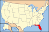
 Location of Sarasota County in Florida