- National Register of Historic Places listings in Rockingham County, New Hampshire
-
 Location of Rockingham County in New Hampshire
This is a list of the National Register of Historic Places listings in Rockingham County, New Hampshire.
This is intended to be a complete list of the properties and districts on the National Register of Historic Places in Rockingham County, New Hampshire, United States. Latitude and longitude coordinates are provided for many National Register properties and districts; these locations may be seen together in a Google map.[1]
There are 113 properties and districts listed on the National Register in the county, including 12 National Historic Landmarks.
Contents: Counties in New Hampshire Belknap - Carroll - Cheshire - Coos - Grafton - Hillsborough - Merrimack - Rockingham - Strafford - Sullivan -
- This National Park Service list is complete through NPS recent listings posted November 10, 2011.[2]
Current listings
[3] Landmark name [4] Image Date listed Location City or town Summary 1 Adams Memorial Building 
January 11, 1982 West Broadway
42°52′48″N 71°19′44″W / 42.88°N 71.328889°WDerry 2 Atkinson Academy School August 26, 1980 Academy Ave.
42°50′23″N 71°08′49″W / 42.839722°N 71.146944°WAtkinson 3 Atlantic Heights Development September 20, 2006 Concord, Crescent, Falkland, Kearsarge, Porpoise, Preble, Raleigh, and Saratoga Ways
43°05′33″N 70°46′22″W / 43.0925°N 70.772778°WPortsmouth 4 Josiah Bartlett House 
November 11, 1971 Main St.
42°56′11″N 71°03′18″W / 42.936389°N 71.055°WKingston 5 Samuel Beck House April 3, 1973 The Hill
43°04′44″N 70°45′36″W / 43.078983°N 70.759947°WPortsmouth 6 Benedict House May 11, 1973 30 Middle St.
43°04′31″N 70°45′41″W / 43.075278°N 70.761389°WPortsmouth 7 Chester Congregational Church June 5, 1986 4 Chester St.
42°57′28″N 71°15′27″W / 42.957778°N 71.2575°WChester 8 Chester Village Cemetery November 29, 1979 NH 102 and NH 121
42°57′27″N 71°15′22″W / 42.9575°N 71.256111°WChester 9 John Crockett House March 24, 1983 245 Portsmouth Ave.
43°02′26″N 70°53′59″W / 43.040556°N 70.899722°WStratham 10 Capt. Jonathan Currier House April 11, 1983 Hilldale Ave.
42°52′34″N 71°00′08″W / 42.876111°N 71.002222°WSouth Hampton 11 Dame School October 30, 1980 NH 152
43°07′14″N 71°06′10″W / 43.120556°N 71.102778°WNottingham 12 Danville Meetinghouse April 19, 1982 N. Main St.
42°56′14″N 71°07′08″W / 42.937222°N 71.118889°WDanville 13 Danville Town House December 1, 2000 210 Main St., NH 111A
42°54′54″N 71°07′24″W / 42.915°N 71.123333°WDanville 14 Deerfield Center Historic District September 14, 2002 1 Candia Rd., 1-14 Old Center Road South
43°08′00″N 71°14′37″W / 43.133333°N 71.243611°WDeerfield 15 Dudley House June 21, 1971 14 Front St.
42°58′49″N 70°56′49″W / 42.980278°N 70.946944°WExeter 16 East Derry Historic District August 10, 1982 Roughly bounded by Hampstead, Lane, and Cemetery Rds.
42°53′33″N 71°17′33″W / 42.8925°N 71.2925°WEast Derry 17 John Elkins Farmstead August 30, 1996 156 Beach Plain Rd.
42°56′39″N 71°06′07″W / 42.944167°N 71.101944°WDanville 18 Elm Farm January 22, 1988 599 Main St.
42°56′58″N 71°08′00″W / 42.949444°N 71.133333°WDanville 19 Exeter Waterfront Commercial Historic District December 3, 1980 Chestnut Hill Ave. and Water, Franklin, Pleasant, High, and Chestnut Sts.
42°58′57″N 70°56′49″W / 42.9825°N 70.946944°WExeter Boundary Increase (added 1986-12-29): Chestnut St. 20 First Church September 10, 1971 21 Front St.
42°58′50″N 70°56′51″W / 42.980556°N 70.9475°WExeter 21 First Universalist Church December 26, 1979 Main St.
42°56′00″N 71°03′15″W / 42.933333°N 71.054167°WKingston 22 Fort Constitution 
July 9, 1973 Walbach St.
43°04′17″N 70°42′37″W / 43.071389°N 70.710278°WNew Castle 23 Franklin Block June 7, 1984 75 Congress St.
43°04′36″N 70°45′35″W / 43.076667°N 70.759722°WPortsmouth 24 Freewill Baptist Church-Peoples Baptist Church-New Hope Church September 13, 2003 45 Pearl St.
43°04′32″N 70°45′49″W / 43.075556°N 70.763611°WPortsmouth 25 Fremont Meeting House May 27, 1993 464 Main St.
42°58′59″N 71°07′44″W / 42.983056°N 71.128889°WFremont 26 Front Street Historic District 
July 5, 1973 Front St. between its junctions with Spring and Water Sts.
42°58′45″N 70°57′04″W / 42.979167°N 70.951111°WExeter 27 Robert Frost Homestead 
May 23, 1968 2 mi (3.2 km) southeast of Derry
42°52′18″N 71°17′40″W / 42.871667°N 71.294444°WDerry Home of poet Robert Frost. 28 Gilman Garrison House 
September 27, 1976 12 Water St.
42°58′50″N 70°56′42″W / 42.980556°N 70.945°WExeter 29 Maj. John Gilman House June 14, 1988 25 Cass St.
42°59′03″N 70°57′16″W / 42.984167°N 70.954444°WExeter 30 Greeley House June 16, 1980 East of East Kingston on NH 108
42°55′18″N 70°59′43″W / 42.921667°N 70.995278°WEast Kingston 31 Hampstead Meetinghouse April 10, 1980 Emerson Ave.
42°52′32″N 71°10′48″W / 42.875556°N 71.18°WHampstead 32 Jeremiah Hart House November 14, 1972 The Hill
43°04′44″N 70°45′41″W / 43.078889°N 70.761389°WPortsmouth 33 John Hart House November 14, 1972 The Hill
43°04′44″N 70°45′41″W / 43.078889°N 70.761389°WPortsmouth 34 Phoebe Hart House April 2, 1973 The Hill
43°04′44″N 70°45′41″W / 43.078889°N 70.761389°WPortsmouth 35 Hart-Rice House August 7, 1972 The Hill
43°04′44″N 70°45′41″W / 43.078889°N 70.761389°WPortsmouth 36 Haven-White House June 6, 1985 229 Pleasant St.
43°04′24″N 70°45′17″W / 43.073333°N 70.754722°WPortsmouth 37 Highland Road Historic District April 11, 1983 Highland and Woodman Rds.
42°53′43″N 70°56′05″W / 42.895278°N 70.934722°WSouth Hampton 38 Isles of Shoals 
December 10, 1980 Address Restricted Rye 39 Richard Jackson House 
November 24, 1968 Northwest St.
43°04′51″N 70°45′59″W / 43.080833°N 70.766389°WPortsmouth Oldest surviving wooden house in New Hampshire, built 1664. 40 Benjamin James House March 13, 2002 186 Towle Farm Rd.
42°56′38″N 70°51′44″W / 42.943889°N 70.862222°WHampton 41 Jewell Town District April 11, 1983 W. Whitehall Rd. and Jewell St.
42°52′22″N 70°58′08″W / 42.872778°N 70.968889°WSouth Hampton 42 John Paul Jones House 
November 28, 1972 Middle and State Sts.
43°04′31″N 70°45′39″W / 43.075278°N 70.760833°WPortsmouth American Revolutionary War naval hero John Paul Jones boarded here in 1781-82, while supervising construction of a new battleship, the America. 43 Ladd-Gilman House 
December 2, 1974 Governors Lane and Water St.
42°58′54″N 70°56′57″W / 42.981667°N 70.949167°WExeter 44 Reuben Lamprey Homestead November 9, 1982 416 Winnacunnet Rd.
42°55′51″N 70°48′46″W / 42.930833°N 70.812778°WHampton 45 Deacon Samuel and Jabez Lane Homestead April 8, 1983 Portsmouth Ave.
43°01′22″N 70°55′00″W / 43.022778°N 70.916667°WStratham 46 Gov. John Langdon Mansion 
December 2, 1974 143 Pleasant St.
43°04′31″N 70°45′23″W / 43.075278°N 70.756389°WPortsmouth Great Georgian house built in 1784, home of John Langdon. 47 Larkin-Rice House November 29, 1979 180 Middle St.
43°04′24″N 70°45′43″W / 43.073333°N 70.761944°WPortsmouth 48 Little Boar's Head Historic District 
June 3, 1999 Parts of Atlantic Ave., Chapel Rd., Ocean Blvd., Sea Rd., and Willow Ave.
42°57′36″N 70°46′45″W / 42.96°N 70.779167°WNorth Hampton 49 Elijah Locke House 
December 19, 1979 5 Grove Rd.
42°59′33″N 70°46′19″W / 42.9925°N 70.771944°WRye 50 MacPheadris-Warner House 
October 15, 1966 Chapel and Daniel Sts.
43°04′41″N 70°45′18″W / 43.078056°N 70.755°WPortsmouth 51 Richman Margeson Estate June 21, 1990 Long Point Rd. near Great Bay shore
43°04′45″N 70°51′29″W / 43.079167°N 70.858056°WNewington 52 Moffatt-Ladd House 
November 24, 1968 154 Market St.
43°04′44″N 70°45′32″W / 43.078889°N 70.758889°WPortsmouth 53 Moses-Kent House September 12, 1985 1 Pine St.
42°58′36″N 70°57′18″W / 42.976667°N 70.955°WExeter 54 James Neal House August 7, 1972 74 Deer St.
43°04′44″N 70°45′41″W / 43.078889°N 70.761389°WPortsmouth 55 New Hampshire Bank Building 
September 10, 1979 22-26 Market Sq.
43°04′37″N 70°45′27″W / 43.076944°N 70.7575°WPortsmouth 56 Newington Center Historic District November 30, 1987 272-336, 305-353 Nimble Hill Rd.; also Merrimac Drive, north of Short St.
43°05′58″N 70°50′00″W / 43.099444°N 70.833333°WNewington Second set of addresses represents a boundary increase 57 Newington Railroad Depot April 19, 2010 Bloody Point Rd.
43°07′00″N 70°49′15″W / 43.116667°N 70.820833°WNewington 58 Newmarket Industrial and Commercial Historic District December 1, 1980 NH 108
43°04′47″N 70°56′14″W / 43.079722°N 70.937222°WNewmarket 59 Nichols Memorial Library January 28, 1981 Main St.
42°56′12″N 71°03′12″W / 42.936667°N 71.053333°WKingston 60 Northwood Congregational Church November 30, 1979 U.S. Route 4
43°13′02″N 71°12′32″W / 43.217222°N 71.208889°WNorthwood 61 Nutter-Rymes House November 3, 1972 48 School St.
43°04′44″N 70°45′41″W / 43.078889°N 70.761389°WPortsmouth 62 Old North Cemetery 
March 8, 1978 Maplewood Ave.
43°04′41″N 70°45′48″W / 43.078056°N 70.763333°WPortsmouth 63 Parsons Homestead 
December 5, 1980 520 Washington Rd.
43°00′49″N 70°46′14″W / 43.013611°N 70.770556°WRye 64 Daniel Pinkham House November 3, 1972 The Hill
43°04′44″N 70°45′41″W / 43.078889°N 70.761389°WPortsmouth 65 Plaistow Carhouse December 10, 1980 27 Elm St.
42°50′21″N 71°05′33″W / 42.839167°N 71.0925°WPlaistow 66 General Porter House October 11, 1985 32-34 Livermore St.
43°04′24″N 70°45′16″W / 43.073333°N 70.754444°WPortsmouth 67 Portsmouth Athenaeum 
May 24, 1973 9 Market Sq.
43°04′37″N 70°45′29″W / 43.076944°N 70.758056°WPortsmouth 68 Portsmouth Cottage Hospital September 13, 1996 Junkins Ave., southern side of South Mill Pond
43°04′14″N 70°45′17″W / 43.070556°N 70.754722°WPortsmouth 69 Portsmouth Harbor Light 
October 8, 2009 0.3 miles east of the Route 1B junction with Wentworth Rd., at the southeastern corner of Fort Constitution
43°04′16″N 70°42′31″W / 43.071036°N 70.708594°WNew Castle 70 Portsmouth Public Library March 20, 1973 8 Islington St.
43°04′31″N 70°45′41″W / 43.075278°N 70.761389°WPortsmouth 71 Benjamin Franklin Prescott House December 3, 1987 Prescott Rd.
43°03′02″N 71°05′55″W / 43.050556°N 71.098611°WEpping 72 Pulpit Rock Base-End Station (N. 142) 
April 16, 2010 9 Davis Rd.
43°02′00″N 70°43′10″W / 43.033333°N 70.719444°WRye 73 Raymond Boston and Maine Railroad Depot May 16, 1979 Main St.
43°02′09″N 71°10′53″W / 43.035833°N 71.181389°WRaymond 74 Rockingham Hotel 
March 11, 1982 401 State St.
43°04′32″N 70°45′38″W / 43.075556°N 70.760556°WPortsmouth 75 George Rogers House June 7, 1976 76 Northwest St.
43°04′53″N 70°46′00″W / 43.081389°N 70.766667°WPortsmouth 76 Rundlet-May House 
June 7, 1976 364 Middle St.
43°04′16″N 70°45′47″W / 43.071111°N 70.763056°WPortsmouth 77 St. Andrew's-by-the-Sea 
December 13, 2001 Church Rd., 0.2 mi (0.32 km) southwest of its junction with South Rd. and NH 1A
42°58′27″N 70°46′02″W / 42.974167°N 70.767222°WRye 78 St. John's Church 
January 31, 1978 105 Chapel St.
43°04′42″N 70°45′20″W / 43.078333°N 70.755556°WPortsmouth 79 Salem Common Historic District April 15, 2011 304, 310, 312 Main St.
42°47′22″N 71°12′01″W / 42.789444°N 71.200278°WSalem 80 Sanborn Seminary 
March 15, 1984 178 Main St.
42°56′21″N 71°03′16″W / 42.939167°N 71.054444°WKingston 81 Sandown Depot, Boston and Maine Railroad September 4, 1986 Depot Rd.
42°55′46″N 71°11′08″W / 42.929444°N 71.185556°WSandown 82 Sandown Old Meetinghouse 
August 9, 1978 Fremont Rd.
42°55′58″N 71°11′10″W / 42.932778°N 71.186111°WSandown 83 Searles School and Chapel January 11, 1982 Range and Searles Rds.
42°48′31″N 71°15′27″W / 42.808611°N 71.2575°WWindham 84 Edward Sewall Garrison January 11, 1980 16 Epping Rd.
42°59′36″N 70°57′41″W / 42.993333°N 70.961389°WExeter 85 Shapley Town House 
February 28, 1973 454-456 Court St.
43°04′37″N 70°45′14″W / 43.076944°N 70.753889°WPortsmouth 86 Henry Sherburne House August 7, 1972 The Hill
43°04′44″N 70°45′41″W / 43.078889°N 70.761389°WPortsmouth 87 Smith's Corner Historic District April 11, 1983 Main Ave., South, Stagecoach, and Chase Rds.
42°53′28″N 70°59′30″W / 42.891111°N 70.991667°WSouth Hampton 88 Simeon P. Smith House November 14, 1972 The Hill
43°04′44″N 70°45′41″W / 43.078889°N 70.761389°WPortsmouth 89 Smyth Public Library September 13, 2007 194 High St.
43°03′47″N 71°18′10″W / 43.063056°N 71.302778°WCandia 90 South Meetinghouse April 19, 1982 Marcy St. and Meeting House Hill
43°04′29″N 70°45′10″W / 43.074722°N 70.752778°WPortsmouth 91 South Parish 
August 21, 1979 292 State St.
43°04′32″N 70°45′29″W / 43.075556°N 70.758056°WPortsmouth 92 Square Schoolhouse 
April 17, 1980 NH 156 and Ledge Farm Rd.
43°06′11″N 71°06′34″W / 43.103056°N 71.109444°WNottingham 93 Stevens Memorial Hall September 10, 2004 Junction of NH 102 and NH 121
42°57′25″N 71°15′29″W / 42.956944°N 71.258056°WChester 94 Stone School July 12, 1978 Granite St.
43°04′44″N 70°56′18″W / 43.078889°N 70.938333°WNewmarket 95 Strawbery Banke Historic District 
June 20, 1975 Bounded by Court and Marcy Sts. and both sides of Hancock and Washington Sts.
43°04′33″N 70°45′14″W / 43.075833°N 70.753889°WPortsmouth 96 Samuel Tenney House 
November 25, 1980 65 High St.
42°58′49″N 70°56′23″W / 42.980278°N 70.939722°WExeter 97 Matthew Thornton House 
November 11, 1971 2 Thornton St.
42°53′38″N 71°18′46″W / 42.893889°N 71.312778°WDerry Village 98 Town Center Historic District April 11, 1983 Main and Hilldale Aves. and Jewell St.
42°52′52″N 70°57′47″W / 42.881111°N 70.963056°WSouth Hampton 99 Town House April 17, 1980 Old Centre Rd.
43°07′59″N 71°14′37″W / 43.133056°N 71.243611°WDeerfield 100 Unitarian Church December 13, 1984 Exeter Rd.
42°56′00″N 70°53′23″W / 42.933333°N 70.889722°WHampton Falls 101 USS ALBACORE 
April 11, 1989 Portsmouth Maritime Museum
43°04′58″N 70°46′00″W / 43.082778°N 70.766667°WPortsmouth 102 Watson Academy November 9, 1982 Academy St.
43°02′36″N 71°04′33″W / 43.043333°N 71.075833°WEpping 103 Gov. Meshech Weare House June 29, 1973 Exeter Rd. (NH 88)
42°55′02″N 70°52′00″W / 42.917222°N 70.866667°WHampton Falls 104 Weeks House June 20, 1975 Weeks Ave. off NH 33
43°02′16″N 70°50′26″W / 43.037778°N 70.840556°WGreenland 105 Gov. John Wentworth House June 29, 1973 346 Pleasant St.
43°04′25″N 70°45′14″W / 43.073611°N 70.753889°WPortsmouth 106 Wentworth-Coolidge Mansion 
November 24, 1968 2 mi (3.2 km) south of Portsmouth, off NH 1A
43°03′42″N 70°44′20″W / 43.061667°N 70.738889°WPortsmouth 107 Wentworth-Gardner and Tobias Lear Houses 
October 30, 1979 Mechanic and Gardner Sts.
43°04′28″N 70°45′02″W / 43.074444°N 70.750556°WPortsmouth 108 Wentworth-Gardner House 
November 24, 1968 140 Mechanic St.
43°04′28″N 70°45′02″W / 43.074444°N 70.750556°WPortsmouth 109 Whidden-Ward House November 5, 1971 The Hill
43°04′43″N 70°45′41″W / 43.078611°N 70.761389°WPortsmouth 110 Wiggin Memorial Library December 10, 1993 Southeastern corner of the junction of Portsmouth Ave. (NH 33) and Stratham Rd.
43°01′30″N 70°54′42″W / 43.025°N 70.911667°WStratham 111 Cornet Thomas Wiggin House March 24, 1983 249 Portsmouth Ave.
43°02′27″N 70°53′56″W / 43.040833°N 70.898889°WStratham 112 Woodman Road Historic District April 11, 1983 Woodman Rd.
42°53′11″N 70°56′21″W / 42.886389°N 70.939167°WSouth Hampton 113 Gen. Mason J. Young House February 27, 1986 4 Young Rd.
42°50′41″N 71°21′56″W / 42.844722°N 71.365556°WLondonderry See also
- List of National Historic Landmarks in New Hampshire
- National Register of Historic Places listings in New Hampshire
References
- ^ The latitude and longitude information provided in this table was derived originally from the National Register Information System, which has been found to be fairly accurate for about 99% of listings. For about 1% of NRIS original coordinates, experience has shown that one or both coordinates are typos or otherwise extremely far off; some corrections may have been made. A more subtle problem causes many locations to be off by up to 150 yards, depending on location in the country: most NRIS coordinates were derived from tracing out latitude and longitudes off of USGS topographical quadrant maps created under North American Datum of 1927, which differs from the current, highly accurate GPS system used by Google maps. Chicago is about right, but NRIS longitudes in Washington are higher by about 4.5 seconds, and are lower by about 2.0 seconds in Maine. Latitudes differ by about 1.0 second in Florida. Some locations in this table may have been corrected to current GPS standards.
- ^ "National Register of Historic Places: Weekly List Actions". National Park Service, United States Department of the Interior. Retrieved on November 10, 2011.
- ^ Numbers represent an ordering by significant words. Various colorings, defined here, differentiate National Historic Landmark sites and National Register of Historic Places Districts from other NRHP buildings, structures, sites or objects.
- ^ "National Register Information System". National Register of Historic Places. National Park Service. . http://nrhp.focus.nps.gov/natreg/docs/All_Data.html.
U.S. National Register of Historic Places Topics Lists by states Alabama • Alaska • Arizona • Arkansas • California • Colorado • Connecticut • Delaware • Florida • Georgia • Hawaii • Idaho • Illinois • Indiana • Iowa • Kansas • Kentucky • Louisiana • Maine • Maryland • Massachusetts • Michigan • Minnesota • Mississippi • Missouri • Montana • Nebraska • Nevada • New Hampshire • New Jersey • New Mexico • New York • North Carolina • North Dakota • Ohio • Oklahoma • Oregon • Pennsylvania • Rhode Island • South Carolina • South Dakota • Tennessee • Texas • Utah • Vermont • Virginia • Washington • West Virginia • Wisconsin • WyomingLists by territories Lists by associated states Other  Category:National Register of Historic Places •
  Portal:National Register of Historic Places
Municipalities and communities of Rockingham County, New Hampshire County seat: Brentwood City 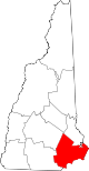
Towns Atkinson | Auburn | Brentwood | Candia | Chester | Danville | Deerfield | Derry | East Kingston | Epping | Exeter | Fremont | Greenland | Hampstead | Hampton | Hampton Falls | Kensington | Kingston | Londonderry | New Castle | Newfields | Newington | Newmarket | Newton | North Hampton | Northwood | Nottingham | Plaistow | Raymond | Rye | Salem | Sandown | Seabrook | South Hampton | Stratham | Windham
Villages Candia Four Corners | East Candia | East Derry | East Hampstead | Hampton Beach | Seabrook Beach
Categories:- National Register of Historic Places in New Hampshire by county
- Rockingham County, New Hampshire
-


Wikimedia Foundation. 2010.