- National Register of Historic Places listings in Posey County, Indiana
-
 Location of Posey County in Indiana
This is a list of the National Register of Historic Places listings in Posey County, Indiana.
This is intended to be a complete list of the properties and districts on the National Register of Historic Places in Posey County, Indiana, United States. Latitude and longitude coordinates are provided for many National Register properties and districts; these locations may be seen together in a Google map.[1]
There are 19 properties and districts listed on the National Register in the county, including 1 National Historic Landmark.
-
- This National Park Service list is complete through NPS recent listings posted November 10, 2011.[2]
Current listings
[3] Landmark name [4] Image Date listed Location City or town Summary 1 Ashworth Archaeological Site (12 Po 7) 
September 12, 1985 Eastern side of State Road 69, about 1 mile (1.6 km) north of Hovey Lake
37°51′0″N 87°56′10″W / 37.85°N 87.93611°W[5]Hovey Lake An archaeological site of the Caborn-Welborn variant of the Mississippian culture. 2 George Bentel House 
September 20, 1984 Brewery and Granary St.
38°07′50″N 87°55′59″W / 38.130694°N 87.933194°WNew Harmony 3 Bozeman-Waters National Bank 
October 1, 1987 19 W. Main St.
38°10′12″N 87°47′02″W / 38.17°N 87.783889°WPoseyville 4 James Elliott Farm 
December 23, 2003 Church St., State Road 66
38°07′44″N 87°55′23″W / 38.128889°N 87.923056°WNew Harmony 5 Ludwig Epple House 
June 21, 1984 520 Granary St.
38°07′50″N 87°56′03″W / 38.130694°N 87.934056°WNew Harmony 6 William Gonnerman House 
December 19, 1985 521 W. 2nd St.
37°55′44″N 87°54′02″W / 37.928889°N 87.900556°WMount Vernon 7 Frederick and Augusta Hagemann Farm 
March 18, 1993 Southwestern corner of the junction of State Roads 62 and 69
37°55′35″N 87°54′37″W / 37.926389°N 87.910278°WMount Vernon 8 Harmony Way Bridge 
October 3, 2007 Indiana State Road 66/Illinois Route 14
38°07′52″N 87°56′32″W / 38.131111°N 87.942222°WNew Harmony Extends into White County, Illinois 9 Hovey Lake Archaeological District 
September 12, 1985 Western side of State Road 69 on the western side of Hovey Lake
37°49′33″N 87°57′30″W / 37.82583°N 87.95833°W[6]Hovey Lake 10 I.O.O.F. and Barker Buildings 
September 12, 1985 402-406 Main St.
37°55′56″N 87°53′44″W / 37.932222°N 87.895556°WMount Vernon 11 Mann Site 
October 1, 1974 Off Indian Mound Rd.
37°54′44.5″N 87°50′20″W / 37.912361°N 87.83889°W[7]Mount Vernon A Hopewell site featuring village areas, geometrical earthworks and mounds. 12 Mount Vernon Downtown Historic District 
June 22, 2003 Roughly bounded by the Ohio River, 6th and Walnut Sts., and College Ave.
37°55′51″N 87°53′46″W / 37.930833°N 87.896111°WMount Vernon 13 Mount Vernon Site 
January 11, 1996 Atop a ridgeline about 100 metres (330 ft) south of County Road 850S, near the entrance to the Mount Vernon General Electric plant
37°54′48″N 87°56′23″W / 37.91333°N 87.93972°W[8]Mount Vernon 14 Murphy Archeological Site 
May 12, 1975 Northwestern side of Pitcher Lake, approximately 1 mile (1.6 km) east of the mouth of the Wabash River
37°48′25″N 88°0′5″W / 37.80694°N 88.00139°W[9]Mount Vernon 15 New Harmony Historic District 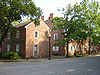
October 15, 1966 Main St. between Granary and Church Sts.; also roughly bounded by 3rd, Steammill, Main, Arthur, and North Sts., including the Maple Hill Cemetery and the Atheneum
38°07′48″N 87°56′08″W / 38.13°N 87.935556°WNew Harmony Second set of boundaries represents a boundary increase of May 3, 2000 16 Posey County Courthouse Square 
January 4, 1989 300 Main St.
37°55′56″N 87°53′39″W / 37.932222°N 87.894167°WMount Vernon 17 Mattias Scholle House 
March 2, 1981 Tavern and Brewery Sts.
38°07′45″N 87°55′59″W / 38.129167°N 87.933056°WNew Harmony 18 Amon Clarence Thomas House 
September 14, 1995 503 West St.
38°07′46″N 87°56′13″W / 38.129583°N 87.936944°WNew Harmony 19 Welborn Historic District 
March 25, 1992 Roughly bounded by 9th, Locust, and 2nd Sts., and the alley between Walnut and Main Sts.
37°56′03″N 87°53′38″W / 37.934167°N 87.893889°WMount Vernon See also
- List of National Historic Landmarks in Indiana
- National Register of Historic Places listings in Indiana
References
- ^ The latitude and longitude information provided in this table was derived originally from the National Register Information System, which has been found to be fairly accurate for about 99% of listings. For about 1% of NRIS original coordinates, experience has shown that one or both coordinates are typos or otherwise extremely far off; some corrections may have been made. A more subtle problem causes many locations to be off by up to 150 yards, depending on location in the country: most NRIS coordinates were derived from tracing out latitude and longitudes off of USGS topographical quadrant maps created under the North American Datum of 1927, which differs from the current, highly accurate WGS84 GPS system used by Google maps. Chicago is about right, but NRIS longitudes in Washington are higher by about 4.5 seconds, and are lower by about 2.0 seconds in Maine. Latitudes differ by about 1.0 second in Florida. Some locations in this table may have been corrected to current GPS standards.
- ^ "National Register of Historic Places: Weekly List Actions". National Park Service, United States Department of the Interior. Retrieved on November 10, 2011.
- ^ Numbers represent an ordering by significant words. Various colorings, defined here, differentiate National Historic Landmark sites and National Register of Historic Places Districts from other NRHP buildings, structures, sites or objects.
- ^ "National Register Information System". National Register of Historic Places. National Park Service. . http://nrhp.focus.nps.gov/natreg/docs/All_Data.html.
- ^ Location derived from Adams, William R. Archaeological Notes on Posey County Indiana. Indianapolis: Indiana Historical Bureau, 1949, 70. The NRIS lists the site as "Address Restricted".
- ^ Location derived from Hovey Lake, Indiana University Bloomington, n.d. Accessed 2011-07-06. The NRIS lists the site as "Address Restricted".
- ^ Location derived from Carr, Christopher, and D. Troy Case. Gathering Hopewell: Society, Ritual, and Ritual Interaction. Boston: Birkhäuser, 2005, 555. Accessed 2009-11-16. The NRIS lists the site as "Address Restricted"
- ^ Location derived from United States v. Gerber, 999 F.2d 1112-1117 (7th Cir. 1993), and from Munson, Cheryl Ann, et al. "The GE Mound: An ARPA Case Study". American Antiquity 60.1 (1995): 131-159, 147 and 157. The NRIS lists the site as "Address Restricted".
- ^ Location derived from Bone Bank Archaeological Research, Indiana University Department of Anthropology, 2001-08-06. Accessed 2011-07-28. The NRIS lists the site as "Address Restricted".
U.S. National Register of Historic Places Topics Lists by states Alabama • Alaska • Arizona • Arkansas • California • Colorado • Connecticut • Delaware • Florida • Georgia • Hawaii • Idaho • Illinois • Indiana • Iowa • Kansas • Kentucky • Louisiana • Maine • Maryland • Massachusetts • Michigan • Minnesota • Mississippi • Missouri • Montana • Nebraska • Nevada • New Hampshire • New Jersey • New Mexico • New York • North Carolina • North Dakota • Ohio • Oklahoma • Oregon • Pennsylvania • Rhode Island • South Carolina • South Dakota • Tennessee • Texas • Utah • Vermont • Virginia • Washington • West Virginia • Wisconsin • WyomingLists by territories Lists by associated states Other Municipalities and communities of Posey County, Indiana City 
Towns Townships Unincorporated
communitiesBlairsville | Caborn | Farmersville | Hovey | Savah | St Phillip | St Wendel | Stewartsville | Solitude | Upton | Wadesville | West Franklin
Categories:- Posey County, Indiana
- National Register of Historic Places in Indiana by county
- National Register of Historic Places in Posey County, Indiana
-


Wikimedia Foundation. 2010.