- National Register of Historic Places listings in Otero County, Colorado
-
 Location of Otero County in Colorado
This is a list of the National Register of Historic Places listings in Otero County, Colorado.
This is intended to be a complete list of the properties and districts on the National Register of Historic Places in Otero County, Colorado, United States. The locations of National Register properties and districts for which the latitude and longitude coordinates are included below, may be seen in a Google map.[1]
There are 15 properties and districts listed on the National Register in the county, including 1 National Historic Landmark.
-
- This National Park Service list is complete through NPS recent listings posted November 10, 2011.[2]
Current listings
[3] Landmark name [4] Image Date listed Location City or town Summary 1 Adobe Stables, Arkansas Valley Fairgrounds December 26, 2007 800 N. 9th St.
38°03′35″N 103°42′56″W / 38.059722°N 103.715556°WRocky Ford 2 Art Building September 27, 1996 Arkansas Valley Fairgrounds, near the junction of Main St. and U.S. Route 50
38°03′20″N 103°42′07″W / 38.055556°N 103.701944°WRocky Ford 3 Bent's Old Fort National Historic Site 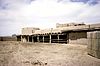
October 15, 1966 State Highway 194
38°02′37″N 103°25′53″W / 38.043611°N 103.431389°WLa Junta 4 Carnegie Public Library November 7, 1995 1005 Sycamore Ave.
38°02′59″N 103°43′07″W / 38.049722°N 103.718611°WRocky Ford 5 Dr. Frank Finney House May 17, 1984 608 Belleview Ave.
37°58′56″N 103°32′49″W / 37.982222°N 103.546944°WLa Junta 6 Wilson A. Hart House May 31, 1979 802 Raton Ave.
37°58′50″N 103°32′29″W / 37.980556°N 103.541389°WLa Junta 7 La Junta City Park April 24, 2007 Bounded by Colorado and Park Aves. and 10th and 14th Sts. La Junta 8 Lincoln School September 13, 1978 300 block of W. 3rd St.
37°59′10″N 103°32′50″W / 37.986111°N 103.547222°WLa Junta 9 North La Junta School June 25, 1992 Junction of State Highways 109 and 194
38°00′02″N 103°31′49″W / 38.000556°N 103.530278°WLa Junta 10 Rocky Ford Post Office January 16, 2008 401 9th St.
38°03′18″N 103°43′12″W / 38.055°N 103.72°WRocky Ford 11 Eugene Rourke House May 9, 1983 619 Carson St.
37°58′55″N 103°32′51″W / 37.981944°N 103.5475°WLa Junta 12 San Juan Avenue Historic District August 27, 1980 San Juan Ave.
37°58′59″N 103°32′42″W / 37.983056°N 103.545°WLa Junta 13 Santa Fe Railway Manzanola Depot April 28, 2004 212 N. Grand Ave.
38°06′35″N 103°51′59″W / 38.109722°N 103.866389°WManzanola 14 Daniel Sciumbato Grocery Store May 17, 1984 706 2nd St.
37°59′12″N 103°33′10″W / 37.986667°N 103.552778°WLa Junta 15 U.S. Post Office 
July 12, 1976 4th and Colorado Ave.
37°59′06″N 103°32′34″W / 37.985°N 103.542778°WLa Junta See also
- List of National Historic Landmarks in Colorado
- National Register of Historic Places listings in Colorado
References
- ^ The latitude and longitude information provided in this table was derived originally from the National Register Information System, which has been found to be fairly accurate for about 99% of listings. For about 1% of NRIS original coordinates, experience has shown that one or both coordinates are typos or otherwise extremely far off; some corrections may have been made. A more subtle problem causes many locations to be off by up to 150 yards, depending on location in the country: most NRIS coordinates were derived from tracing out latitude and longitudes off of USGS topographical quadrant maps created under the North American Datum of 1927, which differs from the current, highly accurate WGS84 GPS system used by Google maps. Chicago is about right, but NRIS longitudes in Washington are higher by about 4.5 seconds, and are lower by about 2.0 seconds in Maine. Latitudes differ by about 1.0 second in Florida. Some locations in this table may have been corrected to current GPS standards.
- ^ "National Register of Historic Places: Weekly List Actions". National Park Service, United States Department of the Interior. Retrieved on November 10, 2011.
- ^ Numbers represent an ordering by significant words. Various colorings, defined here, differentiate National Historic Landmark sites and National Register of Historic Places Districts from other NRHP buildings, structures, sites or objects.
- ^ "National Register Information System". National Register of Historic Places. National Park Service. . http://nrhp.focus.nps.gov/natreg/docs/All_Data.html.
U.S. National Register of Historic Places Topics Lists by states Alabama • Alaska • Arizona • Arkansas • California • Colorado • Connecticut • Delaware • Florida • Georgia • Hawaii • Idaho • Illinois • Indiana • Iowa • Kansas • Kentucky • Louisiana • Maine • Maryland • Massachusetts • Michigan • Minnesota • Mississippi • Missouri • Montana • Nebraska • Nevada • New Hampshire • New Jersey • New Mexico • New York • North Carolina • North Dakota • Ohio • Oklahoma • Oregon • Pennsylvania • Rhode Island • South Carolina • South Dakota • Tennessee • Texas • Utah • Vermont • Virginia • Washington • West Virginia • Wisconsin • WyomingLists by territories Lists by associated states Other Municipalities and communities of Otero County, Colorado Cities 
Towns Unincorporated
communityCategories:- National Register of Historic Places in Colorado by county
- Otero County, Colorado
- Buildings and structures in Otero County, Colorado
-


Wikimedia Foundation. 2010.