- National Register of Historic Places listings in Merrimack County, New Hampshire
-
 Location of Merrimack County in New Hampshire
This is a list of the National Register of Historic Places listings in Merrimack County, New Hampshire.
This is intended to be a complete list of the properties and districts on the National Register of Historic Places in Merrimack County, New Hampshire, United States. Latitude and longitude coordinates are provided for many National Register properties and districts; these locations may be seen together in a Google map.[1]
There are 87 properties and districts listed on the National Register in the county, including 2 National Historic Landmarks.
Contents: Counties in New Hampshire Belknap - Carroll - Cheshire - Coos - Grafton - Hillsborough - Merrimack - Rockingham - Strafford - Sullivan -
- This National Park Service list is complete through NPS recent listings posted November 10, 2011.[2]
Current listings
[3] Landmark name[4] Image Date listed Location City or Town Summary 1 2½ Beacon Street December 17, 1984 2½ Beacon St.
43°12′42″N 71°32′33″W / 43.21167°N 71.5425°WConcord 2 Allenstown Meeting House December 6, 2004 Deerfield Rd.
43°9′37″N 71°22′53″W / 43.16028°N 71.38139°WAllenstown 3 Baptist New Meeting House December 22, 2005 461 Main St.
43°24′53″N 71°58′48″W / 43.41472°N 71.98°WNew London 4 Bear Brook State Park Civilian Conservation Corps (CCC) Camp Historic District June 11, 1992 ½ mile from park entrance, 160 yd (150 m) south of Allenstown-Deerfield Rd., in Bear Brook State Park
43°9′29″N 71°22′44″W / 43.15806°N 71.37889°WAllenstown 5 Beaver Meadow Brook Archeological Site (27MR3) June 2, 1989 Address Restricted Concord 6 Bement Covered Bridge November 21, 1976 Center Rd.
43°15′51″N 71°57′13″W / 43.26417°N 71.95361°WBradford Over the Warner River 7 Bennett Farm September 14, 2002 11 Bennett Rd.
43°10′14″N 71°47′33″W / 43.17056°N 71.7925°WHenniker 8 Blossom Hill and Calvary Cemeteries December 15, 2010 N. State St.
43°13′19″N 71°33′13″W / 43.22194°N 71.55361°WConcord 9 Bog Bridge March 16, 1989 Off NH 11 over Pleasant Brook
43°25′49″N 71°52′11″W / 43.43028°N 71.86972°WAndover 10 Boscawen Academy and Much-I-Do-Hose House December 8, 1980 King St.
43°19′3″N 71°37′20″W / 43.3175°N 71.62222°WBoscawen 11 Boscawen Public Library May 28, 1981 King St.
43°19′9″N 71°37′31″W / 43.31917°N 71.62528°WBoscawen 12 Bradford Town Hall November 13, 1980 W. Main St.
43°16′9″N 71°57′42″W / 43.26917°N 71.96167°WBradford 13 H. Styles Bridges House December 22, 2005 21 Mountain Rd.
43°14′23″N 71°32′20″W / 43.23972°N 71.53889°WConcord 14 Canterbury Shaker Village 
June 17, 1975 4 mi (6.4 km) east of Canterbury on Shaker Rd.
43°21′32″N 71°29′24″W / 43.35889°N 71.49°WCanterbury One of the best-preserved Shaker villages. 15 Center Meetinghouse December 19, 1979 NH 103
43°19′16″N 72°2′8″W / 43.32111°N 72.03556°WNewbury 16 Chamberlin House 
August 16, 1982 44 Pleasant St.
43°12′12″N 71°32′19″W / 43.20333°N 71.53861°WConcord 17 Concord Civic District 
December 22, 1983 107 N. Main St., 25 Capitol St., 39-45 Green St., 20-30 Park St., and 33 N. State St.
43°12′24″N 71°32′22″W / 43.20667°N 71.53944°WConcord 18 Concord Historic District 
June 11, 1975 Roughly bounded by N. State St., Horse Shoe Pond, Boston and Maine railroad tracks, Sen. Styles Bridges Highway, and Church St.
43°12′57″N 71°32′30″W / 43.21583°N 71.54167°WConcord 19 Contoocook Railroad Depot March 16, 2006 868 Main St. in the village of Contoocook
43°13′21″N 71°42′47″W / 43.2225°N 71.71306°WHopkinton 20 Henry J. Crippen House December 22, 1983 189-191 N. Main St.
43°12′45″N 71°32′26″W / 43.2125°N 71.54056°WConcord 21 Dalton Covered Bridge 
November 21, 1976 Joppa Rd.
43°16′36″N 71°48′43″W / 43.27667°N 71.81194°WWarner Over the Warner River 22 Dimond Hill Farm March 15, 2007 314 Hopkinton Rd.
43°11′28″N 71°37′3″W / 43.19111°N 71.6175°WConcord 23 Lewis Downing, Jr. House 
September 11, 1987 33 Pleasant St.
43°12′10″N 71°32′18″W / 43.20278°N 71.53833°WConcord 24 Downtown Concord Historic District 
June 9, 2000 Roughly bounded by Center St., Loudon Rd., Storrs St., Hills Ave., and S. State, Green, School, Capitol, and Park Sts.
43°12′19″N 71°32′15″W / 43.20528°N 71.5375°WConcord 25 Gershom Durgin House December 1, 2000 391 Franklin Highway
43°26′34″N 71°46′14″W / 43.44278°N 71.77056°WAndover 26 Eagle Hotel 
September 20, 1978 110 N. Main St.
43°12′25″N 71°32′12″W / 43.20694°N 71.53667°WConcord 27 East Andover Village Center Historic District 
March 16, 1989 Village of East Andover, junction of NH 11 and Chase Hill Rd.
43°27′34″N 71°44′51″W / 43.45944°N 71.7475°WAndover 28 Endicott Hotel 
May 29, 1987 1-3 S. Main St.
43°12′14″N 71°32′9″W / 43.20389°N 71.53583°WConcord 29 Farrington House 
March 9, 1982 30 S. Main St.
43°12′11″N 71°32′9″W / 43.20306°N 71.53583°WConcord 30 First Congregational Church of Boscawen April 19, 1982 King St.
43°19′19″N 71°37′45″W / 43.32194°N 71.62917°WBoscawen 31 Reuben Foster House and Cleaves March 15, 1982 64 and 62 N. State St.
43°12′35″N 71°32′27″W / 43.20972°N 71.54083°WConcord 32 Franklin Falls Historic District August 19, 1982 Roughly bounded by Bow, River, and School Sts., Ayles Ct., and the Winnipesaukee River
43°26′39″N 71°38′57″W / 43.44417°N 71.64917°WFranklin 33 Hall Memorial Library 
October 4, 1978 Park St.
43°26′30″N 71°35′36″W / 43.44167°N 71.59333°WNorthfield 34 Charles S. Hall House June 13, 2002 1740 Dover Rd.
43°13′32″N 71°20′48″W / 43.22556°N 71.34667°WEpsom 35 Matthew Harvey House September 4, 1992 Western side of Harvey Rd., 0.25 mi (0.40 km) north of its junction with Keyser St.
43°22′22″N 71°57′22″W / 43.37278°N 71.95611°WSutton 36 Hay Estate 
November 2, 2000 NH 103A, 2.2 mi (3.5 km) north of its junction with NH 103
43°21′0″N 72°2′43″W / 43.35°N 72.04528°WNewbury Former summer home of American statesman John Hay 37 Henniker Town Hall 
February 24, 1981 Depot Hill Rd.
43°10′32″N 71°49′23″W / 43.17556°N 71.82306°WHenniker 38 Hersey Farms Historic District June 30, 2008 1057 and 1088 Franklin Highway
43°28′16″N 71°43′50.89″W / 43.47111°N 71.7308028°WAndover 39 Hill Center Church September 12, 1985 Hill Center Rd.
43°31′23″N 71°42′4″W / 43.52306°N 71.70111°WHill 40 Hopkinton Railroad Covered Bridge 
January 11, 1980 Off NH 103 and NH 127
43°13′23″N 71°42′51″W / 43.22306°N 71.71417°WHopkinton Over Contoocook River in village of Contoocook 41 Howe-Quimby House June 27, 1980 Southwest of Hopkinton on Sugar Hill Rd.
43°9′29″N 71°42′3″W / 43.15806°N 71.70083°WHopkinton 42 Keniston Bridge March 16, 1989 Bridge Rd. over the Blackwater River
43°26′6″N 71°50′12″W / 43.435°N 71.83667°WAndover 43 Leavitt Farm March 11, 1982 103 Old Loudon Rd.
43°13′56″N 71°28′52″W / 43.23222°N 71.48111°WConcord 44 William H. Long Memorial July 15, 1977 Main St.
43°11′27″N 71°40′19″W / 43.19083°N 71.67194°WHopkinton 45 Loudon Town Hall 
September 5, 1990 Junction of Clough Hill and Youngs Hill Rds.
43°19′57″N 71°25′51″W / 43.3325°N 71.43083°WLoudon 46 Lower Warner Meetinghouse 
May 25, 1989 NH 103
43°16′28″N 71°47′57″W / 43.27444°N 71.79917°WWarner 47 Memorial Arch of Tilton 
May 19, 1980 Elm St.
43°26′23″N 71°35′17″W / 43.43972°N 71.58806°WNorthfield 48 Merrimack County Bank February 28, 1980 214 N. Main St.
43°12′41″N 71°32′20″W / 43.21139°N 71.53889°WConcord 49 Merrimack County Courthouse 
November 27, 1979 163 N. Main St.
43°12′35″N 71°32′20″W / 43.20972°N 71.53889°WConcord 50 Millville School November 7, 1985 2 Fisk Rd.
43°11′50″N 71°34′28″W / 43.19722°N 71.57444°WConcord 51 Morrill-Lassonde House March 15, 1984 East of King St.
43°18′26″N 71°36′49″W / 43.30722°N 71.61361°WBoscawen 52 Murray Hill Summer Home District March 17, 1988 Murray Hill Rd. roughly between Cass Mill and Lynch Rds.
43°32′24″N 71°47′46″W / 43.54°N 71.79611°WHill 53 New Hampshire Savings Bank Building 
June 14, 1988 97 N. Main St.
43°12′24″N 71°32′14″W / 43.20667°N 71.53722°WConcord 54 Northfield Union Church 
March 15, 1984 Sondogardy Pond Rd.
43°22′14″N 71°36′58″W / 43.37056°N 71.61611°WNorthfield 55 Jacob Noyes Block February 27, 1986 48 Glass St.
43°7′50″N 71°27′6″W / 43.13056°N 71.45167°WSuncook 56 Old North Cemetery November 9, 2008 North State St.
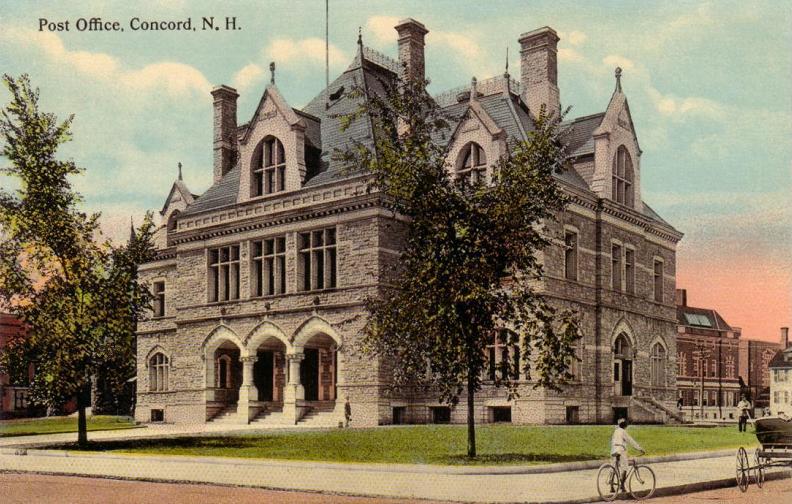
43°12′53.23″N 71°32′39.85″W / 43.2147861°N 71.5444028°WConcord 57 Old Post Office 
August 13, 1973 N. State St., between Capitol and Park St.
43°12′23″N 71°32′24″W / 43.20639°N 71.54°WConcord 58 Old Webster Meeting House March 7, 1985 Off NH 127 on Battle St.
43°19′47″N 71°43′3″W / 43.32972°N 71.7175°WWebster 59 Page Belting Company Mills June 14, 2002 26 Commercial St.
43°13′1″N 71°32′21″W / 43.21694°N 71.53917°WConcord 60 Pembroke Mill September 12, 1985 100 Main St.
43°7′49″N 71°27′18″W / 43.13028°N 71.455°WPembroke 61 Franklin Pierce House 
October 15, 1979 52 S. Main St.
43°12′1″N 71°32′3″W / 43.20028°N 71.53417°WConcord Site of home of President Franklin Pierce, 1856-1869. Not to be confused with Pierce Manse at 14 Horseshoe Pond Lane, Pierce's home from 1842-1848. 62 Pillsbury Memorial Hall March 4, 1993 93 Main St.
43°20′2″N 71°57′13″W / 43.33389°N 71.95361°WSutton 63 Pineground Bridge March 10, 2004 0.15 mi (0.24 km) east of NH 28 on Depot Rd.
43°15′26″N 71°22′12″W / 43.25722°N 71.37°WChichester Over Suncook River 64 Pittsfield Center Historic District December 12, 1980 NH 28 and NH 107
43°18′18″N 71°19′34″W / 43.305°N 71.32611°WPittsfield 65 Pleasant View Home 
September 19, 1984 227 Pleasant St.
43°11′42″N 71°33′31″W / 43.195°N 71.55861°WConcord 66 Potter Place Railroad Station 
March 16, 1989 Depot St.
43°26′18″N 71°51′22″W / 43.43833°N 71.85611°WAndover 67 Robie's Country Store 
August 31, 2000 8 Riverside St.
43°5′52″N 71°27′59″W / 43.09778°N 71.46639°WHooksett 68 Rolfe Barn March 15, 2007 16 Penacook St.
43°17′0″N 71°35′23″W / 43.283333°N 71.58972°WConcord 69 Gov. Frank West Rollins House March 15, 1984 135 N. State St.
43°12′54″N 71°32′36″W / 43.215°N 71.54333°WConcord 70 Rowell's Covered Bridge November 21, 1976 Clement Hill Rd.
43°11′33″N 71°44′54″W / 43.1925°N 71.74833°WWest Hopkinton Over Contoocook River 71 Salisbury Academy Building May 30, 1975 Junction of NH 127 and U.S. Route 4
43°22′47″N 71°42′52″W / 43.37972°N 71.71444°WSalisbury 72 Sanbornton Square Historic District December 8, 1980 Sanbornton Square
43°29′16″N 71°36′59″W / 43.48778°N 71.61639°WSanbornton 73 South Danbury Christian Church June 6, 1985 U.S. Route 4
43°28′58″N 71°53′12″W / 43.48278°N 71.88667°WDanbury 74 South Sutton Meeting House May 27, 1993 17 Meeting House Hill Rd.
43°19′14″N 71°56′7″W / 43.32056°N 71.93528°WSouth Sutton 75 Stanley Tavern September 7, 2005 371 Main St.
43°11′29″N 71°40′27″W / 43.19139°N 71.67417°WHopkinton 76 Sulphite Railroad Bridge 
June 11, 1975 Off US 3 over the Winnipesaukee River
43°26′43″N 71°38′10″W / 43.44528°N 71.63611°WFranklin 77 Suncook Village Commercial-Civic Historic District 
March 15, 2005 1 and 9-15 Glass St., 116-161 Main St., 19 Mill Falls, and 4 Union St. in the village of Suncook
43°7′52″N 71°27′12″W / 43.13111°N 71.45333°WPembroke 78 Tucker Mountain Schoolhouse March 18, 2005 Address Restricted Andover 79 Donald D. Tuttle House August 31, 1995 257 Pleasant St. (now 12 Gabby Lane)
43°10′34″N 71°32′13″W / 43.17611°N 71.53694°WConcord Moved to Gabby Lane in Concord in 2009 to make way for the Langley Parkway.[5] 80 Upham-Walker House 
May 15, 1980 18 Park St.
43°12′26″N 71°32′20″W / 43.20722°N 71.53889°WConcord 81 Waterloo Covered Bridge 
November 21, 1976 Newmarket Rd.
43°17′16″N 71°51′27″W / 43.28778°N 71.8575°WWaterloo Over the Warner River 82 Waterloo Historic District 
September 13, 2003 78-183 Waterloo St., 12 and 68 Newmarket Rd., 4 Willoughby-Colby Rd., Bean Road Cemetery
43°17′19″N 71°51′15″W / 43.28861°N 71.85417°WWarner 83 Webster Congregational Church March 7, 1985 Off NH 127 on Long St.
43°19′48″N 71°43′0″W / 43.33°N 71.716667°WWebster 84 Daniel Webster Family Home May 30, 1974 S. Main St.
43°24′24″N 71°39′6″W / 43.40667°N 71.65167°WWest Franklin Farm owned by family of Daniel Webster. 85 Dr. Solomon M. Whipple House September 12, 1985 Main St.
43°24′48″N 71°59′5″W / 43.41333°N 71.98472°WNew London 86 White Farm May 15, 1981 144 Clinton St.
43°11′19″N 71°33′37″W / 43.18861°N 71.56028°WConcord 87 White Park November 9, 1982 Bounded by Washington, Centre, High, Beacon, and White Sts.
43°12′23″N 71°32′53″W / 43.20639°N 71.54806°WConcord See also
- List of National Historic Landmarks in New Hampshire
- National Register of Historic Places listings in New Hampshire
References
- ^ The latitude and longitude information provided in this table was derived originally from the National Register Information System, which has been found to be fairly accurate for about 99% of listings. For about 1% of NRIS original coordinates, experience has shown that one or both coordinates are typos or otherwise extremely far off; some corrections may have been made. A more subtle problem causes many locations to be off by up to 150 yards, depending on location in the country: most NRIS coordinates were derived from tracing out latitude and longitudes off of USGS topographical quadrant maps created under North American Datum of 1927, which differs from the current, highly accurate GPS system used by Google maps. Chicago is about right, but NRIS longitudes in Washington are higher by about 4.5 seconds, and are lower by about 2.0 seconds in Maine. Latitudes differ by about 1.0 second in Florida. Some locations in this table may have been corrected to current GPS standards.
- ^ "National Register of Historic Places: Weekly List Actions". National Park Service, United States Department of the Interior. Retrieved on November 10, 2011.
- ^ Numbers represent an ordering by significant words. Various colorings, defined here, differentiate National Historic Landmark sites and National Register of Historic Places Districts from other NRHP buildings, structures, sites or objects.
- ^ "National Register Information System". National Register of Historic Places. National Park Service. 2008-04-24. http://nrhp.focus.nps.gov/natreg/docs/All_Data.html.
- ^ http://www.concordmonitor.com/article/keepers-of-the-tuttle-house?CSAuthResp=1311748254%3A0c77vkoraa8m0g0oqi33vq5kd4%3ACSUserId%7CCSGroupId%3Aapproved%3A2786F1B794D98D03FCF51EEDD48BBA4E&CSUserId=94&CSGroupId=1
U.S. National Register of Historic Places Topics Lists by states Alabama • Alaska • Arizona • Arkansas • California • Colorado • Connecticut • Delaware • Florida • Georgia • Hawaii • Idaho • Illinois • Indiana • Iowa • Kansas • Kentucky • Louisiana • Maine • Maryland • Massachusetts • Michigan • Minnesota • Mississippi • Missouri • Montana • Nebraska • Nevada • New Hampshire • New Jersey • New Mexico • New York • North Carolina • North Dakota • Ohio • Oklahoma • Oregon • Pennsylvania • Rhode Island • South Carolina • South Dakota • Tennessee • Texas • Utah • Vermont • Virginia • Washington • West Virginia • Wisconsin • WyomingLists by territories Lists by associated states Other  Category:National Register of Historic Places •
  Portal:National Register of Historic Places
Municipalities and communities of Merrimack County, New Hampshire County seat: Concord Cities 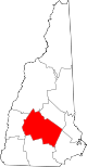
Towns Allenstown | Andover | Boscawen | Bow | Bradford | Canterbury | Chichester | Danbury | Dunbarton | Epsom | Henniker | Hill | Hooksett | Hopkinton | Loudon | New London | Newbury | Northfield | Pembroke | Pittsfield | Salisbury | Sutton | Warner | Webster | Wilmot
Villages Blodgett Landing | Contoocook | East Andover | Elkins | Penacook | South Hooksett | Suncook | Tilton-Northfield‡
Footnotes ‡This populated place also has portions in an adjacent county or counties
Categories:- National Register of Historic Places in New Hampshire by county
- Merrimack County, New Hampshire
-


Wikimedia Foundation. 2010.