- National Register of Historic Places listings in Marlboro County, South Carolina
-
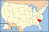
 Location of Marlboro County in South Carolina
This is a list of the National Register of Historic Places listings in Marlboro County, South Carolina.
This is intended to be a complete list of the properties and districts on the National Register of Historic Places in Marlboro County, South Carolina, United States. The locations of National Register properties and districts for which the latitude and longitude coordinates are included below, may be seen in a Google map.[1]
There are 9 properties and districts listed on the National Register in the county.
-
- This National Park Service list is complete through NPS recent listings posted November 10, 2011.[2]
Current listings
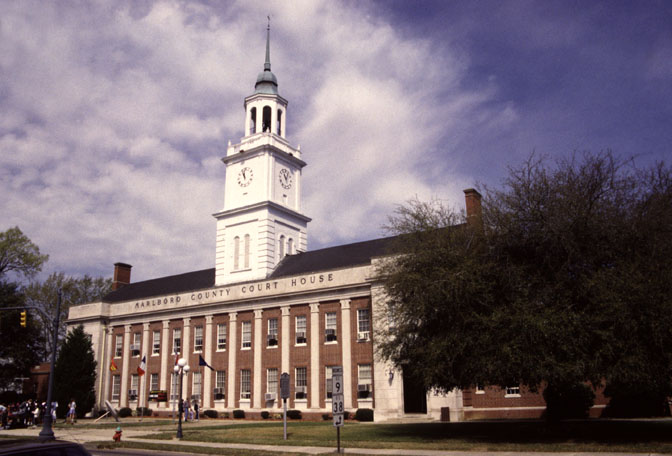
[3] Landmark name [4] Image Date listed Location City or town Summary 1 Appin June 28, 1982 U.S. Route 15; also U.S. Routes 15/401, W., approximately 1 mile southwest of Bennettsville
34°36′18″N 79°43′03″W / 34.605°N 79.7175°WBennettsville Second set of boundaries represents a boundary increase of October 3, 2007 2 Bennettsville Historic District 
April 20, 1978 Irregular pattern along Main St. from Everett to Lindsey and from Parsonage to Murchison; also Clyde St. between Main and Market Sts.
34°36′58″N 79°40′53″W / 34.616111°N 79.681389°WBennettsville Second set of boundaries represents a boundary increase of June 3, 1993 3 Clio Historic District July 16, 1979 South Carolina Highways 9 and 381
34°34′45″N 79°32′49″W / 34.579167°N 79.546944°WClio 4 Jennings-Brown House February 23, 1972 121 S. Marlboro St.
34°36′05″N 79°40′55″W / 34.601389°N 79.681944°WBennettsville 5 Magnolia March 14, 1973 508 E. Main St.
34°37′11″N 79°40′38″W / 34.619683°N 79.677213°WBennettsville 6 Manship Farmstead June 4, 1997 2601 Manship Rd.
34°39′31″N 79°35′46″W / 34.658611°N 79.596111°WTatum 7 McLaurin House March 24, 1978 East of Clio on South Carolina Highway 40
34°35′00″N 79°31′58″W / 34.583333°N 79.532778°WClio 8 Pegues Place January 25, 1971 North of Wallace, off U.S. Route 1
34°48′02″N 79°54′40″W / 34.800556°N 79.911111°WWallace 9 Robertson-Easterling-McLaurin House April 5, 1984 West of Bennettsville off South Carolina Highway 912
34°40′33″N 79°45′22″W / 34.675833°N 79.756111°WBennettsville See also
- List of National Historic Landmarks in South Carolina
- National Register of Historic Places listings in South Carolina
References
- ^ The latitude and longitude information provided in this table was derived originally from the National Register Information System, which has been found to be fairly accurate for about 99% of listings. For about 1% of NRIS original coordinates, experience has shown that one or both coordinates are typos or otherwise extremely far off; some corrections may have been made. A more subtle problem causes many locations to be off by up to 150 yards, depending on location in the country: most NRIS coordinates were derived from tracing out latitude and longitudes off of USGS topographical quadrant maps created under the North American Datum of 1927, which differs from the current, highly accurate WGS84 GPS system used by Google maps. Chicago is about right, but NRIS longitudes in Washington are higher by about 4.5 seconds, and are lower by about 2.0 seconds in Maine. Latitudes differ by about 1.0 second in Florida. Some locations in this table may have been corrected to current GPS standards.
- ^ "National Register of Historic Places: Weekly List Actions". National Park Service, United States Department of the Interior. Retrieved on November 10, 2011.
- ^ Numbers represent an ordering by significant words. Various colorings, defined here, differentiate National Historic Landmark sites and National Register of Historic Places Districts from other NRHP buildings, structures, sites or objects.
- ^ "National Register Information System". National Register of Historic Places. National Park Service. . http://nrhp.focus.nps.gov/natreg/docs/All_Data.html.
U.S. National Register of Historic Places in South Carolina Lists by county Abbeville • Aiken • Allendale • Anderson • Bamberg • Barnwell • Beaufort • Berkeley • Calhoun • Charleston • Cherokee • Chester • Chesterfield • Clarendon • Colleton • Darlington • Dillon • Dorchester • Edgefield • Fairfield • Florence • Georgetown • Greenville • Greenwood • Hampton • Horry • Jasper • Kershaw • Lancaster • Laurens • Lee • Lexington • Marion • Marlboro • McCormick • Newberry • Oconee • Orangeburg • Pickens • Richland • Saluda • Spartanburg • Sumter • Union • Williamsburg • York
Lists by city Other lists Municipalities and communities of Marlboro County, South Carolina City 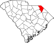
Towns Unincorporated
communityWallace
Categories:- Marlboro County, South Carolina
- National Register of Historic Places in South Carolina by county
-


Wikimedia Foundation. 2010.