- National Register of Historic Places listings in Grafton County, New Hampshire
-
 Location of Grafton County in New Hampshire
This is a list of the National Register of Historic Places listings in Grafton County, New Hampshire.
This is intended to be a complete list of the properties and districts on the National Register of Historic Places in Grafton County, New Hampshire, United States. Latitude and longitude coordinates are provided for many National Register properties and districts; these locations may be seen together in a Google map.[1]
There are 60 properties and districts listed on the National Register in the county.
Contents: Counties in New Hampshire Belknap - Carroll - Cheshire - Coos - Grafton - Hillsborough - Merrimack - Rockingham - Strafford - Sullivan -
- This National Park Service list is complete through NPS recent listings posted November 10, 2011.[2]
Current listings
[3] Landmark name [4] Image Date listed Location City or town Summary 1 Ashland Gristmill and Dam December 10, 1979 Main St.
43°41′44″N 71°37′51″W / 43.695556°N 71.630833°WAshland On the Squam River 2 Ashland Junior High School April 8, 1983 12 School St.
43°41′50″N 71°38′06″W / 43.697222°N 71.635°WAshland 3 Ashland Railroad Station November 10, 1982 39 Depot St.
43°41′26″N 71°38′04″W / 43.690556°N 71.634444°WAshland 4 Ashland Town Hall March 24, 1983 10 Highland St.
43°41′48″N 71°37′57″W / 43.696667°N 71.6325°WAshland 5 Bath Covered Bridge 
September 1, 1976 Off U.S. Route 302/NH 10
44°10′01″N 71°58′03″W / 44.166944°N 71.9675°WBath Over Ammonoosuc River 6 Bedell Covered Bridge 
May 28, 1975 Crossed the Connecticut River between Haverhill and Newbury
44°02′42″N 72°04′27″W / 44.045°N 72.074167°WHaverhill 7 Brick Store 
November 7, 1985 Main St.
44°10′00″N 71°58′00″W / 44.166667°N 71.966667°WBath 8 Burt-Cheney Farm March 25, 1982 U.S. Route 302
44°17′33″N 71°45′24″W / 44.2925°N 71.756667°WBethlehem 9 Canaan Meetinghouse March 24, 1972 Canaan St.
43°39′52″N 72°02′37″W / 43.664444°N 72.043611°WCanaan 10 Canaan Street Historic District 
May 7, 1973 Canaan St.
43°39′56″N 72°02′32″W / 43.665556°N 72.042222°WCanaan 11 Daniel Carr House March 27, 1992 Northern side of Brier Hill Rd., 1.5 mi (2.4 km) from its junction with NH 10
44°06′32″N 72°00′11″W / 44.108889°N 72.003056°WHaverhill 12 Central Square Historic District 
March 24, 1983 2-27 Central Square, 1 Summer St., 1-3 N. Main St., and 2 S. Main St.
43°35′29″N 71°44′11″W / 43.591389°N 71.736389°WBristol 13 Centre Village Meeting House 
June 6, 1985 NH 4A
43°35′24″N 72°06′38″W / 43.59°N 72.110556°WEnfield 14 Chapel of the Holy Cross September 7, 2005 45 Chapel Ln.
43°45′31″N 71°40′31″W / 43.758611°N 71.675278°WHolderness 15 Colburn Park Historic District January 10, 1986 N., S., E., and W. Park Sts., 3 Campbell St., 1 School St., 1 Bank St., and 9-10 Lebanon Mall
43°38′31″N 72°15′08″W / 43.641944°N 72.252222°WLebanon 16 Dorchester Common Historic District March 7, 1985 Roughly bounded by N. Dorchester 2-mile (3.2 km) northwest of its intersection with NH 118
43°45′25″N 71°56′59″W / 43.756944°N 71.949722°WDorchester 17 Dorchester Community Church November 25, 1980 Off NH 118
43°45′25″N 71°57′01″W / 43.756944°N 71.950278°WDorchester 18 Dow Academy August 31, 1982 Dow Ave.
44°13′32″N 71°44′53″W / 44.225556°N 71.748056°WFranconia 19 Enfield Shaker Historic District 
November 7, 1979 NH 4A
43°37′13″N 72°08′49″W / 43.620278°N 72.146944°WEnfield 20 Enfield Village Historic District April 19, 2010 Main St, U.S. Route 4, High St, Balti St, Shaker Hill Rd, Wells St, Stevens, Union, & Pillsbury Sts, Shedd & Mill St.
43°38′31″N 72°08′42″W / 43.641917°N 72.145078°WEnfield 21 Felsengarten June 18, 1973 Southwest of Bethlehem on Lewis Hill Rd.
44°15′20″N 71°42′20″W / 44.255556°N 71.705556°WBethlehem 22 First Free Will Baptist Church and Vestry April 8, 1983 13-15 N. Main St.
43°41′42″N 71°37′59″W / 43.695°N 71.633056°WAshland 23 Frost Place 
November 30, 1976 South of Franconia off NH 116 on Ridge Rd.
44°12′46″N 71°45′27″W / 44.212778°N 71.7575°WFranconia 24 Goodall-Woods Law Office August 26, 1980 Northeast of Bath on U.S. Route 302
44°10′35″N 71°56′40″W / 44.176389°N 71.944444°WBath 25 Great Hollow Road Stone Arch Bridge May 12, 1997 Great Hollow Rd. over Mink Brook, approximately 100 ft (30 m) north of its junction with Smith Ln.
43°41′13″N 72°14′00″W / 43.686944°N 72.233333°WHanover 26 Abbie Greenleaf Library June 13, 2003 439 Main St.
44°13′39″N 71°44′38″W / 44.2275°N 71.743889°WFranconia 27 Hanover Town Library April 25, 1997 130 Etna Rd.
43°41′41″N 72°13′06″W / 43.694722°N 72.218333°WHanover 28 Haverhill Corner Historic District August 27, 1987 NH 10 from N. Piermont to its bisection of NH 25 and Court St.
44°01′53″N 72°03′51″W / 44.031389°N 72.064167°WHaverhill 29 Haverhill-Bath Covered Bridge 
April 18, 1977 NH 135
44°09′16″N 72°02′12″W / 44.154444°N 72.036667°WWoodsville Over the Ammonoosuc River 30 Hebron Village Historic District March 7, 1985 Roughly bounded by the Hebron Village Cemetery, N. and W. Shore Rds., and Hobart Hill and Groton Rds.
43°41′38″N 71°48′21″W / 43.693889°N 71.805833°WHebron 31 Hewitt House November 7, 1985 U.S. Route 4
43°38′10″N 72°08′35″W / 43.636111°N 72.143056°WEnfield 32 Holderness Free Library March 7, 1985 Junction of U.S. Route 3 and NH 113
43°43′55″N 71°35′18″W / 43.731944°N 71.588333°WHolderness 33 Holderness Inn December 13, 1984 U.S. Route 3
43°43′53″N 71°35′24″W / 43.731389°N 71.59°WHolderness 34 Jeremiah Hutchins Tavern September 7, 1984 Northeast of Bath on U.S. Route 302
44°10′41″N 71°56′40″W / 44.178056°N 71.944444°WBath 35 Moses Kent House June 7, 1984 Address Restricted Lyme 36 Edward H. Lane House December 8, 1980 16 Cottage St.
44°18′18″N 71°46′03″W / 44.305°N 71.7675°WLittleton 37 Lisbon Inn December 1, 1980 Main St.
44°12′47″N 71°54′46″W / 44.213056°N 71.912778°WLisbon 38 Littleton Town Building 
May 7, 1973 1 Union St.
44°18′21″N 71°46′12″W / 44.305833°N 71.77°WLittleton 39 Lovett's by Lafayette Brook March 11, 1982 South of Franconia on Profile Rd.
44°12′16″N 71°43′25″W / 44.204444°N 71.723611°WFranconia 40 Lyme Center Historic District March 31, 1987 34-55 Dorchester Rd.
43°47′58″N 72°07′35″W / 43.799444°N 72.126389°WLyme Center 41 Lyme Common Historic District September 1, 1988 Dorchester Rd., John Tomson Way, On the Common; Pleasant and Union Sts., E. Thetford Rd., Main and Market Sts.
43°48′40″N 72°09′28″W / 43.811111°N 72.157778°WLyme 42 North Holderness Freewill Baptist Church-Holderness Historical Society Building September 4, 1986 Owl Brook Rd.
43°44′58″N 71°36′57″W / 43.749444°N 71.615833°WHolderness 43 Old Grafton County Courthouse April 29, 1982 1 Court St.
43°45′29″N 71°41′21″W / 43.758056°N 71.689167°WPlymouth 44 Orford Street Historic District 
August 26, 1977 Orford St. (NH 10) from NH 25A to Archertown Rd., including the cemetery to the east
43°54′16″N 72°08′07″W / 43.904444°N 72.135278°WOrford 45 Piermont Bridge June 6, 2001 NH 25 over the Connecticut River at the Vermont state line
43°58′40″N 72°06′45″W / 43.977778°N 72.1125°WPiermont 46 Plymouth Historic District March 14, 1986 Bounded by Court, Main, and Highland Sts.
43°45′26″N 71°41′17″W / 43.757222°N 71.688056°WPlymouth 47 Rocks Estate September 7, 1984 West of Bethlehem on U.S. Route 302
44°16′52″N 71°44′03″W / 44.281111°N 71.734167°WBethlehem 48 The Samuel Morey Memorial Bridge December 8, 1997 NH 25A over the Connecticut River
43°54′25″N 72°08′23″W / 43.906944°N 72.139722°WOrford 49 Sawyer-Medlicott House December 6, 1991 Junction of Bradford and River Rds.
43°58′40″N 72°06′21″W / 43.977778°N 72.105833°WPiermont 50 Sphinx Tomb 
March 17, 2005 Northeastern corner of the junction of E. Wheelock St. and Observatory Rd.
43°42′12.852″N 72°17′6.468″W / 43.70357°N 72.28513°W[5]Hanover 51 Spring Hill Farm June 13, 2002 263 Meriden Rd.
43°37′30″N 72°13′31″W / 43.625°N 72.225278°WLebanon 52 St. Mark's Episcopal Church December 13, 1984 6-8 Highland St.
43°41′48″N 71°37′57″W / 43.696667°N 71.6325°WAshland 53 Stone Arch Underpass September 12, 1985 Glen Rd.
43°38′03″N 72°18′21″W / 43.634167°N 72.305833°WLebanon 54 Swiftwater Covered Bridge 
November 21, 1976 South of Bath on Valley Rd.
44°08′03″N 71°57′05″W / 44.134167°N 71.951389°WBath Over the Wild Ammonoosuc River 55 Thayer's Hotel March 9, 1982 136 Main St.
44°18′23″N 71°46′28″W / 44.306389°N 71.774444°WLittleton 56 Trinity Church September 7, 1984 East of Plymouth on NH 175
43°45′24″N 71°40′11″W / 43.756667°N 71.669722°WHolderness 57 U.S. Post Office and Courthouse-Littleton Main 
July 17, 1986 165 Main St.
44°18′26″N 71°46′30″W / 44.307222°N 71.775°WLittleton 58 Webster Estate June 9, 1989 NH 113
43°45′35″N 71°33′31″W / 43.759722°N 71.558611°WHolderness 59 Whipple House December 13, 1978 4 Pleasant St.
43°41′42″N 71°37′57″W / 43.695°N 71.6325°WAshland 60 Woodsville Opera Building 
May 15, 1980 67 Central St.
44°09′08″N 72°02′18″W / 44.152222°N 72.038333°WWoodsville See also
- List of National Historic Landmarks in New Hampshire
- National Register of Historic Places listings in New Hampshire
References
- ^ The latitude and longitude information provided in this table was derived originally from the National Register Information System, which has been found to be fairly accurate for about 99% of listings. For about 1% of NRIS original coordinates, experience has shown that one or both coordinates are typos or otherwise extremely far off; some corrections may have been made. A more subtle problem causes many locations to be off by up to 150 yards, depending on location in the country: most NRIS coordinates were derived from tracing out latitude and longitudes off of USGS topographical quadrant maps created under the North American Datum of 1927, which differs from the current, highly accurate WGS84 GPS system used by Google maps. Chicago is about right, but NRIS longitudes in Washington are higher by about 4.5 seconds, and are lower by about 2.0 seconds in Maine. Latitudes differ by about 1.0 second in Florida. Some locations in this table may have been corrected to current GPS standards.
- ^ "National Register of Historic Places: Weekly List Actions". National Park Service, United States Department of the Interior. Retrieved on November 10, 2011.
- ^ Numbers represent an ordering by significant words. Various colorings, defined here, differentiate National Historic Landmark sites and National Register of Historic Places Districts from other NRHP buildings, structures, sites or objects.
- ^ "National Register Information System". National Register of Historic Places. National Park Service. . http://nrhp.focus.nps.gov/natreg/docs/All_Data.html.
- ^ While the NRIS lists the Sphinx as "address restricted", this Dartmouth College map shows its location clearly
U.S. National Register of Historic Places Topics Lists by states Alabama • Alaska • Arizona • Arkansas • California • Colorado • Connecticut • Delaware • Florida • Georgia • Hawaii • Idaho • Illinois • Indiana • Iowa • Kansas • Kentucky • Louisiana • Maine • Maryland • Massachusetts • Michigan • Minnesota • Mississippi • Missouri • Montana • Nebraska • Nevada • New Hampshire • New Jersey • New Mexico • New York • North Carolina • North Dakota • Ohio • Oklahoma • Oregon • Pennsylvania • Rhode Island • South Carolina • South Dakota • Tennessee • Texas • Utah • Vermont • Virginia • Washington • West Virginia • Wisconsin • WyomingLists by territories Lists by associated states Other Municipalities and communities of Grafton County, New Hampshire City 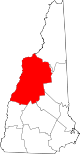
Towns Alexandria | Ashland | Bath | Benton | Bethlehem | Bridgewater | Bristol | Campton | Canaan | Dorchester | Easton | Ellsworth | Enfield | Franconia | Grafton | Groton | Hanover | Haverhill | Hebron | Holderness | Landaff | Lincoln | Lisbon | Littleton | Lyman | Lyme | Monroe | Orange | Orford | Piermont | Plymouth | Rumney | Sugar Hill | Thornton | Warren | Waterville Valley | Wentworth | Woodstock
Township Villages East Hebron | Enfield Center | Etna | Glencliff | Lyme Center | Montcalm | Mountain Lakes | North Woodstock | Pike | West Lebanon | Woodsville
Categories:- National Register of Historic Places in New Hampshire by county
- Grafton County, New Hampshire
-


Wikimedia Foundation. 2010.