- National Register of Historic Places listings in Daggett County, Utah
-
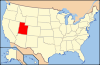
 Location of Daggett County in Utah
This is a list of the National Register of Historic Places listings in Daggett County, Utah.
This is intended to be a complete list of the properties and districts on the National Register of Historic Places in Daggett County, Utah, United States. Latitude and longitude coordinates are provided for many National Register properties and districts; these locations may be seen together in a Google map.[1]
There are 5 properties and districts listed on the National Register in the county.
-
- This National Park Service list is complete through NPS recent listings posted November 10, 2011.[2]
Contents
Current listings
[3] Landmark name [4] Image Date listed Location City or town Summary 1 John Jarvie Historic Ranch District January 14, 1986 Green River and Indian Crossing Bridge southwest of Jarvis
40°54′03″N 109°10′32″W / 40.900833°N 109.175556°WBrowns Park 2 Manila Petroglyphs 
October 6, 1975 Address Restricted[5] Manila 3 Dr. John Parson Cabin Complex November 21, 1976 Southwest of Bridgeport Bridgeport 4 Swett Ranch July 10, 1979 Northeast of Dutch John
40°52′46″N 109°29′15″W / 40.879444°N 109.4875°WDutch John 5 Ute Mountain Fire Tower April 10, 1980 Southwest of Manila
40°52′18″N 109°47′31″W / 40.871667°N 109.791944°WManila See also
References
- ^ The latitude and longitude information provided in this table was derived originally from the National Register Information System, which has been found to be fairly accurate for about 99% of listings. For about 1% of NRIS original coordinates, experience has shown that one or both coordinates are typos or otherwise extremely far off; some corrections may have been made. A more subtle problem causes many locations to be off by up to 150 yards, depending on location in the country: most NRIS coordinates were derived from tracing out latitude and longitudes off of USGS topographical quadrant maps created under the North American Datum of 1927, which differs from the current, highly accurate WGS84 GPS system used by Google maps. Chicago is about right, but NRIS longitudes in Washington are higher by about 4.5 seconds, and are lower by about 2.0 seconds in Maine. Latitudes differ by about 1.0 second in Florida. Some locations in this table may have been corrected to current GPS standards.
- ^ "National Register of Historic Places: Weekly List Actions". National Park Service, United States Department of the Interior. Retrieved on November 10, 2011.
- ^ Numbers represent an ordering by significant words. Various colorings, defined here, differentiate National Historic Landmark sites and National Register of Historic Places Districts from other NRHP buildings, structures, sites or objects.
- ^ "National Register Information System". National Register of Historic Places. National Park Service. . http://nrhp.focus.nps.gov/natreg/docs/All_Data.html.
- ^ Some listings on the NRHP are highly sensitive sites and may be subject to looting or vandalism. The NRHP lists this site as "Address Restricted."
External links
 Media related to National Register of Historic Places in Daggett County, Utah at Wikimedia Commons
Properties on the National Register of Historic Places in Utah 
U.S. National Register of Historic Places Topics Lists by states Alabama • Alaska • Arizona • Arkansas • California • Colorado • Connecticut • Delaware • Florida • Georgia • Hawaii • Idaho • Illinois • Indiana • Iowa • Kansas • Kentucky • Louisiana • Maine • Maryland • Massachusetts • Michigan • Minnesota • Mississippi • Missouri • Montana • Nebraska • Nevada • New Hampshire • New Jersey • New Mexico • New York • North Carolina • North Dakota • Ohio • Oklahoma • Oregon • Pennsylvania • Rhode Island • South Carolina • South Dakota • Tennessee • Texas • Utah • Vermont • Virginia • Washington • West Virginia • Wisconsin • WyomingLists by territories Lists by associated states Other Municipalities and communities of Daggett County, Utah Town 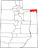
CDP Ghost towns Categories:- National Register of Historic Places in Utah by county
- Daggett County, Utah
-


Wikimedia Foundation. 2010.