| [5] |
Landmark name[6] |
Image |
Date listed[6] |
Location[6] |
Neighborhood |
Description |
| 1 |
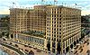
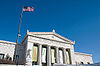
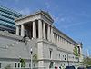
Adler Planetarium |
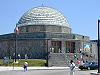 |
01987-02-27 February 27, 1987 |
1300 S. Lake Shore Drive
41°51′58″N 87°36′24″W / 41.86611°N 87.60667°W / 41.86611; -87.60667 (Adler Planetarium) |
Near South Side |
1930 |
| 2 |
Auditorium Building, Roosevelt University |
 |
01970-04-17 April 17, 1970 |
430 S. Michigan Avenue
41°52′32″N 87°37′29″W / 41.87556°N 87.62472°W / 41.87556; -87.62472 (Auditorium Building, Roosevelt University) |
Chicago Loop |
1889 |
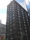
| 3 |
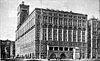
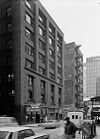
B.F. Goodrich Company Showroom |
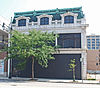 |
02009-05-28 May 28, 2009 |
1925 S. Michigan Avenue
41°51′21.45″N 87°37′24.33″W / 41.8559583°N 87.623425°W / 41.8559583; -87.623425 (B.F. Goodrich Company Showroom) |
Near South Side |
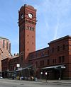
|
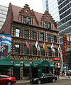
| 4 |
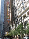
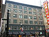
Balaban and Katz Chicago Theatre |
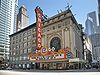 |
01979-06-06 June 6, 1979 |
175 N. State Street
41°53′8″N 87°37′38″W / 41.88556°N 87.62722°W / 41.88556; -87.62722 (Balaban and Katz Chicago Theatre) |
Chicago Loop |
1921 |
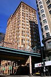
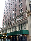
| 5 |
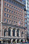
Blackstone Hotel |
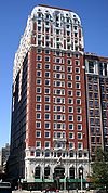 |
01986-05-08 May 8, 1986 |
80 E. Balbo Drive
41°52′24″N 87°37′28″W / 41.87333°N 87.62444°W / 41.87333; -87.62444 (Blackstone Hotel) |
Chicago Loop |
1910 |
| 6 |
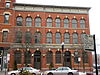
Boyce Building |
 |
01996-02-29 February 29, 1996 |
500-510 N. Dearborn Street
41°53′28″N 87°37′48″W / 41.89111°N 87.63°W / 41.89111; -87.63 (Boyce Building) |
Near North Side |
|
| 7 |
Buckingham Building |
 |
02000-08-10 August 10, 2000 |
59-67 E. Van Buren Street
41°52′36″N 87°37′30″W / 41.87667°N 87.625°W / 41.87667; -87.625 (Buckingham Building) |
Chicago Loop |
|
| 8 |
Building at 14-16 Pearson Street |
 |
01980-05-08 May 8, 1980 |
14-16 E. Pearson Street
41°53′51″N 87°37′40″W / 41.8975°N 87.62778°W / 41.8975; -87.62778 (Building at 14--16 Pearson Street) |
Near North Side |
|
| 9 |
Building at 257 East Delaware Place |
 |
01987-06-26 June 26, 1987 |
257 E. Delaware Place
41°53′57″N 87°37′10″W / 41.89917°N 87.61944°W / 41.89917; -87.61944 (Building at 257 East Delaware) |
Near North Side |
|
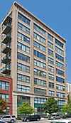
| 10 |
Buildings at 860-880 N. Lake Shore Drive |
 |
01980-08-28 August 28, 1980 |
860-880 N. Lake Shore Drive
41°53′55.17″N 87°37′7.82″W / 41.8986583°N 87.6188389°W / 41.8986583; -87.6188389 (Buildings at 860-880 N. Lake Shore Drive) |
Near North Side |
1949 |
| 11 |
Burlingham Building |
 |
01985-02-14 February 14, 1985 |
104 W. Oak Street
41°54′4″N 87°37′54″W / 41.90111°N 87.63167°W / 41.90111; -87.63167 (Burlingham Building) |
Near North Side |
|
| 12 |
Calumet Plant, R. R. Donnelly & Sons Company |
 |
01983-02-17 February 17, 1983 |
350 E. Cermak Road
41°51′13″N 87°37′5″W / 41.85361°N 87.61806°W / 41.85361; -87.61806 (Calumet Plant, R. R. Donnelly & Sons Company) |
Near South Side |
|
| 13 |
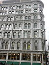
Carson, Pirie, Scott and Company Building |
 |
01970-04-17 April 17, 1970 |
1 S. State Street
41°52′54″N 87°37′39″W / 41.88167°N 87.6275°W / 41.88167; -87.6275 (Carson, Pirie, Scott and Company) |
Chicago Loop |
|
| 14 |
Chapin and Gore Building |
 |
01979-06-27 June 27, 1979 |
63 E. Adams Street
41°52′45″N 87°37′31″W / 41.87917°N 87.62528°W / 41.87917; -87.62528 (Chapin and Gore Building) |
Chicago Loop |
|
| 15 |
James Charnley House |
 |
01970-04-17 April 17, 1970 |
1365 N. Astor Street
41°54′28″N 87°37′40″W / 41.90778°N 87.62778°W / 41.90778; -87.62778 (Charnley, James, House) |
Near North Side |
|
| 16 |
Chicago Avenue Water Tower and Pumping Station |
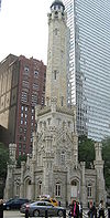 |
01975-04-23 April 23, 1975 |
806 N. Michigan Avenue
41°53′50″N 87°37′26″W / 41.89722°N 87.62389°W / 41.89722; -87.62389 (Chicago Avenue Water Tower and Pumping Station) |
Near North Side |
|
| 17 |
Chicago Board of Trade Building |
 |
01978-06-16 June 16, 1978 |
141 W. Jackson Boulevard
41°52′41.3″N 87°37′56.2″W / 41.878139°N 87.632278°W / 41.878139; -87.632278 (Chicago Board of Trade Building) |
Chicago Loop |
|
| 18 |
Chicago Club |
 |
02005-02-28 February 28, 2005 |
81 E. Van Buren Street
41°52′37″N 87°37′29″W / 41.87694°N 87.62472°W / 41.87694; -87.62472 (Chicago Club) |
Chicago Loop |
|
| 19 |
Chicago Federal Center |
 |
02011-03-24 March 24, 2011 |
Entire block bounded by Dearborn, Jackson, Clark and Adams and the contiguous half-block east of Dearborn
41°52′44″N 87°37′48″W / 41.87889°N 87.63°W / 41.87889; -87.63 (Chicago Federal Center) |
Chicago Loop |
|
| 20 |
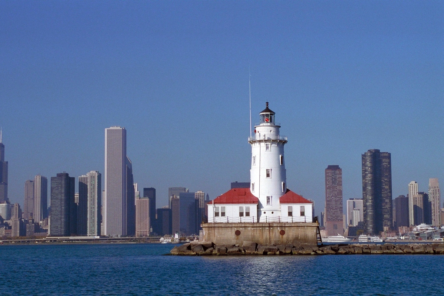
Chicago Harbor Lighthouse |
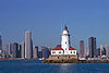 |
01984-07-19 July 19, 1984 |
North Breakwater
41°53′22″N 87°35′26″W / 41.88944°N 87.59056°W / 41.88944; -87.59056 (Chicago Harbor Lighthouse) |
Near North Side |
|
| 21 |
Chicago Public Library, Central Building |
 |
01972-07-31 July 31, 1972 |
78 E. Washington Street
41°53′2″N 87°37′30″W / 41.88389°N 87.625°W / 41.88389; -87.625 (Chicago Public Library, Central Building) |
Chicago Loop |
|
| 22 |
Chicago Savings Bank Building |
 |
01975-09-05 September 5, 1975 |
7 W. Madison Street
41°52′54″N 87°37′42″W / 41.88167°N 87.62833°W / 41.88167; -87.62833 (Chicago Savings Bank Building) |
Chicago Loop |
|
| 23 |
Chicago Varnish Company Building |
 |
02001-06-14 June 14, 2001 |
33 W. Kinzie Street
41°53′20″N 87°37′46″W / 41.88889°N 87.62944°W / 41.88889; -87.62944 (Chicago Varnish Company Building) |
Near North Side |
|
| 24 |
Henry B. Clarke House |
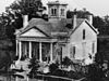 |
01971-05-06 May 6, 1971 |
1827 S. Indiana Avenue
41°51′26″N 87°37′19″W / 41.85722°N 87.62194°W / 41.85722; -87.62194 (Clarke, Henry B., House) |
Near South Side |
|
| 25 |
Coca Cola Company Building |
 |
01991-02-22 February 22, 1991 |
1322-1336 S. Wabash Avenue
41°51′54″N 87°37′34″W / 41.865°N 87.62611°W / 41.865; -87.62611 (Coca Cola Company Building) |
Near South Side |
|
| 26 |
Continental and Commercial National Bank |
 |
02007-02-14 February 14, 2007 |
208 S. LaSalle Street
41°52′45″N 87°37′56″W / 41.87917°N 87.63222°W / 41.87917; -87.63222 (Continental and Commercial National Bank) |
Chicago Loop |
|
| 27 |
Conway Building |
 |
01984-02-09 February 9, 1984 |
111 W. Washington Street
41°52′58″N 87°37′53″W / 41.88278°N 87.63139°W / 41.88278; -87.63139 (Conway Building) |
Chicago Loop |
Now known as the Burnham Center. |
| 28 |
Cook County Criminal Court Building |
 |
01984-11-13 November 13, 1984 |
54 W. Hubbard Street
41°53′25″N 87°37′49″W / 41.89028°N 87.63028°W / 41.89028; -87.63028 (Cook County Criminal Court Building) |
Near North Side |
|
| 29 |
Crane Company Building |
 |
02002-01-28 January 28, 2002 |
836 S. Michigan Avenue
41°52′14″N 87°37′28″W / 41.87056°N 87.62444°W / 41.87056; -87.62444 (Crane Company Building) |
Chicago Loop |
|
| 30 |
Dearborn Station |
 |
01976-03-26 March 26, 1976 |
47 W. Polk Street
41°52′20″N 87°37′42″W / 41.87222°N 87.62833°W / 41.87222; -87.62833 (Dearborn Station) |
Chicago Loop |
|
| 31 |
Delaware Building |
 |
01974-07-18 July 18, 1974 |
36 W. Randolph Street
41°53′5″N 87°37′45″W / 41.88472°N 87.62917°W / 41.88472; -87.62917 (Delaware Building) |
Chicago Loop |
|
| 32 |
Drake Hotel |
 |
01980-05-08 May 8, 1980 |
140 E. Walton Street
41°54′2″N 87°37′27″W / 41.90056°N 87.62417°W / 41.90056; -87.62417 (Drake Hotel) |
Near North Side |
|
| 33 |
Jean Baptiste Point Du Sable Homesite |
 |
01976-05-11 May 11, 1976 |
401 N. Michigan Avenue
41°53′23″N 87°37′24″W / 41.88972°N 87.62333°W / 41.88972; -87.62333 (Du Sable, Jean Baptiste Point, Homesite) |
Near North Side |
|
| 34 |
Emmel Building |
 |
01984-11-13 November 13, 1984 |
1357 N. Wells Street
41°54′26″N 87°38′3″W / 41.90722°N 87.63417°W / 41.90722; -87.63417 (Emmel Building) |
Near North Side |
|
| 35 |
Fairbanks, Morse and Company Building |
 |
01988-11-16 November 16, 1988 |
900 S. Wabash Avenue
41°52′13″N 87°37′34″W / 41.87028°N 87.62611°W / 41.87028; -87.62611 (Fairbanks, Morse and Company Building) |
Chicago Loop |
|
| 36 |
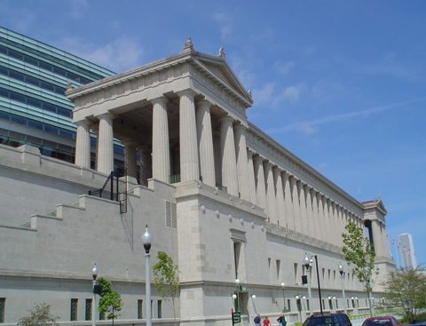
Field Museum of Natural History |
 |
01975-09-05 September 5, 1975 |
1400 S. Lake Shore Drive
41°51′59″N 87°37′1″W / 41.86639°N 87.61694°W / 41.86639; -87.61694 (Field Museum of Natural History) |
Near South Side |
|
| 37 |
Marshall Field Garden Apartments |
 |
01991-12-17 December 17, 1991 |
1336-1452 N. Sedgwick Street, 1337-1453 N. Hudson Avenue, 400-424 W. Evergreen Street and 401-425 W. Blackhawk Street
41°54′29″N 87°38′20″W / 41.90806°N 87.63889°W / 41.90806; -87.63889 (Field, Marshall, Garden Apartments) |
Near North Side |
|
| 38 |
Fisher Building |
 |
01976-03-16 March 16, 1976 |
343 S. Dearborn Street
41°52′37″N 87°37′44″W / 41.87694°N 87.62889°W / 41.87694; -87.62889 (Fsher Building) |
Chicago Loop |
|
| 39 |
Fort Dearborn Hotel |
 |
01982-11-12 November 12, 1982 |
401 S. LaSalle Street
41°52′36″N 87°37′52″W / 41.87667°N 87.63111°W / 41.87667; -87.63111 (Fort Dearborn Hotel) |
Chicago Loop |
|
| 40 |
Fourth Presbyterian Church of Chicago |
 |
01975-09-05 September 5, 1975 |
126 E. Chestnut Street
41°53′55″N 87°37′28″W / 41.89861°N 87.62444°W / 41.89861; -87.62444 (Fourth Presbyterian Church of Chicago) |
Near North Side |
|
| 41 |
Gage Group-Ascher, Keith, and Gage Buildings |
 |
01985-11-14 November 14, 1985 |
18-30 S. Michigan Avenue
41°52′52″N 87°37′30″W / 41.88111°N 87.625°W / 41.88111; -87.625 (Gage Group--Ascher, Keith, and Gage Buildings) |
Chicago Loop |
|
| 42 |
Germania Club |
 |
01976-10-22 October 22, 1976 |
108 W. Germania Place
41°54′38″N 87°37′57″W / 41.91056°N 87.6325°W / 41.91056; -87.6325 (Germania Club) |
Near North Side |
|
| 43 |
John J. Glessner House |
 |
01970-04-17 April 17, 1970 |
1800 S. Prairie Avenue
41°51′27″N 87°37′16″W / 41.8575°N 87.62111°W / 41.8575; -87.62111 (Glessner, John J., House) |
Near South Side |
|
| 44 |
Gold Coast Historic District |
 |
01978-01-30 January 30, 1978 |
Roughly bounded by North Avenue, Lake Shore Drive, Clark and Oak Streets.
41°54′21″N 87°37′41″W / 41.90583°N 87.62806°W / 41.90583; -87.62806 (Gold Coast Historic District) |
Near North Side |
|
| 45 |
Grant Park |
 |
01993-07-21 July 21, 1993 |
Roughly, from the Chicago River to E. McFetridge Drive at Lake Michigan
41°52′31″N 87°37′5″W / 41.87528°N 87.61806°W / 41.87528; -87.61806 (Grant Park) |
Chicago Loop |
|
| 46 |
Raymond M. Hilliard Center Historic District |
 |
01999-09-13 September 13, 1999 |
Jct. of W. Cermak Road and S. State Street
41°51′15″N 87°36′59″W / 41.85417°N 87.61639°W / 41.85417; -87.61639 (Raymond M. Hilliard Center Historic District) |
Near South Side |
|
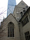
| 47 |
Holy Name Cathedral |
 |
02000-05-25 May 25, 2000 |
735 N. State Street
41°53′46″N 87°37′40″W / 41.89611°N 87.62778°W / 41.89611; -87.62778 (Holy Name Cathedral) |
Near North Side |
|
| 48 |
Hotel St. Benedict Flats |
 |
01995-09-01 September 1, 1995 |
40, 42, 50 E. Chicago Avenue, 801 N. Wabash Avenue
41°53′49″N 87°37′35″W / 41.89694°N 87.62639°W / 41.89694; -87.62639 (Hotel St. Benedict Flats) |
Near North Side |
|
| 49 |
IBM Building |
 |
02010-03-11 March 11, 2010 |
330 N. Wabash Street
41°53′19.0″N 87°37′39.3″W / 41.88861°N 87.627583°W / 41.88861; -87.627583 (IBM Building) |
Near North Side |
|
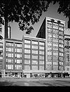
| 50 |
Inland Steel Building |
 |
02009-02-18 February 18, 2009 |
30 W. Monroe Street
41°52′50.72″N 87°37′44.24″W / 41.8807556°N 87.6289556°W / 41.8807556; -87.6289556 (Inland Steel Building) |
Chicago Loop |
|
| 51 |
Jewelers' Building |
 |
01974-08-07 August 7, 1974 |
15-19 S. Wabash Avenue
41°52′53″N 87°37′33″W / 41.88139°N 87.62583°W / 41.88139; -87.62583 (Jewelers' Building) |
Chicago Loop |
|
| 52 |
William W. Kimball House |
 |
01971-12-09 December 9, 1971 |
1801 S. Prairie Avenue
41°51′24″N 87°37′12″W / 41.85667°N 87.62°W / 41.85667; -87.62 (Kimball, William W., House) |
Near South Side |
|
| 53 |
Lakeside Press Building |
 |
01976-06-23 June 23, 1976 |
731 S. Plymouth Court
41°52′21″N 87°37′42″W / 41.8725°N 87.62833°W / 41.8725; -87.62833 (Lakeside Press Building) |
Chicago Loop |
|
| 54 |
Bryan Lathrop House |
 |
01974-02-15 February 15, 1974 |
120 E. Bellevue Place
41°54′6″N 87°37′31″W / 41.90167°N 87.62528°W / 41.90167; -87.62528 (Lathrop, Bryan, House) |
Near North Side |
|
| 55 |
Leiter II Building |
 |
01976-01-07 January 7, 1976 |
401 S. State Street
41°52′35″N 87°37′39″W / 41.87639°N 87.6275°W / 41.87639; -87.6275 (Leiter II Building) |
Chicago Loop |
|
| 56 |
Loop Retail Historic District |
 |
01998-11-27 November 27, 1998 |
Roughly bounded by Lake Street, Wabash Avenue, Congress Parkway, and State Street
41°52′52″N 87°37′37″W / 41.88111°N 87.62694°W / 41.88111; -87.62694 (Loop Retail Historic District) |
Chicago Loop |
|
| 57 |
Ludington Building |
 |
01980-05-08 May 8, 1980 |
1104 S. Wabash Avenue
41°52′8″N 87°37′35″W / 41.86889°N 87.62639°W / 41.86889; -87.62639 (Ludington Building) |
Chicago Loop |
|
| 58 |
Lumber Exchange Building and Tower Addition |
 |
02007-12-06 December 6, 2007 |
11 S. LaSalle Street
41°52′54″N 87°37′55″W / 41.88167°N 87.63194°W / 41.88167; -87.63194 (Lumber Exchange Building and Tower Addition) |
Chicago Loop |
|
| 59 |
Albert F. Madlener House |
 |
01970-10-15 October 15, 1970 |
4 W. Burton Street
41°54′35″N 87°37′45″W / 41.90972°N 87.62917°W / 41.90972; -87.62917 (Madlener, Albert F., House) |
Near North Side |
|
| 60 |
Manhattan Building |
 |
01976-03-16 March 16, 1976 |
431 S. Dearborn Street
41°52′34″N 87°37′45″W / 41.87611°N 87.62917°W / 41.87611; -87.62917 (Manhattan Building) |
Chicago Loop |
|
| 61 |
Marquette Building |
 |
01973-08-17 August 17, 1973 |
140 S. Dearborn Street
41°52′48″N 87°37′46″W / 41.88°N 87.62944°W / 41.88; -87.62944 (Marquette Building) |
Chicago Loop |
|
| 62 |
Marshall Field Company Store |
 |
01978-06-02 June 2, 1978 |
111 N. State Street
41°53′1″N 87°37′37″W / 41.88361°N 87.62694°W / 41.88361; -87.62694 (Marshall Field Company Store) |
Chicago Loop |
|
| 63 |
Maxwell-Briscoe Automobile Company Showroom |
 |
02002-11-18 November 18, 2002 |
1737 S. Michigan Avenue
41°51′36″N 87°37′25″W / 41.86°N 87.62361°W / 41.86; -87.62361 (Maxwell--Briscoe Automobile Company Showroom) |
Near South Side |
|
| 64 |
Isaac N. Maynard Rowhouses |
 |
02004-02-25 February 25, 2004 |
119,121,123 W. Delaware Place
41°54′4″N 87°37′57″W / 41.90111°N 87.6325°W / 41.90111; -87.6325 (Maynard, Isaac N., Rowhouses) |
Near North Side |
|
| 65 |
McClurg Building |
 |
01970-08-17 August 17, 1970 |
218 S. Wabash Avenue
41°52′44″N 87°37′34″W / 41.87889°N 87.62611°W / 41.87889; -87.62611 (McClurg Building) |
Chicago Loop |
|
| 66 |
Michigan-Wacker Historic District |
 |
01978-11-15 November 15, 1978 |
Michigan Avenue and Wacker Drive and environs
41°53′19″N 87°37′29″W / 41.88861°N 87.62472°W / 41.88861; -87.62472 (Michigan-Wacker Historic District) |
Chicago Loop |
|
| 67 |
Monadnock Block |
 |
01970-11-20 November 20, 1970 |
53 W. Jackson Boulevard
41°52′41″N 87°37′46″W / 41.87806°N 87.62944°W / 41.87806; -87.62944 (Monadnock Block) |
Chicago Loop |
|
| 68 |
Montgomery Ward Company Complex |
 |
01978-06-02 June 2, 1978 |
619 W. Chicago Avenue
41°53′50″N 87°38′37″W / 41.89722°N 87.64361°W / 41.89722; -87.64361 (Montgomery Ward Company Complex) |
Near North Side |
|
| 69 |
Motor Row Historic District |
 |
02002-11-18 November 18, 2002 |
Roughly bounded by E. Cermak Road, S. Indiana Avenue, E. 24th Place, and S. Wabash Avenue
41°51′10″N 87°37′26″W / 41.85278°N 87.62389°W / 41.85278; -87.62389 (Motor Row Historic District) |
Near South Side |
|
| 70 |
Municipal Courts Building |
 |
01985-08-29 August 29, 1985 |
116 S. Michigan Avenue
41°52′48″N 87°37′28″W / 41.88°N 87.62444°W / 41.88; -87.62444 (Municipal Courts Building) |
Chicago Loop |
|
| 71 |
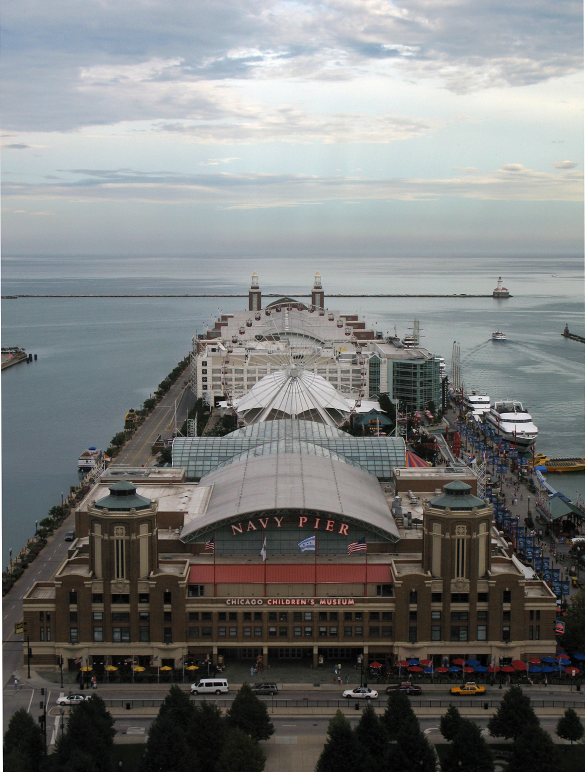
Municipal Pier |
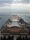 |
01979-09-13 September 13, 1979 |
200 N. Streeter Drive
41°53′29″N 87°35′59″W / 41.89139°N 87.59972°W / 41.89139; -87.59972 (Municipal Pier) |
Near North Side |
|
| 72 |
New Masonic Building and Oriental Theater |
 |
01978-09-26 September 26, 1978 |
20 W. Randolph Street
41°53′4″N 87°37′41″W / 41.88444°N 87.62806°W / 41.88444; -87.62806 (New Masonic Building and Oriental Theater) |
Chicago Loop |
|
| 73 |
Samuel Nickerson House |
 |
01976-11-07 November 7, 1976 |
40 E. Erie Street
41°53′38″N 87°37′36″W / 41.89389°N 87.62667°W / 41.89389; -87.62667 (Nickerson, Samuel, House) |
Near North Side |
|
| 74 |
North Wells Street Historic District |
 |
01984-05-03 May 3, 1984 |
1240-1260 N. Wells Street
41°54′20″N 87°38′5″W / 41.90556°N 87.63472°W / 41.90556; -87.63472 (North Wells Street Historic District) |
Near North Side |
|
| 75 |
Old Chicago Historical Society Building |
 |
01978-11-28 November 28, 1978 |
632 N. Dearborn Street
41°53′37″N 87°37′48″W / 41.89361°N 87.63°W / 41.89361; -87.63 (Old Chicago Historical Society Building) |
Near North Side |
|
| 76 |
Old Colony Buildings |
 |
01976-01-02 January 2, 1976 |
407 S. Dearborn Street
41°52′34.29″N 87°37′44.76″W / 41.8761917°N 87.6291°W / 41.8761917; -87.6291 (Old Colony Buildings) |
Chicago Loop |
|
| 77 |
Oliver Building |
 |
01983-12-08 December 8, 1983 |
159 N. Dearborn Street
41°53′6″N 87°37′45″W / 41.885°N 87.62917°W / 41.885; -87.62917 (Oliver Building) |
Chicago Loop |
|
| 78 |
One LaSalle Street Building |
 |
01999-11-22 November 22, 1999 |
1 N. LaSalle Street
41°52′55″N 87°37′56″W / 41.88194°N 87.63222°W / 41.88194; -87.63222 (One LaSalle Street Building) |
Chicago Loop |
|
| 79 |
Orchestra Hall |
 |
01978-03-21 March 21, 1978 |
220 S. Michigan Avenue
41°52′43″N 87°37′29″W / 41.87861°N 87.62472°W / 41.87861; -87.62472 (Orchestra Hall) |
Chicago Loop |
|
| 80 |
Page Brothers Building |
 |
01975-06-05 June 5, 1975 |
177-91 N. State Street
41°53′8″N 87°37′39″W / 41.88556°N 87.6275°W / 41.88556; -87.6275 (Page Brothers Building) |
Chicago Loop |
|
| 81 |
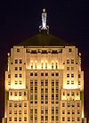
Palmolive Building |
 |
02003-08-21 August 21, 2003 |
919 N. Michigan Avenue
41°53′59″N 87°37′26″W / 41.89972°N 87.62389°W / 41.89972; -87.62389 (Palmolive Building) |
Near North Side |
|
| 82 |
Peoples Gas Building |
 |
01984-11-13 November 13, 1984 |
122 S. Michigan Avenue
41°52′47″N 87°37′29″W / 41.87972°N 87.62472°W / 41.87972; -87.62472 (Peoples Gas Building) |
Chicago Loop |
|
| 83 |
Pontiac Building |
 |
01976-03-16 March 16, 1976 |
542 S. Dearborn Street
41°52′29″N 87°37′44″W / 41.87472°N 87.62889°W / 41.87472; -87.62889 (Pontiac Building) |
Chicago Loop |
|
| 84 |
Prairie Avenue District |
|
01972-11-15 November 15, 1972 |
S. Prairie Avenue on either side of E. 18th Street, about 1 block in
41°51′26″N 87°37′19″W / 41.85722°N 87.62194°W / 41.85722; -87.62194 (Prairie Avenue District) |
Near South Side |
|
| 85 |
Quigley Preparatory Seminary |
 |
01996-02-16 February 16, 1996 |
103 E. Chestnut Street
41°53′52″N 87°37′33″W / 41.89778°N 87.62583°W / 41.89778; -87.62583 (Quigley Preparatory Seminary) |
Near North Side |
|
| 86 |
Quinn Chapel of the A.M.E. Church |
 |
01979-09-04 September 4, 1979 |
2401 S. Wabash Avenue
41°50′56″N 87°37′30″W / 41.84889°N 87.625°W / 41.84889; -87.625 (Quinn Chapel of the A.M.E. Church) |
Near South Side |
|
| 87 |
Railway Exchange Building |
 |
01982-06-03 June 3, 1982 |
80 E. Jackson Boulevard and 224 S. Michigan Avenue
41°52′42″N 87°37′28″W / 41.87833°N 87.62444°W / 41.87833; -87.62444 (Railway Exchange Building) |
Chicago Loop |
|
| 88 |
Harriet F. Rees House |
 |
02007-05-22 May 22, 2007 |
2110 S. Prairie Avenue
41°51′14″N 87°37′15″W / 41.85389°N 87.62083°W / 41.85389; -87.62083 (Rees, Harriet F., House) |
Near South Side |
|
| 89 |
Reid House |
 |
02003-08-21 August 21, 2003 |
2013 S. Prairie Avenue
41°51′19″N 87°37′12″W / 41.85528°N 87.62°W / 41.85528; -87.62 (Reid House) |
Near South Side |
|
| 90 |
Reid Murdoch Building |
 |
01975-08-28 August 28, 1975 |
325 N. LaSalle Street
41°53′17″N 87°37′54″W / 41.88806°N 87.63167°W / 41.88806; -87.63167 (Reid Murdoch Building) |
Near North Side |
|
| 91 |
Reliance Building |
 |
01970-10-15 October 15, 1970 |
32 N. State Street
41°52′58″N 87°37′42″W / 41.88278°N 87.62833°W / 41.88278; -87.62833 (Reliance Building) |
Chicago Loop |
|
| 92 |
Rookery Building |
 |
01970-04-17 April 17, 1970 |
209 S. LaSalle Street
41°52′45″N 87°37′56″W / 41.87917°N 87.63222°W / 41.87917; -87.63222 (Rookery Building) |
Chicago Loop |
|
| 93 |
A. M. Rothschild & Company Store |
 |
01989-11-27 November 27, 1989 |
333 S. State Street
41°52′39″N 87°37′32″W / 41.8775°N 87.62556°W / 41.8775; -87.62556 (Rothschild, A. M., & Company Store) |
Chicago Loop |
|
| 94 |
St. Luke's Hospital Complex |
 |
01982-11-24 November 24, 1982 |
1435 S. Michigan Avenue, 1400 Block S. Indiana Avenue
41°51′47″N 87°37′23″W / 41.86306°N 87.62306°W / 41.86306; -87.62306 (St. Luke's Hospital Complex) |
Near South Side |
|
| 95 |
Second Presbyterian Church |
 |
01974-12-27 December 27, 1974 |
1936 S. Michigan Avenue
41°51′21″N 87°37′28″W / 41.85583°N 87.62444°W / 41.85583; -87.62444 (Second Presbyterian Church) |
Near South Side |
|
| 96 |
John G. Shedd Aquarium |
 |
01987-02-27 February 27, 1987 |
1200 S. Lake Shore Drive
41°52′4″N 87°36′50″W / 41.86778°N 87.61389°W / 41.86778; -87.61389 (Shedd, John G., Aquarium) |
Near South Side |
|
| 97 |
Silversmith Building |
 |
01997-05-16 May 16, 1997 |
10 S. Wabash Avenue
41°52′52″N 87°37′35″W / 41.88111°N 87.62639°W / 41.88111; -87.62639 (Silversmith Building) |
Chicago Loop |
|
| 98 |
Singer Building |
 |
01983-02-10 February 10, 1983 |
120 S. State Street
41°52′48″N 87°37′41″W / 41.88°N 87.62806°W / 41.88; -87.62806 (Singer Building) |
Chicago Loop |
|
| 99 |
Soldier Field |
 |
01984-08-09 August 9, 1984 |
425 E. 14th Street
41°51′45″N 87°36′59″W / 41.8625°N 87.61639°W / 41.8625; -87.61639 (Soldier Field) |
Near South Side |
|
| 100 |
Somerset Hotel |
 |
02000-03-03 March 3, 2000 |
1152-1154 S. Wabash Avenue
41°52′4″N 87°37′34″W / 41.86778°N 87.62611°W / 41.86778; -87.62611 (Somerset Hotel) |
Chicago Loop |
|
| 101 |
South Dearborn Street-Printing House Row Historic District |
 |
01976-01-07 January 7, 1976 |
343, 407, 431 S. Dearborn Street and 53 W. Jackson Boulevard
41°52′42″N 87°37′41″W / 41.87833°N 87.62806°W / 41.87833; -87.62806 (South Dearborn Street--Printing House Row Historic District) |
Chicago Loop |
|
| 102 |
South Loop Printing House District |
 |
01978-03-02 March 2, 1978 |
Roughly bounded by W. Taylor Street, W. Polk Street, S. Wells Street, W. Congress Parkway and S. State Street
41°52′26″N 87°37′51″W / 41.87389°N 87.63083°W / 41.87389; -87.63083 (South Loop Printing House District) |
Chicago Loop |
|
| 103 |
The Steuben Club |
 |
02007-05-22 May 22, 2007 |
188 W. Randolph Street
41°53′4″N 87°38′1″W / 41.88444°N 87.63361°W / 41.88444; -87.63361 (Steuben Club, The) |
Chicago Loop |
|
| 104 |
Studebaker Building |
 |
01975-08-11 August 11, 1975 |
410-418 S. Michigan Avenue
41°52′34″N 87°37′29″W / 41.87611°N 87.62472°W / 41.87611; -87.62472 (Studebaker Building) |
Chicago Loop |
|
| 105 |
Swedish Club of Chicago |
 |
01985-12-02 December 2, 1985 |
1258 N. LaSalle Street
41°54′20″N 87°38′0″W / 41.90556°N 87.633333°W / 41.90556; -87.633333 (Swedish Club of Chicago) |
Near North Side |
|
| 106 |
Tree Studio Building and Annexes |
 |
01974-12-16 December 16, 1974 |
4 E. Ohio Street
41°53′34″N 87°37′40″W / 41.89278°N 87.62778°W / 41.89278; -87.62778 (Tree Studio Building and Annexes) |
Near North Side |
|
| 107 |
Trustees System Service Building |
 |
01998-09-03 September 3, 1998 |
201 N. Wells Street
41°53′10″N 87°38′1″W / 41.88611°N 87.63361°W / 41.88611; -87.63361 (Trustees System Service Building) |
Chicago Loop |
|
| 108 |
William Waller House |
 |
01980-11-21 November 21, 1980 |
1012 N. Dearborn Street
41°54′3″N 87°37′49″W / 41.90083°N 87.63028°W / 41.90083; -87.63028 (Waller, William, House) |
Near North Side |
|
| 109 |
Washington Square |
 |
01991-05-20 May 20, 1991 |
901 N. Clark Street
41°53′58″N 87°37′50″W / 41.89944°N 87.63056°W / 41.89944; -87.63056 (Washington Square) |
Near North Side |
|
| 110 |
Washington Square Historic District |
 |
02003-08-21 August 21, 2003 |
Washington Square, N. Dearborn Street, from W. Walton Street to W. Chicago Avenue
41°53′56″N 87°37′49″W / 41.89889°N 87.63028°W / 41.89889; -87.63028 (Washington Square Historic District) |
Near North Side |
|
| 111 |
West Burton Place Historic District |
 |
02007-12-06 December 6, 2007 |
143-161 W Burton Place
41°54′32″N 87°38′2″W / 41.90889°N 87.63389°W / 41.90889; -87.63389 (West Burton Place Historic District) |
Near North Side |
|
| 112 |
Wheeler-Kohn House |
 |
01999-08-12 August 12, 1999 |
2018 S. Calumet Avenue
41°51′18″N 87°37′10″W / 41.855°N 87.61944°W / 41.855; -87.61944 (Wheeler--Kohn House) |
Near South Side |
|
| 113 |
Wooden Alley |
 |
02002-05-22 May 22, 2002 |
1535 N between N. Astor and N. State Streets
41°54′37″N 87°37′42″W / 41.91028°N 87.62833°W / 41.91028; -87.62833 (Wooden Alley) |
Near North Side |
|
| 114 |
YMCA Hotel |
 |
01989-08-30 August 30, 1989 |
820-828 S. Wabash Avenue
41°52′2″N 87°37′15″W / 41.86722°N 87.62083°W / 41.86722; -87.62083 (YMCA Hotel) |
Chicago Loop |
|
There are at least two formerly listed properties in Chicago. These include two ships that were moved to Michigan.


 Category ·
  PortalCategories: