- National Register of Historic Places listings in metropolitan San Juan, Puerto Rico
-
This portion of National Register of Historic Places listings in Puerto Rico covers the San Juan metropolitan area of Puerto Rico.
See also:
- National Register of Historic Places listings in southern Puerto Rico
- National Register of Historic Places listings in northern Puerto Rico
- National Register of Historic Places listings in western Puerto Rico
- National Register of Historic Places listings in central Puerto Rico
- National Register of Historic Places listings in eastern Puerto Rico
Names of places given are as appear in the National Register, reflecting name as given in NRHP application at the date of listing. Note, the National Register name system does not accommodate Spanish á, ñ and other letters.
Contents
San Juan metro area municipalities
Bayamón
Landmark name Image Date listed Location City/ Town Summary 1 Casa Dr. Agustin Stahl Stamm February 4, 2011 14 Jose Marti St. Bayamón vicinity 2 Casa Natal Dr. José Celso Barbosa 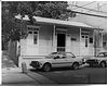
August 24, 1984 13 Barbosa St.
18°24′1″N 66°9′21″W / 18.40028°N 66.15583°WBayamón House from 1850 3 Church Santa Cruz of Bayamón September 18, 1984 Plaza de Hostos
18°24′2″N 66°9′22″W / 18.40056°N 66.15611°WBayamón Church from 1772 4 Farmacia Serra May 4, 1989 Degetau No. 11
18°24′6″N 66°9′18″W / 18.40167°N 66.155°WBayamón 5 Marques de la Serna Bridge July 19, 1995 Near Bayamón
18°24′17″N 66°9′21″W / 18.40472°N 66.15583°WBayamón A rolled iron segmented arch bridge 6 Plata Bridge July 19, 1995 18°18′19″N 66°12′42″W / 18.30528°N 66.21167°W Naranjito A Parker truss bridge, listed in Naranjito and Bayamón municipalities 7 Puerto Rico National Cemetery 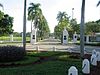
September 26, 1983 PR 168
18°24′56″N 66°10′15″W / 18.41556°N 66.17083°WBayamón The only U.S. national cemetery outside of mainland U.S., established 1948 Carolina
Landmark name Image Date listed Location City/ Town Summary 1 Church of San Fernando of Carolina 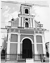
September 18, 1984 Munoz Rivera St., Town Plaza
18°22′59″N 65°57′24″W / 18.38306°N 65.95667°WCarolina Church from 1860 2 Edificio Alcaldia December 28, 1983 Calle Ignacio Arzuaga, Esq. De Diego
18°22′59″N 65°57′28″W / 18.38306°N 65.95778°WCarolina From 1927, designed by Rafael Carmoega 3 Quebrada Maracuto August 27, 2004 Vic. of Carolina Carolina Cataño
Landmark name Image Date listed Location City / Town Summary 1 Bacardi Distillery August 6, 2010 Road 165, kilometer 2.6, intersection Puerto Rico Highway 888, Bay View Industrial Park
18°27′31.5″N 66°8′29″W / 18.45875°N 66.14139°WCataño vicinity Guaynabo
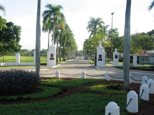
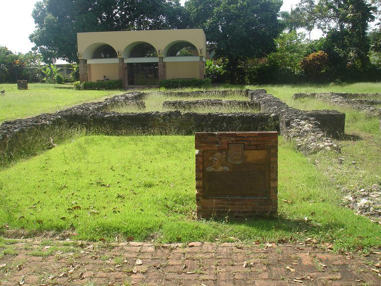
Landmark name Image Date listed Location City/ Town Summary 1 Caparra Archaeological Site 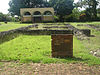
February 28, 1984 Guaynabo Site of original, 1508 Spanish settlement in Puerto Rico 2 Iglesia Parroquial de San Pedro Mártir de Guaynabo September 8, 1976 Plaza de Recreo
18°21′30″N 66°6′30″W / 18.35833°N 66.10833°WGuaynabo San Juan
The following list is organized first by neighborhood/district, and then alphabetically by first significant word. It is sortable into other orders.
Landmark name Image Date listed Location District / Neighborhood Summary 1 House at 659 Concordia Street 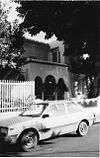
October 18, 1991 659 Concordia St.
18°27′15″N 66°4′58″W / 18.45417°N 66.08278°WMiramar Mission/Spanish Revival house from 1935, designed by Joseph O'Kelly 2 House at 659 La Paz Street 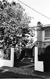
October 18, 1991 659 La Paz St.
18°27′17″N 66°5′0″W / 18.45472°N 66.083333°WMiramar Mission/Spanish Revival house from 1928, designed by Pedro De Castro 3 House at 663 La Paz Street 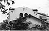
October 18, 1991 663 La Paz St.
18°27′27″N 66°5′0″W / 18.4575°N 66.083333°WMiramar Another Mission/Spanish Revival house designed by Pedro De Castro 4 House at 665 McKinley Street 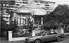
October 19, 1991 665 McKinley St.
18°27′25″N 66°5′4″W / 18.45694°N 66.08444°WMiramar Vernacular Spanish Creole house from 1906 5 US Post Office and Courthouse 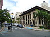
March 28, 1988 Block bounded by Calle San Justo, Calle Tanca, Calle Commercio, and Calle Recinto Sur
18°27′47″N 66°6′55″W / 18.46306°N 66.11528°WOld San Juan From 1914, designed by Oscar Wenderoth 6 Biblioteca Carnegie October 20, 1983 Ponce de León Ave.
18°28′6″N 66°6′34″W / 18.46833°N 66.10944°WPuerta de Tierra Classical Revival building from 1915 7 School of Tropical Medicine (Escuela de Medicina tropical) 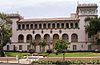
September 29, 1983 Ponce de León Ave.
18°28′12″N 66°6′25″W / 18.47°N 66.10694°WPuerta de Tierra Neo-Plateresque building from 1920 8 Río Piedras State Penitentiary 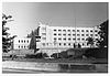
March 7, 2003 18°23′26″N 66°4′15″W / 18.39056°N 66.07083°W Río Piedras Built 1933, closed 2004 9 Rum Pilot Plant July 26, 2010 State Rd #1, Estacion Experimental Agricola, Rio Piedras
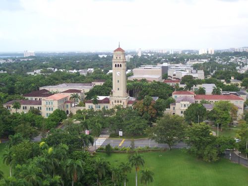
18°23′20″N 66°3′16″W / 18.38889°N 66.05444°WRío Piedras 10 University of Puerto Rico Tower and Quadrangle 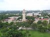
May 17, 1984 Ponce de León Ave.
18°24′17″N 66°2′58″W / 18.40472°N 66.04944°WRío Piedras Tower and quadrangle from 1935, designed by Rafael Carmoega 11 Acueducto de San Juan June 21, 2007 Flamboyant St. San Juan From 1846. Rio Piedras filtration plant, etc. 12 Antiguo Casino de Puerto Rico September 22, 1977 Avenida Ponce de León 1
18°28′5″N 66°6′41″W / 18.46806°N 66.11139°WSan Juan Beaux Arts building from 1917 13 Carcel de Puerta de Tierra August 11, 1976 Avenida Ponce de Leon, Parada 8, Puerta de Tierra
18°27′45″N 66°5′40″W / 18.4625°N 66.09444°WSan Juan Spanish Neo-classical building from 1887 14 Casa Dra. Concha Melendez Ramirez June 30, 2011 1400 Vila Mayo
18°27′10″N 66°4′3″W / 18.45278°N 66.0675°WSan Juan 15 Casa Klumb November 14, 1997 #1 Ramón B. López St.
18°24′5″N 66°2′7″W / 18.40139°N 66.03528°WSan Juan Modern Movement home from 1947 designed by Henry Klumb 16 Casa de España July 5, 1983 Ponce de León Ave.
18°28′10″N 66°6′28″W / 18.46944°N 66.10778°WSan Juan Exotic / Moorish Revival house from 1932, designed by Pedro de Castro 17 Colegio de las Madres del Sagrado Corazon November 25, 1985 Ponce de Leon Ave.
18°27′23″N 66°4′46″W / 18.45639°N 66.07944°WSan Juan From 1880 18 Condado Vanderbilt Hotel November 25, 2005 1055 Ashford Ave.
18°27′31″N 66°4′33″W / 18.45861°N 66.07583°WSan Juan Mission/Spanish Revival style hotel from 1919 19 Edificio Aboy September 28, 2001 603 Aboy St.
18°27′22″N 66°4′53″W / 18.45611°N 66.08139°WSan Juan Art Deco building from 1937, also known as Le Faro, designed by Jorge Julia Pasarell 20 Edificio Patio Espanol 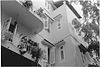
February 18, 2005 153 Cruz St.
18°28′4″N 66°7′3″W / 18.46778°N 66.1175°WSan Juan Mission/Spanish Revival, Eclectic building from 1937, also known as La Filarmonica, designed by Eduardo Fossas López 21 Edificio Victory Garden 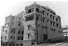
October 13, 2004 1001 Ponce de León Ave., corner of Elisa Colberg St.
18°27′15″N 66°4′46″W / 18.45417°N 66.07944°WSan Juan Mission/Spanish Revival building from 1936, designed by Pedro De Castro 22 Edificio del Valle 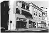
November 20, 2004 1118 Ponce de Leon Ave.
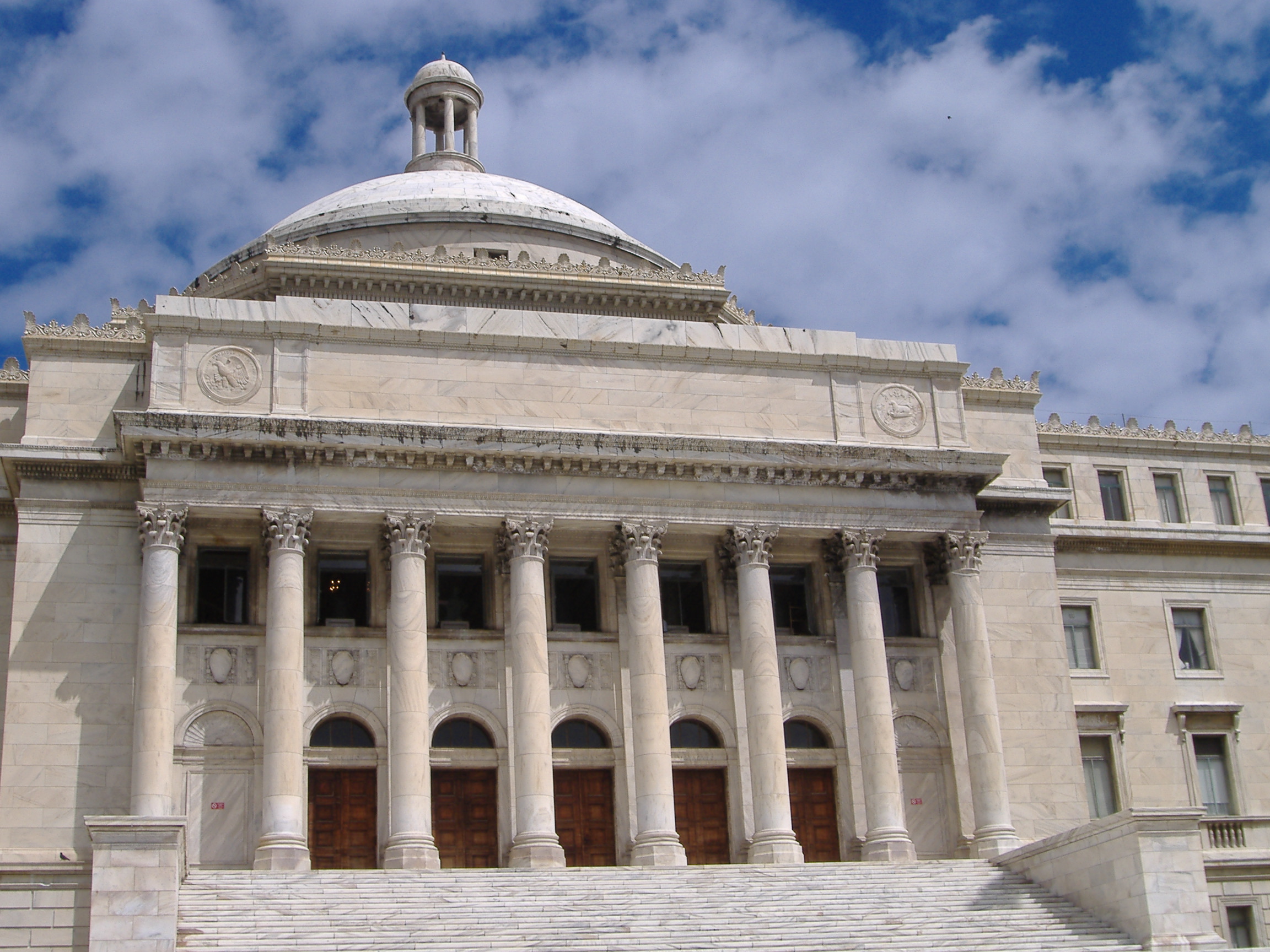
18°27′11″N 66°4′32″W / 18.45306°N 66.07556°WSan Juan Mission/Spanish Revival building from 1941, designed by Rafael Carmoega Morales 23 El Capitolio de Puerto Rico 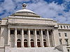
November 18, 1977 Avenida Ponce de León and Avenida Muñoz Rivera
18°28′8″N 66°6′23″W / 18.46889°N 66.10639°WSan Juan The seat of government of Puerto Rico; a Classical Revival / Beaux Arts building from 1929, designed by Rafael Carmoega 24 El Falansterio de Puerta de Tierra 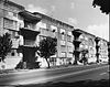
May 3, 1984 Bounded by RR Right-of-Way, Fernández Juncos Ave., Matías Ledesma and San Juan Bautista Sts.
18°27′57″N 66°5′46″W / 18.46583°N 66.09611°WSan Juan Art Deco, from 1937 25 Escuela Brambaugh May 5, 1989 San Juan Bautista St. and Ponce de León Ave.
18°28′2″N 66°5′45″W / 18.46722°N 66.09583°WSan Juan From 1913, also known as Puerta de Tierra Public School 26 Escuela Graduado José Celso Barbosa May 19, 1989 Ponce de Leon Ave.
18°28′4″N 66°6′6″W / 18.46778°N 66.10167°WSan Juan Classical Revival style school from 1927 27 Faro de Morro 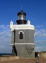
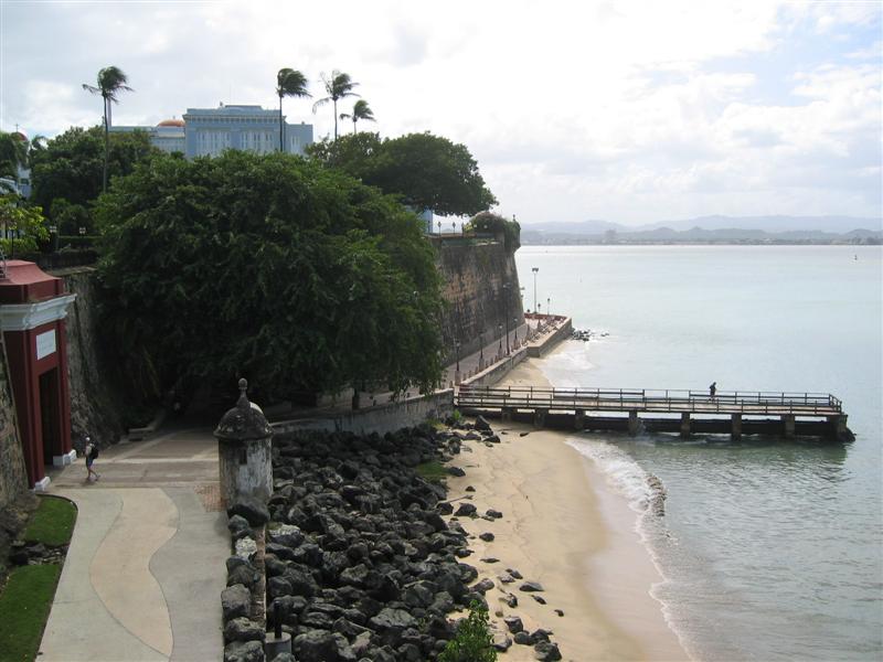
October 22, 1981 Summit of San Felipe del Moro Castle
18°28′15.79″N 66°7′25.01″W / 18.4710528°N 66.1236139°WOld San Juan Oldest lighthouse in Puerto Rico; this version lit in 1908 28 Figueroa Apartments September 14, 2000 601 Fernandez Juncos Ave.
18°27′24.39″N 66°5′14.26″W / 18.456775°N 66.0872944°WSan Juan Art Deco building by Armando Morales Cano, from 1935 29 Fortín de San Gerónimo 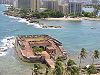
October 11, 1983 Puerta de Tierra
18°27′37″N 66°5′6″W / 18.46028°N 66.085°WSan Juan Building from 1791, also known as Museo de Historia Militar de Puerto Rico 30 General Norzagaray Bridge 
July 19, 1995 PR 873 over the Quebrada Frailes, Barrios Tortugo and Monacillos
18°21′14″N 66°5′31″W / 18.35389°N 66.09194°WSan Juan Brick barrel vault bridge from 1855, known also as Puente de Los Frailes 31 Gran Logia Espiritual Número 1 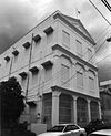
June 8, 2008 1612 Antonsanti St.
18°26′52″N 66°3′53″W / 18.44778°N 66.06472°WSan Juan Classical Revival building from 1910 32 Normandie Hotel 
August 29, 1980 Ponce de León Ave. and San Geronimo St.
18°27′52″N 66°5′15″W / 18.46444°N 66.0875°WSan Juan Hotel that is a spectacular example of Streamline Moderne architecture, inspired by the Art Deco-style design of the ship SS Normandie 33 La Fortaleza 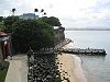
October 15, 1966 Calle Fortaleza, San Juan Island between San Juan Bay and Calle Recinto Oeste
18°27′57″N 66°7′10″W / 18.46583°N 66.11944°WOld San Juan From 1533 34 La Giralda August 11, 2008 651 José Martí St.
18°27′16″N 66°5′8″W / 18.45444°N 66.08556°WSan Juan From 1910 35 Linea Avanzada September 25, 1997 East sector of the San Juan Islet
18°27′55″N 66°5′19″W / 18.46528°N 66.08861°WSan Juan From 1797 36 Martín Peña Bridge August 27, 2008 State Rd. 25, km 8, Santurce Ward San Juan Art Deco style bridge from 1939, designed by Cecilio Delgado and others (Try also Martín Peña Bridge ) 37 Puerto Rico Ilustrado-Edificio El Mundo September 25, 1997 San Jose #254
18°27′58″N 66°7′2″W / 18.46611°N 66.11722°WSan Juan From 1923 38 Río Piedras Bridge July 19, 1995 18°23′49″N 66°3′21″W / 18.39694°N 66.05583°W San Juan A brick barrel vault bridge from 1853 39 Luis Muñoz Rivera Park 
November 14, 2007 Stop 8 Ponce de Leon Ave. San Juan Park with Beaux Arts and Picturesque architecture and/or landscape design 40 San Antonio Railroad Bridge September 30, 2009 Spanning San Antonio Channel at PR 1 E. of San Juan Islet San Juan 41 San Juan National Historic Site 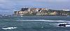
October 15, 1966 18°28′10″N 66°7′17″W / 18.46944°N 66.12139°W Old San Juan Dates from 1525 42 Church, School, Convent and Parish House of San Agustin December 30, 1985 18°28′3″N 66°5′57″W / 18.4675°N 66.09917°W San Juan From 1915 43 Superintendent of Lighthouses' Dwelling 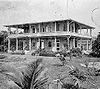
October 22, 1981 La Puntilla
18°27′50″N 66°7′55″W / 18.46389°N 66.13194°WSan Juan Hacienda style building from 1908 located inside the U.S Coast Guard base in La Puntilla 44 Supreme Court Building June 14, 2006 Luis Muñoz Rivera Park
18°27′54″N 66°5′19″W / 18.465°N 66.08861°WSan Juan Modern Movement building from 1955 45 US Custom House February 10, 1988 Calle Puntilla, 1
18°27′53″N 66°6′57″W / 18.46472°N 66.11583°WOld San Juan 1924 building designed by Albert B. Nichols 46 Zona Histórica de San Juan October 10, 1972 NW triangle of the islet of San Juan
18°26′44″N 66°4′33″W / 18.44556°N 66.07583°WOld San Juan 47 Administration Building October 26, 1983 Address Restricted (?) Santurce Also known as Portico and Chapel of the Sacred Heart University, a Classical Revival building from 1906 48 Central High School August 4, 1987 Ponce de León Ave.
18°27′1″N 66°4′13″W / 18.45028°N 66.07028°WSanturce Spanish Renaissance style building from 1925 49 Church of San Mateo de Cangrejos of Santurce 
January 2, 1985 Corner of San Jorge St. and Eduardo Conde Ave.
18°26′48″N 66°3′50″W / 18.44667°N 66.06389°WSanturce 1832 church designed by Pedro Cobreros 50 Miami Building August 23, 1984 868 Ashford Ave.
18°27′44″N 66°4′55″W / 18.46222°N 66.08194°WSanturce Art Deco building from 1936, designed by Pedro Menez 51 Nuestra Senora de Lourdes Chapel September 27, 1984 Ponce de León and Miramar Aves.
18°27′30″N 66°5′7″W / 18.45833°N 66.08528°WSanturce Neo-Gothic style chapel from 1909, designed by Antonin Nechodoma 52 Polvorin de Miraflores March 9, 1984 Antiqua Base Naval de Miramar
18°27′6″N 66°5′40″W / 18.45167°N 66.09444°WSanturce A polvorin from 1776 53 Rafael M. Labra High School August 4, 1987 Junction of Ponce de León and Roberto H. Todd Aves.
18°27′7″N 66°4′29″W / 18.45194°N 66.07472°WSanturce Georgian style school building from 1916 54 Residencia Aboy-Lompré March 22, 1989 Avenida Ponce de León 900
18°27′23″N 66°4′52″W / 18.45639°N 66.08111°WSanturce A Prairie School style house from 1919, designed by Antonin Nechodoma and others 55 Residencia Luis Muñoz Marín September 29, 2011 PR 877, km 0.4
18°23′12″N 66°1′42″W / 18.38667°N 66.02833°WSan Juan vicinity Trujillo Alto
Landmark name Image Date listed Location City/ Town Summary 1 Puente de Trujillo Alto January 28, 2010 Puerto Rico Highway 181, km. 5.6
18°21′26.56″N 66°0′12.34″W / 18.3573778°N 66.0034278°WTrujillo Alto Steel platform bridge over the Río Grande de Loíza; built in 1939 Categories:- National Register of Historic Places in Puerto Rico


Wikimedia Foundation. 2010.