- National Register of Historic Places listings in Burlington County, New Jersey
-
List of the National Register of Historic Places listings in Burlington County, New Jersey
Contents: Counties in New Jersey Atlantic - Bergen - Burlington - Camden - Cape May - Cumberland - Essex - Gloucester - Hudson - Hunterdon - Mercer - Middlesex - Monmouth - Morris - Ocean - Passaic - Salem - Somerset - Sussex - Union - Warren This is intended to be a complete list of properties and districts listed on the National Register of Historic Places in Burlington County, New Jersey. The locations of National Register properties and districts (at least for all showing latitude and longitude coordinates below) may be seen in a Google map by clicking on "Map of all coordinates".[1]
-
- This National Park Service list is complete through NPS recent listings posted November 10, 2011.[2]
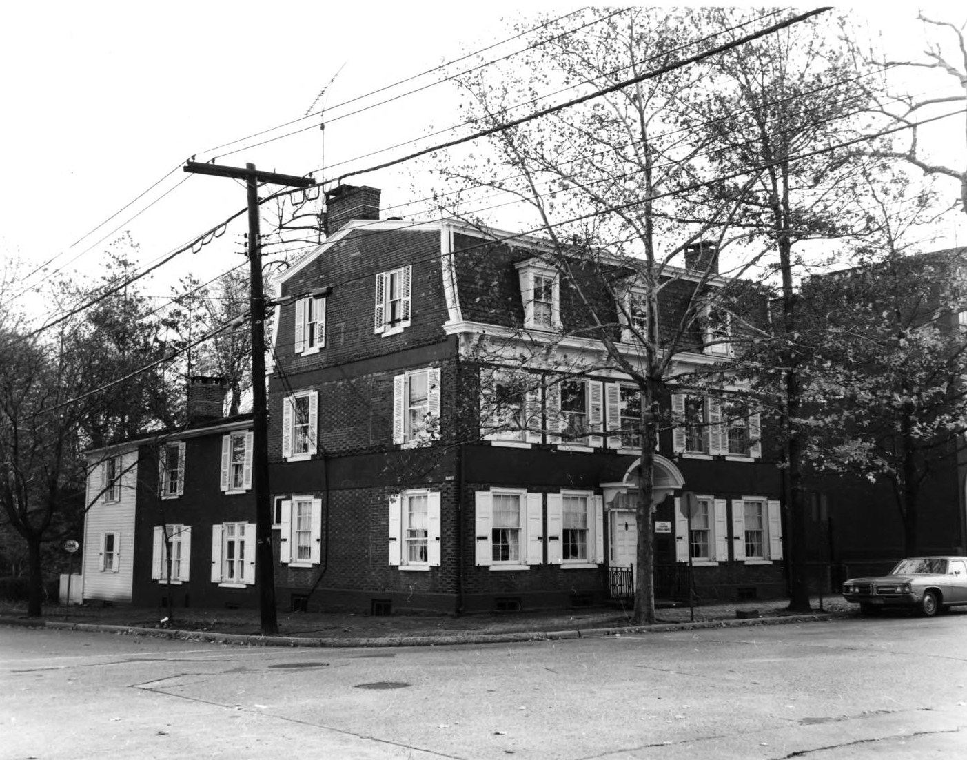
[3] Site name[4] Image Date listed Location[1] City or Town Summary 1 William R. Allen School August 8, 1991 Junction of Mitchell Avenue and East Federal Street
40°4′26″N 74°51′5″W / 40.07389°N 74.85139°WBurlington 2 Arney's Mount Friends Meetinghouse and Burial Ground January 18, 1973 Junction of Mount Holly-Juliustown and Pemberton-Arney's Mount Roads
40°0′33″N 74°41′50″W / 40.00917°N 74.69722°WArney's Mount 3 Arneytown Historic District December 12, 1977 North of Jacobstown
40°6′7″N 74°34′7″W / 40.10194°N 74.56861°WJacobstown 4 Atsion Village October 22, 1974 US 206
39°44′27″N 74°43′29″W / 39.74083°N 74.72472°WAtsion 5 Batsto Village 
September 10, 1971 10 miles (16 km) east of Hammonton on CR 542
39°38′27.83″N 74°38′49.18″W / 39.6410639°N 74.6469944°WBatsto Village 6 Bead Wreck Site October 18, 1988 Address Restricted New Gretna 7 Beverly National Cemetery October 15, 1997 Bridgeboro Road, junction of Mt. Holly, and Bridgeboro Roads
40°3′16″N 74°55′14″W / 40.05444°N 74.92056°WEdgewater Park Township 8 Birmingham School December 31, 1992 Birmingham Road, north of North Branch Rancocas Creek
39°58′47″N 74°42′40″W / 39.97972°N 74.71111°WBirmingham 9 Bishop-Irick Farmstead August 4, 1992 17 Pemberton Road
39°56′23″N 74°44′44″W / 39.93972°N 74.74556°WVincentown 10 Bordentown Historic District June 14, 1982 In an irregular pattern within the city limits
40°8′47″N 74°42′41″W / 40.14639°N 74.71139°WBordentown 11 Breidenhart December 22, 1977 255 East Main Street
39°58′9″N 74°56′8″W / 39.96917°N 74.93556°WMoorestown Township 12 J. F. Budd Baby Shoe Factory December 13, 2000 231 Penn Avenue
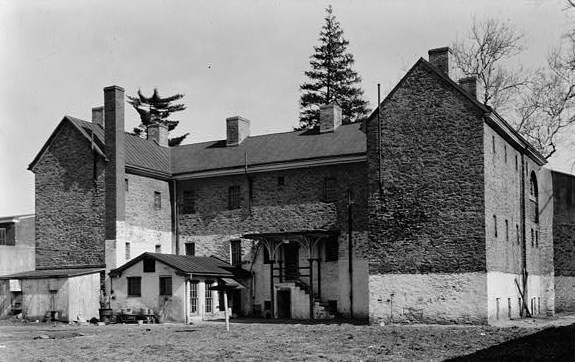
40°4′50″N 74°50′22″W / 40.08056°N 74.83944°WBurlington 13 Burlington County Prison 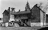
June 24, 1986 High Street
39°59′47″N 74°47′23″W / 39.99639°N 74.78972°WMount Holly Township 14 Burlington Historic District March 13, 1975 Roughly L-shaped, bounded by the Delaware River and High, West Broad, Albot, and Reed Streets
40°4′43″N 74°51′50″W / 40.07861°N 74.86389°WBurlington 15 Burlington's Lost Burial Ground November 26, 2004 Address Restricted
40°4′44″N 74°51′37″W / 40.07889°N 74.86028°WBurlington 16 Buzby's General Store March 25, 2004 3959 CR 563
39°49′9″N 74°32′8″W / 39.81917°N 74.53556°WWoodland Township 17 Chesterford School December 23, 2009 415 W. Main St.
39°57′18.72″N 75°0′32.04″W / 39.9552°N 75.0089°WMaple Shade 18 Cinnaminson Avenue and Spring Garden Street Schools May 29, 1992 Spring Garden Street between Cinnaminson and Parry Avenues
39°59′49″N 75°1′15″W / 39.99694°N 75.02083°WPalmyra 19 Isaac Collins House July 24, 1992 201 Broad Street
40°4′42″N 74°52′1″W / 40.07833°N 74.86694°WBurlington 20 Benjamin Cooper Farm December 12, 1978 Address Restricted Moorestown Township 21 Coopertown Meetinghouse May 22, 1978 Northwest of Willingboro on Cooper Street
40°2′55″N 74°54′16″W / 40.04861°N 74.90444°WWillingboro Township 22 Cropwell Friends Meeting House August 14, 1992 810 Cropwell Road
39°53′36″N 74°55′32″W / 39.89333°N 74.92556°WEvesham Township 23 Crosswicks May 3, 1976 Roughly bounded by Bordentown-Crosswicks and Ellisdale Roads
40°9′7″N 74°38′47″W / 40.15194°N 74.64639°WCrosswicks 24 Crosswicks Creek Site III November 26, 1990 Address Restricted Bordentown 25 Eayres Plantation and Mill Site August 13, 1986 Eayrestown-Red Lion and East Bella Bridge Roads
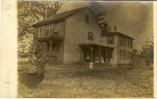
39°56′48″N 74°47′41″W / 39.94667°N 74.79472°WLumberton Township 26 Amos Evans House September 2, 1994 501 East Main Street
39°53′5″N 74°53′49″W / 39.88472°N 74.89694°WEvesham Township 27 William and Susan Evans House August 14, 1992 2 Bill's Lane, Evesham Township
39°52′24″N 74°54′12″W / 39.87333°N 74.90333°WMarlton 28 Evans-Cooper House August 26, 1993 North Elmwood Road between NJ 70 and Marlton Pike
39°53′22″N 74°53′7″W / 39.88944°N 74.88528°WEvesham Township 29 Thomas and Mary Evens House August 26, 1993 South Elmwood Road
39°52′51″N 74°53′19″W / 39.88083°N 74.88861°WEvesham Township 30 Evesham Friends Meeting House April 22, 1982 Moorestown-Mt. Laurel and Hainesport-Mt. Laurel Roads (Evesboro Road)
39°56′5″N 74°53′32″W / 39.93472°N 74.89222°WMount Laurel Township 31 Farmer's Hall August 1, 1979 Southeast corner of Moorestown on Mt. Laurel Road
39°56′2″N 74°53′32″W / 39.93389°N 74.89222°WMoorestown Township 32 Fenwick Manor October 25, 1990 15 Springfield Road
39°57′53″N 74°37′44″W / 39.96472°N 74.62889°WPemberton Township 33 Thomas French, Jr., House January 9, 1978 512 Camden Avenue
39°57′29″N 74°58′0″W / 39.95806°N 74.966667°WMoorestown Township 34 Gen. Edward S. Godfrey House February 28, 1997 27 Main Street
40°2′50″N 74°33′52″W / 40.04722°N 74.56444°WCookstown 35 Green Hill Farm 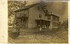
July 8, 1982 Oxmead and Deacon Roads
40°2′43″N 74°48′54″W / 40.04528°N 74.815°WBurlington Township 36 Jonathan Haines House June 16, 1976 Northeast of Medford on Fostertown Road
39°56′29″N 74°47′5″W / 39.94139°N 74.78472°WMedford 37 Hanover Furnace March 1, 1974 Address Restricted Browns Mills 38 High Street Historic District December 15, 1993 Roughly, High Street from Pearl Street to Federal Street
40°4′38″N 74°51′31″W / 40.07722°N 74.85861°WBurlington 39 Thomas Hollinshead House August 14, 1992 18 West Stow Road
39°54′47″N 74°55′26″W / 39.91306°N 74.92389°WMarlton 40 James and Charles B. Holloway Farm Complex July 8, 1982 Newbold Lane
40°6′47″N 74°38′59″W / 40.11306°N 74.64972°WChesterfield Township 41 Francis Hopkinson House 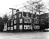
July 17, 1971 101 Farnsworth Avenue at Park Avenue
40°8′54″N 74°42′50″W / 40.14833°N 74.71389°WBordentown 42 John Inskeep Homestead August 26, 1993 70 North Locust Road
39°53′50″N 74°55′0″W / 39.89722°N 74.916667°WMarlton 43 John Irick House September 16, 1977 East of Burlington, off of the New Jersey Turnpike
40°3′2″N 74°45′48″W / 40.05056°N 74.76333°WBurlington 44 Ivins-Conover House April 29, 1977 North of Moorestown off U.S. 130 on Cox Road
40°0′10″N 74°55′7″W / 40.00278°N 74.91861°WMoorestown Township 45 Benjamin Jones House November 30, 1982 Pemberton-Browns Mills Road
39°58′12″N 74°37′31″W / 39.97°N 74.62528°WPemberton 46 Kirby's Mill August 12, 1971 Northeast of Medford at Church and Fostertown Roads
39°55′0″N 74°48′22″W / 39.916667°N 74.80611°WMedford 47 Log Cabin Lodge April 12, 1982 Stokes and Tabernacle Roads
39°51′49″N 74°48′21″W / 39.86361°N 74.80583°WMedford Lakes 48 Main Street Friends Meeting House August 24, 2011 19 South St.
39°53′50″N 74°49′24″W / 39.89722°N 74.82333°WMedford vicinity 49 Moorestown Friends School and Meetinghouse July 22, 1988 Main Street at Chester Avenue
39°57′49″N 74°56′30″W / 39.96361°N 74.94167°WMoorestown Township 50 Moorestown Historic District August 30, 1990 Roughly bounded by Maple Avenue, Chestnust Avenue, Main Street from Zelley Avenue to Locust Street, and Mill Street
39°57′58″N 74°56′13″W / 39.96611°N 74.93694°WMoorestown Township 51 Morris Mansion and Mill September 13, 1977 Hanover Street
39°58′15″N 74°41′4″W / 39.97083°N 74.68444°WPemberton 52 Mount Holly Historic District February 20, 1973 Roughly bounded by Prospect, Elm and Top-E-Toy Streets, railroad tracks, Madison and Clifton Avenues
39°59′37″N 74°47′16″W / 39.99361°N 74.78778°WMount Holly Township 53 New Jersey Manual Training and Industrial School for Colored Youth January 5, 1998 North of Burlington Road, west of I-295
40°8′29″N 74°43′25″W / 40.14139°N 74.72361°WBordentown 54 New St. Mary's Episcopal Church 
May 31, 1972 North side of Broad Street between Talbot and Wood Streets
40°4′37″N 74°51′43″W / 40.07694°N 74.86194°WBurlington 55 Barzillai Newbold House January 26, 1978 East of Columbus on Columbus-Georgetown Roads
40°3′56″N 74°40′4″W / 40.06556°N 74.66778°WColumbus 56 William and Susannah Newbold House September 29, 1980 East of Georgetown
40°4′55″N 74°37′41″W / 40.08194°N 74.62806°WGeorgetown 57 North Pemberton Railroad Station May 23, 1978 Hanover Street
39°58′36″N 74°40′54″W / 39.97667°N 74.68167°WPemberton 58 Oakwood January 30, 1978 West of Wrightstown on Springfield Meeting Road
40°3′7″N 74°38′21″W / 40.05194°N 74.63917°WWrightstown 59 Old Schoolhouse November 26, 2008 35 Brainerd Street
39°59′41.27″N 74°47′11.67″W / 39.9947972°N 74.786575°WMount Holly Township 60 Alice Paul Birthplace 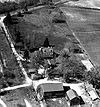
July 5, 1989 128 Hooton Road
39°57′24″N 74°55′50″W / 39.95667°N 74.93056°WMount Laurel Township Also known as Paulsdale 61 Peachfield June 19, 1973 N of Mount Holly on Burr Rd.
40°2′6″N 74°48′9″W / 40.035°N 74.8025°WMount Holly Township 62 Pearson-How, Cooper, and Lawrence Houses April 26, 1978 453–459 High Street
40°4′33″N 74°51′27″W / 40.07583°N 74.8575°WBurlington 63 Pemberton Historic District March 22, 1989 Roughly bounded by Budd Avenue, Budd's Run, Egbert and Cedar Road, and Rancocas Creek and NJ Central Power and Light Company
39°58′12″N 74°41′1″W / 39.97°N 74.68361°WPemberton 64 Perkins House September 15, 1977 Camden Avenue and King's Highway
39°57′34″N 74°57′32″W / 39.95944°N 74.95889°WMoorestown Township 65 Philadelphia Watch Case Company Building January 31, 1978 Pavilion and Lafayette Avenues
40°2′24″N 74°57′34″W / 40.04°N 74.95944°WRiverside Township 66 Point Breeze August 10, 1977 US 206 and Park Street
40°9′22″N 74°42′30″W / 40.15611°N 74.70833°WBordentown 67 Providence Presbyterian Church of Bustleton November 18, 1988 Junction of Old York and Burlington-Bustleton Roads
40°5′16″N 74°47′2″W / 40.08778°N 74.78389°WRoebling 68 Quaker School December 31, 1974 York and Penn Streets
40°4′48″N 74°51′22″W / 40.08°N 74.85611°WBurlington 69 Rancocas Historic Village June 5, 1975 Irregular pattern bounded north and west by Willingboro line, east to Springside Road and to South 3rd Street
40°0′37″N 74°52′1″W / 40.01028°N 74.86694°WRancocas 70 Recklesstown 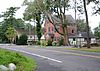
August 19, 1975 Present town of Chesterfield along Chesterfield-Georgetown Road and CR 528
40°6′49″N 74°38′15″W / 40.11361°N 74.6375°WChesterfield 71 Red Dragon Canoe Club February 2, 2001 221 Edgewater Avenue
40°4′11″N 74°53′53″W / 40.06972°N 74.89806°WEdgewater Park Township 72 Riverton Historic District March 5, 1999 Roughly bounded by the Delaware River, Park Avenue, Thomas Avenue, and Fulton Street
40°0′33″N 75°0′50″W / 40.00917°N 75.01389°WRiverton 73 Roebling Historic District May 22, 1978 Roughly bounded by Roebling Park, South Sreet, 2nd and 8th Avenues, Roland Street, Alden, Norman Railroad, and Amboy Avenue
40°7′1″N 74°46′30″W / 40.11694°N 74.775°WRoebling 74 Rosebud Farm August 17, 1979 East of Jobstown on Springfield Meetinghouse Road
40°2′19″N 74°39′42″W / 40.03861°N 74.66167°WJobstown 75 Schoolhouse April 21, 1975 2 miles (3.2 km) east of Bridgeboro on Salem Road
40°1′49″N 74°53′46″W / 40.03028°N 74.89611°WBridgeboro 76 Shamong Hotel September 13, 1979 Main Street
39°49′5″N 74°32′8″W / 39.81806°N 74.53556°WChatsworth 77 Singleton-Lathem-Large House March 7, 1979 Northwest of Chesterfield on CR 528
40°8′33″N 74°40′46″W / 40.1425°N 74.67944°WChesterfield Township 78 Smith Mansion October 22, 1976 12 High Street
39°57′46″N 74°56′51″W / 39.96278°N 74.9475°WMoorestown Township 79 Thomas Smith House September 27, 1990 1645 Hainesport-Mt. Laurel Road
39°55′8″N 74°54′58″W / 39.91889°N 74.91611°WMount Laurel Township 80 Smithville Historic District May 12, 1977 Off of NJ 38
39°58′57″N 74°45′4″W / 39.9825°N 74.75111°WSmithville 81 St. Mary of the Lakes Catholic Church April 27, 2007 108 Stokes Road
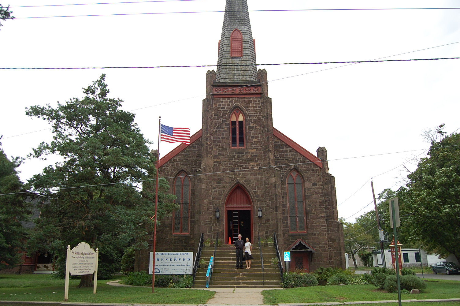
39°51′45″N 74°48′19″W / 39.8625°N 74.80528°WMedford Lakes 82 St. Stephens Episcopal Church 
November 25, 1999 158 Warren Street
40°3′52″N 74°55′1″W / 40.06444°N 74.91694°WBeverly City 83 Dr. James Still Office November 3, 1995 209 Church Road
39°54′56″N 74°49′29″W / 39.91556°N 74.82472°WMedford 84 Charles Stokes House August 12, 1993 600 Beverly-Rancocas Road, Willingboro Township
40°0′44″N 74°52′30″W / 40.01222°N 74.875°WWillingboro Township 85 Stokes-Evans House August 30, 1994 52 East Main Street
39°53′26″N 74°55′3″W / 39.89056°N 74.9175°WMarlton 86 Taylor-Newbold House November 18, 1988 Off Old York Road (CR 660)
40°6′56″N 74°40′6″W / 40.11556°N 74.66833°WChesterfield Township 87 Town Hall August 10, 1977 40 East Main Street
39°57′51″N 74°56′42″W / 39.96417°N 74.945°WMoorestown Township 88 Upper Springfield Meetinghouse August 24, 1979 West of Wrightstown
40°2′40″N 74°38′30″W / 40.04444°N 74.64167°WWrightstown 89 Vincentown Historic District September 21, 1988 Roughly bounded by Mill, Church, Pleasant, Main, and Race Strets, and Red Lion Road
39°56′5″N 74°45′2″W / 39.93472°N 74.75056°WVincentown 90 Whitesbog Historic District October 27, 1988 North of NJ 70 and south of Fort Dix
39°57′34.21″N 74°30′34.32″W / 39.9595028°N 74.5095333°WBrowns Mills 91 Jacob Wills House November 1, 1990 Brick Road, west of Evans Road
39°52′46″N 74°54′2″W / 39.87944°N 74.90056°WMarlton 92 Zurbrugg Mansion August 28, 2009 531 Delaware Avenue
40°3′3″N 74°37′53″W / 40.05083°N 74.63139°WDelanco References
- ^ a b The latitude and longitude information provided in this table was derived originally from the National Register Information System, which has been found to be fairly accurate for about 99% of listings. For about 1% of NRIS original coordinates, experience has shown that one or both coordinates are typos or otherwise extremely far off; some corrections may have been made. A more subtle problem causes many locations to be off by up to 150 yards, depending on location in the country: most NRIS coordinates were derived from tracing out latitude and longitudes off of USGS topographical quadrant maps created under the North American Datum of 1927, which differs from the current, highly accurate WGS84 GPS system used by Google maps. Chicago is about right, but NRIS longitudes in Washington are higher by about 4.5 seconds, and are lower by about 2.0 seconds in Maine. Latitudes differ by about 1.0 second in Florida. Some locations in this table may have been corrected to current GPS standards.
- ^ "National Register of Historic Places: Weekly List Actions". National Park Service, United States Department of the Interior. Retrieved on November 10, 2011.
- ^ Numbers represent an ordering by significant words. Various colorings, defined here, differentiate National Historic Landmark sites, a [[National Historic Site (United States)|]], and several National Register of Historic Places Districts from other NRHP buildings, structures, sites or objects.
- ^ "National Register Information System". National Register of Historic Places. National Park Service. 2008-04-24. http://nrhp.focus.nps.gov/natreg/docs/All_Data.html.
U.S. National Register of Historic Places Topics Lists by states Alabama • Alaska • Arizona • Arkansas • California • Colorado • Connecticut • Delaware • Florida • Georgia • Hawaii • Idaho • Illinois • Indiana • Iowa • Kansas • Kentucky • Louisiana • Maine • Maryland • Massachusetts • Michigan • Minnesota • Mississippi • Missouri • Montana • Nebraska • Nevada • New Hampshire • New Jersey • New Mexico • New York • North Carolina • North Dakota • Ohio • Oklahoma • Oregon • Pennsylvania • Rhode Island • South Carolina • South Dakota • Tennessee • Texas • Utah • Vermont • Virginia • Washington • West Virginia • Wisconsin • WyomingLists by territories Lists by associated states Other  State of New Jersey
Topics Regions - Atlantic Coastal Plain
- Central Jersey
- Delaware River Region
- Delaware Valley
- Gateway Region
- Gold Coast
- Highlands
- Jersey Shore
- Meadowlands
- New York metro area
- North Hudson
- North Jersey
- Pascack Valley
- Piedmont
- Pine Barrens
- Raritan Bayshore
- Ridge-and-Valley Appalachians
- Southern Shore Region
- Skylands Region
- South Jersey
- Tri‑State Region
- West Hudson
Counties Major cities Categories:- National Register of Historic Places in New Jersey
- Burlington County, New Jersey
-

Wikimedia Foundation. 2010.