- National Register of Historic Places listings in Bath County, Virginia
-
This list includes properties and districts listed on the National Register of Historic Places in Bath County, Virginia. Click the "Map of all coordinates" link to the right to view a Google map of all properties and districts with latitude and longitude coordinates in the table below.[1]
-
- This National Park Service list is complete through NPS recent listings posted November 10, 2011.[2]
[3] Landmark name [4] Image Date listed Location City or town Summary 1 Douthat State Park Historic District 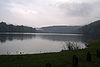
September 20, 1986 VA 629
37°53′13″N 79°48′36″W / 37.886944°N 79.81°WMillboro 2 Hidden Valley February 26, 1970 N of Bacova near jct. of Rtes. 621 and 39 in George Washington National Forest
38°06′23″N 79°48′53″W / 38.106389°N 79.814722°WBacova 3 Hidden Valley Rock Shelter (44BA31) July 22, 1986 Address Restricted Warm Springs 4 Homestead Dairy Barns February 13, 2007 US 220
38°03′02″N 79°46′59″W / 38.050525°N 79.783167°WWarm Springs 5 The Homestead 
May 3, 1984 US 220
37°59′49″N 79°49′50″W / 37.996944°N 79.830556°WHot Springs 6 Millboro School January 16, 2004 Jct. of VA 668 (High St.) and VA 633 (Main St.)
37°58′42″N 79°36′12″W / 37.978333°N 79.603333°WMillboro 7 Mustoe House April 12, 2002 Rt. 2, Box 211
37°55′16″N 79°53′27″W / 37.921111°N 79.890833°WHot Springs 8 Oakley Farm August 8, 2007 11865 Sam Snead Highway (US 220)
38°02′33″N 79°47′23″W / 38.042589°N 79.789597°WWarm Springs 9 Old Stone House February 10, 1983 SW of Milboro Springs on VA 664
37°55′31″N 79°43′53″W / 37.925278°N 79.731389°WMillboro Springs 10 Warm Springs Bathhouses 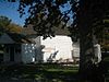
October 8, 1969 NE of Warm Springs off Rt. 220
38°03′13″N 79°46′51″W / 38.053611°N 79.780833°WWarm Springs Also known as Jefferson Pools 11 Warm Springs Mill September 11, 1989 E side of VA 645
38°02′51″N 79°47′25″W / 38.0475°N 79.790278°WWarm Springs 12 The Yard February 13, 2007 381 Old Greenhouse Rd.
37°59′31″N 79°50′08″W / 37.992039°N 79.835447°WHot Springs See also
- List of National Historic Landmarks in Virginia
- National Register of Historic Places listings in Virginia
References
- ^ The latitude and longitude information provided in this table was derived originally from the National Register Information System, which has been found to be fairly accurate for about 99% of listings. For about 1% of NRIS original coordinates, experience has shown that one or both coordinates are typos or otherwise extremely far off; some corrections may have been made. A more subtle problem causes many locations to be off by up to 150 yards, depending on location in the country: most NRIS coordinates were derived from tracing out latitude and longitudes off of USGS topographical quadrant maps created under the North American Datum of 1927, which differs from the current, highly accurate WGS84 GPS system used by Google maps. Chicago is about right, but NRIS longitudes in Washington are higher by about 4.5 seconds, and are lower by about 2.0 seconds in Maine. Latitudes differ by about 1.0 second in Florida. Some locations in this table may have been corrected to current GPS standards.
- ^ "National Register of Historic Places: Weekly List Actions". National Park Service, United States Department of the Interior. Retrieved on November 10, 2011.
- ^ Numbers represent an ordering by significant words. Various colorings, defined here, differentiate National Historic Landmark sites and National Register of Historic Places Districts from other NRHP buildings, structures, sites or objects.
- ^ "National Register Information System". National Register of Historic Places. National Park Service. . http://nrhp.focus.nps.gov/natreg/docs/All_Data.html.
U.S. National Register of Historic Places Topics Lists by states Alabama • Alaska • Arizona • Arkansas • California • Colorado • Connecticut • Delaware • Florida • Georgia • Hawaii • Idaho • Illinois • Indiana • Iowa • Kansas • Kentucky • Louisiana • Maine • Maryland • Massachusetts • Michigan • Minnesota • Mississippi • Missouri • Montana • Nebraska • Nevada • New Hampshire • New Jersey • New Mexico • New York • North Carolina • North Dakota • Ohio • Oklahoma • Oregon • Pennsylvania • Rhode Island • South Carolina • South Dakota • Tennessee • Texas • Utah • Vermont • Virginia • Washington • West Virginia • Wisconsin • WyomingLists by territories Lists by associated states Other Municipalities and communities of Bath County, Virginia CDPs 
Unincorporated
communitiesArmstrong | Ashwood | Bacova | Bacova Junction | Bath Alum | Bolar | Burnsville | Callison | Carloover | Chimney Run | Copeland | Crane | Crowdertown | Fort Lewis | Green Valley | Greenwood | Healing Springs | Hotchkiss | McClung | McCowan Spring | Midway | Millboro | Millboro Springs | Mitchelltown | Mooretown | Mountain Grove | Perkins Point | Shiloh | Sunrise | Switch Back | Thomastown | Tinkertown | West Warm Springs | Williamsville | Yost
Categories:- Bath County, Virginia
- National Register of Historic Places in Virginia
- Virginia-related lists
-


Wikimedia Foundation. 2010.