- National Register of Historic Places listings in Bannock County, Idaho
-
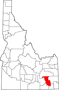 Location of Bannock County in Idaho
This is a list of the National Register of Historic Places listings in Bannock County, Idaho.
This is intended to be a complete list of the properties and districts on the National Register of Historic Places in Bannock County, Idaho, United States. Latitude and longitude coordinates are provided for many National Register properties and districts; these locations may be seen together in a Google map.[1]
There are 29 properties and districts listed on the National Register in the county, including 1 National Historic Landmark. More may be added; properties and districts nationwide are added to the Register weekly.[2]
-
- This National Park Service list is complete through NPS recent listings posted November 10, 2011.[3]
Current listings
[4] Landmark name [5] Image Date listed Location City or town Summary 1 A.F.R. Building November 15, 1990 501 N. Main St.
42°51′55″N 112°27′13″W / 42.865278°N 112.453611°WPocatello 2 Brady Memorial Chapel May 1, 1979 Mountain View Cemetery
42°51′20″N 112°25′44″W / 42.855556°N 112.428889°WPocatello 3 Church of the Assumption May 1, 1979 528 N. 5th Ave.
42°52′12″N 112°26′46″W / 42.87°N 112.446111°WPocatello 4 East Side Downtown Historic District November 25, 1994 Roughly including the 200 and 300 blocks of E. Center St., the 100 block of N. 2nd Ave., and the 100 block of S. 2nd Ave.
42°51′43″N 112°26′46″W / 42.861944°N 112.446111°WPocatello 5 Fort Hall October 15, 1966 11 miles west of Fort Hall on the Fort Hall Indian Reservation
43°01′24″N 112°37′58″W / 43.023333°N 112.632778°WFort Hall 6 H.O. Harkness Stable Building February 1, 1980 111 S. Railroad St.
42°39′21″N 112°11′33″W / 42.65578°N 112.19241°WMcCammon 7 John Hood House December 14, 1978 554 S. 7th Ave.
42°51′58″N 112°26′17″W / 42.866111°N 112.438056°WPocatello 8 William A. Hyde House June 23, 1983 429 N. 7th St.
42°52′10″N 112°26′39″W / 42.869444°N 112.444167°WPocatello 9 Idaho State University Administration Building September 23, 1993 919 S. 8th St., Building 10, on the Idaho State University campus
42°51′43″N 112°25′58″W / 42.861944°N 112.432778°WPocatello 10 Idaho State University Neighborhood Historic District September 7, 1984 Roughly bounded by 6th, 9th, Carter, and Center Sts.
42°51′57″N 112°26′15″W / 42.865833°N 112.4375°WPocatello 11 L.D.S. Ward Building December 9, 1999 187 S. 2nd Ave.
42°37′04″N 112°00′51″W / 42.617778°N 112.014167°WLava Hot Springs 12 Lava High School Gymnasium July 9, 1997 202 W. Fife
42°37′00″N 112°00′52″W / 42.616667°N 112.014444°WLava Hot Springs 13 Lincoln-Johnson Avenues Residential Historic District March 15, 2006 Roughly bounded by W. Hayden St., the Portneuf River, W. Benton St., and the West Bench
42°51′30″N 112°27′17″W / 42.858333°N 112.454722°WPocatello 14 McCammon State Bank Building July 9, 1979 Center and 3rd Sts.
42°39′14″N 112°11′38″W / 42.653889°N 112.193889°WMcCammon 15 Old Town Residential Historic District April 2, 2008 Roughly bounded by W. Benton, S. Garfield, and W. Lewis Sts., and the Portneuf River
42°51′30″N 112°27′06″W / 42.85832°N 112.45155°WPocatello 16 Pocatello Carnegie Library 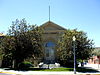
July 2, 1973 113 S. Garfield Ave.
42°51′38″N 112°27′08″W / 42.860556°N 112.452222°WPocatello 17 Pocatello Federal Building October 5, 1977 Arthur Ave. and Lewis St.
42°51′40″N 112°27′00″W / 42.861111°N 112.45°WPocatello 18 Pocatello Historic District 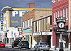
June 3, 1982 Roughly bounded by railroad tracks and W. Fremont, W. Bonneville, and Garfield Sts.
42°51′44″N 112°27′03″W / 42.862222°N 112.450833°WPocatello 19 Pocatello Warehouse Historic District September 3, 1996 Roughly bounded by S. 2nd Ave., E. Halliday, E. Sutter, and the Oregon Short Line railroad tracks
42°51′29″N 112°26′20″W / 42.858056°N 112.438889°WPocatello 20 Pocatello Westside Residential Historic District March 17, 2003 Roughly bounded by N. Arthur Ave., W. Fremont St., N. Grant Ave., and W. Young St.
42°51′53″N 112°27′26″W / 42.864722°N 112.457222°WPocatello 21 Quinn Apartments January 11, 1985 580 W. Clark St.
42°51′41″N 112°27′12″W / 42.861389°N 112.453333°WPocatello 22 Rice-Packard House September 12, 1985 454 N. Hayes Ave.
42°51′48″N 112°27′21″W / 42.863333°N 112.455833°WPocatello 23 Riverside Inn August 29, 1979 112 Portneuf Ave.
42°37′12″N 112°00′28″W / 42.62°N 112.007778°WLava Hot Springs 24 St. Joseph's Catholic Church August 29, 1978 455 N. Hayes
42°51′46″N 112°27′23″W / 42.862778°N 112.456389°WPocatello 25 Standrod House January 18, 1973 648 N. Garfield Ave.
42°51′54″N 112°27′27″W / 42.86498°N 112.45744°WPocatello 26 Sullivan-Kinney House November 9, 1977 441 S. Garfield Ave.
42°51′29″N 112°26′55″W / 42.858056°N 112.448611°WPocatello 27 Trinity Episcopal Church February 17, 1978 248 N. Arthur St.
42°51′47″N 112°27′08″W / 42.863056°N 112.452222°WPocatello 28 Whitestone Hotel April 7, 1980 2nd Ave. and Main St.
42°37′11″N 112°00′31″W / 42.619722°N 112.008611°WLava Hot Springs 29 Woolley Apartments October 31, 1985 303 N. Hayes Ave.
42°51′42″N 112°27′18″W / 42.861667°N 112.455°WPocatello See also
References
- ^ The latitude and longitude information provided in this table was derived originally from the National Register Information System, which has been found to be fairly accurate for about 99% of listings. For about 1% of NRIS original coordinates, experience has shown that one or both coordinates are typos or otherwise extremely far off; some corrections may have been made. A more subtle problem causes many locations to be off by up to 150 yards, depending on location in the country: most NRIS coordinates were derived from tracing out latitude and longitudes off of USGS topographical quadrant maps created under the North American Datum of 1927, which differs from the current, highly accurate WGS84 GPS system used by Google maps. Chicago is about right, but NRIS longitudes in Washington are higher by about 4.5 seconds, and are lower by about 2.0 seconds in Maine. Latitudes differ by about 1.0 second in Florida. Some locations in this table may have been corrected to current GPS standards.
- ^ "National Register of Historic Places: Weekly List Actions". National Park Service. http://www.cr.nps.gov/nr/nrlist.htm. Retrieved March 29, 2009.
- ^ "National Register of Historic Places: Weekly List Actions". National Park Service, United States Department of the Interior. Retrieved on November 10, 2011.
- ^ Numbers represent an ordering by significant words. Various colorings, defined here, differentiate National Historic Landmark sites and National Register of Historic Places Districts from other NRHP buildings, structures, sites or objects.
- ^ "National Register Information System". National Register of Historic Places. National Park Service. . http://nrhp.focus.nps.gov/natreg/docs/All_Data.html.
Properties on the National Register of Historic Places in Idaho  Ada • Adams • Bannock • Bear Lake • Benewah • Bingham • Blaine • Boise • Bonner • Bonneville • Boundary • Butte • Camas • Canyon • Caribou • Cassia • Clark • Clearwater • Custer • Elmore • Franklin • Fremont • Gem • Gooding • Idaho • Jefferson • Jerome • Kootenai • Latah • Lemhi • Lewis • Lincoln • Madison • Minidoka • Nez Perce • Oneida • Owyhee • Payette • Power • Shoshone • Teton • Twin Falls • Valley • Washington
U.S. National Register of Historic Places Topics Lists by states Alabama • Alaska • Arizona • Arkansas • California • Colorado • Connecticut • Delaware • Florida • Georgia • Hawaii • Idaho • Illinois • Indiana • Iowa • Kansas • Kentucky • Louisiana • Maine • Maryland • Massachusetts • Michigan • Minnesota • Mississippi • Missouri • Montana • Nebraska • Nevada • New Hampshire • New Jersey • New Mexico • New York • North Carolina • North Dakota • Ohio • Oklahoma • Oregon • Pennsylvania • Rhode Island • South Carolina • South Dakota • Tennessee • Texas • Utah • Vermont • Virginia • Washington • West Virginia • Wisconsin • WyomingLists by territories Lists by associated states Other Municipalities and communities of Bannock County, Idaho Cities 
CDPs Fort Hall‡ | Tyhee
Unincorporated
communitySwanlake
Indian reservation Categories:- National Register of Historic Places in Idaho by county
- Bannock County, Idaho
-


Wikimedia Foundation. 2010.