|
Landmark name |
Image |
Date listed |
Location |
City or Town |
Summary |
| 1 |
Warren Bane Site |
 |
01982-03-19 March 19, 1982 |
Address Restricted |
Ellsworth |
|
| 2 |
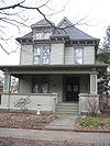
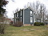
Ruben M. Benjamin House |
 |
01978-08-30 August 30, 1978 |
510 East Grove Street
40°28′41″N 88°59′16″W / 40.47806°N 88.98778°W / 40.47806; -88.98778 (Ruben M. Benjamin House) |
Bloomington |
|
| 3 |
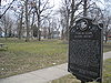
Benjaminville Friends Meetinghouse and Burial Ground |
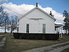 |
01983-12-13 December 13, 1983 |
North of Holder
40°28′35″N 88°48′21″W / 40.47639°N 88.80583°W / 40.47639; -88.80583 (Benjaminville Friends Meetinghouse and Burial Ground) |
Holder |
|
| 4 |
Bloomington Central Business District |
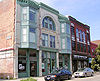 |
01985-02-28 February 28, 1985 |
Roughly bounded by Main, Center and Front Streets
40°28′50″N 88°59′35″W / 40.48056°N 88.99306°W / 40.48056; -88.99306 (Bloomington Central Business District) |
Bloomington |
|
| 5 |
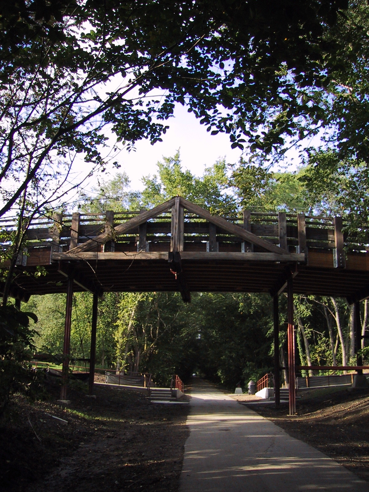
Camelback Bridge |
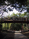 |
01997-05-15 May 15, 1997 |
Virginia Avenue, across the Constitution Trail
40°29′53.5″N 88°59′1″W / 40.498194°N 88.98361°W / 40.498194; -88.98361 (Camelback Bridge) |
Normal |
|
| 6 |
Cedar Crest Addition Historic District |
 |
02006-11-15 November 15, 2006 |
Roughly bounded by Constitutional Trail, Division Street, Highland Avenue and Fell Avenue
40°29′46″N 88°59′7″W / 40.49611°N 88.98528°W / 40.49611; -88.98528 (Cedar Crest Addition Historic District) |
Normal |
|
| 7 |
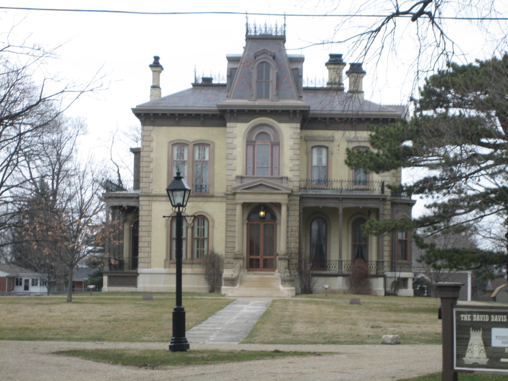
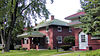
Clover Lawn |
 |
01972-10-18 October 18, 1972 |
1000 East Monroe Drive
40°28′56″N 88°58′47″W / 40.48222°N 88.97972°W / 40.48222; -88.97972 (Clover Lawn) |
Bloomington |
|
| 8 |
John W. Cook Hall |
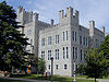 |
01986-02-20 February 20, 1986 |
Illinois State University, U.S. Route 51
40°30′33″N 88°59′32″W / 40.50917°N 88.99222°W / 40.50917; -88.99222 (John W. Cook Hall) |
Normal |
|
| 9 |
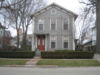
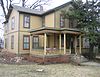
George H. Cox House |
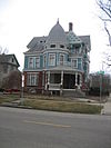 |
01985-11-14 November 14, 1985 |
701 East Grove Street
40°28′40″N 88°59′8″W / 40.47778°N 88.98556°W / 40.47778; -88.98556 (George H. Cox House) |
Bloomington |
|
| 10 |
David Davis III & IV House |
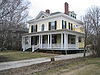 |
01982-11-12 November 12, 1982 |
1005 East Jefferson
40°28′50″N 88°58′48″W / 40.48056°N 88.98°W / 40.48056; -88.98 (David Davis III & IV House) |
Bloomington |
|
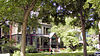
| 11 |
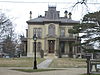
Duncan Manor |
 |
01979-02-09 February 9, 1979 |
Southwest of Towanda off Illinois Route 4
40°34′10″N 88°54′38″W / 40.56944°N 88.91056°W / 40.56944; -88.91056 (Duncan Manor) |
Towanda |
|
| 12 |
East Grove Street District–Bloomington |
 |
01987-02-26 February 26, 1987 |
400–700 East Grove Street
40°28′39″N 88°59′22″W / 40.4775°N 88.98944°W / 40.4775; -88.98944 (East Grove Street District--Bloomington) |
Bloomington |
|
| 13 |
Franklin Square |
 |
01976-01-11 January 11, 1976 |
300 and 400 blocks of East Chestnut and East Walnut Streets, 900 block of North Prairie and North McLean Streets
40°29′12″N 88°59′25″W / 40.48667°N 88.99028°W / 40.48667; -88.99028 (Franklin Square) |
Bloomington |
|
| 14 |
Gildersleeve House |
|
01977-07-28 July 28, 1977 |
108 Broadway
40°36′25″N 88°59′18″W / 40.60694°N 88.98833°W / 40.60694; -88.98833 (Gildersleeve House) |
Hudson |
|
| 15 |
Robert Greenlee House |
 |
01997-02-07 February 7, 1997 |
806 North Evans Street
40°29′6″N 88°59′14″W / 40.485°N 88.98722°W / 40.485; -88.98722 (Robert Greenlee House) |
Bloomington |
|
| 16 |
John M. Hamilton House |
 |
01978-09-06 September 6, 1978 |
502 South Clayton Street
40°28′33″N 88°59′10″W / 40.47583°N 88.98611°W / 40.47583; -88.98611 (John M. Hamilton House) |
Bloomington |
|
| 17 |
Holy Trinity Church Rectory and Convent |
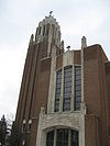 |
01983-12-08 December 8, 1983 |
704 North Main and 106 West Chestnut Streets
40°29′6″N 88°59′39″W / 40.485°N 88.99417°W / 40.485; -88.99417 (Holy Trinity Church Rectory and Convent) |
Bloomington |
|
| 18 |
Hubbard House |
 |
01979-02-01 February 1, 1979 |
310 Broadway |
Hudson |
|
| 19 |
LeRoy Commercial Historic District |
|
01996-02-16 February 16, 1996 |
111–123, 200–223, 300 Center and 106–118 Chestnut Streets
40°20′49″N 88°45′38″W / 40.34694°N 88.76056°W / 40.34694; -88.76056 (LeRoy Commercial Historic District) |
Le Roy |
|
| 20 |
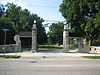
McLean County Courthouse and Square |
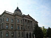 |
01973-02-06 February 6, 1973 |
Main, Washington, Center, and Jefferson Streets
40°28′40″N 88°59′39″W / 40.47778°N 88.99417°W / 40.47778; -88.99417 (McLean County Courthouse and Square) |
Bloomington |
|
| 21 |
George H. Miller House |
 |
01978-07-20 July 20, 1978 |
405 West Market Street
40°28′56″N 88°59′48″W / 40.48222°N 88.99667°W / 40.48222; -88.99667 (George H. Miller House) |
Bloomington |
|
| 22 |
Miller–Davis Law Buildings |
 |
01979-04-27 April 27, 1979 |
101–103 North Main Street and 102–104 East Front Street
40°28′48″N 88°59′35″W / 40.48°N 88.99306°W / 40.48; -88.99306 (Miller-Davis Law Buildings) |
Bloomington |
|
| 23 |
Normal Theater |
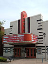 |
01997-07-25 July 25, 1997 |
209 North Street
40°30′33″N 88°59′11″W / 40.50917°N 88.98639°W / 40.50917; -88.98639 (Normal Theater) |
Normal |
|
| 24 |
John Patton Log Cabin |
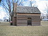 |
01986-08-01 August 1, 1986 |
Lexington Park District Park
40°38′55″N 88°46′48″W / 40.64861°N 88.78°W / 40.64861; -88.78 (John Patton Log Cabin) |
Lexington |
|
| 25 |
Matthew T. Scott House |
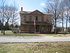 |
01983-02-10 February 10, 1983 |
227 1st Avenue
40°44′21″N 88°43′41″W / 40.73917°N 88.72806°W / 40.73917; -88.72806 (Matthew T. Scott House) |
Chenoa |
|
| 26 |
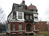
Scott–Vrooman House |
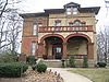 |
01983-08-18 August 18, 1983 |
701 East Taylor Street
40°28′33″N 88°59′7″W / 40.47583°N 88.98528°W / 40.47583; -88.98528 (Scott-Vrooman House) |
Bloomington |
|
| 27 |
Sprague's Super Service |
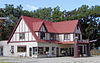 |
02008-04-25 April 25, 2008 |
305 E. Pine St.
40°31′3″N 88°58′51″W / 40.5175°N 88.98083°W / 40.5175; -88.98083 (Sprague's Super Service) |
Normal |
|
| 28 |
Stevenson House |
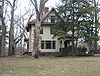 |
01974-05-24 May 24, 1974 |
1316 East Washington Street
40°28′18″N 88°58′11″W / 40.47167°N 88.96972°W / 40.47167; -88.96972 (Stevenson House) |
Bloomington |
|
| 29 |
US Army Aircraft C–53–DO–41–20124 |
|
01996-08-01 August 1, 1996 |
1.25 miles (2.01 km) east of junction of Illinois Route 9 and Interstate 55 Business
40°29′7″N 88°55′52″W / 40.48528°N 88.93111°W / 40.48528; -88.93111 (US Army Aircraft C-53-DO-41-20124) |
Bloomington |
|
| 30 |
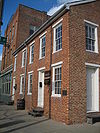
White Building |
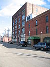 |
01994-06-17 June 17, 1994 |
215–223 East Douglas Street
40°28′58″N 88°59′28″W / 40.48278°N 88.99111°W / 40.48278; -88.99111 (White Building) |
Bloomington |
|
| 31 |
White Place Historic District |
 |
01988-08-12 August 12, 1988 |
White Place, Clinton Boulevard, and east side of Fell Avenue between Empire and Emerson Streets
40°29′27″N 88°59′6″W / 40.49083°N 88.985°W / 40.49083; -88.985 (White Place Historic District) |
Bloomington |
|