- Mullet Peninsula
-
"The Mullet" redirects here. For other uses, see Mullet (disambiguation).
Mullet Peninsula — Town — Location in Ireland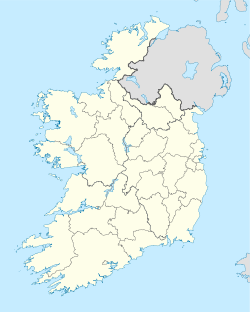
 Mullet Peninsula
Coordinates: 54°13′30″N 9°59′27″W / 54.225°N 9.9908°WCoordinates: 54°13′30″N 9°59′27″W / 54.225°N 9.9908°W Country Ireland Province Connacht County County Mayo Elevation 1 m (3 ft) Population (2006) - Urban 2,009 - Rural 7,909 Time zone WET (UTC+0) - Summer (DST) IST (WEST) (UTC-1) Irish Grid Reference F701326 The Mullet Peninsula, also known as the Mullet, is a peninsula in the barony of Erris in County Mayo, Ireland. It consists of a large promontory connected to the mainland at Belmullet (Irish: Béal an Mhuirthead), a town of about 2,000 inhabitants, by a narrow isthmus. There are several small towns on the Mullet peninsula including Aughleam, Elly, Corclough and Binghamstown (An Geata Mór). It is about 33 km long and 12 km wide at its widest parts, and about 50 metres at the narrowest part. Its northernmost point is Erris Head. The peninsula's doglegged shape forms two bays, Blacksod Bay and Broadhaven Bay.
The Mullet Peninsula is part of the Mayo Gaeltacht. Irish is the most common language in rural areas, while English is also commonly spoken in Belmullet. The area has several Irish-language summer schools. The Mullet is popular with tourists who find miles upon miles of uncluttered white sandy beaches and a mild climate; chief attractions include golf, watersports, kiting, boating and fishing, particularly sea-angling.
Antiquities and places of interest
Despite its apparent sandy 'barrenness', the Mullet Peninsula has much to offer in way of interesting historical artefacts.[1] The parish of Kilcommon which lies to the north-east of the Mullet has more visible prehistoric monuments such as in-situ megalithic tombs.
Several islands lie off the coast of the Mullet peninsula including the Inishkea Islands, Inishglora and Duvillaun. There are lighthouses on other small islands off the coast at Blackrock and Eagle Island.[2]
The Saint Deirbhle heritage centre based at Aughleam near the southern end of the peninsula has a collection of books and historical information on the area. The saint's old church and St. Deirbhile's Well, where it is alleged that a cure for eye problems can be acquired, is a couple of miles from the Centre.[3]
Ocean wave energy test site
In the northwest of the Mullet peninsula a site for testing full-scale ocean wave power devices has been selected between Frenchport Pier, Annagh Head and Cross. This site will be the first time full-scale devices have been tested off the west coast of Ireland. Prototypes have been tank tested in Cork and scaled models have undergone testing near Spiddal in Galway Bay in recent years. The wave energy potential in the Atlantic Ocean between North Mayo and West Donegal is one of the best in the world for the development of this exciting new renewable energy technology. Several device types will be tested off the Mullet Peninsula.[4][5]
 Sea holly at Termoncarragh
 Cross Lake, Mullet Peninsula. July 2010
References
- ^ http://www.mayolibrary.ie/en/LocalStudies/IrishTouristAssociationSurvey/Kilmore-Erris/Antiquities/
- ^ http://www.mayococo.ie/en/Services/Environment/LeisureAmenities/Beaches/Mullaghroe/
- ^ http://www.museumsofmayo.com/deirbhile1.htm
- ^ http://www.seai.ie/News_Events/Press_Releases/SEI_Commences_Wave_Energy_Monitoring.html
- ^ http://www.mayotoday.ie/2010/05/04/wave-energy/-4177
Categories:- Peninsulas of County Mayo
- Gaeltacht towns and villages
- Gaeltacht places in County Mayo
- Erris


Wikimedia Foundation. 2010.