- Mount Clear, Victoria
-
Mount Clear
Ballarat, Victoria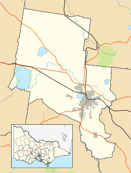
 Mount Clear
Population: 2,346[1] Postcode: 3350 Location: 6 km (4 mi) from Ballarat Central LGA: City of Ballarat State District: Ballarat East Federal Division: Ballarat Suburbs around Mount Clear: Mount Pleasant Canadian Canadian Mount Pleasant, Magpie Mount Clear Mount Helen Magpie Mount Helen Mount Helen Mount Clear is a semi-rural suburb of Ballarat, Victoria, Australia located south of the CBD is a suburb of Ballarat, Victoria, Australia located south of the CBD in the Canadian Creek Valley. At the 2006 census, Mount Clear had a population of 2,346.[1]
Mount Clear is characterised by its topography of gently undulating hills flanked by bush and pine plantation forestry. Canadian Creek, on the suburb's eastern border, flows southward.
It began as a small mining community, however it expanded rapidly in the latter 20th Century to become part of the Ballarat urban area and much subdivision activity continues.
The suburb is organized primarily on a street hierarchy with the main roads through it being Midland Highway/Geelong Road (north-south) and Sebastopol Road (east-west). Housing consists almost solely of Single-family detached homes constructed since the 1970s on larger than average blocks. There is a small commercial area on the corners of Geelong and Sebastopol Road.
Historically Mount Clear had its own railway station on the Buninyong railway line however the station closed to passengers in 1930. Today Mount Clear is classed as automobile dependent and traffic along its main roads are some of the heaviest in urban Ballarat[2] with over 15,000 vehicles per day passing through Mount Clear and expected to increase by almost 50% over the next three decades.[3] The main form of public transport is a bus service which runs along the Midland Highway between Bunninyong and northern Ballarat at a frequency of approximately 30 minutes.
The suburb has several educational institutions catering for all age levels, including Mount Clear Secondary College, a campus of Damascus College and a community kindergarten.
References
- ^ a b Australian Bureau of Statistics (25 October 2007). "Mount Clear (State Suburb)". 2006 Census QuickStats. http://www.censusdata.abs.gov.au/ABSNavigation/prenav/LocationSearch?collection=Census&period=2006&areacode=SSC23081&producttype=QuickStats&breadcrumb=PL&action=401. Retrieved 2009-06-24.
- ^ Nolon, Patrick More Geelong Road Traffic Problems Feared The Courier 26 Nov, 2010
- ^ University of Ballarat Travel Plan
 Localities of Greater Ballarat
Addington · Alfredton · Ascot · Bakery Hill · Ballarat Central · Ballarat East · Ballarat North · Black Hill · Bo Peep · Bonshaw · Brown Hill · Buninyong · Bunkers Hill · Burrumbeet · Canadian · Cardigan · Cardigan Village · Chapel Flat · Coghills Creek · Delacombe · Durham Lead · Ercildoune · Eureka · Glen Park · Glendaruel · Glendonnell · Golden Point · Gong Gong · Invermay · Invermay Park · Lake Gardens · Lake Wendouree · Learmonth · Magpie · Miners Rest · Mitchell Park · Mount Clear · Mount Helen · Mount Pleasant · Mount Rowan · Nerrina · Newington · Redan · Scotchmans Lead · Scotsburn · Sebastopol · Soldiers Hill · Tourello · Warrenheip · Weatherboard · Wendouree · Windermere
Categories:- Suburbs of Ballarat
- Victoria (Australia) geography stubs

Wikimedia Foundation. 2010.