- Motorways in the Republic of Ireland
-
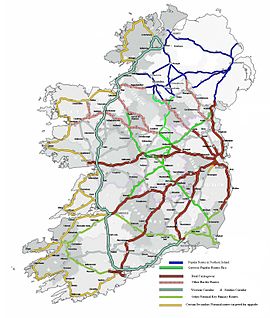 Planned National Roads Network for 2015.
 Main article: Roads in Ireland
In Ireland, the highest category of road is a Motorway (mótarbhealach, plural: mótarbhealaí), indicated by the prefix M followed by one or two digits. The Motorway network predominantly consists of two-lane dual carriageways primarily focused around Dublin, although a few Motorways contain three lanes and the M50 has four lanes at a number of points throughout its length. Completion of the Major Inter Urban route Motorway development project in December 2010 which connected Dublin completely by motorway to the cities of Cork, Limerick, Waterford & Galway, as well as other projects, has increased the total motorway network in the state to approximately 1,017 kilometres (632 mi). Planned new road construction will possibly lead to almost 1,100 kilometres (680 mi) of motorway by 2015, but these plans are not funded.
Contents
Features
Regulations
Motorways in Ireland have a set of restrictions,[1] which prohibit certain traffic from using the road. The following classes of traffic are not allowed on Irish motorways:
- Learner drivers
- Slow vehicles (less than 50 km/h or 31 mph)
- Invalid carriages
- Pedestrians
- Pedal-cycles
- Vehicles under 50cc
- Vehicles without pneumatic tyres
- Animals
Rules for driving on motorways include the following:
- The keep left rule applies unless overtaking
- No stopping at any time
- No reversing
- No hitchhiking
- Only vehicles that can travel faster than 80 km/h (50 mph) may use the outside lane
- You may not drive on the hard-shoulder
The general motorway speed limit is 120 km/h (75 mph)
Specification
For more on motorway specification in general, view this motorway article.
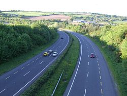
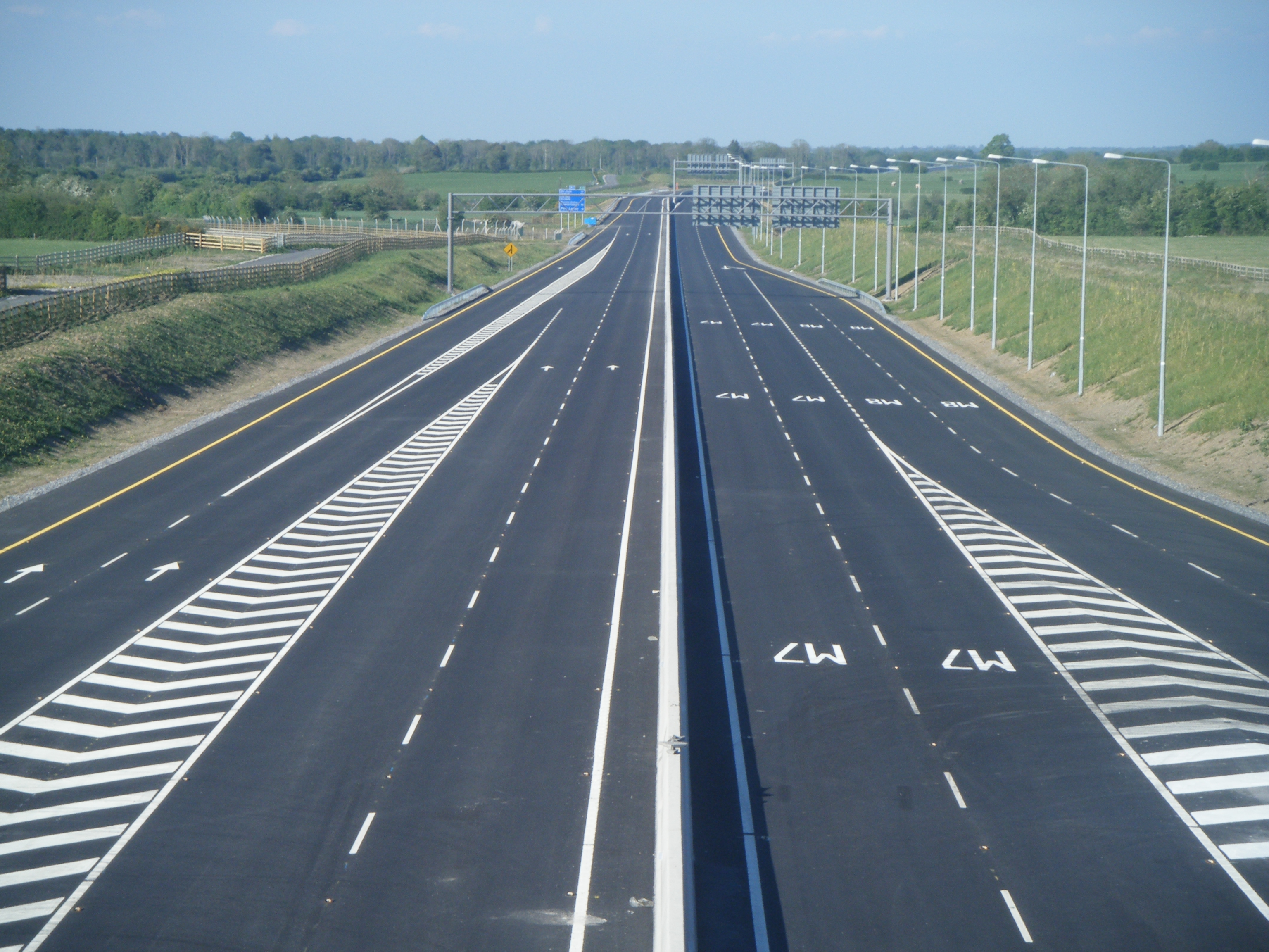
Motorways in Ireland are generally constructed to high-quality dual carriageway standard - with sightlines, curves and elevation designed for 120 km/h speeds. Until recently, all motorways were built with wide medians in the centre, which typically have a wire or steel barrier. The more recent schemes have narrow medians, only 3 metres in width, with a concrete barrier in the middle. These narrow-median schemes also have reduced carriageway width - a typical narrow-median motorway cross section has two 3.5 metre running lanes, a 2.5 metre hard shoulder and a 1.5 metre central reserve in each direction where as a typical wide median motorway has 3.75 metre running lanes and a 3 metre hard shoulder. Ireland has only a small amount of D3M (motorway with three lanes in each direction). The M50 is the most notable example, having been upgraded in parts from a two-lane motorway, to a three or four lane motorway in each direction.
Apart from terminal junctions, motorways can only be accessed using grade-separated junctions. These typically take the form of roundabout interchanges for higher-capacity junctions, or dumbbell interchanges - which are a variant on the diamond-style interchange. - for lower-trafficked interchanges. A number of other types of junction are also used on the Republic's motorway network. The M4/M6 and M7/M9 junctions use a variant of the trumpet-style interchange while the M50/N7 and M50/N4 interchanges use partial cloverleaf junctions.
Safety
Motorways in Ireland include several safety features not found on other classes of road. The most notable include the presence of a continuous hard-shoulder, use of crash barriers, superior lighting and provision of emergency phones at regular intervals. Some motorway schemes include deflectors to provide protection at interchanges.
Signage
Motorway signage in Ireland is blue, and is similar in design to UK signage. Route numbers use the Motorway font, and text uses an Irish variant of the Transport Medium typeface (officially described as italic, but more correctly oblique).
Route Number Inheritance
In the Republic of Ireland all motorways form part of a national route. The M50 was the only motorway that initially did not part of an existing national primary route, though it was designated as the national primary route N50 in 1994.
In most cases, motorways have been built as a by-pass of a road previously forming the national road (e.g. M7 by-passing roads previously forming the N7). The by-passed roads are then generally reclassified as regional roads. Under Irish legislation (the Roads Act 1993), motorways are sections of roads with special regulations and they are signposted with the M prefix to indicate that they are under motorway regulations.
Present Network
The following table shows a list of motorways currently open in the Republic of Ireland.
Route Motorway section Destinations Toll 
Dublin to north of Dundalk (Border with Northern Ireland). Dublin – Belfast / (Derry) Yes 
Killshane to north of Ashbourne. Dublin – Derry No 
Dublin to north of Kells. Dublin – Donegal Yes 
Lucan to Mullingar. Dublin – Sligo Yes 
Kinnegad to east of Athlone, west of Athlone to Galway Dublin – Galway Yes 
Naas to Limerick. Dublin – Limerick / (Cork) / (Tralee) Yes 
Entire route. Dublin – Cork Yes (Junctions 14 through 17) 
Entire route. Dublin – Waterford No 
Shankill/Bray Bypass, Ashford/Rathnew Bypass, Arklow/Gorey Bypass. Dublin – Wexford No 
Shannon, Co. Clare to north of Gort. Limerick – Galway No 
Outskirts of Limerick City to Patrickswell, (Remainder to Cork Planned) Limerick – Cork No 
Entire route. Dublin ring road Yes (West-Link and Dublin Port Tunnel only) History
1983-1989
In 1983, the first sections of Irish motorway were opened: a short section of M7 bypassing Naas and the first stretch of M1 (part of which has now been redesignated M50). The M1 was later extended in 1985 to Dublin Airport.[2]
1990-1999
Ireland's motorway network began to expand significantly between 1990 and 1999. The first of the projects completed in this period was the western section of the M50, linking the N7, N4 and N3 together in 1990. This was quickly followed by the M11 Bray/Shankhill bypass in 1991. After this there followed a lull in construction after what had been a busy few years in motorway construction by then Irish road building standards. 1993 saw an extension to the M7, continuing from the Naas Bypass and providing a bypass of the town of Newbridge, as well as the M9 Kilcullen spur. In addition, another small section of M1, a bypass of Dunleer in Co. Louth was opened. The Leixlip to Kilcock motorway was completed in 1994, forming part of the M4. In 1995 there were no new motorways opened and in 1996 only the northern section of the M50 was opened, linking the existing motorway to the N2 and M1. The Portlaoise bypass opened as M7 in 1997 and like the M1 Dunleer bypass, seemed very isolated compared to the rest of the network which was concentrated around Dublin. 1998 featured the opening of another short piece of M1, this time to the south of Balbriggan, modern day junctions 5 and 6. In 1999 however, there were no new sections of motorway opened.
2000-2010
The first decade of the twenty-first century saw a major expansion in the construction of new motorways in Ireland, after an initially slow start. There were no new motorways opened in 2000 but another section of the M1, extending the Dunleer bypass northwards to the south of Dundalk (junction 16), was opened in 2001. Continuing the quiet period, 2002 also saw no new motorway in Ireland, but 2003 was a big year. Finally the various sections of M1 were joined together, creating continuous motorway from Dublin to just south of Dundalk. A key part of this route was the Drogheda bypass which was tolled. Also in 2003, the M7 was extended westwards from Newbridge to also bypass Kildare (up to modern day junction 13). A year later and this had been extended further so that both sections of M7 were joined. This provided continuous motorway from Naas to Portlaoise.
By 2005, projects were beginning to be completed faster and in this year the M4 was extended from Kilcock to Kinnegad, this section of motorway having a toll applied to it, one of the first PPP schemes to be trialled in Ireland. The M1 Dundalk bypass was also finished, meaning that there was now a full motorway link on the Dublin to Belfast route virtually as far as the border. Finally in 2005, the M50 was extended to link up to the M11, providing a full western bypass of the capital. In 2006, the M8 Fermoy to Watergrasshill motorway was opened, another section that was tolled. Also a section of what would become M6 was completed, going westwards from the M4 at Kinnegad to Tyrellspass, the road was opened as N6 and was the first section of road to be completed that would be affected by the Roads Act 2007 and motorway redesignation. In 2007 the same road was extended by some 10 km to join with the N52 north of Tullamore, still opened as N6 as the first tranche of motorway redesignations had only just been submitted.
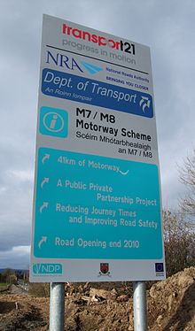
2008 was one of the most important years for Irish motorways, with a large section of M8 opened, making it the longest motorway in the country. Stretching from Urlingford to just east of Mitchelstown, the motorway opened in various sections, the first being the Cashel bypass, which opened in 2004, and which was followed by the Cashel to Mitchelstown section, both of which were open before the redesignation to motorway came into effect on 24 September 2008. The Urlingford to Cashel section opened later on in the year and so became motorway immediately. Also opened in 2008 was the M9 Carlow bypass which was also open to traffic before the redesignation came into effect. Finally, the M6 was extended to the Athlone bypass and Ireland's motorway network was greatly expanded.
2009 was another major milestone in the development of the Irish motorway network, with many projects under construction finished by the end of the year. Redesignation of High-Quality Dual-Carriageway sections of National Primary routes to motorway took effect on 28 August 2009, further expanding the network. On the 18th of December 2009 the M6 was opened (Dublin-Galway direct)it is 194 km of motorway. The M9 (linking Dublin to Carlow) was opened on Monday the 21st of December 2009 and was expanded in March 2010 to link Dublin to Waterford directly. The M9 was fully completed with the opening of the Carlow to Knocktopher section on the 9th of September 2010.
2010: M3: 61 km of motorway in Co. Meath opened on June 4, 2010.
M7: Nenagh - Limerick, 38 km long, opened in three stages, being fully opened on September 28, 2010.
M7: Limerick - Shannon motorway tunnel, 10 km long, opened ahead of schedule on July 27, 2010.
M7: Castletown - Nenagh, 36 km long, opened 22 December 2010.
M7/M8: Portlaoise - Castletown, Portlaoise to Cullahill, 40 km, opened on May 28, 2010.
M9: Carlow - Knocktopher, 40 km long, opened September 9, 2010.[3]
M9: Knocktopher - Waterford, 24 km long, opened March 22, 2010.
M50: improvements for Dublin, completed August 2010, but expected earlier.
M18: Crusheen and Gort, 22 km, opened November 12, 2010.
Motorway Redesignation (Tranche 1)
The Roads Act 2007 was passed into law in mid-2007. This Act makes provision for the redesignation of suitable dual carriageways to motorway status. The National Roads Authority made formal applications under Section 8 of the Act to the Minister for Transport on 16 October 2007 regarding dual carriageways which the authority believed to be suitable for redesignation as motorways.
On 29 January 2008, the Department of Transport published notice of the Minister's intention to make the orders being sought and invited submissions or observations to be made to the Minister regarding the NRA's applications.
The consultation procession lasted until 28 March 2008. On 17 July 2008 the statutory instrument redesignating the roads as motorways was signed, and any open parts of these roads have officially become motorways as of 24 September 2008.[4] The Carlow bypass and Kilbeggan-Athlone roads opened with motorway signage but with temporary 100 km/h general speed limits between their opening and their official re-designation as motorways.
The following sections were redesignated:
Route Proposed motorway section Destinations N6 road Kinnegad (M6 J2) – Athlone[5] (Dublin) – Galway N7 road South of Borris-in-Ossory to Annacotty[6] Dublin – Limerick N8 road Urlingford – Fermoy[7] (Dublin) – Cork N9 road Kilcullen – Powerstown )[8] (Dublin) – Waterford Motorway Redesignation (Tranche 2)
 This section of the N8 5km (3.1 miles) north of Cork City has been redesignated as motorway, effective 28 August 2009
On 30 September 2008, the NRA announced its second tranche of proposed motorway redesignations. The closing date for submissions was 14 November 2008 and the Statutory Instrument reclassifying the roads as motorways was made on 2 July 2009, taking effect from 28 August 2009
The following schemes were included:
Route Proposed motorway section Destinations N2 road Junction 2 – north of Ashbourne[9] Dublin – Derry N3 road Mulhuddart – Dunboyne[10] Dublin – Ballyshannon N4 road Kinnegad – McNead's Bridge[11] Dublin – Sligo N6 road West of Athlone – Galway[12] (Dublin) – Galway N7 road Annacotty – Limerick[13] Dublin – Limerick N8 road Watergrasshill – Cork[14] (Dublin) – Cork N11 road Ashford – Rathnew and Arklow – Gorey[15] (Dublin) – Wexford N18 road Shannon – Athenry[16] Limerick – Galway N20 road Limerick – Patrickswell[17] Limerick – Cork On the N6, the Athlone bypass had also been included in the proposed redesignations. However, the final order (the Roads Act 2007 (Declaration of Motorways) Order 2009) did not include this section. However, the section of the N9 road between Powerstown and Waterford, which had been proposed as part of the first tranche but not included in the final order, was included in this order.
Future
Inter-urban motorways
Linking Dublin to regional cities. These motorways are:
- M1 - linking Dublin with border (Belfast)
- M6 - linking Dublin with Galway (Officially opened, 18 December 2009 and was the first city to city motorway in Ireland)
- M7 - linking Dublin with Limerick
- M8 - linking Dublin with Cork
- M9 - linking Dublin with Waterford (completed September 9, 2010)[18]
As of the end of 2010, all sections of these motorways are completed. The completion of these schemes has added more than 300 km of motorway to the current network.
Atlantic Corridor
Under the government's Transport 21 iniative, Letterkenny will be linked to Waterford and Cork with new high quality roads - collectively known as the "Atlantic Corridor". While it is anticipated much of this scheme will be constructed as either 2+2 dual carriageway or higher quality single-carriageway - a significant portion of it is expected to be constructed as motorway.

- The M20 scheme linking Cork with Limerick, will provide a complete connection between the two cities. It will be approximately 90 km in length. It is being progressed as a PPP.
[19]

- The M18 scheme linking Ennis with Galway will provide a high quality link between Galway, Ennis and Limerick. It will be approximately 70 km in length when complete. A significant proportion of this route is already complete (and has been redesignated to motorway standard - effective 28/8/09), with a 22 km section between Crusheen and Gort opened in November 2010.

Other Motorways
Other motorway schemes are also being progressed at the moment. A motorway project, the Dublin Outer Orbital Route, may be progressed in the future.[20] It is possible that a motorway will be built to the north of Cork City to link the existing N22, N20 and M8 routes: this route, if built, will most likely be designated as the M22. Other potential motorways include the planned M11 Enniscorthy bypass, a possible extension of the M4 from Mullingar to Longford and the Galway City Outer Bypass which may be built as an extension to the M6.
Motorway Service Areas
Main article: Motorway service areas (Ireland)The NRA has proposed to build a series of service areas[21] across the new motorway network to address the current critical lack of safe rest areas. The first of these opening 15 Sept 2010 on the M1 Motorway (Republic of Ireland) at Lusk.
Current service areas:
- M1 - Lusk
- M1 - Castlebellingham
- M4 - Enfield
- M8 - Cashel
The following sites have also been proposed:
- M6 - Athlone
- M7 - Mountrath
- M7 - Nenagh
- M8 - Kilworth
- M9 - Kilcullen
- M9 - Carlow
- M11 - Gorey
- M20 - Charleville
Originally, service areas were to be located at 12 locations, but a recent An Bord Pleanála decision ruled that a service area to be located at Rathmorrissey at an M6 junction be removed from an adjacent scheme.
It is anticipated that service areas will be provided on both the M3 motorway and the proposed M20 motorway.[22]
Improvement Schemes
Predicted 2015 Network
Motorway Number Estimated/Actual Length Corridor M1 90.7 km Dublin - Dundalk M2 13 km Dublin - Ashbourne M3 51.4 km Dublin - Kells M4 61.9 km Lucan - Mullingar M6 144 km Kinnegad - Galway M7 185 km Dublin - Limerick M8 143 km Portlaoise - Cork M9 116.75 km Naas -Waterford M11 62.5 km Dublin - Wexford M17 25.5 km Galway - Tuam M18 70.8 km Shannon - Galway M20 Approx. 90 km Cork - Limerick M50 49.25 km Dublin Orbital Total 1,110 km National motorway network. See also
- Roads in Ireland
- List of motorways in Northern Ireland
- National primary road
- National secondary road
- Regional road
- Local Roads in Ireland
- Atlantic Corridor
- Dublin Port Tunnel
- Jack Lynch Tunnel
- History of Roads in Ireland
- Trunk Roads in Ireland
- National Roads Authority
- Road signs in the Republic of Ireland
- Road speed limits in the Republic of Ireland
- Vehicle registration plates of Ireland
- Northern Irish Vehicle Registration Plates
- Transport in Ireland
- List of Ireland-related topics
References
- ^ [1] Rules for driving on Irish motorways
- ^ [2] Naas Bypass News Article
- ^ http://www.rte.ie/news/2010/0909/m9.html
- ^ [3] Irish Times: Just under 300km of roads upgraded to motorway
- ^ [4] Department of Transport: N6-Proposed Motorway Declarations
- ^ [5] Department of Transport: N7-Proposed Motorway Declarations
- ^ [6] Department of Transport: N8-Proposed Motorway Declarations
- ^ [7] Department of Transport: N9-Proposed Motorway Declarations
- ^ [8] Department of Transport: N2-Proposed Motorway Declarations
- ^ [9] Department of Transport: N3-Proposed Motorway Declarations
- ^ [10] Department of Transport: N4-Proposed Motorway Declarations
- ^ [11] Department of Transport: N6-Proposed Motorway Declarations
- ^ [12] Department of Transport: N7-Proposed Motorway Declarations
- ^ [13] Department of Transport: N8-Proposed Motorway Declarations
- ^ [14] Department of Transport: N11-Proposed Motorway Declarations
- ^ [15] Department of Transport: N18-Proposed Motorway Declarations
- ^ [16] Department of Transport: N20-Proposed Motorway Declarations
- ^ http://www.nra.ie/News/PressReleases/htmltext,17283,en.html
- ^ [17] NRA Website - M20 scheme
- ^ http://www.nra.ie/News/PressReleases/htmltext,16141,en.html
- ^ [18] NRA Motorway Service Area Policy Document
- ^ NRA Second tranche of PPP schemes,
Roads in Europe Sovereign
states- Albania
- Andorra
- Armenia
- Austria
- Azerbaijan
- Belarus
- Belgium
- Bosnia and Herzegovina
- Bulgaria
- Croatia
- Cyprus
- Czech Republic
- Denmark
- Estonia
- Finland
- France
- Georgia
- Germany
- Greece
- Hungary
- Iceland
- Ireland
- Italy
- Kazakhstan
- Latvia
- Liechtenstein
- Lithuania
- Luxembourg
- Macedonia
- Malta
- Moldova
- Monaco
- Montenegro
- Netherlands
- Norway
- Poland
- Portugal
- Romania
- Russia
- San Marino
- Serbia
- Slovakia
- Slovenia
- Spain
- Sweden
- Switzerland
- Turkey
- Ukraine
- United Kingdom
States with limited
recognition- Abkhazia
- Kosovo
- Nagorno-Karabakh
- Northern Cyprus
- South Ossetia
- Transnistria
Dependencies
and other territories- Åland
- Faroe Islands
- Gibraltar
- Guernsey
- Jan Mayen
- Jersey
- Isle of Man
- Svalbard
Other entities Categories:- Lists of roads in Ireland
- Roads in the Republic of Ireland
- Motorways in the Republic of Ireland
- Lists of buildings and structures in Ireland
- Ireland transport-related lists


Wikimedia Foundation. 2010.