- Moston, Cheshire West and Chester
-
Coordinates: 53°13′23″N 2°53′53″W / 53.223°N 2.898°W
Moston 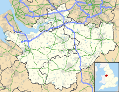
 Moston
Moston shown within CheshirePopulation 680 (2001 Census)[1] OS grid reference SJ401699 Parish Moston Unitary authority Cheshire West and Chester Ceremonial county Cheshire Region North West Country England Sovereign state United Kingdom Post town CHESTER Postcode district CH2 Dialling code 01244 Police Cheshire Fire Cheshire Ambulance North West EU Parliament North West England UK Parliament City of Chester List of places: UK • England • Cheshire Moston is a small village and civil parish in the unitary authority of Cheshire West and Chester and the ceremonial county of Cheshire, England. It is situated in the north east of Chester, close to the Shropshire Union Canal and the A41 trunk road between Chester and Birkenhead. At the 2001 Census, Moston had a population of 680.[1]
Including the hamlet of The Dale, Moston was a township in St. Mary on the Hill Parish of the Broxton Hundred. The population was 14 in 1801, 14 in 1851, 51 in 1901 and 850 in 1951.[2]
Moston combines with Upton-by-Chester and Bache ('The Bache') to form a joint parish council.
References
- ^ a b 2001 Census: Moston, Office for National Statistics, http://neighbourhood.statistics.gov.uk/dissemination/LeadTableView.do?a=7&b=792490&c=moston&d=16&e=15&g=427636&i=1001x1003x1004&o=1&m=0&r=1&s=1195351243890&enc=1&dsFamilyId=779, retrieved 18 November 2007
- ^ Cheshire Towns & Parishes: Moston, GENUKI UK & Ireland Genealogy, http://www.ukbmd.org.uk/genuki/chs/moston1.html, retrieved 7 November 2007
External links
 Media related to Moston, Cheshire West and Chester at Wikimedia Commons
Ceremonial county of Cheshire Unitary authorities Major settlements Alsager • Birchwood • Bollington • Chester • Congleton • Crewe • Ellesmere Port • Frodsham • Knutsford • Macclesfield • Middlewich • Nantwich • Neston • Northwich • Poynton • Runcorn • Sandbach • Warrington • Widnes • Wilmslow • Winsford
See also: List of civil parishes in CheshireRivers Topics History • MuseumsCategories:- Villages in Cheshire
- Civil parishes in Cheshire
- Cheshire geography stubs

Wikimedia Foundation. 2010.