- Table of the most isolated major summits of the United States
-
Main article: Mountain peaks of the United StatesSee also: Table of the highest major summits of the United States and Table of the most prominent summits of the United States
Contents
The following sortable table lists the 180 most topographically isolated mountain peaks of the United States with at least 500 meters (1640.4 feet) of topographic prominence.
Topographic elevation is the vertical distance above the reference geoid, a precise mathematical model of the Earth's sea level as an equipotential gravitational surface. Topographic prominence is the elevation difference between the summit and the highest or key col to a higher summit. Topographic isolation is the minimum great circle distance to a point of higher elevation.
This article defines a significant summit as a summit with at least 100 meters (328.1 feet) of topographic prominence, and a major summit as a summit with at least 500 meters (1640.4 feet) of topographic prominence. An ultra-prominent summit is a summit with at least 1500 meters (4921.3 feet) of topographic prominence. There are 129 ultra-prominent summits in the United States.
All elevations in the 48 states of the contiguous United States include an elevation adjustment from the National Geodetic Vertical Datum of 1929 (NGVD 29) to the North American Vertical Datum of 1988 (NAVD 88). For further information, please see this United States National Geodetic Survey note.
Of these 180 most isolated peaks, 60 are located in Alaska, 18 in Montana, 15 in California, 13 in Utah, 9 in Colorado, 9 in Arizona, 9 in Nevada, 8 in Wyoming, 6 in Washington, 6 in New Mexico, 6 in Oregon, 4 in Hawaiʻi, 4 in Idaho, 3 in Texas, 2 in North Carolina, 2 in Maine, 2 in New York, and one each in New Hampshire, Arkansas, West Virginia, and South Dakota.
In the United States, only Mount McKinley exceeds 4000 kilometers (2485.5 miles) of topographic isolation. Three summits exceed 2000 kilometers (1242.7 miles), seven exceed 1000 kilometers (621.4 miles), 12 exceed 500 kilometers (310.7 miles), 45 exceed 200 kilometers (124.3 miles), and 112 exceed 100 kilometers (62.14 miles) of topographic isolation.
Table
The 180 most topographically isolated mountain peaks of the United States
with at least 500 meters of topographic prominence
Rank Mountain Peak State Mountain Range Elevation Prominence Isolation Location 1 Mount McKinley[1][2]
(Denali) Alaska
Alaska Range 20,320 ft
6194 m20,174 ft
6149 m4,629 mi
7,450 km63.0690°N
151.0063°W2 Mauna Kea[3][4][5]  Hawaii
Island of Hawaiʻi 13,803 ft
4207 m13,796 ft
4205 m2,453 mi
3,947 km19.8207°N
155.4681°W3 Mount Whitney[6][7][8][9]  California
Sierra Nevada 14,505 ft
4421 m10,079 ft
3072 m1,646 mi
2,649 km36.5786°N
118.2920°W4 Mount Mitchell[10][11][12]  North Carolina
Blue Ridge Mountains 6,684 ft
2037 m6,091 ft
1857 m1,189 mi
1,913 km35.7650°N
82.2652°W5 Mount Washington[13][14][15][16]  New Hampshire
White Mountains 6,288 ft
1917 m6,158 ft
1877 m820 mi
1,319 km44.2705°N
71.3032°W6 Mount Rainier[17][18][19][20]  Washington
Cascade Range 14,417 ft
4394 m13,236 ft
4034 m731 mi
1,177 km46.8521°N
121.7579°W7 Mount Elbert[21][22][23][24]  Colorado
Sawatch Range 14,440 ft
4401 m9,093 ft
2772 m671 mi
1,079 km39.1178°N
106.4454°W8 Shishaldin Volcano[25][26] AlaskaUnimak Island 9,414 ft
2869 m9,414 ft
2869 m545 mi
877 km54.7554°N
163.9709°W9 Tanaga Volcano[27][28] AlaskaTanaga Island 5,925 ft
1806 m5,925 ft
1806 m407 mi
656 km51.8833°N
178.1333°W10 Mount Chamberlin[29][30] AlaskaBrooks Range 9,020 ft
2749 m7,945 ft
2422 m395 mi
636 km69.2820°N
144.8996°W11 Magazine Mountain[31][32][33][34]  Arkansas
Ouachita Mountains 2,753 ft
839 m2,142 ft
653 m381 mi
613 km35.1670°N
93.6447°W12 Mount Shasta[35][36][37] CaliforniaCascade Range 14,179 ft
4322 m9,832 ft
2997 m335 mi
539 km41.4092°N
122.1949°W13 Gannett Peak[38][39][40][41]  Wyoming
Wind River Range 13,809 ft
4209 m7,076 ft
2157 m290 mi
467 km43.1842°N
109.6542°W14 Mount Osborn[42][43][44] AlaskaSeward Peninsula 4,714 ft
1437 m4,326 ft
1319 m282 mi
454 km64.9922°N
165.3294°W15 Mount Igikpak[45] AlaskaBrooks Range 8,276 ft
2523 m6,126 ft
1867 m282 mi
453 km67.4129°N
154.9656°W16 Humphreys Peak[46][47][48][49]  Arizona
San Francisco Peaks 12,637 ft
3852 m6,039 ft
1841 m246 mi
396 km35.3463°N
111.6779°W17 Wheeler Peak[50][51][52]  Nevada
Snake Range 13,065 ft
3982 m7,568 ft
2307 m232 mi
373 km38.9858°N
114.3139°W18 Mount Vsevidof[53][54][55] AlaskaUmnak Island 7,051 ft
2149 m7,051 ft
2149 m223 mi
359 km53.1251°N
168.6947°W19 Mount Veniaminof[56][57] AlaskaAleutian Range 8,225 ft
2507 m8,200 ft
2499 m210 mi
337 km56.2191°N
159.2980°W20 Kawaikini[58][59] HawaiiIsland of Kauaʻi 5,243 ft
1598 m5,243 ft
1598 m204 mi
328 km22.0586°N
159.4973°W21 Dillingham High Point[60][61] AlaskaKuskokwim Mountains 5,250 ft
1600 m4,475 ft
1364 m193 mi
311 km60.1159°N
159.3241°W22 Hall Island High Point[62] AlaskaHall Island 1,665 ft
507 m1,665 ft
507 m193 mi
311 km60.6647°N
173.0887°W23 Tooth Benchmark[63][64] AlaskaSaint Lawrence Island 2,207 ft
673 m2,207 ft
673 m178 mi
287 km63.5920°N
170.3804°W24 Spruce Knob[65][66][67][68]  West Virginia
Allegheny Mountains 4,862 ft
1482 m2,792 ft
851 m175 mi
282 km38.7008°N
79.5319°W25 Mount Roberts[69][70] AlaskaNunivak Island 1,675 ft
511 m1,675 ft
511 m174 mi
280 km60.0280°N
166.2627°W26 Kings Peak[71][72][73][74]  Utah
UtahUinta Mountains 13,518 ft
4120 m6,358 ft
1938 m167 mi
268 km40.7659°N
110.3779°W27 Sierra Blanca Peak[75][76][77]  New Mexico
Sierra Blanca 11,981 ft
3652 m5,553 ft
1693 m166 mi
267 km33.3743°N
105.8087°W28 San Gorgonio Mountain[78][79] CaliforniaSan Bernardino Mountains 11,503 ft
3506 m8,294 ft
2528 m162 mi
262 km34.0992°N
116.8249°W29 Mount Katahdin[80][81][82][83]  Maine
MaineLongfellow Mountains 5,270 ft
1606 m4,293 ft
1309 m158 mi
255 km45.9044°N
68.9213°W30 Peak 4030[84] AlaskaNulato Hills 4,030 ft
1228 m>1,640 ft
>500 m158 mi
255 km64.4535°N
159.4152°W31 Mount Baldy[85][86][87] ArizonaWhite Mountains 11,409 ft
3477 m4,728 ft
1441 m154 mi
248 km33.9059°N
109.5626°W32 Borah Peak[88][89][90][91]  Idaho
IdahoLost River Range 12,668 ft
3861 m6,002 ft
1829 m151 mi
243 km44.1374°N
113.7811°W33 Cloud Peak[92][93][94] WyomingBighorn Mountains 13,167 ft
4013 m7,077 ft
2157 m145 mi
233 km44.3821°N
107.1739°W34 Harney Peak[95][96][97][98]  South Dakota
Black Hills 7,244 ft
2208 m2,933 ft
894 m140 mi
226 km43.8658°N
103.5324°W35 Slide Mountain[99][100][101]  New York
Catskill Mountains 4,180 ft
1274 m3,294 ft
1004 m136 mi
220 km41.9992°N
74.3859°W36 Mount Griggs[102] AlaskaAleutian Range 7,650 ft
2332 m7,300 ft
2225 m136 mi
219 km58.3534°N
155.0958°W37 Charleston Peak[103][104][105]
(Mount Charleston) NevadaSpring Mountains 11,916 ft
3632 m8,257 ft
2517 m135 mi
218 km36.2716°N
115.6956°W38 Junipero Serra Peak[106][107][108] CaliforniaSanta Lucia Range 5,857 ft
1785 m4,447 ft
1355 m132 mi
212 km36.1456°N
121.4190°W39 Mount Baker[109][110] WashingtonCascade Range 10,786 ft
3287 m8,845 ft
2696 m132 mi
212 km48.7768°N
121.8145°W40 Mount Marcy[111][112][113][114] New YorkAdirondack Mountains 5,343 ft
1629 m4,919 ft
1499 m130 mi
209 km44.1127°N
73.9237°W41 Mount Hayes[115][116][117] AlaskaAlaska Range 13,832 ft
4216 m11,507 ft
3507 m127 mi
205 km63.6199°N
146.7174°W42 Mount Marcus Baker[118] AlaskaChugach Mountains 13,176 ft
4016 m10,751 ft
3277 m127 mi
204 km61.4374°N
147.7525°W43 Sacajawea Peak[119][120]  Oregon
Wallowa Mountains 9,843 ft
3000 m6,377 ft
1944 m126 mi
202 km45.2450°N
117.2929°W44 Steens Mountain[121][122][123] OregonSteens Mountain 9,725 ft
2964 m4,383 ft
1336 m125 mi
201 km42.6378°N
118.5785°W45 Mount Fairweather[124][125]
(Fairweather Mountain) Alaska
 British Columbia
Saint Elias Mountains 15,325 ft
4671 m12,995 ft
3961 m125 mi
201 km58.9064°N
137.5265°W46 Delano Peak[126][127][128] UtahTushar Mountains 12,174 ft
3711 m4,709 ft
1435 m112 mi
180 km38.3692°N
112.3714°W47 Black Mountain[129] AlaskaBrooks Range 5,020 ft
1530 m>1,640 ft
>500 m112 mi
180 km68.5598°N
160.3281°W48 Mount Tozi[130][131] AlaskaRay Mountains 5,519 ft
1682 m4,169 ft
1271 m111 mi
178 km65.6863°N
150.9496°W49 Mount Olympus[132][133][134] WashingtonOlympic Mountains 7,980 ft
2432 m7,838 ft
2389 m108 mi
174 km47.8013°N
123.7108°W50 Blanca Peak[135][136][137] ColoradoSangre de Cristo Range 14,351 ft
4374 m5,326 ft
1623 m103 mi
166 km37.5775°N
105.4857°W51 Mount Cleveland[138][139][140]  Montana
Lewis Range 10,479 ft
3194 m5,246 ft
1599 m99 mi
160 km48.9249°N
113.8482°W52 Mount Jefferson[141][142][143] NevadaToquima Range 11,949 ft
3642 m5,869 ft
1789 m99 mi
159 km38.7520°N
116.9268°W53 Mount Torbert[144] AlaskaAlaska Range 11,413 ft
3479 m8,688 ft
2648 m98 mi
157 km61.4086°N
152.4125°W54 Mount Chiginagak[145] AlaskaAleutian Range 6,925 ft
2111 m6,675 ft
2035 m98 mi
157 km57.1312°N
156.9836°W55 Baldy Peak[146][147][148]  Texas
TexasDavis Mountains 8,381 ft
2555 m3,923 ft
1196 m95 mi
154 km30.6356°N
104.1737°W56 Hualapai Peak[149][150][151] ArizonaHualapai Mountains 8,426 ft
2568 m4,439 ft
1353 m95 mi
153 km35.0751°N
113.8979°W57 Ruby Dome[152][153][154] NevadaRuby Mountains 11,392 ft
3472 m4,810 ft
1466 m95 mi
152 km40.6217°N
115.4754°W58 Pavlof Volcano[155][156] AlaskaAleutian Range 8,250 ft
2515 m8,225 ft
2507 m94 mi
152 km55.4175°N
161.8932°W59 Truuli Peak[157] AlaskaKenai Mountains 6,612 ft
2015 m6,062 ft
1848 m89 mi
143 km59.9129°N
150.4348°W60 South Baldy[158][159][160] New MexicoMagdalena Mountains 10,789 ft
3289 m3,813 ft
1162 m89 mi
143 km33.9910°N
107.1879°W61 Eagle Peak[161][162][163] CaliforniaWarner Mountains 9,895 ft
3016 m4,364 ft
1330 m87 mi
141 km41.2835°N
120.2007°W62 Great Sitkin Volcano[164] AlaskaGreat Sitkin Island 5,710 ft
1740 m5,710 ft
1740 m87 mi
140 km52.0756°N
176.1114°W63 Mount Taylor[165][166][167] New MexicoSan Mateo Mountains 11,305 ft
3446 m4,094 ft
1248 m87 mi
140 km35.2387°N
107.6084°W64 Accomplishment Peak[168] AlaskaBrooks Range 8,045 ft
2452 m3,395 ft
1035 m87 mi
139 km68.4433°N
148.0947°W65 Granite Peak[169][170][171][172] MontanaAbsaroka Range 12,807 ft
3904 m4,779 ft
1457 m86 mi
139 km45.1634°N
109.8075°W66 Korovin Volcano[173] AlaskaAtka Island 5,030 ft
1533 m5,030 ft
1533 m86 mi
138 km52.3789°N
174.1561°W67 Devils Paw[174] Alaska
British ColumbiaCoast Mountains 8,507 ft
2593 m5,643 ft
1720 m86 mi
138 km58.7296°N
133.8407°W68 Kiska Volcano[175] AlaskaKiska Island 4,004 ft
1220 m4,004 ft
1220 m86 mi
138 km52.1028°N
-177.6092°W69 Uncompahgre Peak[176][177][178] ColoradoSan Juan Mountains 14,321 ft
4365 m4,277 ft
1304 m85 mi
137 km38.0717°N
107.4621°W70 Kaʻala[179][180][181] HawaiiIsland of Oʻahu 4,017 ft
1224 m4,017 ft
1224 m84 mi
136 km21.5079°N
158.1426°W71 West Butte[182][183][184] MontanaSweetgrass Hills 6,986 ft
2129 m3,638 ft
1109 m84 mi
136 km48.9316°N
111.5323°W72 Koniag Peak[185][186] AlaskaKodiak Island 4,520 ft
1378 m4,520 ft
1378 m84 mi
135 km57.3548°N
153.3235°W73 Makushin Volcano[187][188] AlaskaUnalaska Island 5,905 ft
1800 m5,905 ft
1800 m83 mi
134 km53.8782°N
166.9299°W74 Cache Peak[189][190][191] IdahoAlbion Range 10,343 ft
3153 m4,479 ft
1365 m83 mi
134 km42.1856°N
113.6611°W75 Snowshoe Peak[192][193] MontanaCabinet Mountains 8,742 ft
2665 m5,441 ft
1658 m83 mi
134 km48.2231°N
115.6890°W76 Granite Peak[194][195][196] NevadaSanta Rosa Range 9,732 ft
2966 m4,400 ft
1341 m83 mi
134 km41.6681°N
117.5889°W77 Mount Pinos[197][198][199] CaliforniaSan Emigdio Mountains 8,849 ft
2697 m4,800 ft
1463 m83 mi
133 km34.8127°N
119.1452°W78 Mount Graham[200][201][202] ArizonaPinaleño Mountains 10,724 ft
3269 m6,340 ft
1932 m82 mi
133 km32.7017°N
109.8714°W79 Guadalupe Peak[203][204][205][206] TexasGuadalupe Mountains 8,751 ft
2667 m3,039 ft
926 m81 mi
130 km31.8915°N
104.8607°W80 Baranof Island High Point[207] AlaskaBaranof Island 5,390 ft
1643 m5,390 ft
1643 m80 mi
128 km57.0151°N
134.9882°W81 Haleakalā[208][209] HawaiiIsland of Maui 10,023 ft
3055 m10,023 ft
3055 m80 mi
128 km20.7097°N
156.2533°W82 McDonald Peak[210][211] MontanaMission Mountains 9,824 ft
2994 m5,650 ft
1722 m79 mi
128 km47.3826°N
113.9191°W83 Mount Nebo[212][213] UtahWasatch Range 11,933 ft
3637 m5,508 ft
1679 m76 mi
122 km39.8219°N
111.7603°W84 Hilgard Peak[214][215] MontanaMadison Range 11,321 ft
3451 m4,063 ft
1238 m75 mi
121 km44.9166°N
111.4593°W85 Cinnabar Mountain[216][217][218] IdahoOwyhee Mountains 8,409 ft
2563 m3,133 ft
955 m75 mi
121 km42.9805°N
116.6575°W86 Tweedy Mountain[219][220][221] MontanaPioneer Mountains 11,159 ft
3401 m3,814 ft
1163 m75 mi
121 km45.4805°N
112.9655°W87 Buldir Volcano[222][223] AlaskaBuldir Island 2,152 ft
656 m2,152 ft
656 m74 mi
119 km52.3482°N
-175.9105°W88 Blackburn Hills[224] AlaskaNulato Hills 3,295 ft
1004 m>1,640 ft
>500 m74 mi
119 km63.4121°N
159.9389°W89 Mount Peale[225][226][227] UtahLa Sal Mountains 12,726 ft
3879 m6,181 ft
1884 m73 mi
118 km38.4385°N
109.2292°W90 Mount Tom White[228][229] AlaskaChugach Mountains 11,191 ft
3411 m7,641 ft
2329 m73 mi
118 km60.6512°N
143.6970°W91 Lassen Peak[230][231][232] CaliforniaCascade Range 10,462 ft
3189 m5,229 ft
1594 m71 mi
115 km40.4882°N
121.5050°W92 Laramie Peak[233][234][235] WyomingLaramie Mountains 10,276 ft
3132 m3,317 ft
1011 m71 mi
114 km42.2681°N
105.4425°W93 Clingmans Dome[236][237][238][239] North CarolinaGreat Smoky Mountains 6,643 ft
2025 m4,513 ft
1376 m71 mi
114 km35.5625°N
83.4980°W94 Kaibab Plateau High Point[240][241] ArizonaKaibab Plateau 9,204 ft
2805 m3,610 ft
1100 m70 mi
113 km36.3958°N
112.1509°W95 Anvil Peak[242][243] AlaskaSemisopochnoi Island 4,007 ft
1221 m4,007 ft
1221 m70 mi
112 km51.9854°N
-179.6005°W96 Mount McLoughlin[244][245][246] OregonCascade Range 9,499 ft
2895 m4,475 ft
1364 m69 mi
112 km42.4445°N
122.3156°W97 Grand Teton[247][248][249] WyomingTeton Range 13,775 ft
4199 m6,545 ft
1995 m69 mi
112 km43.7412°N
110.8024°W98 Pyre Peak[250][251] AlaskaSeguam Island 3,458 ft
1054 m3,458 ft
1054 m69 mi
111 km52.3159°N
172.5106°W99 Star Peak[252][253][254] NevadaHumboldt Range 9,840 ft
2999 m5,400 ft
1646 m69 mi
111 km40.5224°N
118.1708°W100 White Mountain Peak[255][256][257] CaliforniaWhite Mountains 14,252 ft
4344 m7,196 ft
2193 m67 mi
109 km37.6341°N
118.2557°W101 Miller Peak[258][259] ArizonaHuachuca Mountains 9,470 ft
2886 m5,011 ft
1527 m67 mi
108 km31.3928°N
110.2930°W102 Baldy Mountain[260][261][262] MontanaBearpaw Mountains 6,919 ft
2109 m4,228 ft
1289 m67 mi
108 km48.1487°N
109.6509°W103 Peak E[263][264][265]
(Wade Hampton High Point) AlaskaNulato Hills 2,905 ft
885 m2,155 ft
657 m66 mi
106 km62.9285°N
161.7461°W104 Copernicus Peak[266][267] CaliforniaDiablo Range 4,383 ft
1336 m3,120 ft
951 m65 mi
105 km37.3468°N
121.6301°W105 Prince of Wales Island High Point[268] AlaskaPrince of Wales Island 3,996 ft
1218 m3,996 ft
1218 m65 mi
104 km55.5373°N
132.8773°W106 Sugarloaf Mountain[269][270] MaineLongfellow Mountains 4,250 ft
1295 m3,180 ft
969 m65 mi
104 km45.0318°N
70.3132°W107 Naomi Peak[271][272][273] UtahWasatch Range 9,984 ft
3043 m3,169 ft
966 m65 mi
104 km41.9114°N
111.6754°W108 Chiricahua Peak[274][275] ArizonaChiricahua Mountains 9,763 ft
2976 m5,149 ft
1569 m64 mi
103 km31.8465°N
109.2910°W109 Mount Ajo[276][277][278] ArizonaAjo Range 4,811 ft
1466 m2,703 ft
824 m64 mi
103 km32.0268°N
112.6905°W110 Mount Harper[279] AlaskaYukon-Tanana Uplands 6,543 ft
1994 m>1,640 ft
>500 m64 mi
103 km64.2370°N
143.8442°W111 Mount Angayukaqsraq[280] AlaskaBrooks Range 4,750 ft
1448 m3,500 ft
1067 m64 mi
102 km67.7083°N
159.4053°W112 Mount Prindle[281][282] AlaskaYukon-Tanana Uplands 5,286 ft
1611 m>1,640 ft
>500 m63 mi
101 km65.4608°N
146.4756°W113 Mount Linn[283][284][285] CaliforniaSouth Yolla Bolly 8,098 ft
2468 m4,854 ft
1479 m61 mi
99 km40.0365°N
122.8542°W114 Ibapah Peak[286][287][288] UtahDeep Creek Range 12,093 ft
3686 m5,267 ft
1605 m61 mi
99 km39.8282°N
113.9198°W115 Pikes Peak[289][290][291] ColoradoPikes Peak Massif 14,115 ft
4302 m5,530 ft
1686 m61 mi
98 km38.8405°N
105.0442°W116 Mount Blackburn[292][293] AlaskaWrangell Mountains 16,390 ft
4996 m11,640 ft
3548 m61 mi
98 km61.7305°N
143.4031°W117 Redoubt Volcano[294][295] AlaskaAleutian Range 10,197 ft
3108 m9,147 ft
2788 m59 mi
94 km60.4851°N
152.7439°W118 Mooseheart Mountain[296][297] AlaskaKuskokwim Mountains 2,136 ft
651 m>1,640 ft
>500 m58 mi
94 km64.7452°N
151.0514°W119 Mount Hesperus[298] AlaskaAlaska Range 9,828 ft
2996 m6,978 ft
2127 m58 mi
93 km61.8036°N
154.1469°W120 Bonasila Dome[299][300] AlaskaNulato Hills 1,807 ft
551 m>1,640 ft
>500 m58 mi
93 km62.3219°N
160.5003°W121 Mount Hood[301][302][303][304] OregonCascade Range 11,249 ft
3429 m7,706 ft
2349 m57 mi
92 km45.3735°N
121.6959°W122 Telescope Peak[305][306][307] CaliforniaPanamint Range 11,043 ft
3366 m6,188 ft
1886 m57 mi
92 km36.1698°N
117.0892°W123 Ferris Mountain[308][309][310] WyomingFerris Mountains 10,071 ft
3070 m3,282 ft
1000 m57 mi
91 km42.2566°N
107.2394°W124 Mount Cleveland[311][312][313] AlaskaChuginadak Island 5,675 ft
1730 m5,675 ft
1730 m56 mi
91 km52.8230°N
169.9465°W125 Mount Ellen Peak[314][315] UtahHenry Mountains 11,527 ft
3513 m5,862 ft
1787 m56 mi
90 km38.1089°N
110.8136°W126 Glacier Peak[316][317][318] WashingtonCascade Range 10,545 ft
3214 m7,518 ft
2291 m56 mi
90 km48.1125°N
121.1138°W127 Greathouse Peak[319][320] MontanaBig Snowy Mountains 8,685 ft
2647 m4,071 ft
1241 m56 mi
90 km46.7683°N
109.3567°W128 Mount Kimball[321] AlaskaAlaska Range 10,350 ft
3155 m7,425 ft
2263 m56 mi
90 km63.2390°N
144.6419°W129 Pilot Peak[322][323][324] NevadaPilot Range 10,720 ft
3268 m5,731 ft
1747 m55 mi
88 km41.0211°N
114.0774°W130 Red Mountain[325][326][327] MontanaFlathead Range 9,413 ft
2869 m3,801 ft
1159 m53 mi
86 km47.1166°N
112.7388°W131 Currant Mountain[328][329] NevadaWhite Pine Range 11,518 ft
3511 m4,575 ft
1394 m53 mi
86 km38.9097°N
115.4247°W132 Brian Head[330][331] UtahMarkagunt Plateau 11,312 ft
3448 m3,767 ft
1148 m53 mi
85 km37.6812°N
112.8312°W133 Mount Lemmon[332][333][334] ArizonaSanta Catalina Mountains 9,159 ft
2792 m5,177 ft
1578 m52 mi
83 km32.4430°N
110.7885°W134 Mount Greenough[335] AlaskaBrooks Range 7,250 ft
2210 m4,100 ft
1250 m51 mi
82 km69.1626°N
141.6669°W135 Wyoming Peak[336][337][338] WyomingWyoming Range 11,423 ft
3482 m3,558 ft
1085 m51 mi
82 km42.6043°N
110.6238°W136 De Long Peak[339][340] AlaskaChugach Mountains 8,084 ft
2464 m6,234 ft
1900 m50 mi
81 km60.8299°N
145.1335°W137 Mount Bona[341][342] AlaskaSaint Elias Mountains 16,550 ft
5044 m6,900 ft
2103 m50 mi
80 km61.3845°N
141.7529°W138 Peak 4085[343] AlaskaZane Hills 4,085 ft
1245 m>1,640 ft
>500 m49 mi
80 km66.2398°N
156.0071°W139 Mount Orizaba[344][345][346][347] CaliforniaSanta Catalina Island 2,129 ft
649 m2,126 ft
648 m49 mi
79 km33.3751°N
118.4197°W140 Rocky Mountain[348][349][350] MontanaRocky Mountain Front 9,398 ft
2864 m3,252 ft
991 m48 mi
77 km47.8123°N
112.8003°W141 Mount Jefferson[351][352][353] OregonCascade Range 10,502 ft
3201 m5,797 ft
1767 m48 mi
77 km44.6743°N
121.7996°W142 Sovereign Mountain[354] AlaskaTalkeetna Mountains 8,849 ft
2697 m5,874 ft
1790 m48 mi
77 km62.1311°N
148.6044°W143 Francs Peak[355][356][357] WyomingAbsaroka Range 13,164 ft
4012 m4,056 ft
1236 m47 mi
76 km43.9613°N
109.3392°W144 Emory Peak[358][359][360] TexasChisos Mountains 7,812 ft
2381 m4,495 ft
1370 m46 mi
74 km29.2460°N
103.3053°W145 Big Baldy Mountain[361][362][363] MontanaLittle Belt Mountains 9,181 ft
2798 m3,567 ft
1087 m46 mi
74 km46.9685°N
110.6063°W146 Deseret Peak[364][365][366] UtahStansbury Mountains 11,035 ft
3364 m5,812 ft
1772 m46 mi
74 km40.4595°N
112.6263°W147 Mount Adams[367][368][369] WashingtonCascade Range 12,281 ft
3743 m8,136 ft
2480 m46 mi
74 km46.2024°N
121.4909°W148 Crazy Peak[370][371][372] MontanaCrazy Mountains 11,214 ft
3418 m5,719 ft
1743 m45 mi
72 km46.0182°N
110.2766°W149 Mount Stuart[373][374][375] WashingtonCascade Range 9,420 ft
2871 m5,354 ft
1632 m44 mi
72 km47.4751°N
120.9024°W150 Longs Peak[376][377][378] ColoradoFront Range 14,259 ft
4346 m2,940 ft
896 m44 mi
70 km40.2550°N
105.6151°W151 San Benito Mountain[379][380][381] CaliforniaDiablo Range 5,247 ft
1599 m3,491 ft
1064 m43 mi
70 km36.3697°N
120.6446°W152 Mount Douglas[382] AlaskaAleutian Range 7,050 ft
2149 m6,300 ft
1920 m43 mi
69 km58.8598°N
153.5353°W153 Flat Top Mountain[383][384][385] ColoradoFlat Tops 12,361 ft
3768 m4,054 ft
1236 m43 mi
69 km40.0147°N
107.0833°W154 Abajo Peak[386][387] UtahAbajo Mountains 11,365 ft
3464 m4,555 ft
1388 m43 mi
69 km37.8396°N
109.4623°W155 Mount San Antonio[388][389][390] CaliforniaSan Gabriel Mountains 10,068 ft
3069 m6,244 ft
1903 m43 mi
68 km34.2892°N
117.6464°W156 Truchas Peak[391][392][393] New MexicoSanta Fe Mountains 13,108 ft
3995 m4,001 ft
1220 m42 mi
68 km35.9625°N
105.6450°W157 Akutan Peak[394][395] AlaskaAkutan Island 4,251 ft
1296 m4,251 ft
1296 m42 mi
68 km54.1330°N
165.9854°W158 Saint Joseph Peak[396][397][398] MontanaBitterroot Range 9,592 ft
2924 m3,407 ft
1039 m42 mi
67 km46.6015°N
114.2550°W159 Trapper Peak[399][400] MontanaBitterroot Range 10,161 ft
3097 m3,570 ft
1088 m41 mi
66 km45.8898°N
114.2978°W160 Medicine Bow Peak[401][402][403] WyomingMedicine Bow Mountains 12,016 ft
3662 m3,243 ft
989 m41 mi
66 km41.3603°N
106.3176°W161 Tututalak Mountain[404] AlaskaBrooks Range 4,474 ft
1364 m3,199 ft
975 m41 mi
65 km67.7646°N
161.1744°W162 Mount Miller[405] AlaskaBarkley Ridge 10,750 ft
3277 m5,300 ft
1615 m40 mi
65 km60.4605°N
142.3012°W163 Mount Sanford[406] AlaskaWrangell Mountains 16,237 ft
4949 m7,687 ft
2343 m40 mi
65 km62.2132°N
144.1292°W164 Troy Peak[407][408][409] NevadaGrant Range 11,302 ft
3445 m4,790 ft
1460 m40 mi
65 km38.3194°N
115.5019°W165 Summit Peak[410][411][412] ColoradoSan Juan Mountains 13,308 ft
4056 m2,760 ft
841 m40 mi
64 km37.3506°N
106.6968°W166 Mount McGuire[413][414][415] IdahoSalmon River Mountains 10,087 ft
3075 m3,542 ft
1080 m40 mi
64 km45.1742°N
114.6021°W167 Mount Timpanogos[416][417][418] UtahWasatch Range 11,752 ft
3582 m5,279 ft
1609 m40 mi
64 km40.3908°N
111.6459°W168 Willard Peak[419][420][421] UtahWasatch Range 9,771 ft
2978 m3,263 ft
995 m40 mi
64 km41.3828°N
111.9746°W169 South Sister[422][423][424] OregonCascade Range 10,363 ft
3159 m5,608 ft
1709 m39 mi
63 km44.1035°N
121.7693°W170 West Goat Peak[425][426] MontanaAnaconda Range 10,798 ft
3291 m3,973 ft
1211 m39 mi
63 km45.9625°N
113.3949°W171 Ute Peak[427][428][429] ColoradoUte Mountain 9,984 ft
3043 m4,039 ft
1231 m39 mi
63 km37.2841°N
108.7787°W172 Purcell Mountain[430][431] AlaskaColumbia Mountains 3,831 ft
1168 m3,156 ft
962 m39 mi
63 km66.3300°N
157.6376°W173 Mount Zirkel[432][433] ColoradoPark Range 12,185 ft
3714 m3,470 ft
1058 m38 mi
61 km40.8313°N
106.6631°W174 Baldy Mountain[434][435][436] MontanaSalish Mountains 7,469 ft
2277 m4,084 ft
1245 m38 mi
61 km47.6214°N
114.8246°W175 Wheeler Peak[437][438][439][440] New MexicoTaos Mountains 13,167 ft
4013 m3,409 ft
1039 m37 mi
60 km36.5569°N
105.4169°W176 Kichatna Spire[441] AlaskaAlaska Range 8,985 ft
2739 m6,235 ft
1900 m37 mi
60 km62.4231°N
152.7231°W177 Chicoma Mountain[442][443][444] New MexicoJemez Mountains 11,561 ft
3524 m4,291 ft
1308 m37 mi
60 km36.0073°N
106.3846°W178 Mount Edith[445][446] MontanaBig Belt Mountains 9,504 ft
2897 m4,110 ft
1253 m37 mi
60 km46.4318°N
111.1862°W179 Thompson Peak[447][448][449] CaliforniaKlamath Mountains 8,999 ft
2743 m3,934 ft
1199 m37 mi
59 km41.0006°N
123.0484°W180 South Tent Mountain[450][451][452] UtahWasatch Range 11,288 ft
3441 m3,385 ft
1032 m37 mi
59 km39.3922°N
111.3576°WGallery
-

1. Mount McKinley, or Denali, in Alaska is the highest mountain peak of the United States and North America.
-

3. Mount Whitney in California is the highest mountain peak of the contiguous United States.
-

4. Mount Mitchell in North Carolina is the highest mountain peak of the Eastern United States.
-

5. Mount Washington is the highest mountain peak in the Northeastern United States.
-

6. Mount Rainier in Washington is the third most topographically prominent mountain peak of the U.S.
-

7. Mount Elbert in Colorado is the highest peak of the Rocky Mountains.
-

8. Mount Shishaldin on Unimak Island in Alaska is the highest point in the Aleutian Islands.
-
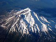
12. Mount Shasta in California is the second highest summit of the Cascade Range.
-

29. Mount Katahdin is the peak having the greatest spire measure in Eastern United States.
-
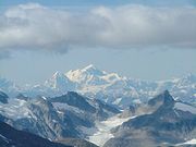
45. Mount Fairweather on the border of Alaska and British Columbia is the fourth most topographically prominent mountain peak of the U.S.
-

116. Mount Blackburn in Alaska is the highest peak of the Wrangell Mountains.
-

163. Mount Sanford in Alaska is the second highest peak of the Wrangell Mountains.
See also
- Outline of the United States
- Index of United States-related articles
- Lists of mountains
- Mountain peaks of North America
- Mountain peaks of Greenland
- Mountain peaks of Canada
- Mountain peaks of the Rocky Mountains
- Mountain peaks of the United States
- The 180 highest major summits of the United States
- The 104 major 4000 meter summits of the United States
- The 180 most prominent summits of the United States
- The 129 ultra-prominent summits of the United States
- The 180 most isolated major summits of the United States
- Mountain peaks of Alaska
- Mountain peaks of California
- Mountain peaks of Colorado
- The 180 highest major summits of the United States
- Mountain peaks of México
- Mountain peaks of Central America
- Mountain peaks of the Caribbean
- Physical geography
- Topography
- Topographic elevation
- Topographic isolation
- Topographic prominence
- Topographic summit
- Topography
- United States of America
- Geography of the United States
- Category:Mountains of the United States
- Geography of the United States
References
- ^ The summit of Mount McKinley (Denali) is the highest point of the Alaska Range, the State of Alaska, the United States of America, and all of North America.
- ^ "Mount McKinley". Summits of the World. peakbagger.com. http://www.peakbagger.com/peak.aspx?pid=271. Retrieved January 27, 2010.
- ^ The summit of Mauna Kea is the highest point of the Island of Hawaiʻi, the State of Hawaiʻi, and the entire North Pacific Ocean. Mauna Kea is also the tallest mountain on Earth as measured from base to summit. The shield volcano sits on the ocean floor at a depth of 5,998 meters (19,678 ft) for a total height of 10,205.3 meters (33,482 ft).
- ^ "Mauna Kea". NGS Station Datasheet. United States National Geodetic Survey. http://www.ngs.noaa.gov/cgi-bin/ds_mark.prl?PidBox=TU2314. Retrieved January 2, 2010.
- ^ "Mauna Kea". Summits of the World. peakbagger.com. http://www.peakbagger.com/peak.aspx?pid=11909. Retrieved January 2, 2010.
- ^ The summit of Mount Whitney is the highest point of the Sierra Nevada, the State of California, and the contiguous United States.
- ^ "Mount Whitney". NGS Station Datasheet. United States National Geodetic Survey. http://www.ngs.noaa.gov/cgi-bin/ds_mark.prl?PidBox=GT1812. Retrieved January 17, 2010.
- ^ "Mount Whitney". Summits of the World. peakbagger.com. http://www.peakbagger.com/peak.aspx?pid=2829. Retrieved January 17, 2010.
- ^ The summit elevation of Mount Whitney includes a vertical adjustment of +1.869 m (+6.1 ft).
- ^ The summit of Mount Mitchell is the highest point of the Appalachian Mountains, the State of North Carolina, and all of eastern North America.
- ^ "Mount Mitchell". Summits of the World. peakbagger.com. http://www.peakbagger.com/peak.aspx?pid=7822. Retrieved January 28, 2010.
- ^ The summit elevation of Mount Mitchell includes a vertical adjustment of +0.025 m (+0.1 ft).
- ^ The summit of Mount Washington is the highest point of the Northern Appalachian Mountains, the State of New Hampshire, and all of northeastern North America. Mount Washington is the easternmost ultra-prominent summit of continental North America.
- ^ "Mount Washington". NGS Station Datasheet. United States National Geodetic Survey. http://www.ngs.noaa.gov/cgi-bin/ds_mark.prl?PidBox=PF0951. Retrieved January 17, 2010.
- ^ "Mount Washington". Summits of the World. peakbagger.com. http://www.peakbagger.com/peak.aspx?pid=6960. Retrieved January 17, 2010.
- ^ The summit elevation of Mount Washington includes a vertical adjustment of +0.02 m (+0.1 ft).
- ^ The summit of Mount Rainier is the highest point of the Cascade Range and the State of Washington.
- ^ "Mount Rainier". NGS Station Datasheet. United States National Geodetic Survey. http://www.ngs.noaa.gov/cgi-bin/ds_mark.prl?PidBox=SB1041. Retrieved January 27, 2010.
- ^ "Mount Rainier". Summits of the World. peakbagger.com. http://www.peakbagger.com/peak.aspx?pid=2296. Retrieved January 27, 2010.
- ^ The summit elevation of Mount Rainier includes a vertical adjustment of +1.935 m (+6.3 ft).
- ^ The summit of Mount Elbert is the highest point of the Rocky Mountains and the State of Colorado.
- ^ "Mount Elbert". NGS Station Datasheet. United States National Geodetic Survey. http://www.ngs.noaa.gov/cgi-bin/ds_mark.prl?PidBox=KL0637. Retrieved January 17, 2010.
- ^ "Mount Elbert". Summits of the World. peakbagger.com. http://www.peakbagger.com/peak.aspx?pid=5736. Retrieved January 17, 2010.
- ^ The summit elevation of Mount Elbert includes a vertical adjustment of +1.995 m (+6.5 ft).
- ^ The summit of Shishaldin Volcano is the highest point of Unimak Island and all the Aleutian Islands.
- ^ "Shishaldin Volcano". Summits of the World. peakbagger.com. http://www.peakbagger.com/peak.aspx?pid=359. Retrieved January 4, 2010.
- ^ The summit of Tanaga Volcano is the highest point of Tanaga Island.
- ^ "Tanaga Volcano". Summits of the World. peakbagger.com. http://www.peakbagger.com/peak.aspx?pid=328. Retrieved January 2, 2010.
- ^ "Mount Chamberlin". NGS Station Datasheet. United States National Geodetic Survey. http://www.ngs.noaa.gov/cgi-bin/ds_mark.prl?PidBox=TT7804. Retrieved January 2, 2010.
- ^ "Mount Chamberlin". Summits of the World. peakbagger.com. http://www.peakbagger.com/peak.aspx?pid=117. Retrieved January 2, 2010.
- ^ The summit of Magazine Mountain is the highest point of the Ozark Mountains, the State of Arkansas, and the central United States.
- ^ "Magazine Mountain". NGS Station Datasheet. United States National Geodetic Survey. http://www.ngs.noaa.gov/cgi-bin/ds_mark.prl?PidBox=FG1888. Retrieved January 28, 2010.
- ^ "Magazine Mountain". Summits of the World. peakbagger.com. http://www.peakbagger.com/peak.aspx?pid=6606. Retrieved January 28, 2010.
- ^ The summit elevation of Magazine Mountain includes a vertical adjustment of +0.075 m (+0.2 ft).
- ^ "Mount Shasta". NGS Station Datasheet. United States National Geodetic Survey. http://www.ngs.noaa.gov/cgi-bin/ds_mark.prl?PidBox=MX1016. Retrieved January 17, 2010.
- ^ "Mount Shasta". Summits of the World. peakbagger.com. http://www.peakbagger.com/peak.aspx?pid=2477. Retrieved January 17, 2010.
- ^ The summit elevation of Mount Shasta includes a vertical adjustment of +1.791 m (+5.9 ft).
- ^ The summit of Gannett Peak is the highest point of the Central Rocky Mountains and the State of Wyoming.
- ^ "Gannett Peak". NGS Station Datasheet. United States National Geodetic Survey. http://www.ngs.noaa.gov/cgi-bin/ds_mark.prl?PidBox=OW0356. Retrieved January 17, 2010.
- ^ "Gannett Peak". Summits of the World. peakbagger.com. http://www.peakbagger.com/peak.aspx?pid=5352. Retrieved January 17, 2010.
- ^ The summit elevation of Gannett Peak includes a vertical adjustment of +1.737 m (+5.7 ft).
- ^ "Mount Osborn". NGS Station Datasheet. United States National Geodetic Survey. http://www.ngs.noaa.gov/cgi-bin/ds_mark.prl?PidBox=UW3831. Retrieved January 25, 2010.
- ^ "Mount Osborn". Summits of the World. peakbagger.com. http://www.peakbagger.com/peak.aspx?pid=145. Retrieved January 25, 2010.
- ^ Adam Helman. "Alaska Borough Prominences". cohp.org. http://www.cohp.org/prominence/lists/ak_boroughs.html. Retrieved February 11, 2010.
- ^ "Mount Igikpak". Summits of the World. peakbagger.com. http://www.peakbagger.com/peak.aspx?pid=73. Retrieved January 27, 2010.
- ^ The summit of Humphreys Peak is the highest point of the State of Arizona.
- ^ "Humphreys Peak". NGS Station Datasheet. United States National Geodetic Survey. http://www.ngs.noaa.gov/cgi-bin/ds_mark.prl?PidBox=FQ0624. Retrieved January 28, 2010.
- ^ "Humphreys Peak". Summits of the World. peakbagger.com. http://www.peakbagger.com/peak.aspx?pid=3938. Retrieved January 28, 2010.
- ^ The summit elevation of Humphreys Peak includes a vertical adjustment of +1.345 m (+4.4 ft).
- ^ "Wheeler Peak". NGS Station Datasheet. United States National Geodetic Survey. http://www.ngs.noaa.gov/cgi-bin/ds_mark.prl?PidBox=JP0339. Retrieved January 17, 2010.
- ^ "Wheeler Peak". Summits of the World. peakbagger.com. http://www.peakbagger.com/peak.aspx?pid=3572. Retrieved January 17, 2010.
- ^ The summit elevation of Wheeler Peak includes a vertical adjustment of +1.649 m (+5.4 ft).
- ^ The summit of Mount Vsevidof is the highest point of Umnak Island.
- ^ "Mount Vsevidof". NGS Station Datasheet. United States National Geodetic Survey. http://www.ngs.noaa.gov/cgi-bin/ds_mark.prl?PidBox=UV9745. Retrieved January 27, 2010.
- ^ "Mount Vsevidof". Summits of the World. peakbagger.com. http://www.peakbagger.com/peak.aspx?pid=352. Retrieved January 27, 2010.
- ^ "Mount Veniaminof". NGS Station Datasheet. United States National Geodetic Survey. http://www.ngs.noaa.gov/cgi-bin/ds_mark.prl?PidBox=UW1462. Retrieved January 27, 2010.
- ^ "Mount Veniaminof". Summits of the World. peakbagger.com. http://www.peakbagger.com/peak.aspx?pid=400. Retrieved January 27, 2010.
- ^ The summit of Kawaikini is the highest point of the Island of Kaua‘i.
- ^ "Kawaikini". Summits of the World. peakbagger.com. http://www.peakbagger.com/peak.aspx?pid=11862. Retrieved January 28, 2010.
- ^ "Dillingham High Point". Summits of the World. peakbagger.com. http://www.peakbagger.com/peak.aspx?pid=180. Retrieved January 27, 2010.
- ^ Adam Helman. "Alaska Borough Prominences". cohp.org. http://www.cohp.org/prominence/lists/ak_boroughs.html. Retrieved February 11, 2010.
- ^ "Hall Island High Point". Summits of the World. peakbagger.com. http://www.peakbagger.com/peak.aspx?pid=25744. Retrieved January 2, 2010.
- ^ "Tooth Benchmark". NGS Station Datasheet. United States National Geodetic Survey. http://www.ngs.noaa.gov/cgi-bin/ds_mark.prl?PidBox=UW3479. Retrieved January 2, 2010.
- ^ "Tooth Benchmark". Summits of the World. peakbagger.com. http://www.peakbagger.com/peak.aspx?pid=25738. Retrieved January 2, 2010.
- ^ The summit of Spruce Knob is the highest point of the Allegheny Mountains and the State of West Virginia.
- ^ "Spruce Knob". NGS Station Datasheet. United States National Geodetic Survey. http://www.ngs.noaa.gov/cgi-bin/ds_mark.prl?PidBox=HW3570. Retrieved January 17, 2010.
- ^ "Spruce Knob". Summits of the World. peakbagger.com. http://www.peakbagger.com/peak.aspx?pid=7376. Retrieved January 17, 2010.
- ^ The summit elevation of Spruce Knob includes a vertical adjustment of -0.075 m (−0.2 ft).
- ^ "Mount Roberts". NGS Station Datasheet. United States National Geodetic Survey. http://www.ngs.noaa.gov/cgi-bin/ds_mark.prl?PidBox=UV8284. Retrieved January 25, 2010.
- ^ "Mount Roberts". Summits of the World. peakbagger.com. http://www.peakbagger.com/peak.aspx?pid=25752. Retrieved January 25, 2010.
- ^ The summit of Kings Peak is the highest point of the Western Rocky Mountains and the State of Utah.
- ^ "Kings Peak". NGS Station Datasheet. United States National Geodetic Survey. http://www.ngs.noaa.gov/cgi-bin/ds_mark.prl?PidBox=LO1058. Retrieved January 3, 2010.
- ^ "Kings Peak". Summits of the World. peakbagger.com. http://www.peakbagger.com/peak.aspx?pid=5507. Retrieved January 3, 2010.
- ^ The summit elevation of Kings Peak includes a vertical adjustment of +1.794 m (+5.9 ft).
- ^ "Sierra Blanca Peak". NGS Station Datasheet. United States National Geodetic Survey. http://www.ngs.noaa.gov/cgi-bin/ds_mark.prl?PidBox=DR1010. Retrieved January 2, 2010.
- ^ "Sierra Blanca Peak". Summits of the World. peakbagger.com. http://www.peakbagger.com/peak.aspx?pid=4277. Retrieved January 2, 2010.
- ^ The summit elevation of Sierra Blanca Peak includes a vertical adjustment of +1.098 m (+3.6 ft).
- ^ "San Gorgonio Mountain". Summits of the World. peakbagger.com. http://www.peakbagger.com/peak.aspx?pid=1417. Retrieved January 28, 2010.
- ^ The summit elevation of San Gorgonio Mountain includes a vertical adjustment of +1.303 m (+4.3 ft).
- ^ The summit of Mount Katahdin is the highest point of the State of Maine.
- ^ "Mount Katahdin". NGS Station Datasheet. United States National Geodetic Survey. http://www.ngs.noaa.gov/cgi-bin/ds_mark.prl?PidBox=QG1451. Retrieved January 17, 2010.
- ^ "Mount Katahdin". Summits of the World. peakbagger.com. http://www.peakbagger.com/peak.aspx?pid=6820. Retrieved January 17, 2010.
- ^ The summit elevation of Mount Katahdin includes a vertical adjustment of -0.125 m (−0.4 ft).
- ^ "Peak 4030". Summits of the World. peakbagger.com. http://www.peakbagger.com/peak.aspx?pid=26174. Retrieved January 27, 2010.
- ^ "Mount Baldy". NGS Station Datasheet. United States National Geodetic Survey. http://www.ngs.noaa.gov/cgi-bin/ds_mark.prl?PidBox=DT0788. Retrieved January 17, 2010.
- ^ "Mount Baldy". Summits of the World. peakbagger.com. http://www.peakbagger.com/peak.aspx?pid=3963. Retrieved January 17, 2010.
- ^ The summit elevation of Mount Baldy includes a vertical adjustment of +1.375 m (+4.5 ft).
- ^ The summit of Borah Peak is the highest point of the State of Idaho.
- ^ "Borah Peak". NGS Station Datasheet. United States National Geodetic Survey. http://www.ngs.noaa.gov/cgi-bin/ds_mark.prl?PidBox=PZ0770. Retrieved January 28, 2010.
- ^ "Borah Peak". Summits of the World. peakbagger.com. http://www.peakbagger.com/peak.aspx?pid=5142. Retrieved January 28, 2010.
- ^ The summit elevation of Borah Peak includes a vertical adjustment of +1.682 m (+5.5 ft).
- ^ "Cloud Peak". NGS Station Datasheet. United States National Geodetic Survey. http://www.ngs.noaa.gov/cgi-bin/ds_mark.prl?PidBox=PW0524. Retrieved January 17, 2010.
- ^ "Cloud Peak". Summits of the World. peakbagger.com. http://www.peakbagger.com/peak.aspx?pid=5323. Retrieved January 17, 2010.
- ^ The summit elevation of Cloud Peak includes a vertical adjustment of +1.293 m (+4.2 ft).
- ^ The summit of Harney Peak is the highest point of the Black Hills and the State of South Dakota.
- ^ "Harney Peak". NGS Station Datasheet. United States National Geodetic Survey. http://www.ngs.noaa.gov/cgi-bin/ds_mark.prl?PidBox=OT0810. Retrieved January 17, 2010.
- ^ "Harney Peak". Summits of the World. peakbagger.com. http://www.peakbagger.com/peak.aspx?pid=6236. Retrieved January 17, 2010.
- ^ The summit elevation of Harney Peak includes a vertical adjustment of +0.676 m (+2.2 ft).
- ^ "Slide Mountain". NGS Station Datasheet. United States National Geodetic Survey. http://www.ngs.noaa.gov/cgi-bin/ds_mark.prl?PidBox=LY2488. Retrieved January 17, 2010.
- ^ "Slide Mountain". Summits of the World. peakbagger.com. http://www.peakbagger.com/peak.aspx?pid=7335. Retrieved January 17, 2010.
- ^ The summit elevation of Slide Mountain includes a vertical adjustment of -0.158 m (−0.5 ft).
- ^ "Mount Griggs". Summits of the World. peakbagger.com. http://www.peakbagger.com/peak.aspx?pid=387. Retrieved January 27, 2010.
- ^ "Charleston Peak". NGS Station Datasheet. United States National Geodetic Survey. http://www.ngs.noaa.gov/cgi-bin/ds_mark.prl?PidBox=GR1965. Retrieved January 2, 2010.
- ^ "Charleston Peak". Summits of the World. peakbagger.com. http://www.peakbagger.com/peak.aspx?pid=3748. Retrieved January 2, 2010.
- ^ The summit elevation of Charleston Peak includes a vertical adjustment of +1.25 m (+4.1 ft).
- ^ "Junipero Serra Peak". NGS Station Datasheet. United States National Geodetic Survey. http://www.ngs.noaa.gov/cgi-bin/ds_mark.prl?PidBox=GU3676. Retrieved January 28, 2010.
- ^ "Junipero Serra Peak". Summits of the World. peakbagger.com. http://www.peakbagger.com/peak.aspx?pid=1205. Retrieved January 28, 2010.
- ^ The summit elevation of Junipero Serra Peak includes a vertical adjustment of +0.971 m (+3.2 ft).
- ^ "Mount Baker". Summits of the World. peakbagger.com. http://www.peakbagger.com/peak.aspx?pid=1633. Retrieved January 27, 2010.
- ^ The summit elevation of Mount Baker includes a vertical adjustment of +1.43 m (+4.7 ft).
- ^ The summit of Mount Marcy is the highest point of the Adirondack Mountains and the State of New York.
- ^ "Mount Marcy". NGS Station Datasheet. United States National Geodetic Survey. http://www.ngs.noaa.gov/cgi-bin/ds_mark.prl?PidBox=PG2096. Retrieved January 17, 2010.
- ^ "Mount Marcy". Summits of the World. peakbagger.com. http://www.peakbagger.com/peak.aspx?pid=6048. Retrieved January 17, 2010.
- ^ The summit elevation of Mount Marcy includes a vertical adjustment of -0.029 m (−0.1 ft).
- ^ The summit of Mount Hayes is the northernmost 4000 m (13,123-foot) summit of North America.
- ^ "Mount Hayes". NGS Station Datasheet. United States National Geodetic Survey. http://www.ngs.noaa.gov/cgi-bin/ds_mark.prl?PidBox=TT6365. Retrieved January 27, 2010.
- ^ "Mount Hayes". Summits of the World. peakbagger.com. http://www.peakbagger.com/peak.aspx?pid=305. Retrieved January 27, 2010.
- ^ "Mount Marcus Baker". Summits of the World. peakbagger.com. http://www.peakbagger.com/peak.aspx?pid=443. Retrieved January 27, 2010.
- ^ "Sacajawea Peak". Summits of the World. peakbagger.com. http://www.peakbagger.com/peak.aspx?pid=3158. Retrieved January 28, 2010.
- ^ The summit elevation of Sacajawea Peak includes a vertical adjustment of +1.56 m (+5.1 ft).
- ^ "Steens Mountain". NGS Station Datasheet. United States National Geodetic Survey. http://www.ngs.noaa.gov/cgi-bin/ds_mark.prl?PidBox=NX0261. Retrieved January 17, 2010.
- ^ "Steens Mountain". Summits of the World. peakbagger.com. http://www.peakbagger.com/peak.aspx?pid=3338. Retrieved January 17, 2010.
- ^ The summit elevation of Steens Mountain includes a vertical adjustment of +1.504 m (+4.9 ft).
- ^ The summit of Mount Fairweather (Fairweather Mountain) on the border of Alaska is the highest point of the Province of British Columbia.
- ^ "Mount Fairweather". Summits of the World. peakbagger.com. http://www.peakbagger.com/peak.aspx?pid=566. Retrieved January 11, 2010.
- ^ "Delano Peak". NGS Station Datasheet. United States National Geodetic Survey. http://www.ngs.noaa.gov/cgi-bin/ds_mark.prl?PidBox=JO0502. Retrieved January 17, 2010.
- ^ "Delano Peak". Summits of the World. peakbagger.com. http://www.peakbagger.com/peak.aspx?pid=3824. Retrieved January 17, 2010.
- ^ The summit elevation of Delano Peak includes a vertical adjustment of +1.664 m (+5.5 ft).
- ^ "Black Mountain". Summits of the World. peakbagger.com. http://www.peakbagger.com/peak.aspx?pid=14. Retrieved January 27, 2010.
- ^ "Mount Tozi". NGS Station Datasheet. United States National Geodetic Survey. http://www.ngs.noaa.gov/cgi-bin/ds_mark.prl?PidBox=TT7078. Retrieved January 2, 2010.
- ^ "Mount Tozi". Summits of the World. peakbagger.com. http://www.peakbagger.com/peak.aspx?pid=12382. Retrieved January 2, 2010.
- ^ "Mount Olympus". NGS Station Datasheet. United States National Geodetic Survey. http://www.ngs.noaa.gov/cgi-bin/ds_mark.prl?PidBox=SY1857. Retrieved January 17, 2010.
- ^ "Mount Olympus". Summits of the World. peakbagger.com. http://www.peakbagger.com/peak.aspx?pid=950. Retrieved January 17, 2010.
- ^ The summit elevation of Mount Olympus includes a vertical adjustment of +1.338 m (+4.4 ft).
- ^ "Blanca Peak". NGS Station Datasheet. United States National Geodetic Survey. http://www.ngs.noaa.gov/cgi-bin/ds_mark.prl?PidBox=HK0514. Retrieved January 2, 2010.
- ^ "Blanca Peak". Summits of the World. peakbagger.com. http://www.peakbagger.com/peak.aspx?pid=5921. Retrieved January 2, 2010.
- ^ The summit elevation of Blanca Peak includes a vertical adjustment of +1.755 m (+5.8 ft).
- ^ "Mount Cleveland". NGS Station Datasheet. United States National Geodetic Survey. http://www.ngs.noaa.gov/cgi-bin/ds_mark.prl?PidBox=TM1009. Retrieved January 17, 2010.
- ^ "Mount Cleveland". Summits of the World. peakbagger.com. http://www.peakbagger.com/peak.aspx?pid=4756. Retrieved January 17, 2010.
- ^ The summit elevation of Mount Cleveland includes a vertical adjustment of +1.432 m (+4.7 ft).
- ^ "Mount Jefferson". NGS Station Datasheet. United States National Geodetic Survey. http://www.ngs.noaa.gov/cgi-bin/ds_mark.prl?PidBox=JQ0584. Retrieved January 17, 2010.
- ^ "Mount Jefferson". Summits of the World. peakbagger.com. http://www.peakbagger.com/peak.aspx?pid=3501. Retrieved January 17, 2010.
- ^ The summit elevation of Mount Jefferson includes a vertical adjustment of +1.666 m (+5.5 ft).
- ^ "Mount Torbert". Summits of the World. peakbagger.com. http://www.peakbagger.com/peak.aspx?pid=221. Retrieved January 27, 2010.
- ^ "Mount Chiginagak". Summits of the World. peakbagger.com. http://www.peakbagger.com/peak.aspx?pid=16712. Retrieved January 27, 2010.
- ^ "Baldy Peak". NGS Station Datasheet. United States National Geodetic Survey. http://www.ngs.noaa.gov/cgi-bin/ds_mark.prl?PidBox=BQ0414. Retrieved January 17, 2010.
- ^ "Baldy Peak". Summits of the World. peakbagger.com. http://www.peakbagger.com/peak.aspx?pid=4304. Retrieved January 17, 2010.
- ^ The summit elevation of Baldy Peak includes a vertical adjustment of +0.771 m (+2.5 ft).
- ^ "Hualapai Peak". NGS Station Datasheet. United States National Geodetic Survey. http://www.ngs.noaa.gov/cgi-bin/ds_mark.prl?PidBox=FR0973. Retrieved January 17, 2010.
- ^ "Hualapai Peak". Summits of the World. peakbagger.com. http://www.peakbagger.com/peak.aspx?pid=4020. Retrieved January 17, 2010.
- ^ The summit elevation of Hualapai Peak includes a vertical adjustment of +1.022 m (+3.4 ft).
- ^ "Ruby Dome". NGS Station Datasheet. United States National Geodetic Survey. http://www.ngs.noaa.gov/cgi-bin/ds_mark.prl?PidBox=LQ0693. Retrieved January 17, 2010.
- ^ "Ruby Dome". Summits of the World. peakbagger.com. http://www.peakbagger.com/peak.aspx?pid=3524. Retrieved January 17, 2010.
- ^ The summit elevation of Ruby Dome includes a vertical adjustment of +1.429 m (+4.7 ft).
- ^ "Pavlof Volcano". NGS Station Datasheet. United States National Geodetic Survey. http://www.ngs.noaa.gov/cgi-bin/ds_mark.prl?PidBox=UW1057. Retrieved January 2, 2010.
- ^ "Pavlof Volcano". Summits of the World. peakbagger.com. http://www.peakbagger.com/peak.aspx?pid=403. Retrieved January 2, 2010.
- ^ "Truuli Peak". Summits of the World. peakbagger.com. http://www.peakbagger.com/peak.aspx?pid=477. Retrieved January 27, 2010.
- ^ "South Baldy". NGS Station Datasheet. United States National Geodetic Survey. http://www.ngs.noaa.gov/cgi-bin/ds_mark.prl?PidBox=DS1461. Retrieved January 28, 2010.
- ^ "South Baldy". Summits of the World. peakbagger.com. http://www.peakbagger.com/peak.aspx?pid=4231. Retrieved January 28, 2010.
- ^ The summit elevation of South Baldy includes a vertical adjustment of +1.077 m (+3.5 ft).
- ^ "Eagle Peak". NGS Station Datasheet. United States National Geodetic Survey. http://www.ngs.noaa.gov/cgi-bin/ds_mark.prl?PidBox=MW0748. Retrieved January 17, 2010.
- ^ "Eagle Peak". Summits of the World. peakbagger.com. http://www.peakbagger.com/peak.aspx?pid=3289. Retrieved January 17, 2010.
- ^ The summit elevation of Eagle Peak includes a vertical adjustment of +1.342 m (+4.4 ft).
- ^ "Great Sitkin Volcano". Summits of the World. peakbagger.com. http://www.peakbagger.com/peak.aspx?pid=322. Retrieved January 27, 2010.
- ^ "Mount Taylor". NGS Station Datasheet. United States National Geodetic Survey. http://www.ngs.noaa.gov/cgi-bin/ds_mark.prl?PidBox=FO1614. Retrieved January 2, 2010.
- ^ "Mount Taylor". Summits of the World. peakbagger.com. http://www.peakbagger.com/peak.aspx?pid=4000. Retrieved January 2, 2010.
- ^ The summit elevation of Mount Taylor includes a vertical adjustment of +1.438 m (+4.7 ft).
- ^ "Accomplishment Peak". Summits of the World. peakbagger.com. http://www.peakbagger.com/peak.aspx?pid=26344. Retrieved January 27, 2010.
- ^ The summit of Granite Peak is the highest point of the State of Montana.
- ^ "Granite Peak". NGS Station Datasheet. United States National Geodetic Survey. http://www.ngs.noaa.gov/cgi-bin/ds_mark.prl?PidBox=QW0616. Retrieved January 17, 2010.
- ^ "Granite Peak". Summits of the World. peakbagger.com. http://www.peakbagger.com/peak.aspx?pid=5258. Retrieved January 17, 2010.
- ^ The summit elevation of Granite Peak includes a vertical adjustment of +1.569 m (+5.1 ft).
- ^ "Korovin Volcano". Summits of the World. peakbagger.com. http://www.peakbagger.com/peak.aspx?pid=319. Retrieved January 27, 2010.
- ^ "Devils Paw". Summits of the World. peakbagger.com. http://www.peakbagger.com/peak.aspx?pid=782. Retrieved January 25, 2010.
- ^ "Kiska Volcano". Summits of the World. peakbagger.com. http://www.peakbagger.com/peak.aspx?pid=313. Retrieved January 3, 2010.
- ^ "Uncompahgre Peak". NGS Station Datasheet. United States National Geodetic Survey. http://www.ngs.noaa.gov/cgi-bin/ds_mark.prl?PidBox=JL0798. Retrieved January 17, 2010.
- ^ "Uncompahgre Peak". Summits of the World. peakbagger.com. http://www.peakbagger.com/peak.aspx?pid=5836. Retrieved January 17, 2010.
- ^ The summit elevation of Uncompahgre Peak includes a vertical adjustment of +1.967 m (+6.5 ft).
- ^ The summit of Kaʻala is the highest point of the Island of Oʻahu.
- ^ "Kaʻala". NGS Station Datasheet. United States National Geodetic Survey. http://www.ngs.noaa.gov/cgi-bin/ds_mark.prl?PidBox=TU1531. Retrieved January 2, 2010.
- ^ "Kaʻala". Summits of the World. peakbagger.com. http://www.peakbagger.com/peak.aspx?pid=11864. Retrieved January 2, 2010.
- ^ "West Butte". NGS Station Datasheet. United States National Geodetic Survey. http://www.ngs.noaa.gov/cgi-bin/ds_mark.prl?PidBox=TL0584. Retrieved January 27, 2010.
- ^ "West Butte". Summits of the World. peakbagger.com. http://www.peakbagger.com/peak.aspx?pid=6138. Retrieved January 27, 2010.
- ^ The summit elevation of West Butte includes a vertical adjustment of +1.061 m (+3.5 ft).
- ^ The summit of Koniag Peak is the highest point of Kodiak Island.
- ^ "Koniag Peak". Summits of the World. peakbagger.com. http://www.peakbagger.com/peak.aspx?pid=492. Retrieved January 27, 2010.
- ^ The summit of Makushin Volcano is the highest point of Unalaska Island.
- ^ "Makushin Volcano". Summits of the World. peakbagger.com. http://www.peakbagger.com/peak.aspx?pid=343. Retrieved January 27, 2010.
- ^ "Cache Peak". NGS Station Datasheet. United States National Geodetic Survey. http://www.ngs.noaa.gov/cgi-bin/ds_mark.prl?PidBox=NU1721. Retrieved January 17, 2010.
- ^ "Cache Peak". Summits of the World. peakbagger.com. http://www.peakbagger.com/peak.aspx?pid=3438. Retrieved January 17, 2010.
- ^ The summit elevation of Cache Peak includes a vertical adjustment of +1.281 m (+4.2 ft).
- ^ "Snowshoe Peak". Summits of the World. peakbagger.com. http://www.peakbagger.com/peak.aspx?pid=4694. Retrieved January 27, 2010.
- ^ The summit elevation of Snowshoe Peak includes a vertical adjustment of +1.367 m (+4.5 ft).
- ^ "Granite Peak". NGS Station Datasheet. United States National Geodetic Survey. http://www.ngs.noaa.gov/cgi-bin/ds_mark.prl?PidBox=MU0442. Retrieved January 28, 2010.
- ^ "Granite Peak". Summits of the World. peakbagger.com. http://www.peakbagger.com/peak.aspx?pid=3394. Retrieved January 28, 2010.
- ^ The summit elevation of Granite Peak includes a vertical adjustment of +1.325 m (+4.3 ft).
- ^ "Mount Pinos". NGS Station Datasheet. United States National Geodetic Survey. http://www.ngs.noaa.gov/cgi-bin/ds_mark.prl?PidBox=EW7675. Retrieved January 17, 2010.
- ^ "Mount Pinos". Summits of the World. peakbagger.com. http://www.peakbagger.com/peak.aspx?pid=1267. Retrieved January 17, 2010.
- ^ The summit elevation of Mount Pinos includes a vertical adjustment of +1.097 m (+3.6 ft).
- ^ "Mount Graham". NGS Station Datasheet. United States National Geodetic Survey. http://www.ngs.noaa.gov/cgi-bin/ds_mark.prl?PidBox=CY1235. Retrieved January 17, 2010.
- ^ "Mount Graham". Summits of the World. peakbagger.com. http://www.peakbagger.com/peak.aspx?pid=4211. Retrieved January 17, 2010.
- ^ The summit elevation of Mount Graham includes a vertical adjustment of +1.036 m (+3.4 ft).
- ^ The summit of Guadalupe Peak is the highest point of the State of Texas.
- ^ "Guadalupe Peak". NGS Station Datasheet. United States National Geodetic Survey. http://www.ngs.noaa.gov/cgi-bin/ds_mark.prl?PidBox=CD0988. Retrieved January 17, 2010.
- ^ "Guadalupe Peak". Summits of the World. peakbagger.com. http://www.peakbagger.com/peak.aspx?pid=4297. Retrieved January 17, 2010.
- ^ The summit elevation of Guadalupe Peak includes a vertical adjustment of +0.681 m (+2.2 ft).
- ^ "Baranof Island High Point". Summits of the World. peakbagger.com. http://www.peakbagger.com/peak.aspx?pid=737. Retrieved January 27, 2010.
- ^ The summit of Haleakalā is the highest point of the Island of Maui.
- ^ "Haleakalā". Summits of the World. peakbagger.com. http://www.peakbagger.com/peak.aspx?pid=11905. Retrieved January 2, 2010.
- ^ "McDonald Peak". Summits of the World. peakbagger.com. http://www.peakbagger.com/peak.aspx?pid=4705. Retrieved January 27, 2010.
- ^ The summit elevation of McDonald Peak includes a vertical adjustment of +1.318 m (+4.3 ft).
- ^ "Mount Nebo". Summits of the World. peakbagger.com. http://www.peakbagger.com/peak.aspx?pid=5475. Retrieved January 28, 2010.
- ^ The summit elevation of Mount Nebo includes a vertical adjustment of +1.395 m (+4.6 ft).
- ^ "Hilgard Peak". Summits of the World. peakbagger.com. http://www.peakbagger.com/peak.aspx?pid=4927. Retrieved January 28, 2010.
- ^ The summit elevation of Hilgard Peak includes a vertical adjustment of +1.49 m (+4.9 ft).
- ^ "Cinnabar Mountain". NGS Station Datasheet. United States National Geodetic Survey. http://www.ngs.noaa.gov/cgi-bin/ds_mark.prl?PidBox=NW0395. Retrieved January 28, 2010.
- ^ "Cinnabar Mountain". Summits of the World. peakbagger.com. http://www.peakbagger.com/peak.aspx?pid=3385. Retrieved January 28, 2010.
- ^ The summit elevation of Cinnabar Mountain includes a vertical adjustment of +1.234 m (+4.0 ft).
- ^ "Tweedy Mountain". NGS Station Datasheet. United States National Geodetic Survey. http://www.ngs.noaa.gov/cgi-bin/ds_mark.prl?PidBox=QY0549. Retrieved January 17, 2010.
- ^ "Tweedy Mountain". Summits of the World. peakbagger.com. http://www.peakbagger.com/peak.aspx?pid=4882. Retrieved January 17, 2010.
- ^ The summit elevation of Tweedy Mountain includes a vertical adjustment of +1.598 m (+5.2 ft).
- ^ "Buldir Volcano". NGS Station Datasheet. United States National Geodetic Survey. http://www.ngs.noaa.gov/cgi-bin/ds_mark.prl?PidBox=TT5847. Retrieved January 27, 2010.
- ^ "Buldir Volcano". Summits of the World. peakbagger.com. http://www.peakbagger.com/peak.aspx?pid=312. Retrieved January 27, 2010.
- ^ "Blackburn Hills". Summits of the World. peakbagger.com. http://www.peakbagger.com/peak.aspx?pid=148. Retrieved January 27, 2010.
- ^ "Mount Peale". NGS Station Datasheet. United States National Geodetic Survey. http://www.ngs.noaa.gov/cgi-bin/ds_mark.prl?PidBox=JM0496. Retrieved January 3, 2010.
- ^ "Mount Peale". Summits of the World. peakbagger.com. http://www.peakbagger.com/peak.aspx?pid=3879. Retrieved January 3, 2010.
- ^ The summit elevation of Mount Peale includes a vertical adjustment of +1.509 m (+5.0 ft).
- ^ "Mount Tom White". NGS Station Datasheet. United States National Geodetic Survey. http://www.ngs.noaa.gov/cgi-bin/ds_mark.prl?PidBox=UV3135. Retrieved January 27, 2010.
- ^ "Mount Tom White". Summits of the World. peakbagger.com. http://www.peakbagger.com/peak.aspx?pid=456. Retrieved January 27, 2010.
- ^ "Lassen Peak". NGS Station Datasheet. United States National Geodetic Survey. http://www.ngs.noaa.gov/cgi-bin/ds_mark.prl?PidBox=LT0688. Retrieved January 17, 2010.
- ^ "Lassen Peak". Summits of the World. peakbagger.com. http://www.peakbagger.com/peak.aspx?pid=2513. Retrieved January 17, 2010.
- ^ The summit elevation of Lassen Peak includes a vertical adjustment of +1.332 m (+4.4 ft).
- ^ "Laramie Peak". NGS Station Datasheet. United States National Geodetic Survey. http://www.ngs.noaa.gov/cgi-bin/ds_mark.prl?PidBox=NQ0621. Retrieved January 17, 2010.
- ^ "Laramie Peak". Summits of the World. peakbagger.com. http://www.peakbagger.com/peak.aspx?pid=5567. Retrieved January 17, 2010.
- ^ The summit elevation of Laramie Peak includes a vertical adjustment of +1.041 m (+3.4 ft).
- ^ The summit of Clingmans Dome on the border of the State of North Carolina is the highest point of the State of Tennessee.
- ^ "Clingmans Dome". NGS Station Datasheet. United States National Geodetic Survey. http://www.ngs.noaa.gov/cgi-bin/ds_mark.prl?PidBox=FB2491. Retrieved January 28, 2010.
- ^ "Clingmans Dome". Summits of the World. peakbagger.com. http://www.peakbagger.com/peak.aspx?pid=7764. Retrieved January 28, 2010.
- ^ The summit elevation of Clingmans Dome includes a vertical adjustment of +0.062 m (+0.2 ft).
- ^ "Kaibab Plateau High Point". Summits of the World. peakbagger.com. http://www.peakbagger.com/peak.aspx?pid=3904. Retrieved January 28, 2010.
- ^ The summit elevation of Kaibab Plateau High Point includes a vertical adjustment of +1.301 m (+4.3 ft).
- ^ "Anvil Peak". NGS Station Datasheet. United States National Geodetic Survey. http://www.ngs.noaa.gov/cgi-bin/ds_mark.prl?PidBox=TT5194. Retrieved January 17, 2010.
- ^ "Anvil Peak". Summits of the World. peakbagger.com. http://www.peakbagger.com/peak.aspx?pid=315. Retrieved January 17, 2010.
- ^ "Mount McLoughlin". NGS Station Datasheet. United States National Geodetic Survey. http://www.ngs.noaa.gov/cgi-bin/ds_mark.prl?PidBox=NZ1067. Retrieved January 17, 2010.
- ^ "Mount McLoughlin". Summits of the World. peakbagger.com. http://www.peakbagger.com/peak.aspx?pid=2465. Retrieved January 17, 2010.
- ^ The summit elevation of Mount McLoughlin includes a vertical adjustment of +1.306 m (+4.3 ft).
- ^ "Grand Teton". NGS Station Datasheet. United States National Geodetic Survey. http://www.ngs.noaa.gov/cgi-bin/ds_mark.prl?PidBox=OX0838. Retrieved January 17, 2010.
- ^ "Grand Teton". Summits of the World. peakbagger.com. http://www.peakbagger.com/peak.aspx?pid=5218. Retrieved January 17, 2010.
- ^ The summit elevation of Grand Teton includes a vertical adjustment of +1.571 m (+5.2 ft).
- ^ "Pyre Peak". NGS Station Datasheet. United States National Geodetic Survey. http://www.ngs.noaa.gov/cgi-bin/ds_mark.prl?PidBox=TT5609. Retrieved January 17, 2010.
- ^ "Pyre Peak". Summits of the World. peakbagger.com. http://www.peakbagger.com/peak.aspx?pid=321. Retrieved January 17, 2010.
- ^ "Star Peak". NGS Station Datasheet. United States National Geodetic Survey. http://www.ngs.noaa.gov/cgi-bin/ds_mark.prl?PidBox=LS0554. Retrieved January 17, 2010.
- ^ "Star Peak". Summits of the World. peakbagger.com. http://www.peakbagger.com/peak.aspx?pid=3442. Retrieved January 17, 2010.
- ^ The summit elevation of Star Peak includes a vertical adjustment of +1.167 m (+3.8 ft).
- ^ "White Mountain Peak". NGS Station Datasheet. United States National Geodetic Survey. http://www.ngs.noaa.gov/cgi-bin/ds_mark.prl?PidBox=HR2559. Retrieved January 17, 2010.
- ^ "White Mountain Peak". Summits of the World. peakbagger.com. http://www.peakbagger.com/peak.aspx?pid=3628. Retrieved January 17, 2010.
- ^ The summit elevation of White Mountain Peak includes a vertical adjustment of +1.91 m (+6.3 ft).
- ^ "Miller Peak". Summits of the World. peakbagger.com. http://www.peakbagger.com/peak.aspx?pid=4202. Retrieved January 28, 2010.
- ^ The summit elevation of Miller Peak includes a vertical adjustment of +1.067 m (+3.5 ft).
- ^ "Baldy Mountain". NGS Station Datasheet. United States National Geodetic Survey. http://www.ngs.noaa.gov/cgi-bin/ds_mark.prl?PidBox=TK0492. Retrieved January 17, 2010.
- ^ "Baldy Mountain". Summits of the World. peakbagger.com. http://www.peakbagger.com/peak.aspx?pid=6142. Retrieved January 17, 2010.
- ^ The summit elevation of Baldy Mountain includes a vertical adjustment of +0.887 m (+2.9 ft).
- ^ "Peak E". NGS Station Datasheet. United States National Geodetic Survey. http://www.ngs.noaa.gov/cgi-bin/ds_mark.prl?PidBox=UV8908. Retrieved January 27, 2010.
- ^ "Peak E". Summits of the World. peakbagger.com. http://www.peakbagger.com/peak.aspx?pid=150. Retrieved January 27, 2010.
- ^ Adam Helman. "Alaska Borough Prominences". cohp.org. http://www.cohp.org/prominence/lists/ak_boroughs.html. Retrieved February 11, 2010.
- ^ "Copernicus Peak". Summits of the World. peakbagger.com. http://www.peakbagger.com/peak.aspx?pid=1218. Retrieved January 3, 2010.
- ^ The summit elevation of Copernicus Peak includes a vertical adjustment of +0.924 m (+3.0 ft).
- ^ "Prince of Wales Island High Point". Summits of the World. peakbagger.com. http://www.peakbagger.com/peak.aspx?pid=742. Retrieved January 2, 2010.
- ^ "Sugarloaf Mountain". Summits of the World. peakbagger.com. http://www.peakbagger.com/peak.aspx?pid=6839. Retrieved January 28, 2010.
- ^ The summit elevation of Sugarloaf Mountain includes a vertical adjustment of -0.119 m (−0.4 ft).
- ^ "Naomi Peak". NGS Station Datasheet. United States National Geodetic Survey. http://www.ngs.noaa.gov/cgi-bin/ds_mark.prl?PidBox=MR0721. Retrieved January 17, 2010.
- ^ "Naomi Peak". Summits of the World. peakbagger.com. http://www.peakbagger.com/peak.aspx?pid=5436. Retrieved January 17, 2010.
- ^ The summit elevation of Naomi Peak includes a vertical adjustment of +1.355 m (+4.4 ft).
- ^ "Chiricahua Peak". Summits of the World. peakbagger.com. http://www.peakbagger.com/peak.aspx?pid=4223. Retrieved January 28, 2010.
- ^ The summit elevation of Chiricahua Peak includes a vertical adjustment of +1.173 m (+3.8 ft).
- ^ "Mount Ajo". NGS Station Datasheet. United States National Geodetic Survey. http://www.ngs.noaa.gov/cgi-bin/ds_mark.prl?PidBox=DA1510. Retrieved January 28, 2010.
- ^ "Mount Ajo". Summits of the World. peakbagger.com. http://www.peakbagger.com/peak.aspx?pid=4116. Retrieved January 28, 2010.
- ^ The summit elevation of Mount Ajo includes a vertical adjustment of +0.793 m (+2.6 ft).
- ^ "Mount Harper". Summits of the World. peakbagger.com. http://www.peakbagger.com/peak.aspx?pid=12390. Retrieved January 2, 2010.
- ^ "Mount Angayukaqsraq". Summits of the World. peakbagger.com. http://www.peakbagger.com/peak.aspx?pid=67. Retrieved January 27, 2010.
- ^ "Mount Prindle". NGS Station Datasheet. United States National Geodetic Survey. http://www.ngs.noaa.gov/cgi-bin/ds_mark.prl?PidBox=TT6975. Retrieved January 2, 2010.
- ^ "Mount Prindle". Summits of the World. peakbagger.com. http://www.peakbagger.com/peak.aspx?pid=12381. Retrieved January 2, 2010.
- ^ "Mount Linn". NGS Station Datasheet. United States National Geodetic Survey. http://www.ngs.noaa.gov/cgi-bin/ds_mark.prl?PidBox=LU2028. Retrieved January 2, 2010.
- ^ "Mount Linn". Summits of the World. peakbagger.com. http://www.peakbagger.com/peak.aspx?pid=1166. Retrieved January 2, 2010.
- ^ The summit elevation of Mount Linn includes a vertical adjustment of +1.148 m (+3.8 ft).
- ^ "Ibapah Peak". NGS Station Datasheet. United States National Geodetic Survey. http://www.ngs.noaa.gov/cgi-bin/ds_mark.prl?PidBox=KO0484. Retrieved January 3, 2010.
- ^ "Ibapah Peak". Summits of the World. peakbagger.com. http://www.peakbagger.com/peak.aspx?pid=3543. Retrieved January 3, 2010.
- ^ The summit elevation of Ibapah Peak includes a vertical adjustment of +1.517 m (+5.0 ft).
- ^ "Pikes Peak". NGS Station Datasheet. United States National Geodetic Survey. http://www.ngs.noaa.gov/cgi-bin/ds_mark.prl?PidBox=JK1242. Retrieved January 17, 2010.
- ^ "Pikes Peak". Summits of the World. peakbagger.com. http://www.peakbagger.com/peak.aspx?pid=5689. Retrieved January 17, 2010.
- ^ The summit elevation of Pikes Peak includes a vertical adjustment of +1.678 m (+5.5 ft).
- ^ "Mount Blackburn". NGS Station Datasheet. United States National Geodetic Survey. http://www.ngs.noaa.gov/cgi-bin/ds_mark.prl?PidBox=UV4136. Retrieved January 11, 2010.
- ^ "Mount Blackburn". Summits of the World. peakbagger.com. http://www.peakbagger.com/peak.aspx?pid=437. Retrieved January 11, 2010.
- ^ "Redoubt Volcano". NGS Station Datasheet. United States National Geodetic Survey. http://www.ngs.noaa.gov/cgi-bin/ds_mark.prl?PidBox=UW6080. Retrieved January 2, 2010.
- ^ "Redoubt Volcano". Summits of the World. peakbagger.com. http://www.peakbagger.com/peak.aspx?pid=411. Retrieved January 2, 2010.
- ^ "Mooseheart Mountain". NGS Station Datasheet. United States National Geodetic Survey. http://www.ngs.noaa.gov/cgi-bin/ds_mark.prl?PidBox=TT6777. Retrieved January 17, 2010.
- ^ "Mooseheart Mountain". Summits of the World. peakbagger.com. http://www.peakbagger.com/peak.aspx?pid=168. Retrieved January 17, 2010.
- ^ "Mount Hesperus". Summits of the World. peakbagger.com. http://www.peakbagger.com/peak.aspx?pid=210. Retrieved January 2, 2010.
- ^ "Bonasila Dome". NGS Station Datasheet. United States National Geodetic Survey. http://www.ngs.noaa.gov/cgi-bin/ds_mark.prl?PidBox=UV8894. Retrieved January 17, 2010.
- ^ "Bonasila Dome". Summits of the World. peakbagger.com. http://www.peakbagger.com/peak.aspx?pid=151. Retrieved January 17, 2010.
- ^ The summit of Mount Hood is the highest point of the State of Oregon.
- ^ "Mount Hood". NGS Station Datasheet. United States National Geodetic Survey. http://www.ngs.noaa.gov/cgi-bin/ds_mark.prl?PidBox=RC2244. Retrieved January 17, 2010.
- ^ "Mount Hood". Summits of the World. peakbagger.com. http://www.peakbagger.com/peak.aspx?pid=2382. Retrieved January 17, 2010.
- ^ The summit elevation of Mount Hood includes a vertical adjustment of +1.341 m (+4.4 ft).
- ^ "Telescope Peak". NGS Station Datasheet. United States National Geodetic Survey. http://www.ngs.noaa.gov/cgi-bin/ds_mark.prl?PidBox=GS0799. Retrieved January 17, 2010.
- ^ "Telescope Peak". Summits of the World. peakbagger.com. http://www.peakbagger.com/peak.aspx?pid=3662. Retrieved January 17, 2010.
- ^ The summit elevation of Telescope Peak includes a vertical adjustment of +1.169 m (+3.8 ft).
- ^ "Ferris Mountain". NGS Station Datasheet. United States National Geodetic Survey. http://www.ngs.noaa.gov/cgi-bin/ds_mark.prl?PidBox=NR0432. Retrieved January 17, 2010.
- ^ "Ferris Mountain". Summits of the World. peakbagger.com. http://www.peakbagger.com/peak.aspx?pid=5411. Retrieved January 17, 2010.
- ^ The summit elevation of Ferris Mountain includes a vertical adjustment of +1.227 m (+4.0 ft).
- ^ The summit of Mount Cleveland is the highest point of Chuginadak Island.
- ^ "Mount Cleveland". NGS Station Datasheet. United States National Geodetic Survey. http://www.ngs.noaa.gov/cgi-bin/ds_mark.prl?PidBox=UV9122. Retrieved January 2, 2010.
- ^ "Mount Cleveland". Summits of the World. peakbagger.com. http://www.peakbagger.com/peak.aspx?pid=334. Retrieved January 2, 2010.
- ^ "Mount Ellen Peak". Summits of the World. peakbagger.com. http://www.peakbagger.com/peak.aspx?pid=3883. Retrieved January 28, 2010.
- ^ The summit elevation of Mount Ellen Peak includes a vertical adjustment of +1.486 m (+4.9 ft).
- ^ "Glacier Peak". NGS Station Datasheet. United States National Geodetic Survey. http://www.ngs.noaa.gov/cgi-bin/ds_mark.prl?PidBox=TQ0506. Retrieved January 17, 2010.
- ^ "Glacier Peak". Summits of the World. peakbagger.com. http://www.peakbagger.com/peak.aspx?pid=1972. Retrieved January 17, 2010.
- ^ The summit elevation of Glacier Peak includes a vertical adjustment of +1.492 m (+4.9 ft).
- ^ "Greathouse Peak". Summits of the World. peakbagger.com. http://www.peakbagger.com/peak.aspx?pid=4907. Retrieved January 28, 2010.
- ^ The summit elevation of Greathouse Peak includes a vertical adjustment of +1.136 m (+3.7 ft).
- ^ "Mount Kimball". Summits of the World. peakbagger.com. http://www.peakbagger.com/peak.aspx?pid=16711. Retrieved January 27, 2010.
- ^ "Pilot Peak". NGS Station Datasheet. United States National Geodetic Survey. http://www.ngs.noaa.gov/cgi-bin/ds_mark.prl?PidBox=MT0738. Retrieved January 3, 2010.
- ^ "Pilot Peak". Summits of the World. peakbagger.com. http://www.peakbagger.com/peak.aspx?pid=3441. Retrieved January 3, 2010.
- ^ The summit elevation of Pilot Peak includes a vertical adjustment of +1.178 m (+3.9 ft).
- ^ "Red Mountain". NGS Station Datasheet. United States National Geodetic Survey. http://www.ngs.noaa.gov/cgi-bin/ds_mark.prl?PidBox=ST0521. Retrieved January 19, 2010.
- ^ "Red Mountain". Summits of the World. peakbagger.com. http://www.peakbagger.com/peak.aspx?pid=4859. Retrieved January 19, 2010.
- ^ The summit elevation of Red Mountain includes a vertical adjustment of +1.278 m (+4.2 ft).
- ^ "Currant Mountain". Summits of the World. peakbagger.com. http://www.peakbagger.com/peak.aspx?pid=3550. Retrieved January 1, 2010.
- ^ The summit elevation of Currant Mountain includes a vertical adjustment of +1.493 m (+4.9 ft).
- ^ "Brian Head". Summits of the World. peakbagger.com. http://www.peakbagger.com/peak.aspx?pid=3826. Retrieved January 1, 2010.
- ^ The summit elevation of Brian Head includes a vertical adjustment of +1.556 m (+5.1 ft).
- ^ "Mount Lemmon". NGS Station Datasheet. United States National Geodetic Survey. http://www.ngs.noaa.gov/cgi-bin/ds_mark.prl?PidBox=AI1947. Retrieved January 28, 2010.
- ^ "Mount Lemmon". Summits of the World. peakbagger.com. http://www.peakbagger.com/peak.aspx?pid=4191. Retrieved January 28, 2010.
- ^ The summit elevation of Mount Lemmon includes a vertical adjustment of +1.003 m (+3.3 ft).
- ^ "Mount Greenough". Summits of the World. peakbagger.com. http://www.peakbagger.com/peak.aspx?pid=133. Retrieved January 27, 2010.
- ^ "Wyoming Peak". NGS Station Datasheet. United States National Geodetic Survey. http://www.ngs.noaa.gov/cgi-bin/ds_mark.prl?PidBox=NT0655. Retrieved January 19, 2010.
- ^ "Wyoming Peak". Summits of the World. peakbagger.com. http://www.peakbagger.com/peak.aspx?pid=5431. Retrieved January 19, 2010.
- ^ The summit elevation of Wyoming Peak includes a vertical adjustment of +1.548 m (+5.1 ft).
- ^ "De Long Peak". Summits of the World. peakbagger.com. http://www.peakbagger.com/peak.aspx?pid=16715. Retrieved January 27, 2010.
- ^ "De Long Peak". Canadian Mountain Encyclopedia. bivouac.com. http://www.bivouac.com/MtnPg.asp?MtnId=7783. Retrieved January 27, 2010.
- ^ "Mount Bona". NGS Station Datasheet. United States National Geodetic Survey. http://www.ngs.noaa.gov/cgi-bin/ds_mark.prl?PidBox=UV4083. Retrieved January 27, 2010.
- ^ "Mount Bona". Summits of the World. peakbagger.com. http://www.peakbagger.com/peak.aspx?pid=496. Retrieved January 27, 2010.
- ^ "Peak 4085". Summits of the World. peakbagger.com. http://www.peakbagger.com/peak.aspx?pid=26175. Retrieved January 2, 2010.
- ^ The summit of Mount Orizaba is the highest point of Santa Catalina Island.
- ^ "Mount Orizaba". NGS Station Datasheet. United States National Geodetic Survey. http://www.ngs.noaa.gov/cgi-bin/ds_mark.prl?PidBox=DY2975. Retrieved January 28, 2010.
- ^ "Mount Orizaba". Summits of the World. peakbagger.com. http://www.peakbagger.com/peak.aspx?pid=1532. Retrieved January 28, 2010.
- ^ The summit elevation of Mount Orizaba includes a vertical adjustment of +0.728 m (+2.4 ft).
- ^ "Rocky Mountain". NGS Station Datasheet. United States National Geodetic Survey. http://www.ngs.noaa.gov/cgi-bin/ds_mark.prl?PidBox=ST0546. Retrieved January 27, 2010.
- ^ "Rocky Mountain". Summits of the World. peakbagger.com. http://www.peakbagger.com/peak.aspx?pid=4866. Retrieved January 27, 2010.
- ^ The summit elevation of Rocky Mountain includes a vertical adjustment of +1.321 m (+4.3 ft).
- ^ "Mount Jefferson". NGS Station Datasheet. United States National Geodetic Survey. http://www.ngs.noaa.gov/cgi-bin/ds_mark.prl?PidBox=QD1739. Retrieved January 17, 2010.
- ^ "Mount Jefferson". Summits of the World. peakbagger.com. http://www.peakbagger.com/peak.aspx?pid=2401. Retrieved January 17, 2010.
- ^ The summit elevation of Mount Jefferson includes a vertical adjustment of +1.388 m (+4.6 ft).
- ^ "Sovereign Mountain". Summits of the World. peakbagger.com. http://www.peakbagger.com/peak.aspx?pid=418. Retrieved January 27, 2010.
- ^ "Francs Peak". NGS Station Datasheet. United States National Geodetic Survey. http://www.ngs.noaa.gov/cgi-bin/ds_mark.prl?PidBox=OW0325. Retrieved January 17, 2010.
- ^ "Francs Peak". Summits of the World. peakbagger.com. http://www.peakbagger.com/peak.aspx?pid=5311. Retrieved January 17, 2010.
- ^ The summit elevation of Francs Peak includes a vertical adjustment of +1.674 m (+5.5 ft).
- ^ "Emory Peak". NGS Station Datasheet. United States National Geodetic Survey. http://www.ngs.noaa.gov/cgi-bin/ds_mark.prl?PidBox=BA0431. Retrieved January 28, 2010.
- ^ "Emory Peak". Summits of the World. peakbagger.com. http://www.peakbagger.com/peak.aspx?pid=4333. Retrieved January 28, 2010.
- ^ The summit elevation of Emory Peak includes a vertical adjustment of +0.614 m (+2.0 ft).
- ^ "Big Baldy Mountain". NGS Station Datasheet. United States National Geodetic Survey. http://www.ngs.noaa.gov/cgi-bin/ds_mark.prl?PidBox=RW0512. Retrieved January 27, 2010.
- ^ "Big Baldy Mountain". Summits of the World. peakbagger.com. http://www.peakbagger.com/peak.aspx?pid=4896. Retrieved January 27, 2010.
- ^ The summit elevation of Big Baldy Mountain includes a vertical adjustment of +1.184 m (+3.9 ft).
- ^ "Deseret Peak". NGS Station Datasheet. United States National Geodetic Survey. http://www.ngs.noaa.gov/cgi-bin/ds_mark.prl?PidBox=LP0457. Retrieved January 17, 2010.
- ^ "Deseret Peak". Summits of the World. peakbagger.com. http://www.peakbagger.com/peak.aspx?pid=3586. Retrieved January 17, 2010.
- ^ The summit elevation of Deseret Peak includes a vertical adjustment of +1.366 m (+4.5 ft).
- ^ "Mount Adams". NGS Station Datasheet. United States National Geodetic Survey. http://www.ngs.noaa.gov/cgi-bin/ds_mark.prl?PidBox=SB1004. Retrieved January 17, 2010.
- ^ "Mount Adams". Summits of the World. peakbagger.com. http://www.peakbagger.com/peak.aspx?pid=2365. Retrieved January 17, 2010.
- ^ The summit elevation of Mount Adams includes a vertical adjustment of +1.655 m (+5.4 ft).
- ^ "Crazy Peak". NGS Station Datasheet. United States National Geodetic Survey. http://www.ngs.noaa.gov/cgi-bin/ds_mark.prl?PidBox=RV0503. Retrieved January 28, 2010.
- ^ "Crazy Peak". Summits of the World. peakbagger.com. http://www.peakbagger.com/peak.aspx?pid=4905. Retrieved January 28, 2010.
- ^ The summit elevation of Crazy Peak includes a vertical adjustment of +1.422 m (+4.7 ft).
- ^ "Mount Stuart". NGS Station Datasheet. United States National Geodetic Survey. http://www.ngs.noaa.gov/cgi-bin/ds_mark.prl?PidBox=SX1189. Retrieved January 17, 2010.
- ^ "Mount Stuart". Summits of the World. peakbagger.com. http://www.peakbagger.com/peak.aspx?pid=2182. Retrieved January 17, 2010.
- ^ The summit elevation of Mount Stuart includes a vertical adjustment of +1.388 m (+4.6 ft).
- ^ "Longs Peak". NGS Station Datasheet. United States National Geodetic Survey. http://www.ngs.noaa.gov/cgi-bin/ds_mark.prl?PidBox=LL1346. Retrieved January 17, 2010.
- ^ "Longs Peak". Summits of the World. peakbagger.com. http://www.peakbagger.com/peak.aspx?pid=5642. Retrieved January 17, 2010.
- ^ The summit elevation of Longs Peak includes a vertical adjustment of +1.652 m (+5.4 ft).
- ^ "San Benito Mountain". NGS Station Datasheet. United States National Geodetic Survey. http://www.ngs.noaa.gov/cgi-bin/ds_mark.prl?PidBox=GU3500. Retrieved January 19, 2010.
- ^ "San Benito Mountain". Summits of the World. peakbagger.com. http://www.peakbagger.com/peak.aspx?pid=1229. Retrieved January 19, 2010.
- ^ The summit elevation of San Benito Mountain includes a vertical adjustment of +1.104 m (+3.6 ft).
- ^ "Mount Douglas". Summits of the World. peakbagger.com. http://www.peakbagger.com/peak.aspx?pid=373. Retrieved January 27, 2010.
- ^ "Flat Top Mountain". NGS Station Datasheet. United States National Geodetic Survey. http://www.ngs.noaa.gov/cgi-bin/ds_mark.prl?PidBox=LM0694. Retrieved January 17, 2010.
- ^ "Flat Top Mountain". Summits of the World. peakbagger.com. http://www.peakbagger.com/peak.aspx?pid=5574. Retrieved January 17, 2010.
- ^ The summit elevation of Flat Top Mountain includes a vertical adjustment of +1.698 m (+5.6 ft).
- ^ "Abajo Peak". Summits of the World. peakbagger.com. http://www.peakbagger.com/peak.aspx?pid=3893. Retrieved January 1, 2010.
- ^ The summit elevation of Abajo Peak includes a vertical adjustment of +1.379 m (+4.5 ft).
- ^ "Mount San Antonio". NGS Station Datasheet. United States National Geodetic Survey. http://www.ngs.noaa.gov/cgi-bin/ds_mark.prl?PidBox=EV3735. Retrieved January 28, 2010.
- ^ "Mount San Antonio". Summits of the World. peakbagger.com. http://www.peakbagger.com/peak.aspx?pid=1338. Retrieved January 28, 2010.
- ^ The summit elevation of Mount San Antonio includes a vertical adjustment of +1.214 m (+4.0 ft).
- ^ "Truchas Peak". NGS Station Datasheet. United States National Geodetic Survey. http://www.ngs.noaa.gov/cgi-bin/ds_mark.prl?PidBox=FN0666. Retrieved January 17, 2010.
- ^ "Truchas Peak". Summits of the World. peakbagger.com. http://www.peakbagger.com/peak.aspx?pid=5944. Retrieved January 17, 2010.
- ^ The summit elevation of Truchas Peak includes a vertical adjustment of +1.478 m (+4.8 ft).
- ^ The summit of Akutan Peak is the highest point of Akutan Island.
- ^ "Akutan Peak". Summits of the World. peakbagger.com. http://www.peakbagger.com/peak.aspx?pid=354. Retrieved January 3, 2010.
- ^ "Saint Joseph Peak". NGS Station Datasheet. United States National Geodetic Survey. http://www.ngs.noaa.gov/cgi-bin/ds_mark.prl?PidBox=RY1027. Retrieved January 24, 2010.
- ^ "Saint Joseph Peak". Summits of the World. peakbagger.com. http://www.peakbagger.com/peak.aspx?pid=17191. Retrieved January 24, 2010.
- ^ The summit elevation of Saint Joseph Peak includes a vertical adjustment of +1.326 m (+4.4 ft).
- ^ "Trapper Peak". Summits of the World. peakbagger.com. http://www.peakbagger.com/peak.aspx?pid=4983. Retrieved January 28, 2010.
- ^ The summit elevation of Trapper Peak includes a vertical adjustment of +1.367 m (+4.5 ft).
- ^ "Medicine Bow Peak". NGS Station Datasheet. United States National Geodetic Survey. http://www.ngs.noaa.gov/cgi-bin/ds_mark.prl?PidBox=MP0546. Retrieved January 17, 2010.
- ^ "Medicine Bow Peak". Summits of the World. peakbagger.com. http://www.peakbagger.com/peak.aspx?pid=5558. Retrieved January 17, 2010.
- ^ The summit elevation of Medicine Bow Peak includes a vertical adjustment of +1.495 m (+4.9 ft).
- ^ "Tututalak Mountain". Summits of the World. peakbagger.com. http://www.peakbagger.com/peak.aspx?pid=66. Retrieved January 27, 2010.
- ^ "Mount Miller". Summits of the World. peakbagger.com. http://www.peakbagger.com/peak.aspx?pid=460. Retrieved January 3, 2010.
- ^ "Mount Sanford". Summits of the World. peakbagger.com. http://www.peakbagger.com/peak.aspx?pid=428. Retrieved January 27, 2010.
- ^ "Troy Peak". NGS Station Datasheet. United States National Geodetic Survey. http://www.ngs.noaa.gov/cgi-bin/ds_mark.prl?PidBox=JP0387. Retrieved January 28, 2010.
- ^ "Troy Peak". Summits of the World. peakbagger.com. http://www.peakbagger.com/peak.aspx?pid=3554. Retrieved January 28, 2010.
- ^ The summit elevation of Troy Peak includes a vertical adjustment of +1.408 m (+4.6 ft).
- ^ "Summit Peak". NGS Station Datasheet. United States National Geodetic Survey. http://www.ngs.noaa.gov/cgi-bin/ds_mark.prl?PidBox=HL0503. Retrieved January 17, 2010.
- ^ "Summit Peak". Summits of the World. peakbagger.com. http://www.peakbagger.com/peak.aspx?pid=5882. Retrieved January 17, 2010.
- ^ The summit elevation of Summit Peak includes a vertical adjustment of +1.877 m (+6.2 ft).
- ^ "Mount McGuire". NGS Station Datasheet. United States National Geodetic Survey. http://www.ngs.noaa.gov/cgi-bin/ds_mark.prl?PidBox=QZ0600. Retrieved January 24, 2010.
- ^ "Mount McGuire". Summits of the World. peakbagger.com. http://www.peakbagger.com/peak.aspx?pid=5023. Retrieved January 24, 2010.
- ^ The summit elevation of Mount McGuire includes a vertical adjustment of +1.609 m (+5.3 ft).
- ^ "Mount Timpanogos". NGS Station Datasheet. United States National Geodetic Survey. http://www.ngs.noaa.gov/cgi-bin/ds_mark.prl?PidBox=LO0769. Retrieved January 17, 2010.
- ^ "Mount Timpanogos". Summits of the World. peakbagger.com. http://www.peakbagger.com/peak.aspx?pid=5474. Retrieved January 17, 2010.
- ^ The summit elevation of Mount Timpanogos includes a vertical adjustment of +1.352 m (+4.4 ft).
- ^ "Willard Peak". NGS Station Datasheet. United States National Geodetic Survey. http://www.ngs.noaa.gov/cgi-bin/ds_mark.prl?PidBox=MR0719. Retrieved January 24, 2010.
- ^ "Willard Peak". Summits of the World. peakbagger.com. http://www.peakbagger.com/peak.aspx?pid=5437. Retrieved January 24, 2010.
- ^ The summit elevation of Willard Peak includes a vertical adjustment of +1.142 m (+3.7 ft).
- ^ "South Sister". NGS Station Datasheet. United States National Geodetic Survey. http://www.ngs.noaa.gov/cgi-bin/ds_mark.prl?PidBox=QD1872. Retrieved January 17, 2010.
- ^ "South Sister". Summits of the World. peakbagger.com. http://www.peakbagger.com/peak.aspx?pid=2416. Retrieved January 17, 2010.
- ^ The summit elevation of South Sister includes a vertical adjustment of +1.41 m (+4.6 ft).
- ^ "West Goat Peak". Summits of the World. peakbagger.com. http://www.peakbagger.com/peak.aspx?pid=4880. Retrieved January 28, 2010.
- ^ The summit elevation of West Goat Peak includes a vertical adjustment of +1.52 m (+5.0 ft).
- ^ "Ute Peak". NGS Station Datasheet. United States National Geodetic Survey. http://www.ngs.noaa.gov/cgi-bin/ds_mark.prl?PidBox=HM0511. Retrieved January 2, 2010.
- ^ "Ute Peak". Summits of the World. peakbagger.com. http://www.peakbagger.com/peak.aspx?pid=3983. Retrieved January 2, 2010.
- ^ The summit elevation of Ute Peak includes a vertical adjustment of +1.139 m (+3.7 ft).
- ^ "Purcell Mountain". NGS Station Datasheet. United States National Geodetic Survey. http://www.ngs.noaa.gov/cgi-bin/ds_mark.prl?PidBox=UW4405. Retrieved January 2, 2010.
- ^ "Purcell Mountain". Summits of the World. peakbagger.com. http://www.peakbagger.com/peak.aspx?pid=147. Retrieved January 2, 2010.
- ^ "Mount Zirkel". Summits of the World. peakbagger.com. http://www.peakbagger.com/peak.aspx?pid=5547. Retrieved January 28, 2010.
- ^ The summit elevation of Mount Zirkel includes a vertical adjustment of +1.632 m (+5.4 ft).
- ^ "Baldy Mountain". NGS Station Datasheet. United States National Geodetic Survey. http://www.ngs.noaa.gov/cgi-bin/ds_mark.prl?PidBox=SU0971. Retrieved January 24, 2010.
- ^ "Baldy Mountain". Summits of the World. peakbagger.com. http://www.peakbagger.com/peak.aspx?pid=4700. Retrieved January 24, 2010.
- ^ The summit elevation of Baldy Mountain includes a vertical adjustment of +1.259 m (+4.1 ft).
- ^ The summit of Wheeler Peak is the highest point of the State of New Mexico.
- ^ "Wheeler Peak". NGS Station Datasheet. United States National Geodetic Survey. http://www.ngs.noaa.gov/cgi-bin/ds_mark.prl?PidBox=GM0779. Retrieved January 2, 2010.
- ^ "Wheeler Peak". Summits of the World. peakbagger.com. http://www.peakbagger.com/peak.aspx?pid=5937. Retrieved January 2, 2010.
- ^ The summit elevation of Wheeler Peak includes a vertical adjustment of +1.631 m (+5.4 ft).
- ^ "Kichatna Spire". Summits of the World. peakbagger.com. http://www.peakbagger.com/peak.aspx?pid=16713. Retrieved January 27, 2010.
- ^ "Chicoma Mountain". NGS Station Datasheet. United States National Geodetic Survey. http://www.ngs.noaa.gov/cgi-bin/ds_mark.prl?PidBox=GN0677. Retrieved January 28, 2010.
- ^ "Chicoma Mountain". Summits of the World. peakbagger.com. http://www.peakbagger.com/peak.aspx?pid=3989. Retrieved January 28, 2010.
- ^ The summit elevation of Chicoma Mountain includes a vertical adjustment of +1.377 m (+4.5 ft).
- ^ "Mount Edith". Summits of the World. peakbagger.com. http://www.peakbagger.com/peak.aspx?pid=4892. Retrieved January 3, 2010.
- ^ The summit elevation of Mount Edith includes a vertical adjustment of +1.249 m (+4.1 ft).
- ^ "Thompson Peak". NGS Station Datasheet. United States National Geodetic Survey. http://www.ngs.noaa.gov/cgi-bin/ds_mark.prl?PidBox=MX1198. Retrieved January 24, 2010.
- ^ "Thompson Peak". Summits of the World. peakbagger.com. http://www.peakbagger.com/peak.aspx?pid=1135. Retrieved January 24, 2010.
- ^ The summit elevation of Thompson Peak includes a vertical adjustment of +1.206 m (+4.0 ft).
- ^ "South Tent Mountain". NGS Station Datasheet. United States National Geodetic Survey. http://www.ngs.noaa.gov/cgi-bin/ds_mark.prl?PidBox=KN0397. Retrieved January 24, 2010.
- ^ "South Tent Mountain". Summits of the World. peakbagger.com. http://www.peakbagger.com/peak.aspx?pid=3818. Retrieved January 24, 2010.
- ^ The summit elevation of South Tent Mountain includes a vertical adjustment of +1.509 m (+5.0 ft).
External links
- National Geodetic Survey (NGS)
- United States Geological Survey (USGS)
- North America @ peakbagger.com
- peaklist.org
- summitpost.org
- World Mountain Encyclopedia @ peakware.com
Mountain peaks of North America Sovereign states - Antigua and Barbuda
- Bahamas
- Barbados
- Belize
- Canada
- Costa Rica
- Cuba
- Dominica
- Dominican Republic
- El Salvador
- Grenada
- Guatemala
- Haiti
- Honduras
- Jamaica
- Mexico
- Nicaragua
- Panama
- Saint Kitts and Nevis
- Saint Lucia
- Saint Vincent and the Grenadines
- Trinidad and Tobago
- United States
Dependencies and
other territories- Anguilla
- Aruba
- Bermuda
- Bonaire
- British Virgin Islands
- Cayman Islands
- Curaçao
- Greenland
- Guadeloupe
- Martinique
- Montserrat
- Puerto Rico
- Saint Barthélemy
- Saint Martin
- Saint Pierre and Miquelon
- Saba
- Sint Eustatius
- Sint Maarten
- Turks and Caicos Islands
- United States Virgin Islands
Categories:- Geography of the United States
- Lists of mountains by country
- Lists of mountains of the United States
- Mountains of the United States
- Top lists
-
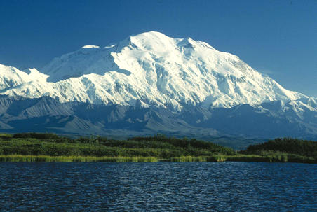

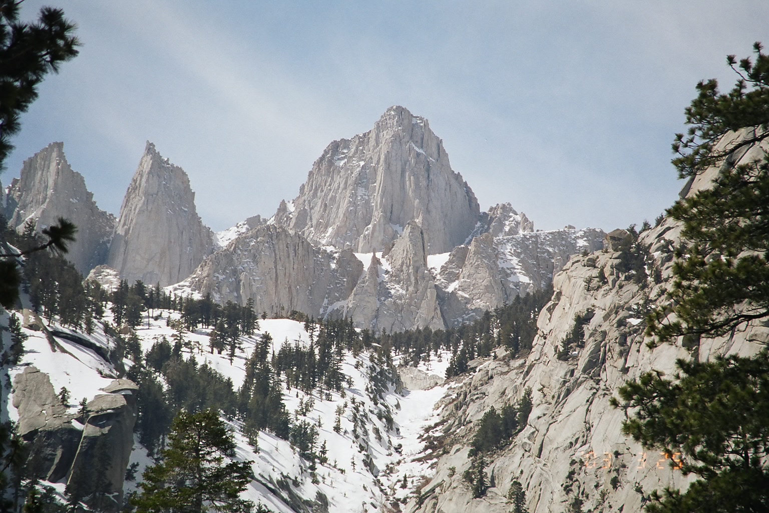
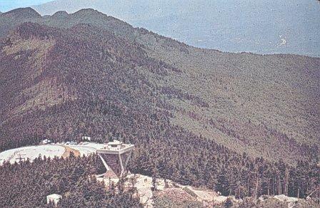
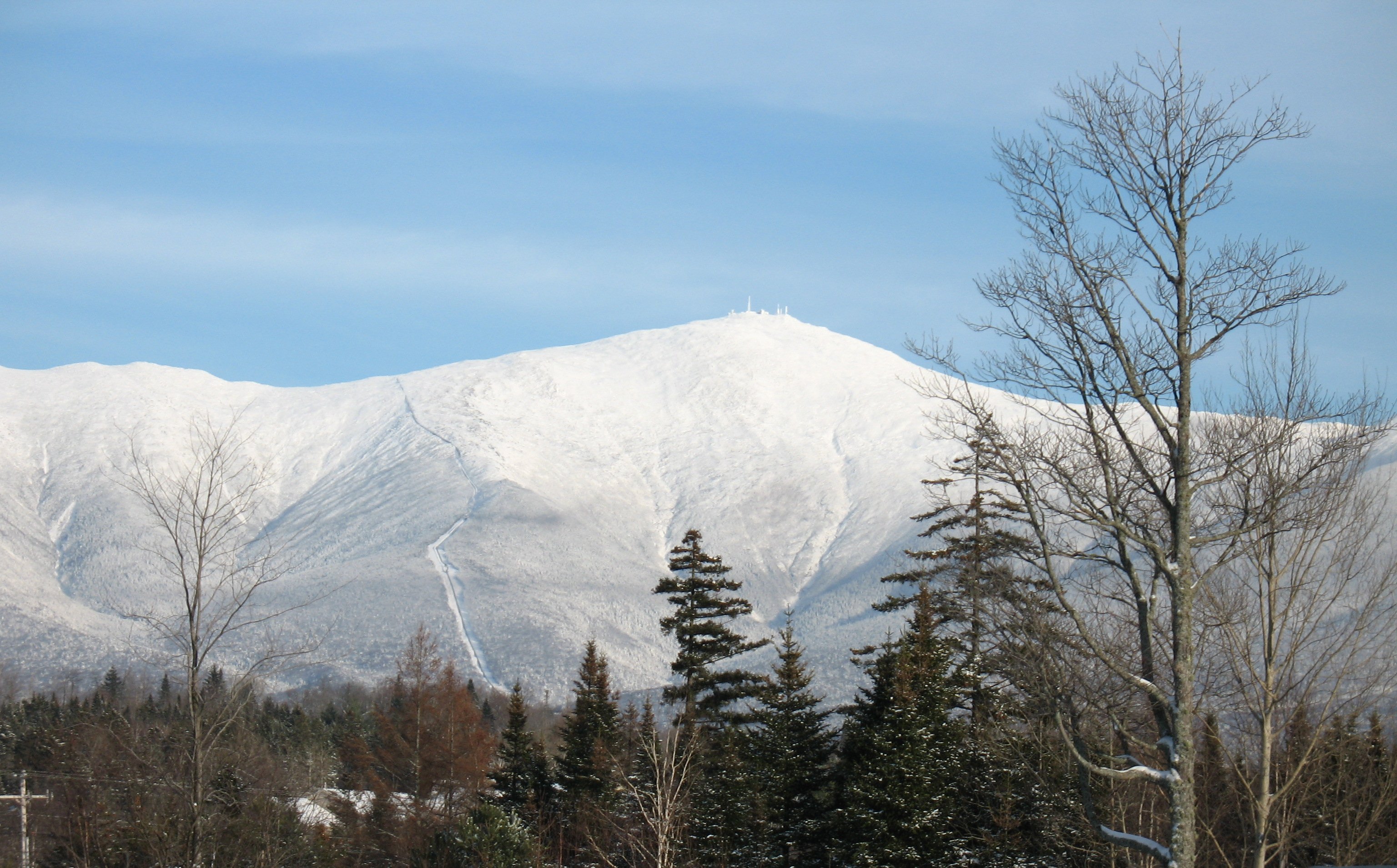

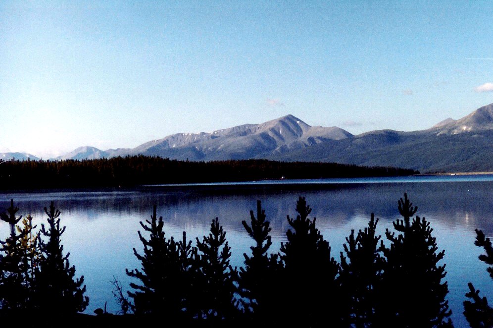


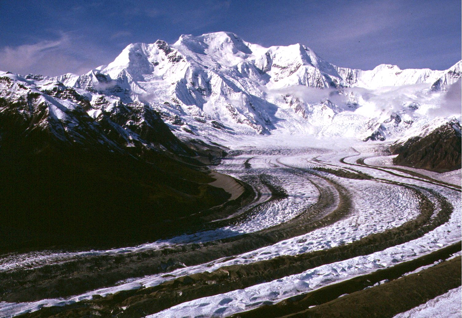
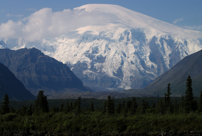
Wikimedia Foundation. 2010.