- 156 Street, Edmonton
-
156 Street Campbell Road Maintained by: the City of Edmonton
and City of St. AlbertLength: 16.8 km (10.4 mi) Location: Edmonton, Jasper Place, St. Albert South end: Rio Park Road Major
junctions:87 Avenue, 100 Avenue, Stony Plain Road, 107 Avenue, 111 Avenue, 118 Avenue, Yellowhead Trail, 137 Avenue, St. Albert Trail, 167 Avenue, Boudreau Road North end: Poundmaker Road (St. Albert City Limits) 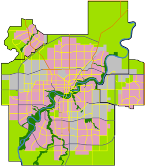

 Start/End points of 156 Street
156 Street is a major arterial road in west Edmonton, and east St. Albert, Alberta, Canada. In Edmonton, 156 Street runs through the old town of Jasper Place, and Edmonton's west industrial district. St. Albert names their roads, rather than numbering them, even if a street runs straight from Edmonton into St. Albert (170 Street, 184 Street, and future 137 Avenue.) However, because this street realigns before entering St. Albert, it acquirers the name Campbell Road at St. Albert Trail. 156 Street NW also starts (being aligned with the northern 156 Street) again in the south side of the city. At one time Terwillegar Drive turned into 156 Street before development in Terwillegar. Eventually the freeway replaced it, leaving small broken parts within the Terwillegar residental areas, retaining its numerical name in named areas. 156 Street continues as 156 Street SW below Quadrant (1) Avenue until the city limits at 41 Avenue SW.
Neighbourhoods
List of neighbourhoods 156 Street/Campbell Road runs through, in order from south to north.[1]
- Rio Terrace
- Lynnwood
- Jasper Park
- Meadowlark Park
- Sherwood
- West Jasper Place
- Glenwood
- Canora
- Britannia Youngstown
- Mayfield
- High Park
- Akinsdale, St. Albert
- Pineview, St. Albert
- Kingswood, St. Albert
Interchanges and intersections
This is a list of major intersections, starting at the south end of 156 Street.[1]
References
- ^ a b "City of Edmonton map utility". Archived from the original on 2009-06-25. http://maps.edmonton.ca. Retrieved 2009-06-23.
Roads in Edmonton, Sherwood Park, and St. Albert, Alberta, Canada North-south streets - Clover Bar Road
- Broadmoor Boulevard
- Victoria Trail
- 34 Street
- 50 Street
- 66 Street
- 91 Street
- 97 Street
- Parsons Road (99 Street)
- Gateway Boulevard
- Calgary Trail (104 Street)
- 105 Street
- 109 Street
- 111 Street
- 113/114 Street
- 119/122 Street
- 124 Street
- 127 Street
- 156 Street
- Mayfield Road
- 170 Street
- Winterburn Road (215 Street)
East-west streets - Ellerslie Road (9 Avenue SW)
- 23 Avenue NW
- 34 Avenue NW
- Roper Road (51 Avenue)
- 61/63 Avenue
- Fox Drive
- University Avenue
- Whyte (82) Avenue
- 100 Avenue
- Baseline Road (101 Avenue)
- Jasper Avenue
- Stony Plain Road (101 Avenue)
- 107 Avenue (of Nations)
- 111/112 Avenue (Norwood Boulevard)
- 118 (Alberta) Avenue
- 137 Avenue
- 153 Avenue
- 167 Avenue
Other streets - Argyll Road
- Belgravia Road
- Bellerose Drive
- Boudreau Road
- Campbell Road
- Castle Downs Road
- Fort Road
- Giroux Road
- Hebert Road
- Kingsway (Avenue)
- McKenney Avenue
- Mill Woods Road
- Princess Elizabeth Avenue
- Queen Elizabeth Park Road
- St. Albert Trail
- Saskatchewan Drive
- Scona Road
- Sherwood Drive
- Sir Winston Churchill Avenue
- Walterdale Hill
Freeways and highways - 2 (QE2 Highway)
- 14
- 15 (Manning Drive)
- 16 (Yellowhead Trail)
- 16A
- 21
- 28
- 28A
- 37 (259 Avenue)
- Sherwood Park Freeway (100)
- Anthony Henday Drive (216)
- 627
- Whitemud Drive (628)
- Wye Road (630)
- Villeneuve Road (633)
- 814
- 825
- Groat Road
- Ray Gibbon Drive
- Terwillegar Drive
- Wayne Gretzky Drive
More Categories:- Roads in Edmonton
- Roads in St. Albert, Alberta
- Alberta road stubs
- Edmonton stubs

Wikimedia Foundation. 2010.