- May 1–2, 2008 tornado outbreak
-
May 2008 tornado outbreak Tornado damage in Damascus, Arkansas on May 2, 2008
Date of tornado outbreak: May 1—2, 2008 Duration1: 29 hours, 51 minutes Maximum rated tornado2: EF3 tornado Tornadoes caused: 62 confirmed Damages: $82.8 million Fatalities: 6 + 1 non-tornadic Areas affected: Most of the Central and Southern United States 1Time from first tornado to last tornado
2Most severe tornado damage; see Enhanced Fujita ScaleThe May 1–2, 2008 tornado outbreak was a tornado outbreak that took place across the Southern and Central United States on May 1 and May 2, 2008. The outbreak was responsible for at least seven fatalities (six from tornadoes[1]) and 23 injuries in Arkansas.[2] There were at least 29 tornado reports from Iowa to Oklahoma on May 1 and 67 more in Arkansas, Missouri, Mississippi, Tennessee, Louisiana and Texas on May 2.[3][4] At least 63 tornadoes were confirmed by weather authorities.
Contents
Meteorological synopsis
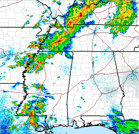
 NEXRAD weather radars composite image of the thunderstorms producing tornadoes in the south-central United States
On May 1, 2008, a large low pressure system developed over Nebraska, with a long warm front stretching east towards the Great Lakes. A cold front and dry line were situated across Oklahoma and Kansas during the late afternoon. The Storm Prediction Center (SPC) issued a moderate risk of severe weather for eastern Kansas and a small part of Missouri, which included Kansas City.[5] On May 2 another moderate risk of severe weather was issued by the SPC from Central Illinois to northern Louisiana.[6] The risk area was later revised southward to only include eastern Arkansas, western Tennessee, and northwestern Mississippi.[7] Most of the severe weather shifted into Arkansas where dewpoints were near 70 °F (21 °C) with CAPE values over 2000 j/kg (in some places up to 3000 j/kg) and helicity values (potential for rotating winds) were exceeding 200 m2/s2.[8]
While most of the severe activity was situated across the southern states, tornado watches were also issued for portions of southern Wisconsin, southern Michigan and northern Indiana as activity developed near the center of the low.[9][10] No tornadoes were reported in this watch area.[4]
On the northern fringes of the storm system heavy snow fell across northeastern Wyoming and western South Dakota. The town of Lead, South Dakota received a total of 54.5 inches, or about 4.5 feet (1.4 m) of snow from April 30 to May 2. Several other areas received one – four feet (30 – 120 cm) of snow.[11]
Reported tornadoes
Confirmed
TotalConfirmed
EF0Confirmed
EF1Confirmed
EF2Confirmed
EF3Confirmed
EF4Confirmed
EF562 28 21 10 3 0 0 May 1 event
List of reported tornadoes - Thursday, May 1, 2008 EF# Location County/Parish Coord. Time (UTC) Path length Damage Kansas EF0 S of Elk Falls Elk 37°13′N 96°06′W / 37.21°N 96.10°W 2350 1 mile (1.6 km) Brief tornado remained over open country. EF0 NE of Buxton Wilson 37°18′N 95°21′W / 37.30°N 95.35°W 0035 1 mile (1.6 km) Brief tornado remained over open country. EF0 E of Fredonia Wilson 37°19′N 95°28′W / 37.31°N 95.46°W 0038 1 mile (1.6 km) Brief tornado remained over open country. EF0 NE of Petrolia Allen 37°28′N 95°16′W / 37.46°N 95.26°W 0121 2 miles (3.2 km) Brief tornado remained over open country. EF0 SW of Johnson Neosho 37°23′N 95°11′W / 37.39°N 95.19°W 0214 1 mile (1.6 km) Brief tornado remained over open country. EF0 N of Earlton Neosho 37°21′N 95°17′W / 37.35°N 95.28°W 0244 unknown Brief tornado remained over open country. EF0 E of Savonburg Allen 37°27′N 95°05′W / 37.45°N 95.08°W 0251 1 mile (1.6 km) Brief tornado remained over open country. EF0 NE of Lyndon Osage 38°23′N 95°23′W / 38.38°N 95.38°W 0543 1.5 miles (2.4 km) Significant damage to trees and the roof of a home was lifted. An antenna and garage were also damaged. EF2 NW of Clinton Douglas 38°35′N 95°17′W / 38.58°N 95.28°W 0604 2 miles (3.2 km) Significant damage to an unoccupied home with two-thirds of it removed from its foundation. Damage also reported to a garage and an outbuilding. Several trees were also knocked down. Iowa EF0 SW of Sioux Center Sioux 43°01′N 96°08′W / 43.02°N 96.14°W 2355 unknown Brief tornado touchdown with no damage. EF2 Rock Valley Sioux, Lyon 43°09′N 96°13′W / 43.15°N 96.22°W 2359 13 miles (21 km) Tornado on the west side of the town with power lines down. 8 farmsteads sustained varying amounts of damage. EF0 E of Doon Lyon 43°10′N 96°07′W / 43.16°N 96.11°W 0030 unknown Brief tornado touchdown with no damage. EF0 S of Sheldon O'Brien 43°05′N 95°31′W / 43.08°N 95.52°W 0042 unknown Brief tornado touchdown with no damage. EF0 W of George Lyon 43°13′N 96°01′W / 43.21°N 96.02°W 0044 unknown Brief tornado touchdown with no damage. EF0 NE of Ashton Osceola 43°11′N 95°28′W / 43.19°N 95.47°W 0105 unknown Brief tornado touchdown with no damage. Missouri EF0 E of Plattsburg Clinton 39°20′N 94°15′W / 39.33°N 94.25°W 0026 unknown Reported tornado briefly touched down. EF0 SW of Belton Cass 38°29′N 94°19′W / 38.49°N 94.31°W 0208 unknown Brief tornado touchdown. EF3 NW of Liberty Clay 39°10′N 94°14′W / 39.17°N 94.23°W 0656 1 mile (1.6 km) Brief but intense spin-up tornado developed near the apex of a bow echo. Four homes were destroyed and 117 others were damaged. EF2 Gladstone Clay 39°08′N 94°20′W / 39.13°N 94.33°W 0703 1 mile (1.6 km) 200 homes were damaged including 20 destroyed according to Mayor Mark Revenaugh.[12] Several businesses were also damaged or destroyed. Oklahoma EF0 NW of Choctaw Oklahoma 35°18′N 97°10′W / 35.30°N 97.16°W 0029 unknown Brief tornado with damage to an outbuilding. EF0 NE of Glencoe Payne 36°08′N 96°03′W / 36.14°N 96.05°W 0042 unknown Brief tornado with no damage reported. EF0 NE of Pawnee Pawnee 36°12′N 96°28′W / 36.20°N 96.47°W 0118 unknown Tornado confirmed by storm spotters, but remained in open country. EF1 W of Blackburn Pawnee 36°15′N 96°25′W / 36.25°N 96.42°W 0125 3 miles (4.8 km) Large cone tornado with structural damage to one house and trees and power poles snapped. EF1 SE of Ralston Osage 36°19′N 96°19′W / 36.32°N 96.31°W 0137 17 miles (27 km) Two houses were damaged and widespread tree and power line damage was reported. EF0 SW of Pawhuska Osage 36°20′N 96°16′W / 36.34°N 96.26°W 0206 5 miles (8.0 km) Damage limited to trees and power lines. EF0 SE of Bristow Creek 35°30′N 96°11′W / 35.50°N 96.19°W 0645 7 miles (11 km) Barns and outbuildings were destroyed along the path. Tree damage was also reported. EF1 NW of Pryor Rogers, Mayes 36°11′N 95°16′W / 36.18°N 95.26°W 0703 9 miles (14 km) Several roofs were blown off houses, and mobile homes were heavily damaged. Extensive tree damage also reproted. Two people were injured. EF1 W of Pryor Mayes 36°11′N 95°16′W / 36.18°N 95.26°W 0703 0.5 miles (800 m) One home sustained roof damage and trees and power lines were downed Sources: Storms Reports for May 1, 2008, NWS Kansas City, NWS Tulsa, 2008 Oklahoma tornadoes NWS Tulsa PNS NWS Sioux Falls, SD, NWS Topeka May 2 event
List of reported tornadoes - Friday, May 2, 2008 EF# Location County/Parish Coord. Time (UTC) Path length Damage Missouri EF0 SW of Ava Douglas 36°32′N 92°13′W / 36.54°N 92.22°W 1052 7 miles (11 km) Intermittent tornado touchdown with damage to trees. EF0 NW of Ava Douglas 36°34′N 92°23′W / 36.57°N 92.39°W 1102 0.25 miles (400 m) Brief tornado in the northeast part of town, amidst widespread derecho damage. Minor damage to several houses and some tree damage. EF0 NE of Senath Dunklin 36°05′N 90°05′W / 36.09°N 90.08°W 1839 unknown Brief weak tornado with moderate damage to a barn. Arkansas EF3 Damascus area Conway, Van Buren, Cleburne 35°13′N 92°17′W / 35.22°N 92.28°W 1315 45 miles (72 km) 5 deaths - Severe damage reported in the area with houses damaged and destroyed. Two of the fatalities were in a mobile home and three in a permanent home. Several structures including homes, outbuildings, kennels and chicken houses were destroyed. Hundreds of other homes suffered varying degrees of damage in all three counties. 24 others were injured. EF1 NW of Damascus Van Buren 35°13′N 92°16′W / 35.22°N 92.26°W 1328 1 mile (1.6 km) Satellite tornado from the main Damascus storm. Damage limited to a few trees. EF1 N of Dierks Howard 33°52′N 84°26′W / 33.87°N 84.43°W 1403 4 miles (6.4 km) 2 barns were destroyed and a mobile home was damaged due to a fallen tree. EF1 NW of Billstown Pike 34°01′N 93°13′W / 34.01°N 93.21°W 1523 8 miles (13 km) Two chicken houses were damaged, trees were blown down and tin was removed from a barn. EF2 E of Tull to S of Lonoke Grant, Saline, Pulaski, Lonoke 34°17′N 92°10′W / 34.29°N 92.17°W 1615 40.5 miles (65 km) 1 death - Initially reported by law enforcement. Several manufactured homes, outbuildings and barns were destroyed. Nearly 100 other homes and structures were damaged, some heavily. Communities affected included Palestine, Belfast, Ico, Hensley, Woodson and Keo. Three others were injured. EF2 N of Carthage to Sheridan Dallas, Grant 34°05′N 92°20′W / 34.09°N 92.34°W 1623 22 miles (35 km) Ham radio operator reporting a wall cloud rotation with possible debris. Manufactured homes and mobile homes were damaged or destroyed. Minor damage to well-built homes. Barns and outbuildings were destroyed and a church was damaged. In total, about 60 structures were damaged. EF1 Carlisle area Lonoke 34°28′N 91°26′W / 34.47°N 91.44°W 1623 2.6 miles (4.2 km) Some homes had roof damage with more seriously damaged due to fallen trees. Vehicles flipped over on Interstate 40. 25 homes were damaged in total with damage to businessess. EF0 SW of Maberry Woodruff 35°00′N 91°11′W / 35.00°N 91.19°W 1801 2 miles (3.2 km) Damaged to timber and some metal-roofed structures. EF1 NW of Hazen Lonoke, Prairie 34°29′N 91°13′W / 34.49°N 91.22°W 1802 2 miles (3.2 km) Tornado reported with damage to trees and power lines. EF1 N of Center Point Prairie 34°31′N 91°12′W / 34.51°N 91.20°W 1805 2.6 miles (4.2 km) About 20 trees were knocked down. EF0 SW of Saulsburg Monroe 34°34′N 91°09′W / 34.57°N 91.15°W 1840 0.5 miles (800 m) One tree was uprooted and tin was removed from barns. EF2 Etowah area Mississippi 35°25′N 90°04′W / 35.42°N 90.07°W 1954 4 miles (6.4 km) Reported of significant damage in the town of Etowah, Arkansas according to a KAIT-TV spotter. A metal building and trailers were destroyed, roofs were removed from homes and a Winnebago was blown off. Trees were snapped with vinyl sidings hanging into some trees. One person was injured. EF3 Earle/Heaver area Cross, Crittenden, Mississippi 35°08′N 90°02′W / 35.14°N 90.03°W 2018 20 miles (32 km) Spotters reported a large and extremely dangerous tornado on the ground. Cars were overturned and the Earle High School, a Baptist church, a warehouse and many businesses were damaged, as well as numerous houses. Four people were injured. EF2 N of Lake Village Chicot 33°13′N 91°01′W / 33.21°N 91.02°W 2052 10 miles (16 km) Large and dangerous tornado reported. A mobile home, sheds, barns, outbuildings and carports were damaged or destroyed. Two boats, fences and a house were also damaged and a trampoline was blown about 75 yds (70 m) away. Initially rated an EF1, it was later upgraded to an EF2 in post-analysis. Texas EF1 Canton Van Zandt 32°20′N 95°31′W / 32.33°N 95.52°W 1330 1 mile (1.6 km) Survey confirmed a tornado in the area with damage reported. Eight people were injured. This storm affected the first day of the popular First Monday Trade Days flea market; however, the damage was quickly cleaned up and the event continued without further interruption. EF1 NE of Henderson Rusk 32°06′N 94°27′W / 32.10°N 94.45°W 1621 5.5 miles (8.9 km) A metal building was completely destroyed and minor damage to one home. EF1 Beckville area Panola 32°07′N 94°17′W / 32.12°N 94.29°W 1655 4 miles (6.4 km) Reported by sheriff. A manufactured home lost its roof and other homes were damaged due to fallen trees. Tennessee EF2 W of Dyersburg Dyer 35°34′N 89°24′W / 35.57°N 89.40°W 2125 1.5 miles (2.4 km) Spotted by trained spotter. A mobile home was destroyed and power lines were downed. EF1 SW of Clarksville (1st tornado) Montgomery 36°13′N 87°19′W / 36.22°N 87.32°W 0457 0.8 miles (1.3 km) First of several tornadoes damaged several trees. EF1 SW of Clarksville (2nd tornado) Montgomery 36°14′N 87°19′W / 36.23°N 87.31°W 0500 0.2 miles (320 m) Brief tornado tore a mobile home from its foundation. EF1 SW of Clarksville (3rd tornado) Montgomery 36°15′N 87°18′W / 36.25°N 87.30°W 0505 0.5 miles (800 m) A mobile home rolled over, injuring three occupants. Trees were also snapped. EF1 SW of Clarksville (4th tornado) Montgomery 36°18′N 87°13′W / 36.30°N 87.22°W 0510 0.3 miles (480 m) Tornado struck the Montgomery County Fairgrounds, destroying a pavilion. Mississippi EF2 New Albany area (1st tornado) Union 34°17′N 89°05′W / 34.28°N 89.08°W 2248 3 miles (4.8 km) Large and dangerous tornado reported. Numerous houses were damaged, along with a church and several large buildings. EF2 New Albany area (2nd tornado) Union 34°18′N 89°01′W / 34.30°N 89.01°W 2300 1 mile (1.6 km) At least 10 houses were damaged, including two houses that completely lost their roofs. EF1 NE of Baker Union 34°19′N 88°33′W / 34.32°N 88.55°W 2312 3 miles (4.8 km) Damage to two homes, grain bins, shed and trees. EF1 S of Jumpertown Prentiss, Alcorn 34°27′N 88°19′W / 34.45°N 88.31°W 2341 14 miles (23 km) Tornado knocked down many trees along its path, some of which landed on houses. EF0 SW of Benoit Washington, Bolivar 33°19′N 91°04′W / 33.31°N 91.06°W 0032 1.5 miles (2.4 km) Damage limited to some trees. EF1 NE of Benoit Bolivar 33°26′N 90°30′W / 33.43°N 90.50°W 0107 10 miles (16 km) Trees and power lines snapped. EF1 SE of Morgan City Leflore 33°13′N 90°11′W / 33.22°N 90.18°W 0549 1.3 miles (2.1 km) Numerous trees snapped. One tree fell on a house causing significant damage. Louisiana EF0 E of Livingston Livingston 30°18′N 90°24′W / 30.30°N 90.40°W 2051 unknown Weak tornado reported by a motorist near Interstate 12. No damage reported. EF0 NW of Mer Rouge Morehouse 32°29′N 91°16′W / 32.49°N 91.26°W 0101 3.5 miles (5.6 km) Trees damaged and grass flattened. No buildings impacted. Sources: Storms Reports for May 2, 2008, NWS Springfield NWS Little Rock NWS Shreveport, LA, NWS Memphis, NWS Nashville, NWS Jackson, MS, NWS Jackson, MS (LSR) Kansas City area derecho/tornadoes
 Home heavily damaged in Gladstone, Missouri.
Thunderstorms developed during the late afternoon and early evening of May 1 near Oklahoma City and Kansas City, and produced large hail of up to 3 inches (76 mm) near Midwest City, Oklahoma.[3] There was extensive hail damage throughout Oklahoma County.[13] Ten tornadoes also touched down from these storms in Kansas and Oklahoma.
 Radar image of the bow echo crossing Kansas City just after 2:00 am CDT
In the overnight hours of May 2, the supercells re-organized into a squall line/serial derecho that moved across the eastern Great Plains. Significant damage was reported across the Kansas City area, particularly in the Gladstone area near 77th Street and Euclid and northwest of Liberty near 108th Street and Cookingham were several homes and businesses were severely damaged or destroyed, including an Arby's restaurant. Several other commercial structures and homes sustained significant damage and railway cars were also overturned. Forty-thousand Kansas City Power & Light customers were left without power. At least three people were injured by the storms in the Kansas City Metro Area. St. Pius X High School and Oak Hill Day School were closed on Friday as a result of the storm.[14]
It was later confirmed that much of the damage was caused by two strong tornadoes that were embedded inside the derecho; an EF2 in Gladstone and an EF3 in Brookridge. According to Kansas City Mayor Mark Funkhouser, over 300 structures were damaged. In Gladstone over 200 buildings were damaged and several were destroyed according to the mayor. Tornadoes also hit Douglas County, Kansas causing locally significant damage. There no reports of fatalities with these storms. It was later reported that despite tornado warnings, many tornado sirens were not sounded in Douglas County and in other parts of the Kansas City Metro.[15][16][17]
Five years prior to these tornadoes, areas near Gladstone were hit by an F4 tornado that caused extensive damage while a strong tornado also hit near Liberty during the same outbreak.[18][19]
Arkansas tornadoes
 Tornado damage near Damascus, Arkansas.
At around 8:30 am CDT on May 2, an EF3 tornado touched down north of Little Rock in Conway County, killing two people.[20] The tornado then proceeded into Van Buren County and caused extensive damage to the Damascus area and killed three people.[21] One person was also killed in Benton County by straight-line winds when a tree fell onto the mobile home where she was sleeping.[22] In Pulaski County, another person was killed by a tornado. Some damage was reported to several structures south and east of Little Rock including near Hensley were the fatality was reported.[23][24]
At around 3:30 pm CDT, a large F3 tornado hit the town of Earle, Arkansas west of Memphis causing major damage to homes, businesses and the high school, and several people were injured.[25] A supercell to its north also produced a significant tornado in the Etowah area causing extensive damage to several structures including destroyed trailers.[26]
Governor of Arkansas Mike Beebe stated that in Arkansas alone about 350 homes were damaged or destroyed. Seven counties were declared disaster areas including Van Buren, Saline, Pulaski, Cleburne, Conway, Grant and Benton. National Guard were deployed to assist in the cleanup and relief efforts. About 6,000 homes lost power across much of north Arkansas.[27]
See also
- Tornadoes of 2008
- List of North American tornadoes and tornado outbreaks
- Mid-May 2008 tornado outbreak sequence
- Late-May 2008 tornado outbreak sequence
References
- ^ "Severe Weather/Heavy Rain on May 2, 2008". NWS - Little Rock. May 2, 2008. http://www.srh.noaa.gov/lzk/html/svr0508.htm. Retrieved 2008-06-01.
- ^ "STATE SITUATION SUMMARY 05/09/2008". ARKANSAS DEPARTMENT OF EMERGENCY MANAGEMENT. May 2, 1998. http://www.adem.arkansas.gov/documents/Situation%20Reports/2008/SIT%20SUM%20STORMS%205-2-08.htm. Retrieved 2008-06-01.[dead link]
- ^ a b "Storm Reports for 05/01/08". Storm Prediction Center (SPC). May 1, 2008. http://www.spc.noaa.gov/climo/reports/080501_rpts.html. Retrieved 2008-06-01.
- ^ a b "Storm Reports for 05/02/08". SPC. May 2, 2008. http://www.spc.noaa.gov/climo/reports/080502_rpts.html. Retrieved 2008-06-01.
- ^ "May 1, 2008 2000 UTC Day 1 Convective Outlook". SPC. May 1, 2008. http://www.spc.noaa.gov/products/outlook/archive/2008/day1otlk_20080501_2000.html. Retrieved 2008-06-01.
- ^ "May 2, 2008 0600 UTC Day 1 Convective Outlook". SPC. May 2, 2008. http://www.spc.noaa.gov/products/outlook/archive/2008/day1otlk_20080502_1200.html. Retrieved 2008-06-01.
- ^ "May 2, 2008 1300 UTC Day 1 Convective Outlook". SPC. May 2, 2008. http://www.spc.noaa.gov/products/outlook/archive/2008/day1otlk_20080502_1300.html. Retrieved 2008-06-01.
- ^ "Severe Weather/Heavy Rain on May 2, 2008". NWS - Little Rock. May 5, 2008. http://www.srh.noaa.gov/lzk/html/svr0508a.htm. Retrieved 2008-06-01.
- ^ Hales (May 2, 2008). "Tornado Watch 252". SPC. http://www.spc.noaa.gov/products/watch/ww0252.html. Retrieved 2008-06-01.
- ^ Hales (May 2, 2008). "Tornado Watch 256". SPC. http://www.spc.noaa.gov/products/watch/ww0256.html. Retrieved 2008-06-01.
- ^ "Heavy snow in the Black Hills region". University of Wisconsin–Madison. May 4, 2008. http://cimss.ssec.wisc.edu/goes/blog/archives/category/winter-weather. Retrieved 2008-06-01.
- ^ 2 Tornadoes Destroy Northland Homes - Kansas City News Story - KMBC Kansas City
- ^ "Hail Causes Extensive Damage In Oklahoma County". KOCO.com. May 2, 2008. http://www.koco.com/news/16133182/detail.html. Retrieved 2008-06-01.
- ^ "At Least 3 Hurt When Violent Storms Hit KC". KMBC.com. May 2, 2008. http://www.kmbc.com/news/16128378/detail.html. Retrieved 2006-06-01.
- ^ Diepenbrock, George (May 3, 2008). "Storm blows through area". LJWorld.com. http://www2.ljworld.com/news/2008/may/03/storm_blows_through_area/. Retrieved 2008-06-01.
- ^ "Why Didn't Tornado Sirens Go Off?". KMBC.com. May 2, 2008. http://www.kmbc.com/news/16140693/detail.html. Retrieved 2008-06-01.
- ^ "2 Tornadoes Destroy Northland Homes". KMBC.com. May 2, 2008. http://www.kmbc.com/news/16130580/detail.html. Retrieved 2008-06-01.
- ^ "Event Record Details". National Climatic Data Center. May 4, 2003. http://www4.ncdc.noaa.gov/cgi-win/wwcgi.dll?wwevent~ShowEvent~502987. Retrieved 2006-06-01.
- ^ "Event Record Details". National Climatic Data Center. May 4, 2003. http://www4.ncdc.noaa.gov/cgi-win/wwcgi.dll?wwevent~ShowEvent~502996. Retrieved 2006-06-01.
- ^ National Weather Service - Little Rock, Arkansas...Severe Weather/Heavy Rain on May 2, 2008 (Pg1)
- ^ "Spotter: Tornado Touches Down North of Damascus". Associated Press. May 2, 2008. http://www.kait8.com/Global/story.asp?S=8261134. Retrieved 2008-06-01.
- ^ "Seven killed in Arkansas storms". Associated Press. May 2, 2008. Archived from the original on 2008-05-05. http://web.archive.org/web/20080505103155/http://edition.cnn.com/2008/US/weather/05/02/midwest.storms.ap/index.html. Retrieved 2008-06-01.
- ^ Fisher, Kristin; Robin Skiles (May 2, 2008). "One Person Killed in Hensley During Friday's Storms". KATV.com. http://www.katv.com/news/stories/0508/516505.html. Retrieved 2008-06-01.[dead link]
- ^ "Death Toll Climbs to Three From Arkansas Severe Weather". Associated Press. May 2, 2008. http://www.kait8.com/Global/story.asp?S=8261754. Retrieved 2008-06-01.
- ^ Brown, George (May 2, 2008). "EF3 Tornado Causes "Significant Damage" In Earle, AR". WREG.com. http://www.wreg.com/Global/story.asp?S=8263309. Retrieved 2008-06-01.
- ^ Miles, Jason (May 2, 2008). "Town of Etowah picks up after tornado sweeps through town". WMCTV.com. http://www.wmctv.com/Global/story.asp?S=8264858. Retrieved 2008-06-01.
- ^ "7 killed in Arkansas storms". Associated Press. May 2, 2008. http://www2.arkansasonline.com/news/2008/may/02/severe-weather-moving-across-state/?print. Retrieved 2008-06-01.
External links
- NWS Little Rock, Arkansas summary page
- NWS Memphis, Tenneesee summary page
- NWS Kansas City, Kansas summary page
- NWS Springfield, MO summary page
- Multimedia Review from the Severe weather event from the NWS Tulsa
- Severe weather outbreak gallery from WMC-TV
- Severe weather outbreak gallery from KAIT-TV
- FEMA analysis
Tornado Outbreaks of 2008 January · Vancouver · Super Tuesday · February 16-18 · March blizzard · Atlanta · April 8-11 · April 28 · May 1–2 · Mid-May · Late-May · June · July 7–11 · Europe · TS Fay · Hurricane Gustav · Hurricane Ike · November 15 · December 9-11Categories:- Tornadoes of 2008
- F3 tornadoes
- Tornadoes in Arkansas
- Tornadoes in Iowa
- Tornadoes in Kansas
- Tornadoes in Louisiana
- Tornadoes in Mississippi
- Tornadoes in Missouri
- Tornadoes in Oklahoma
- Tornadoes in Tennessee
- Tornadoes in Texas
- 2008 natural disasters in the United States


Wikimedia Foundation. 2010.