- Matamoros–Brownsville Metropolitan Area
-
Matamoros–Brownsville Metropolitan Area 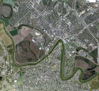
Common name: Matamoros–BrownsvilleLargest city
Other cities Matamoros, TAM -
  Brownsville, TX
Valle Hermoso
Harlingen
RaymondvillePopulation Ranked 71 in 2010 in the Americas - Total 1,136,995 - Density 3,643/sq mi
1,407/km²Area 161.76 sq mi
418.96 km²Subdivision(s) Texas
-Cameron County
Texas
-Willacy County
Tamaulipas
-Municipality of MatamorosTime Zones(s) UTC-6
Matamoros–Brownsville,[1] also known as Brownsville–Matamoros,[2] or simply as the Borderplex,[3] is one of the six bi-national metropolitan areas along the Mexico–U.S border.[4] The city of Matamoros is situated on the Mexican state of Tamaulipas, on the southern bank of the Rio Grande, while the city of Brownsville is located in the American state of Texas, directly north across the bank of the Rio Grande. The Matamoros–Brownsville is connected by four international bridges.[5] In addition, this transnational conurbation area counts with a population of 1,136,995,[6] making it the 4th largest metropolitan area in the Mexico-US border.[7]The area of Matamoros–Brownsville lies among the top ten fastest growing urban areas in the United States.[8]
See also
- San Diego–Tijuana
- El Paso-Juárez
- Reynosa–McAllen Metropolitan Area
- Laredo – Nuevo Laredo
- Metropolitan area of Tampico
- Transnational conurbations Mexico/USA
References
- ^ Herzog, Lawrence A.. "Cross-Border Planning and Cooperation". The U.S.-Mexican Border Environment. http://www.scerp.org/pubs/m1c7.pdf. Retrieved 5 November 2011.
- ^ "Brownsville MSA and Matamoros". Brownsville Economic Development Counci. http://brownsvilleedc.businesscatalyst.com/BEDC%20MARKET%20PROFILE%202010.pdf. Retrieved 5 November 2011.
- ^ "One river, one country". The Economist Newspaper. http://www.uwec.edu/geography/Ivogeler/w188/articles/txmx.htm. Retrieved 5 November 2011.
- ^ "The U.S.-Mexican borderlands region: a binational spatial analysis". The Social Science Journal 38. http://www.uky.edu/~tmute2/mexico/Mex%20PDFs/pick-viswanathan-het.pdf. Retrieved 5 November 2011.
- ^ "Border Wait Times". U.S. Customs and Border Protection. http://apps.cbp.gov/bwt/. Retrieved 5 November 2011.
- ^ "Matamoros-Brownsville". World Gazetteer. http://world-gazetteer.com/wg.php?x=&men=gpro&lng=en&des=wg&geo=-2&srt=pnan&col=adhoq&msz=1500&pt=a&va=x&geo=-1049423. Retrieved 22 August 2011.
- ^ "World Gazetter: America - Largest Cities". http://world-gazetteer.com/wg.php?x=&men=gcis&lng=en&dat=32&geo=-2&srt=pnan&col=aohdq&pt=a&va=x.
- ^ "State of the art facilities: McAllen". Aries Freight Systems. http://www.ariesfreight.com/about-aries/facilities. Retrieved 3 November 2011.
Categories:- Brownsville, Texas
- Metropolitan areas of Mexico
- Metropolitan areas of Texas
- Populated places in Tamaulipas
- Heroica Matamoros

Wikimedia Foundation. 2010.