- Marilândia do Sul
-
Marilândia do Sul — Municipality and town — Country  Brazil
Region Southern State Paraná Mesoregion Noroeste Paranaense Time zone UTC -3 Marilândia do Sul is a town and municipality in the state of Paraná in the Southern Region of Brazil.[1][2][3][4]
See also
References
- ^ "Divisão Territorial do Brasil" (in Portuguese). Divisão Territorial do Brasil e Limites Territoriais, Instituto Brasileiro de Geografia e Estatística (IBGE). July 1, 2008. ftp://geoftp.ibge.gov.br/Organizacao/Divisao_Territorial/2008/DTB_2008.zip. Retrieved December 17, 2009.
- ^ "Estimativas da população para 1º de julho de 2009" (in Portuguese) (PDF). Estimativas de População, Instituto Brasileiro de Geografia e Estatística (IBGE). August 14, 2009. http://www.ibge.gov.br/home/estatistica/populacao/estimativa2009/POP2009_DOU.pdf. Retrieved December 17, 2009.
- ^ "Ranking decrescente do IDH-M dos municípios do Brasil" (in Portuguese). Atlas do Desenvolvimento Humano, Programa das Nações Unidas para o Desenvolvimento (PNUD). 2000. http://www.pnud.org.br/atlas/ranking/IDH-M%2091%2000%20Ranking%20decrescente%20(pelos%20dados%20de%202000).htm. Retrieved December 17, 2009.
- ^ "Produto Interno Bruto dos Municípios 2002-2005" (in Portuguese). Instituto Brasileiro de Geografia e Estatística (IBGE). December 19, 2007. http://www.ibge.gov.br/home/estatistica/economia/pibmunicipios/2005/tab01.pdf. Retrieved December 17, 2009.
 Municipalities of ParanáCapital: Curitiba
Centro Ocidental Paranaense Campo MouraoAraruna · Barbosa Ferraz · Campo Mourão · Corumbataí do Sul · Engenheiro Beltrão · Farol · Fênix · Iretama · Luiziana · Mamborê · Peabiru · Quinta do Sol · Roncador · Terra BoaGoioereAltamira do Paraná · Boa Esperança · Campina da Lagoa · Goioerê · Janiópolis · Juranda · Moreira Sales · Nova Cantu · Quarto Centenário · Rancho Alegre d'Oeste · Ubiratã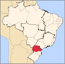
Centro Oriental Paranaense JaguariaivaPonta GrossaTelemaco BorbaCentro-Sul Paranaense GuarapuavaCampina do Simão · Candói · Cantagalo · Espigão Alto do Iguaçu · Foz do Jordão · Goioxim · Guarapuava · Inácio Martins · Laranjeiras do Sul · Marquinho · Nova Laranjeiras · Pinhão · Porto Barreiro · Quedas do Iguaçu · Reserva do Iguaçu · Rio Bonito do Iguaçu · Turvo · VirmondPalmasPitangaMetropolitana de Curitiba Cerro AzulCuritibaAlmirante Tamandaré · Araucária · Balsa Nova · Bocaiúva do Sul · Campina Grande do Sul · Campo Largo · Campo Magro · Colombo · Contenda · Curitiba · Fazenda Rio Grande · Itaperuçu · Mandirituba · Pinhais · Piraquara · Quatro Barras · Rio Branco do Sul · São José dos Pinhais · Tunas do ParanáLapaLapa · Porto AmazonasParanaguaRio NegroNoroeste Paranaense CianorteCianorte · Cidade Gaúcha · Guaporema · Indianópolis · Japurá · Jussara · Rondon · São Manoel do Paraná · São Tomé · Tapejara · Tuneiras do OesteParanavaiAlto Paraná · Amaporã · Cruzeiro do Sul · Diamante do Norte · Guairaçá · Inajá · Itaúna do Sul · Jardim Olinda · Loanda · Marilena · Mirador · Nova Aliança do Ivaí · Nova Londrina · Paraíso do Norte · Paranacity · Paranapoema · Paranavaí · Planaltina do Paraná · Porto Rico · Querência do Norte · Santa Cruz do Monte Castelo · Santa Isabel do Ivaí · Santa Mônica · Santo Antônio do Caiuá · São Carlos do Ivaí · São João do Caiuá · São Pedro do Paraná · Tamboara · Terra RicaUmuaramaAlto Paraíso · Alto Piquiri · Altônia · Brasilândia do Sul · Cafezal do Sul · Cruzeiro do Oeste · Douradina · Esperança Nova · Francisco Alves · Icaraíma · Iporã · Ivaté · Maria Helena · Mariluz · Nova Olímpia · Perobal · Pérola · São Jorge do Patrocínio · Tapira · Umuarama · XambrêNorte Central Paranaense ApucaranaApucarana · Arapongas · Califórnia · Cambira · Jandaia do Sul · Marilândia do Sul · Mauá da Serra · Novo Itacolomi · SabáudiaAstorgaÂngulo · Astorga · Atalaia · Cafeara · Centenário do Sul · Colorado · Flórida · Guaraci · Iguaraçu · Itaguajé · Jaguapitã · Lobato · Lupionópolis · Mandaguaçu · Munhoz de Melo · Nossa Senhora das Graças · Nova Esperança · Presidente Castelo Branco · Santa Fé · Santa Inês · Santo Inácio · UniflorFaxinalFloraiIvaiporaArapuã · Ariranha do Ivaí · Cândido de Abreu · Godoy Moreira · Grandes Rios · Ivaiporã · Jardim Alegre · Lidianópolis · Lunardelli · Manoel Ribas · Nova Tebas · Rio Branco do Ivaí · Rosário do Ivaí · São João do Ivaí · São Pedro do IvaíLondrinaMaringaPorecatuNorte Pioneiro Paranaense AssaiAssaí · Jataizinho · Nova Santa Bárbara · Rancho Alegre · Santa Cecília do Pavão · São Jerônimo da Serra · São Sebastião da Amoreira · UraíCornelio ProcopioAbatiá · Andirá · Bandeirantes · Congonhinhas · Cornélio Procópio · Itambaracá · Leópolis · Nova América da Colina · Nova Fátima · Ribeirão do Pinhal · Santa Amélia · Santa Mariana · Santo Antônio do Paraíso · SertanejaIbaitiJacarezinhoBarra do Jacaré · Cambará · Jacarezinho · Jundiaí do Sul · Ribeirão Claro · Santo Antônio da PlatinaWenceslau BrazCarlópolis · Guapirama · Joaquim Távora · Quatiguá · Salto do Itararé · Santana do Itararé · São José da Boa Vista · Siqueira Campos · Tomazina · Wenceslau BrazOeste Paranaense CascavelAnahy · Boa Vista da Aparecida · Braganey · Cafelândia · Campo Bonito · Capitão Leônidas Marques · Cascavel · Catanduvas · Corbélia · Diamante do Sul · Guaraniaçu · Ibema · Iguatu · Lindoeste · Nova Aurora · Santa Lúcia · Santa Tereza do Oeste · Três Barras do ParanáFoz do IguacuCéu Azul · Foz do Iguaçu · Itaipulândia · Matelândia · Medianeira · Missal · Ramilândia · Santa Terezinha de Itaipu · São Miguel do Iguaçu · Serranópolis do Iguaçu · Vera Cruz do OesteToledoAssis Chateaubriand · Diamante d'Oeste · Entre Rios do Oeste · Formosa do Oeste · Guaíra · Iracema do Oeste · Jesuítas · Marechal Cândido Rondon · Maripá · Mercedes · Nova Santa Rosa · Ouro Verde do Oeste · Palotina · Pato Bragado · Quatro Pontes · Santa Helena · São José das Palmeiras · São Pedro do Iguaçu · Terra Roxa · Toledo · TupãssiSudeste Paranaense IratiPrudentopolisFernandes Pinheiro · Guamiranga · Imbituva · Ipiranga · Ivaí · Prudentópolis · Teixeira SoaresSao Mateus do SulAntônio Olinto · São João do Triunfo · São Mateus do SulUniao da VitoriaBituruna · Cruz Machado · General Carneiro · Paula Freitas · Paulo Frontin · Porto Vitória · União da VitóriaSudoeste Paranaense CapanemaAmpére · Bela Vista da Caroba · Capanema · Pérola d'Oeste · Planalto · Pranchita · Realeza · Santa Izabel do OesteFrancisco BeltraoBarracão · Boa Esperança do Iguaçu · Bom Jesus do Sul · Cruzeiro do Iguaçu · Dois Vizinhos · Enéas Marques · Flor da Serra do Sul · Francisco Beltrão · Manfrinópolis · Marmeleiro · Nova Esperança do Sudoeste · Nova Prata do Iguaçu · Pinhal de São Bento · Renascença · Salgado Filho · Salto do Lontra · Santo Antônio do Sudoeste · São Jorge d'Oeste · VerêPato BrancoBom Sucesso do Sul · Chopinzinho · Coronel Vivida · Itapejara d'Oeste · Mariópolis · Pato Branco · São João · Saudade do Iguaçu · Sulina · VitorinoCategories:- Municipalities of Brazil
- Paraná (state) geography stubs
- Populated places in Paraná (state)

Wikimedia Foundation. 2010.