- Kölnbrein Dam
-
Kölnbrein Dam  Location of Kölnbrein Dam
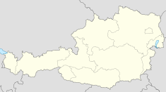

Official name Kölnbreinsperre Location Carinthia, Austria Coordinates 47°04′45″N 13°20′21″E / 47.07917°N 13.33917°ECoordinates: 47°04′45″N 13°20′21″E / 47.07917°N 13.33917°E Status In use Construction began 1971 Opening date 1977 Dam and spillways Type of dam Concrete arch Height 200 m (660 ft) Length 626 m (2,054 ft) Crest width 7.6 m (25 ft) Base width 41 m (135 ft) Volume 1,580,000 m3 (2,070,000 cu yd) Impounds Malta River Reservoir Capacity 205,000,000 m3 (166,000 acre·ft) Catchment area 129 km2 (50 sq mi) Surface area 2.55 km2 (0.98 sq mi) Power station Operator(s) Verbund AG Installed capacity Upper stage: 120 MW
Main stage: 730 MW
Lower stage: 41 MW
Reisseck plants: 137.5 MW
Total: 1028.5 MWAnnual generation 1,216 GWh The Kölnbrein Dam is an arch dam in the Hohe Tauern range within Carinthia, Austria. It was constructed between 1971 and 1979 and at 200 m (656 ft) high, it is the tallest dam in Austria.[1] While the reservoir was filling, several cracks appeared in the dam and it took more than a decade of repairs before the reservoir could operate at maximum levels. The reservoir serves as the primary storage in a three-stage pumped-storage power system that consists of nine dams, four hydroelectric power plants and a series of pipeline and penstocks. The complex is owned by Verbund and is referred to as the Malta-Reisseck Power Plant Group. The installed capacity of the group is 1,028.5 MW and its annual generation is 1,216 GWh.[2][3][4] Currently, the Reisseck II pumped-storage power plant is under construction and will effectively connect both the Malta and Reisseck groups and add an additional 430 MW of production capacity.
Contents
Construction
 Concrete pouring in 1975
Plans for the dam were drafted in 1930 but construction did not begin until 1971. Before cement and other construction materials could be moved on site, an access road had to be constructed. This proved difficult as the Malta Valley rises over 300 m (984 ft) along a 14 km (9 mi) stretch and at times has 13 percent gradients. To complete the road, six tunnels were excavated. In 1973, as superstructure construction progressed, cement was transported on site and mixed with aggregate from local sources. To reduce thermal expansion, concrete was poured 30 m3 (39 cu yd) at a time and pipes with circulating water were placed throughout the mass. The structure consisted of 30 columns with each joint grouted. Construction conditions high in the valley were not ideal as workers coped with snow and rain along with wind speeds of 80 km/h (50 mph).[1]
Completion and cracks
By 1977, construction on the dam had reached an advanced stage where it could begin to impound its reservoir. While filling with water, cracks began to appear in the dam on its upstream heel when the reservoir level was 42 m (138 ft) below its maximum operating level of 1,902 m (6,240 ft) above sea level. Uplift pressure on the dam had unexpectedly increased as well and engineers worried that the structure's grout curtain had been damaged. Because the dam is in a "U"-shaped valley instead of the usual "V"-shaped for arch dams, hydrostatic pressure is exceptionally strong on the center-bottom (heel) upstream portion of the dam. As excessive water leaked into lower areas of the dam, the water level was drawn down and engineers increased drainage. In 1979, the grout curtain was strengthened and another full impoundment was unsuccessfully attempted. Between 1980 and 1981, a polyurethane resin grout was used to re-grout joints and they were frozen during the next impoundment attempt, allowing them to thaw naturally. As remedial works progressed, cracks near the abutments (flanks) of the dam formed as well; on the downstream side and in a horizontal direction.[5]
 Dam in 2007 with "thrust block" at base
A plastic sheet-covered concrete blanket was laid on the upstream valley floor behind the dam between 1981 and 1983. In the next few years, the sheets had to be repaired and the grout curtain re-grouted. In 1984, the reservoir was able reach 90 percent full. In 1979 and 1983, it had temporarily reached its maximum level as well but it could not be safely sustained. In 1984, the reservoir levels were limited to 15–20 m (49–66 ft) below maximum, and at those levels it was able to operate safely though at reduced capacities.
Notwithstanding these remedial actions, a long-term solution was required. This came in the form of a 70 m (230 ft) tall "thrust block" that had to be constructed at the downstream base of the dam in order to absorb load from the dam and pressure on its abutments. Its construction was approved in 1988 and executed between 1989 and 1992. Joining the dam and the block are over 600 special neoprene pads which adjust to forces from the reservoir rising and lowering. In addition, joints and fissures in the dam were re-grouted again but with a water-tight resin epoxy.[5][6][7] The reservoir was able to operate at maximum levels and operate as normal in 1993.[8]
Design and operation
 Diagram of the power plant and reservoir group. Click to expand.
The water in the reservoir is used to generate electricity. It is drawn down as electric load demands. Because the catchment area around the dam can only supply half the needed water to sustain its reservoir levels, a series pumps and pumped-storage power plants are utilized to supplement storage capacity. These pumps operate during periods of low power demand, filling the reservoir. When demand is high, water is released back into the system to produce hydroelectricity.[1] Of the power plant group, the Reisseck plants were constructed between 1948 and 1961 and the Malta group from 1971 to 1979.[9]
Immediately downstream from the Kölnbrein Dam is the Galgenbichl dam and reservoir. This reservoir serves to receive water from several different locations in Malta via pipeline and is the lower reservoir for the Upper stage pumped-storage power station. From the northeast, water is pumped in from several smaller reservoirs and tributaries. Water is principally received from sources to the south though. As part of the Reisseck group, water collected above the Möll River in the Reisseck and Kreuzeck mountains is pumped towards the valley. On the south side of the river, water is used to generate power at the Niklai power station. From there, the water is then received at the Rosswiese reservoir and utilized to generate power at the Kolbnitz station down in the Möll River Valley. At Kolbnitz, water can be released into the Möll River which flows into a reservoir create by the Rottau Dam. This reservoir also serves as the lower reservoir for pumping by the Rottau (Main stage) power plant which is located downstream of Kolbnitz. At Kolbnitz, water can also be received and pumped from sources to the north which primarily includes the Grosser Mühldorfer reservoir (Reisseck annual reservoir). The Grosser Mühldorfer also receives water from the Kleiner Mühldorfer, Hochalmsee and Radlsee reservoirs as well. From the Grosser Mühldorfer, water can be released back down to Kolbnitz for power production. Additional water from the Reisseck daily reservoir, about half way between Grosser and Kolbnitz, can be used as well. This completes the Reisseck scheme of plants which all together have an installed capacity of 138 MW.[10]
In the Malta group, water from the Rottau reservoir down in the Möll River Valley is pumped via the Main stage (Rottau) to the Galgenbichl reservoir below the Kölnbrein. Along the tunneled route, the Gösskar reservoir, and various tributaries provide additional water via pipeline as well. Water storage in the Galgenbichl reservoir is eventually pumped via the Upper storage pumped-storage station into the Kölnbrein reservoir. When generating electricity, water from the upper Kölnbrein reservoir is released about 200 m (656 ft) back down to the Upper stage power plant. The upper stage consists of two reversible Francis turbine generators with a total installed capacity of 120 MW. Water can then be released back through 20.4 km (13 mi) of pipeline south towards the Möll River Valley. Ultimately, it will drop from 1,704 m (5,591 ft) above sea level to 598 m (1,962 ft) through two 1.9 km (1 mi) penstocks where the Main stage (Rottau) power plant is located. The Main stage is operated by four Pelton turbines with an installed capacity of 730 MW. Water released from this plant enters Rottau reservoir on the Möll. Prior its confluence with the Drau River, water is diverted through a 2.5 km (2 mi) canal on the right bank of the river which converts into a 1.75 km (1 mi) long tunnel which feeds the Lower stage (Möllbrücke) power station. It is powered by two Kaplan turbine generators with an installed capacity of 120 MW. From the Lower stage, water is discharged into the Drau River upstream from the mouth of the Möll.[10]
Malta-Reisseck Power Plant Group[10][11][12] Name Type Capacity (MW) Annual generation (GWh) Commission Coordinates Malta upper stage (Galgenbichl) Pumped-storage 120 76 1979 47°04′08″N 13°21′16″E / 47.06889°N 13.35444°E Malta main stage (Rottau) Pumped-storage 730 715 1979 46°52′14″N 13°19′46″E / 46.87056°N 13.32944°E Malta lower stage (Möllbrücke) Run-of-the-river 41 120 1979 46°49′59″N 13°21′36″E / 46.83306°N 13.36°E Reisseck annual reservoir (Kolbnitz) Pumped-storage 67.7 73 1962 46°54′55″N 13°22′28″E / 46.91528°N 13.37444°E Reisseck daily reservoir (Kolbnitz) Storage 23.2 62 1953 46°52′52″N 13°20′13″E / 46.88111°N 13.33694°E Reisseck/Kreuzeck reservoir (Kolbnitz) Storage 45 163 1963 46°51′37″N 13°18′18″E / 46.86028°N 13.305°E Niklai Inter-system 1.6 7 1960 46°49′29″N 13°17′39″E / 46.82472°N 13.29417°E Total 1,028.5 1,216 Dams of the Malta-Reisseck Power Plant Group Name Type Height Length Storage capacity Elevation Catchment area Year built Coordinates Kölnbrein Arch 200 m (656 ft) 626 m (2,054 ft) 205,000,000 m3 (166,196 acre·ft) 1,902 m (6,240 ft) 129 km2 (50 sq mi) 1977 47°04′45″N 13°20′21″E / 47.07917°N 13.33917°E[13] Galgenbichl Gravity/rock-fill 50 m (164 ft) 200 m (656 ft) 4,800,000 m3 (3,891 acre·ft) 1,704 m (5,591 ft) 53 km2 (20 sq mi) 1974 47°03′59″N 13°21′05″E / 47.06639°N 13.35139°E[14] Gösskar Embankment 55 m (180 ft) 260 m (853 ft) 520,000 m3 (422 acre·ft) 1,704 m (5,591 ft) 1979 46°58′56″N 13°19′52″E / 46.98222°N 13.33111°E Radlsee Rock-fill 12 m (39 ft) 212 m (696 ft) 2,600,000 m3 (2,108 acre·ft) 2,399 m (7,871 ft) 2 km2 (1 sq mi) 1958 46°56′26″N 13°22′33″E / 46.94056°N 13.37583°E[15] Hochalmsee Gravity/rock-fill 34 m (112 ft) 357 m (1,171 ft) 4,100,000 m3 (3,324 acre·ft) 2,379 m (7,805 ft) 160 km2 (62 sq mi) 1958 46°56′53″N 13°20′17″E / 46.94806°N 13.33806°E[16] Kleiner Mühldorfer Gravity 41 m (135 ft) 159 m (522 ft) 2,800,000 m3 (2,270 acre·ft) 2,379 m (7,805 ft) 160 km2 (62 sq mi) 1958 46°55′18″N 13°22′12″E / 46.92167°N 13.37°E[17] Grosser Mühldorfer Gravity 46 m (151 ft) 433 m (1,421 ft) 7,700,000 m3 (6,242 acre·ft) 2,319 m (7,608 ft) 158 km2 (61 sq mi) 1957 46°54′55″N 13°22′29″E / 46.91528°N 13.37472°E[18] Rottau Gravity 13.7 m (45 ft) 68 m (223 ft) 500,000 m3 (405 acre·ft) 598 m (1,962 ft) 1979 46°51′49″N 13°20′06″E / 46.86361°N 13.335°E Rosswiese Embankment 16 m (52 ft) 320 m (1,050 ft) 204,000 m3 (165 acre·ft) 1,194 m (3,917 ft) 115 km2 (44 sq mi) 1958 46°51′59″N 13°20′06″E / 46.86639°N 13.335°E[19] Expansion: Reisseck II
Verbund is currently constructing the Reisseck II pumped-storage station which will utilize the Grosser Mühldorfer reservoir as an upper reservoir and the Gösskar reservoir as its lower. A 5.3 km (3 mi) headrace tunnel from the Grosser Mühldorfer is being excavated and will connect to the existing headrace tunnel of the Rottau main stage. Feeding water into the Reisseck II power station will be a 820 km (510 mi) long penstock. The power station will be located 200 m (656 ft) underground and contain two 215 MW reversible-Francis turbines. It will have a total installed capacity of 430 MW and increase the overall capacity of the power plant group by 40%; from 1,026 to 1,459 MW. Construction began in 2010 and is expected to be complete in 2014 at a cost of €385 million.[9]
Tourism
 Bungee jumping at the dam
Verbund offers tours of the power plant group, in particular the Kölnbrein Dam.[4] In 2010, a skywalk was installed on top of the dam for visitors and it is a bungee jumping venue as well. The dam lies within the Hohe Tauern National Park and at the top of the Malta High Alpine Road which are tourist destinations as well. Tours of the dam occur daily while tours are the road are held between 9 May and 26 October each year.[20][21]
References
- ^ a b c Langdon, John (August 2008). "Kölnbreinsperre". John Milton Langdon. http://www.jmlangdon.com/koelnbreinsperre.html. Retrieved 4 June 2011.
- ^ "The pumped storage power plant - an intelligent power storage system". Verbund. http://www.verbund.com/cc/en/news-media/power-plants/pumped-storage-plants. Retrieved 29 May 2011.
- ^ "Kolnbrein". Austrian National Committee on Large Dams. http://www.atcold.at/index.php?option=com_sobi2&sobi2Task=sobi2Details&sobi2Id=160&Itemid=9. Retrieved 29 May 2011.
- ^ a b "Visitor Centres". Verbund. http://www.verbund.com/cc/en/news-media/vistor-centres. Retrieved 1 June 2011.
- ^ a b Lombardi, G. (June 1991). "Kolnbrein dam: an unusual solution for an unusual problem". Water Power & Dam Construction. http://docs.google.com/viewer?a=v&q=cache:HJvmhP7m38YJ:www.lombardi.ch/publications/pdfviewer.php%3FID%3D41+Austrian+Draukraftwerke+AG+malta&hl=en&pid=bl&srcid=ADGEESiD5zqn5Y7VeElWCJRRyJsA1Uxe5m_nn0-8XjgZlhEq5Oqq3Jed9N8U98-i-1RPX_ngvfhH-IyrfWuTfEOmKX4reFDPvUpHIaMF2ekstFifw_0bmwvUkKqgQivFZsetPit2oNeG&sig=AHIEtbRS7gKHUUffrK8fszTztAyTpyOLkQ. Retrieved 4 June 2011.
- ^ "Kolnbrein Background". SimScience. http://www.simscience.org/cracks/advanced/kolnbrein_backg.html. Retrieved 4 June 2011.
- ^ Smoltczyk, ed.: Ulrich (2003). Procedures. Berlin [u.a.]: Ernst. pp. 85. ISBN 3433014507. http://books.google.com/books?id=sRTfxHEtM7sC&pg=PA85&lpg=PA85&dq=Austrian+Draukraftwerke+AG+malta&source=bl&ots=U5WhTDwDv_&sig=HXFEJ801DSKkVcNbY9b-YrO49vE&hl=en&ei=VXnnTYS_BJGYvAOtnN3_DQ&sa=X&oi=book_result&ct=result&resnum=8&ved=0CFIQ6AEwBw#v=onepage&q&f=false.
- ^ "Kolnbrein Current Status". SimScience. http://www.simscience.org/cracks/advanced/kolnbrein_current.html. Retrieved 4 June 2011.
- ^ a b "Thyssen Schachtbau wins contract for an 820 m raise-bore shaft for the pumped storage power station in Kärnten". Thyssen Schachtbau. http://www.schachtbau-bergbau.de/en/documents/RAISE_BORING_in_AUSTRIA_2011_en.pdf. Retrieved 4 June 2011.
- ^ a b c "Composite storage power plants in the AHP in Carinthia (Map)". Verbund (on Wikimedia Commons). http://de.wikipedia.org/w/index.php?title=Datei:Speicherkraftwerke_Malta_schematische_%C3%9Cbersicht.jpg&filetimestamp=20070719180348. Retrieved 1 June 2011.
- ^ "Austrian Hydro Power Brochure". Verbund. http://www.energa.com.gr/userfiles/82512bf2-d409-47bb-b89c-fe6717a96452/Austrian%20Hydro%20Power.pdf. Retrieved 1 June 2011.
- ^ "Following electricity's traces – with the interactive VERBUND power plant map". Verbund. http://www.verbund.com/cc/en/about-us/our-power-plants. Retrieved 1 June 2011On the interactive map, the power plants have the following numbers: Malta upper (60), Malta main (59), Malta lower (61), Reisseck annual (85), Reisseck daily (86), Kreuzeck/Reisseck (51), Niklai (69)
- ^ "Koelnbrein". Austrian National Committee on Large Dams. http://www.atcold.at/index.php?option=com_sobi2&sobi2Task=sobi2Details&sobi2Id=160&Itemid=9. Retrieved 1 June 2011.
- ^ "Galgenbichl". Austrian National Committee on Large Dams. http://www.atcold.at/index.php?option=com_sobi2&sobi2Task=sobi2Details&sobi2Id=132&Itemid=9. Retrieved 1 June 2011.
- ^ "Radlsee". Austrian National Committee on Large Dams. http://www.atcold.at/index.php?option=com_sobi2&sobi2Task=sobi2Details&sobi2Id=202&Itemid=9. Retrieved 1 June 2011.
- ^ "Hochalmsee". Austrian National Committee on Large Dams. http://www.atcold.at/index.php?option=com_sobi2&sobi2Task=sobi2Details&sobi2Id=150&Itemid=9. Retrieved 1 June 2011.
- ^ "Kleiner Mühldorfer". Austrian National Committee on Large Dams. http://www.atcold.at/index.php?option=com_sobi2&sobi2Task=sobi2Details&sobi2Id=159&Itemid=9. Retrieved 1 June 2011.
- ^ "Grosser Mühldorfer". Austrian National Committee on Large Dams. http://www.atcold.at/index.php?option=com_sobi2&sobi2Task=sobi2Details&catid=0&sobi2Id=142&Itemid=9. Retrieved 1 June 2011.
- ^ "Rosswiese". Austrian National Committee on Large Dams. http://www.atcold.at/index.php?option=com_sobi2&sobi2Task=sobi2Details&sobi2Id=207&Itemid=9. Retrieved 1 June 2011.
- ^ "Malta High Alpine Road". Nationalpark-Region Hohe Tauern. http://www.nationalpark-hohetauern.at/en.aspx/Sehenswertes/View/563. Retrieved 4 June 2011.
- ^ "Malta. At the gateway to the Hohe Tauern National Park.". Kärnten Information. http://www.carinthia.at/en.aspx/Articles/View/77. Retrieved 4 June 2011.
Categories:- Lakes of Carinthia
- Dams in Austria
- Hydroelectric power stations in Austria
- Pumped storage power stations
- Arch dams


Wikimedia Foundation. 2010.