- Dr. Knisley Covered Bridge
-
Dr. Knisley Covered Bridge
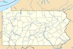

Location: Southeast of Alum Bank on Legislative Route 05098, West St. Clair Township, Pennsylvania Coordinates: 40°9′36″N 78°36′8″W / 40.16°N 78.60222°WCoordinates: 40°9′36″N 78°36′8″W / 40.16°N 78.60222°W Area: less than one acre Governing body: Private MPS: Bedford County Covered Bridges TR NRHP Reference#: 80003411[1] Added to NRHP: April 10, 1980 Dr. Knisley Covered Bridge is a historic wooden covered bridge located at West St. Clair Township in Bedford County, Pennsylvania. It is a 80-foot-long (24 m), medium Burr Truss bridge with a shallow gable roof. It crosses Dunning Creek. It is one of 15 historic covered bridges in Bedford County.[2]
It was listed on the National Register of Historic Places in 1980.[1]
References
- ^ a b "National Register Information System". National Register of Historic Places. National Park Service. 2010-07-09. http://nrhp.focus.nps.gov/natreg/docs/All_Data.html.
- ^ ""National Historic Landmarks & National Register of Historic Places in Pennsylvania"" (Searchable database). CRGIS: Cultural Resources Geographic Information System. https://www.dot7.state.pa.us/ce/SelectWelcome.asp. Note: This includes Susan M. Zacher and Barbara Hufnagel (undated). "National Register of Historic Places Inventory Nomination Form: Dr. Knisley Covered Bridge" (PDF). https://www.dot7.state.pa.us/ce_imagery/phmc_scans/H050713_01H.pdf. Retrieved 2011-11-19.
Bridges and tunnels on the National Register of Historic Places Alabama · Alaska · Arizona · Arkansas · California · Colorado · Connecticut · Delaware · Florida · Georgia · Guam · Hawaii · Idaho · Illinois · Indiana · Iowa · Kansas · Kentucky · Louisiana · Maine · Maryland · Massachusetts · Michigan · Minnesota · Mississippi · Missouri · Montana · Nebraska · Nevada · New Hampshire · New Jersey · New Mexico · New York · North Carolina · North Dakota · Ohio · Oklahoma · Oregon · Pennsylvania (covered) · Puerto Rico · Rhode Island · South Carolina · South Dakota · Tennessee · Texas · Utah · Vermont · Virginia · Washington · Washington, D.C. · West Virginia · Wisconsin · Wyoming
Categories:- Bridges on the National Register of Historic Places in Pennsylvania
- Covered bridges in Pennsylvania
- Wooden bridges in the United States
- Bridges in Bedford County, Pennsylvania
- Road bridges in Pennsylvania
- Pennsylvania Registered Historic Place stubs


Wikimedia Foundation. 2010.